
Flash flooding threatens areas from the Tennessee Valley to the Carolinas as storms repeat along a stalled front. Monsoonal storms may trigger flooding in the Southwest. Dangerous heat expands across the Desert Southwest, Plains, mid-Mississippi Valley and Southern Tier. Critical fire weather for interior Pacific Northwest. Cooler, drier air brings brief relief to the Great Lakes and Northeast. Read More >
Overview
|
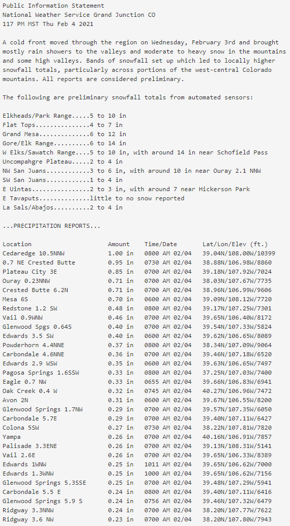
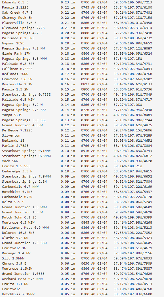
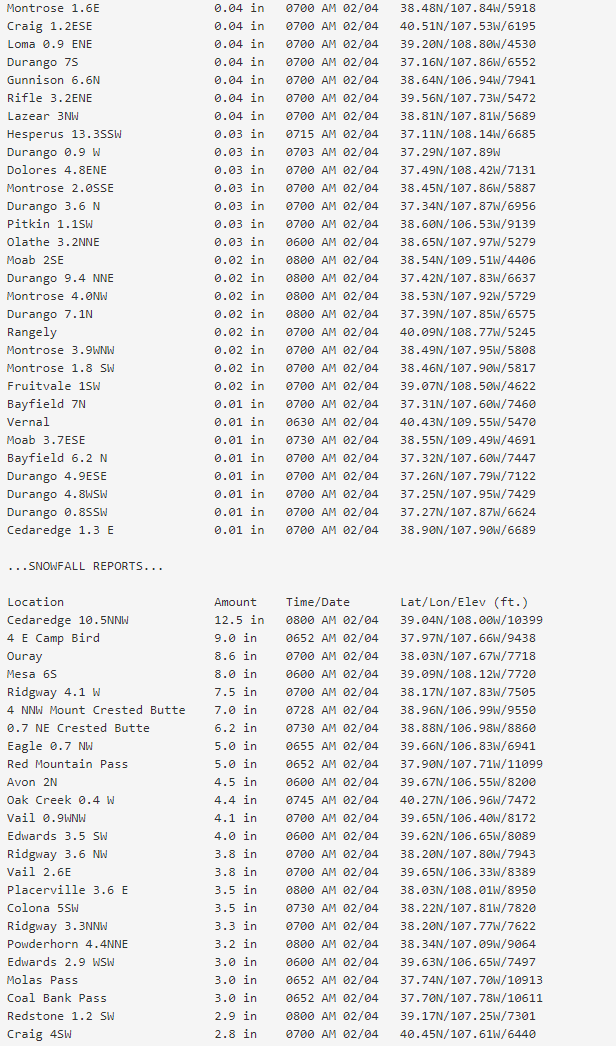
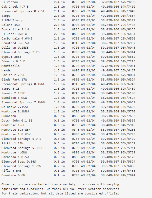
A midlevel Pacific trough and associated surface cold front progressed through western Colorado on Wednesday, February 3, 2021. Scattered to numerous showers occurred out ahead of and with the passage of the front. Mild and well above normal temperatures occurred out ahead of the front with the Cooperative Observer in Moab, Utah recording a new record high for February 3 with a high temperature of 66 degrees. This broke the previous record of 64 degrees, set in 2018. Unfortunately, the warm temperatures led to mostly rain in the lower elevations with the heaviest snow falling above 8000 feet. The presence of a strong upper level jet overhead led to breezy conditions at the surface with winds gusting up to 60 mph in the higher elevations at times and close to 40 mph in the valleys. Generally 6 to 12 inches of snow fell across the Elkhead, Park, Gore and Elk Mountains with this system as well as over the Grand and Battlement Mesas in west-central Colorado. Closer to 3 to 9 inches of snow fell over the Flat Tops and the Northwest San Juan Mountains. In addition to the abundance of moisture, moderate instability associated with the cold front led to stronger snow bands along portions of west-central Colorado. The Central Colorado River Basin saw 2 to 4 inches of snow in a short period of time as a band of snow settled over the region. The Snowmass Ski Area reported a 24-hour snowfall total of 20 inches in response to a heavy band of snow. A snow squall developed near Crested Butte, Colorado Wednesday evening as a webcam north of town showed near zero visibilities with the arrival of the squall. |
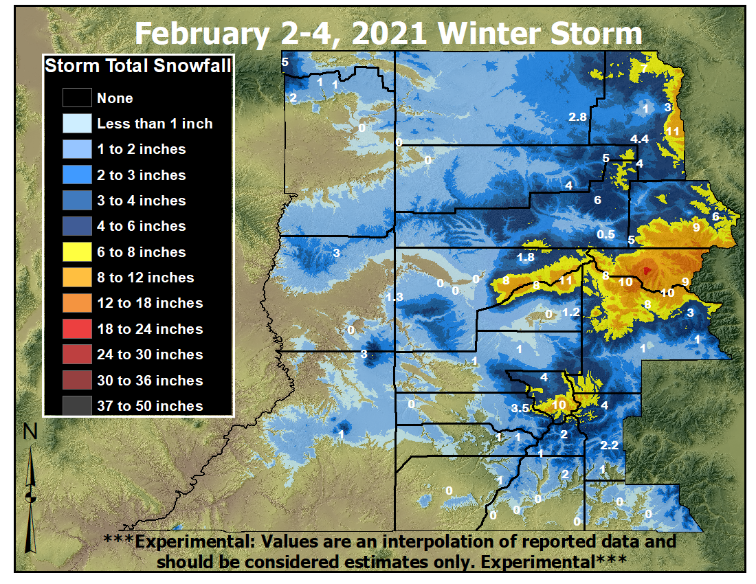 Storm Total Snowfall: February 2-4, 2021 |
Photos
 |
 |
 |
 |
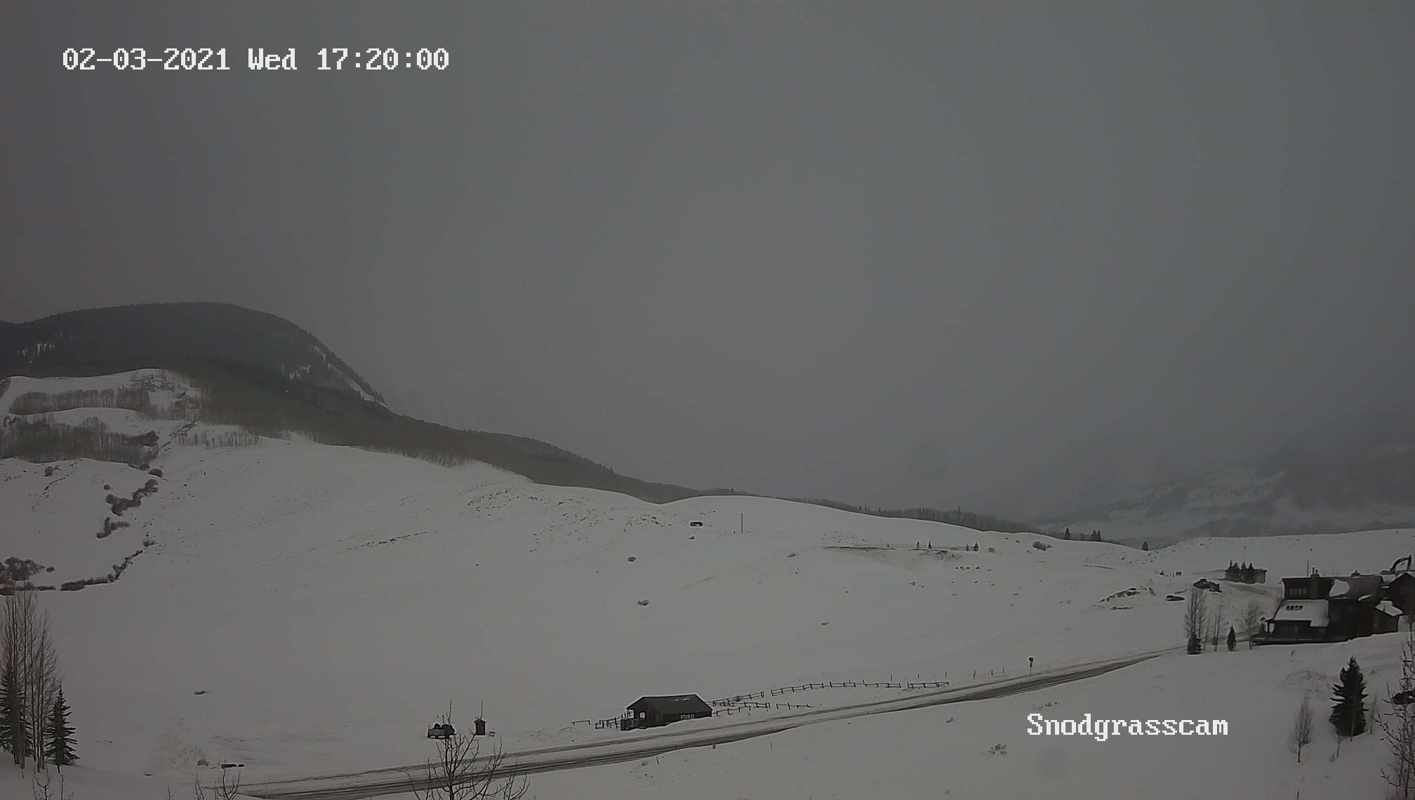
| Snow Squall approaching Crested Butte, CO on 2/3/21 (Credit: Snodgrasscam) |
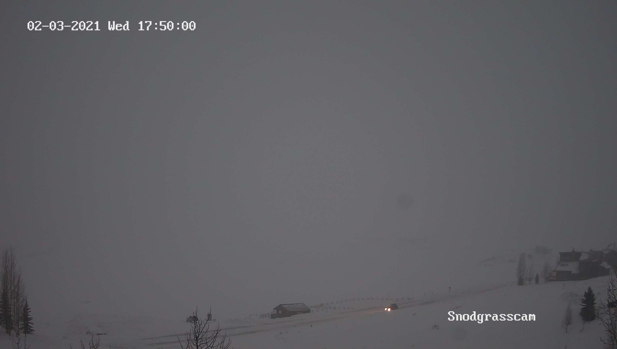
Snow Squall moving through Crested Butte, CO on 2/3/21 (Credit: Snodgrasscam) |
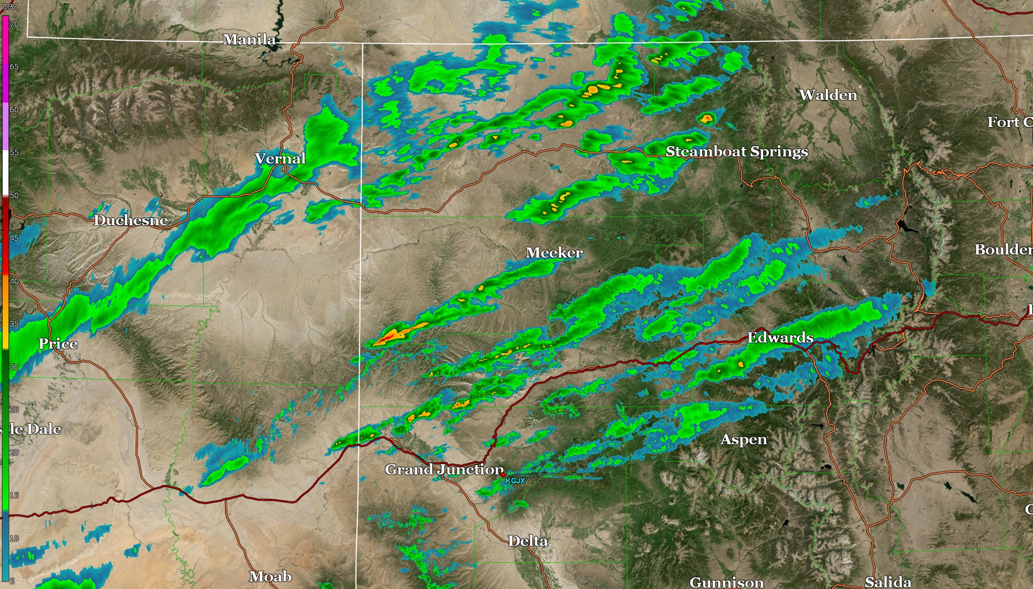
Banded rain and snow showers on radar on 2/3/21 (Credit: NWS Grand Junction) |
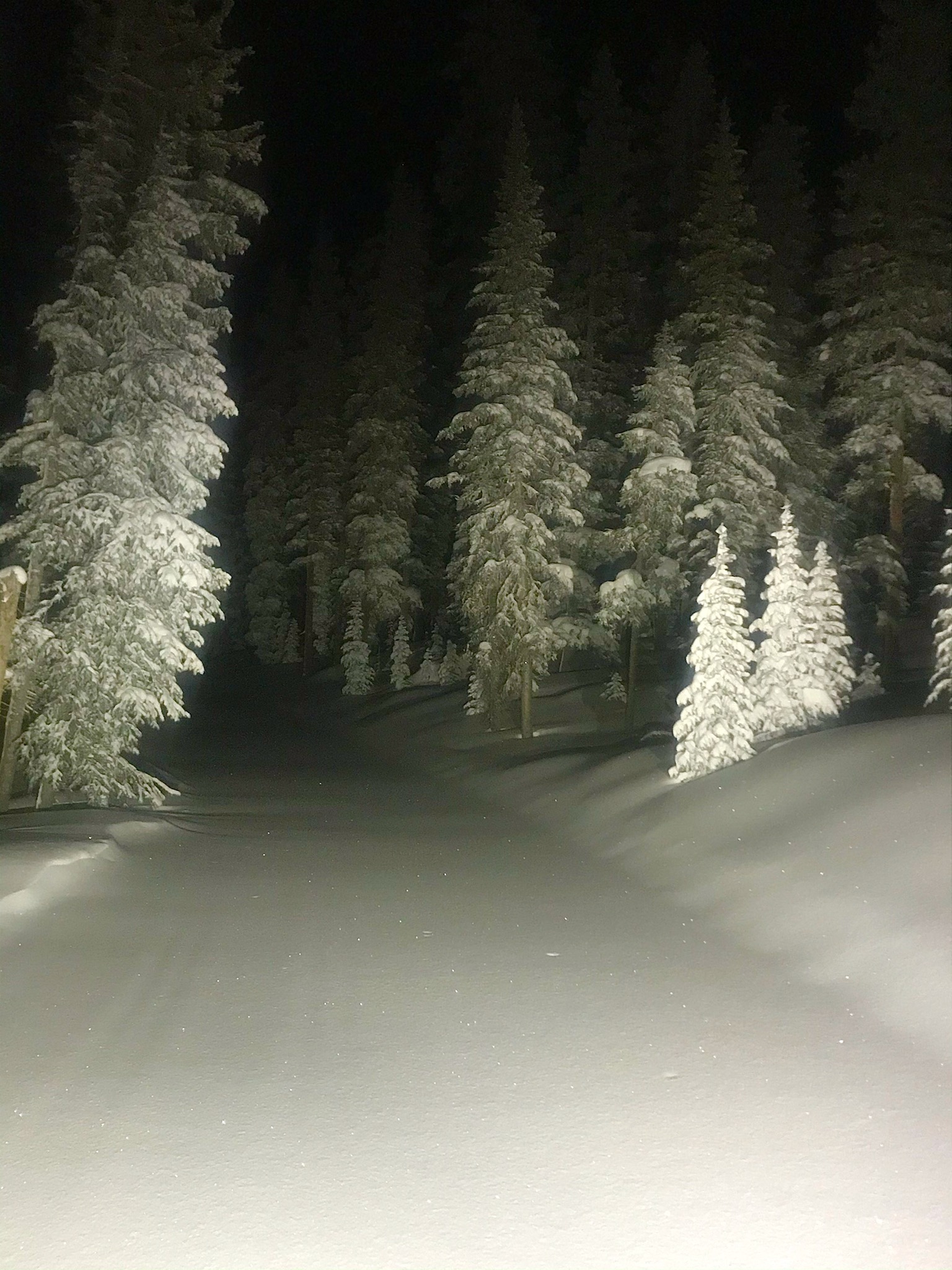
Skyway-County Line Ski Trails on the Grand Mesa (Credit: Grand Mesa Nordic Council) |
Scattered to numerous rain and snow showers occurred across eastern Utah and western Colorado. Below is a summary of the precipitation totals from a variety of sites across the region. All data is considered preliminary.
 |
Media use of NWS Web News Stories is encouraged! Please acknowledge the NWS as the source of any news information accessed from this site. |
|

