
Wildfire smoke will push into the Midwest, worsening air quality. A frontal system brings severe storms from the Northern Plains to the Mid‑Atlantic the next few days. Heavy Gulf Coast rain is possible as Tropical Depression Two has formed, while monsoonal storms persist in the Southwest with heavy rainfall. Hazardous heat expands from the Plains into the Lower Mississippi Valley. Read More >
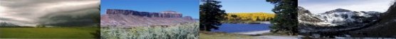
Grand Junction, CO
Weather Forecast Office
Mission and Strategic Plan
Office ResearchOffice HistoryStation Digest
Spotter Information Forecast Area Maps
In 1996, the National Weather Service (NWS) office in Grand Junction began a gradual process of taking over warning and forecast responsibilities for western Colorado and eastern Utah from the NWS offices in Denver and Salt Lake City, respectively. Prior to 1996, the Grand Junction weather office only had warning responsibilities for severe thunderstorms and flash floods in a portion of western Colorado. Currently, the office has weather forecasting and warning responsibility for 22 counties in western Colorado and eastern Utah.
The first group of meteorologists to round out the present staff at the NWS office in Grand Junction arrived in September 1995. The forecasters received intensive training to better understand and operate the new technology, such as the Doppler radar and the Automated Surface Observing System (ASOS) , in order to provide more timely warnings and short term forecast updates.
The Doppler radar began operating on the Grand Mesa in October 1995. This was the first system to provide true weather radar coverage for western Colorado and eastern Utah.
An additional group of 5 forecasters joined the staff at Grand Junction in 1998, coinciding with the planned arrival of the Advanced Weather Interactive Processing System (AWIPS) . This computer system replaced the AFOS computers that were designed from technology dating back to the late 1960s. With a full contingent of forecasters and modern forecasting tools, the process to take over all warning and forecast responsibilities for western Colorado and portions of eastern Utah was completed in April 1999.
Hazards
Detailed Hazards Viewer
National Briefing
Outlooks
Transportation Decision Support
Winter Storm Severity Index
Forecasts
Aviation Weather
Fire Weather
Forecast Discussion
Forecast Points
Local Area
Severe Weather
Soaring Forecast
Winter Weather
Hydrology
Recreational River Report
River Forecast
Weather Safety
Preparedness
NOAA Weather Radio
StormReady
SkyWarn
US Dept of Commerce
National Oceanic and Atmospheric Administration
National Weather Service
Grand Junction, CO
2844 Aviators Way
Grand Junction, CO 81506-8644
970-243-7007
Comments? Questions? Please Contact Us.

