Extremely critical fire weather concerns for portions of the southern High Plans as strong wind and very dry conditions could result in rapid spread of any fires. Meanwhile, severe thunderstorms are expected once again across areas of the Central and Southern Plains, then spreading in the Mississippi Valley regions on Monday. Damaging winds, very large hail and strong tornadoes are possible. Read More >
Grand Junction, CO
Weather Forecast Office
Overview
|
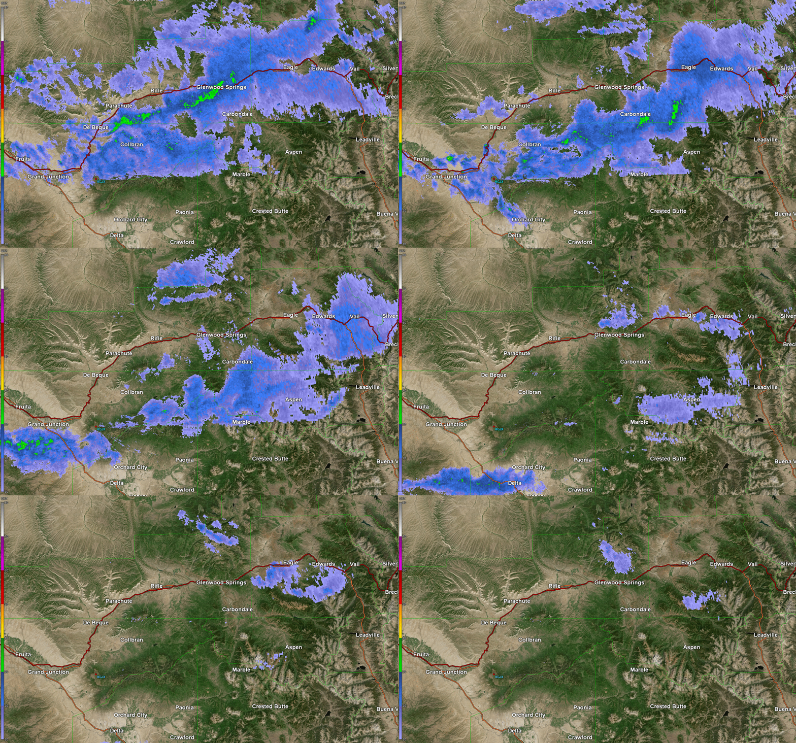
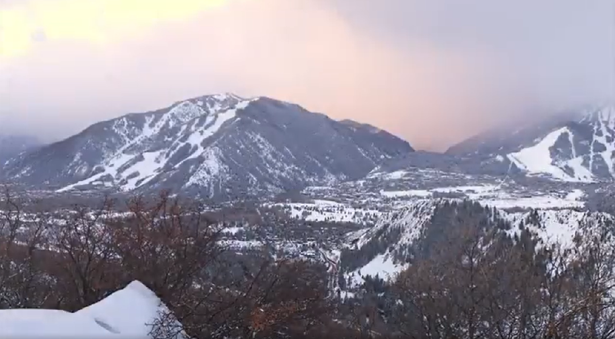
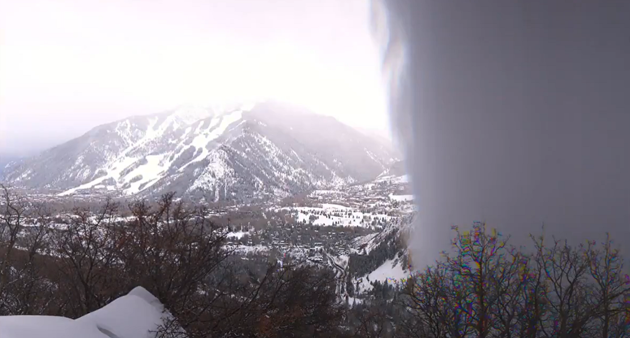
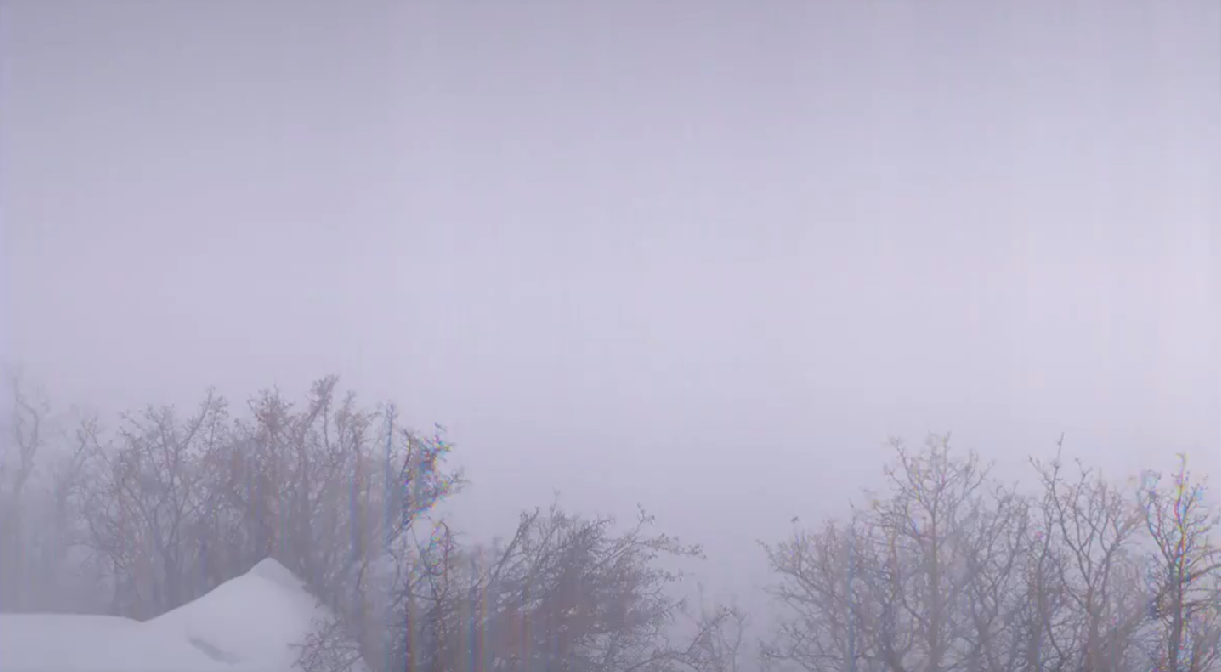
A strong cold front moved across the Western Slope of Colorado on the morning of Monday, February 24, 2020. The cold front, combined with a tight pressure gradient, instability aloft, and favorable upper level dynamics, produced strong winds at the surface. This led to the development of a snow squall which progressed through the Roaring Fork Valley between 7:30 and 8:30 AM on the 24th. The National Weather Service defines a snow squall as "an intense, but limited duration, period of moderate to heavy snowfall, accompanied by strong, gusty surface winds". This was most certainly the case on the 24th as winds gusted from 55 to 65 MPH which led to significantly reduced visibility in blowing snow. This resulted in severe travel impacts along Interstate 70 with Vail Pass being closed for a couple of hours due to white-out conditions as the squall moved through. The Aspen Airport recorded visibility of 1/4 mile and a peak wind gust of 55 MPH with this squall. The webcam at Aspen Snowmass Ski Resort captured the snow squall moving through, and numerous people witnessed this impressive but dangerous phenomenon. |
 KGJX Radar Data Showing Snow Squall Moving Through on February 24, 2020 |
 |
 |
 |
| View Before the Snow Squall Begins (Credit: Aspen Snowmass) | View as the Snow Squall Begins to Move Through (Credit: Aspen Snowmass) | Visibility Just After the Snow Squall Moved Through (Credit: Aspen Snowmass) |
Photos & Video
| Video 1: View of Snow Squall from Roof in Aspen (Credit: Justin Hurlburt) |
Video 2: View of Snow Squall from Roof in Aspen (Credit: Justin Hurlburt) |
 |
Media use of NWS Web News Stories is encouraged! Please acknowledge the NWS as the source of any news information accessed from this site. |
 |
Hazards
Detailed Hazards Viewer
National Briefing
Outlooks
Transportation Decision Support
Winter Storm Severity Index
Forecasts
Aviation Weather
Fire Weather
Forecast Discussion
Forecast Points
Local Area
Severe Weather
Soaring Forecast
Winter Weather
Hydrology
Recreational River Report
River Forecast
Weather Safety
Preparedness
NOAA Weather Radio
StormReady
SkyWarn
US Dept of Commerce
National Oceanic and Atmospheric Administration
National Weather Service
Grand Junction, CO
2844 Aviators Way
Grand Junction, CO 81506-8644
970-243-7007
Comments? Questions? Please Contact Us.

