
A heat wave over the Southwest will intensify late week, peaking and expanding into the Intermountain West and northern High Plains this weekend. Severe thunderstorms and heavy rain are expected over portions of the Plains and Mississippi Valley tonight, which will shift to parts of the Upper Midwest and mid-Mississippi Valley Friday. Monsoonal showers and flooding persist in the Desert Southwest. Read More >
Overview
A round of severe thunderstorms moved across a portion of
southeast Utah which generated two confirmed tornadoes in San Juan
County, Utah on Saturday, Sept 13, 2025. The first tornado was
short lived, as noted by a resident`s video footage narration,
along with information from local emergency management and law
enforcement. A second, more well developed tornado, formed five
minutes after the first tornado dissipated in a similar location as the first tornado.
The second tornado was well documented by local officials and video footage
to have remained nearly stationary throughout its duration before finally
dissipating. Both events were located north of Montezuma Creek.

The entire event lasted around one hour and 20 minutes, with the
first tornado beginning around 12:30pm and the second tornado
dissipating by 1:50pm MDT.
This is a preliminary event summary and may be updated as we receive more information. |
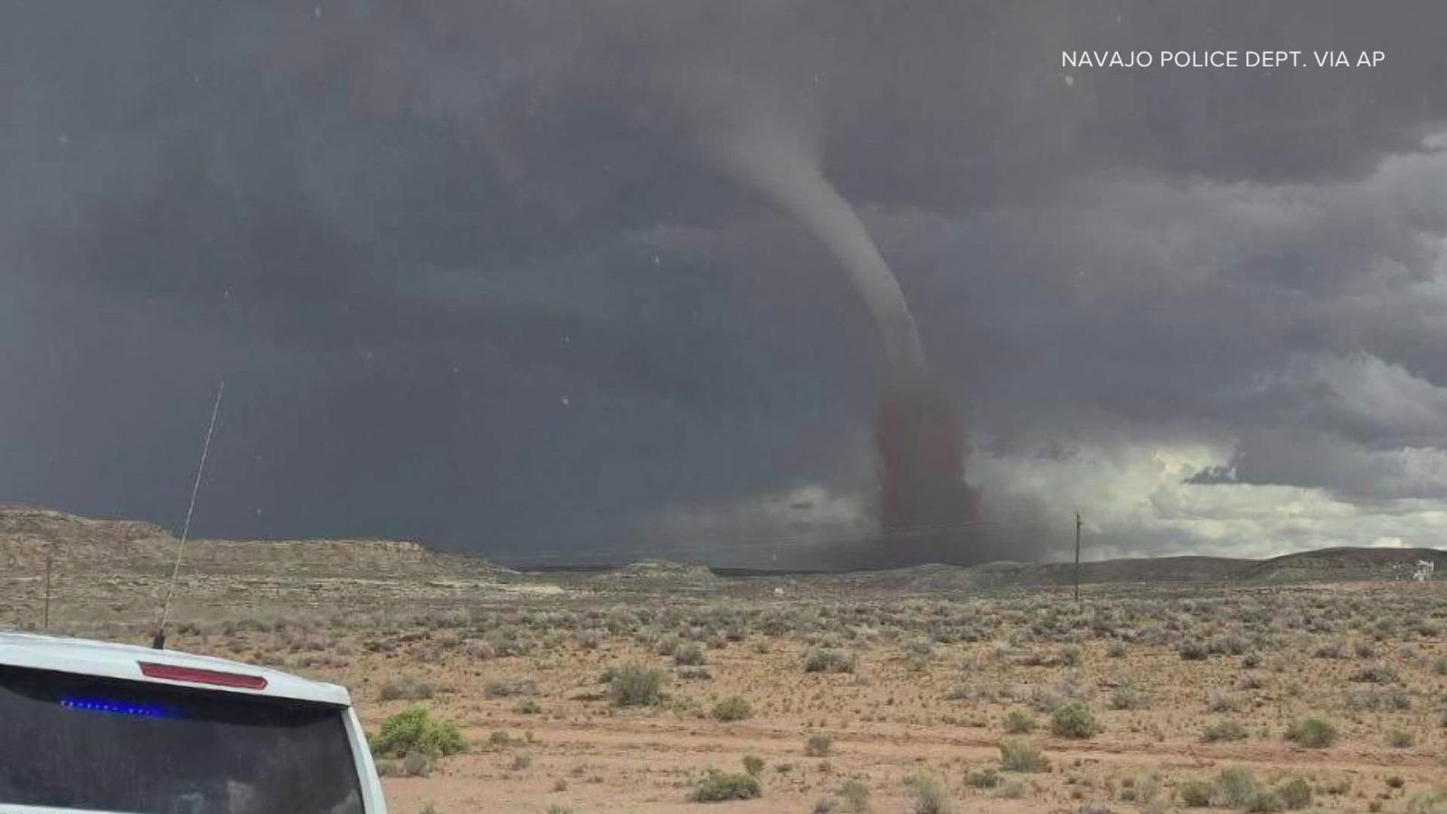 Image of the second tornado taken by the Navajo Police Dept. |
Tornadoes
Select a tornado from the table to zoom into the track and view more information. The default table view is limited to 8 tracks, but can be scrolled by a mouse wheel or dynamically expanded. Additionally, the table can fill the entire window by clicking the small circular expanding arrow icon at the very top right of the table and returned to its original size by clicking the button again. The side information panel that opens over the map can be closed using the "X" on the upper right corner of the pop-up. Zoom into the map and click damage points to see detailed information and pictures from the surveys.
|
NOTE: Times shown below are local to your device's time zone. |

The Enhanced Fujita (EF) Scale classifies tornadoes into the following categories:
| EF0 Weak 65-85 mph |
EF1 Moderate 86-110 mph |
EF2 Significant 111-135 mph |
EF3 Severe 136-165 mph |
EF4 Extreme 166-200 mph |
EF5 Catastrophic 200+ mph |
 |
|||||
| Tornadoes that fail to impact any ratable damage indicators on the EF-Scale are rated EF-Unknown (EF-U) | |||||
Radar & Satellite
 |
 |
 |
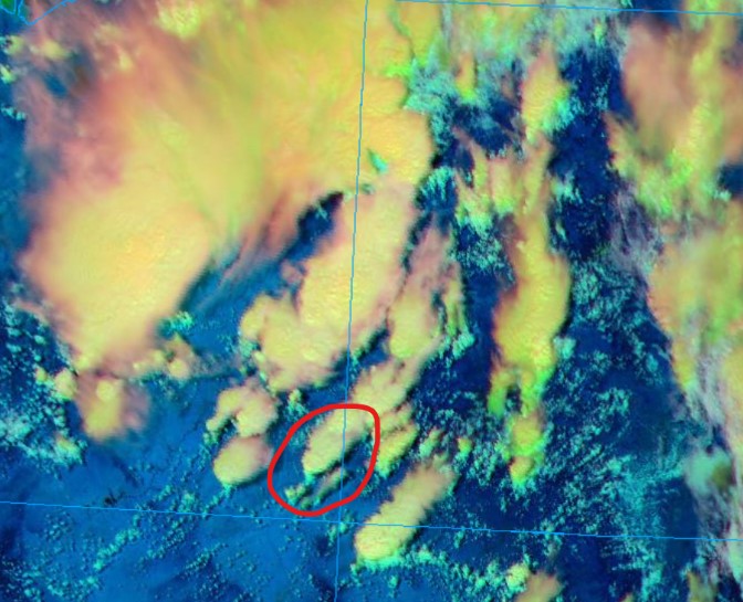 |
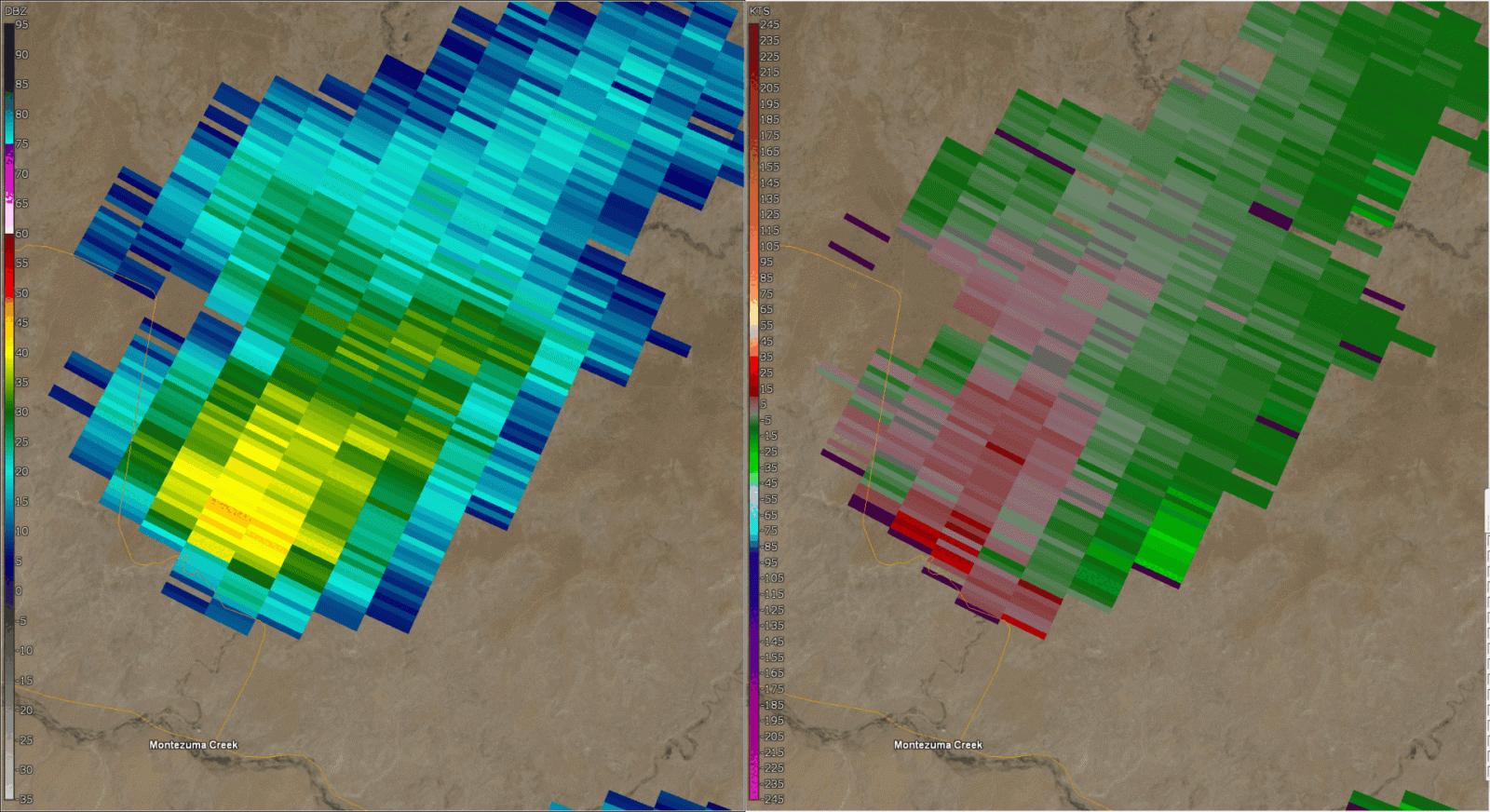
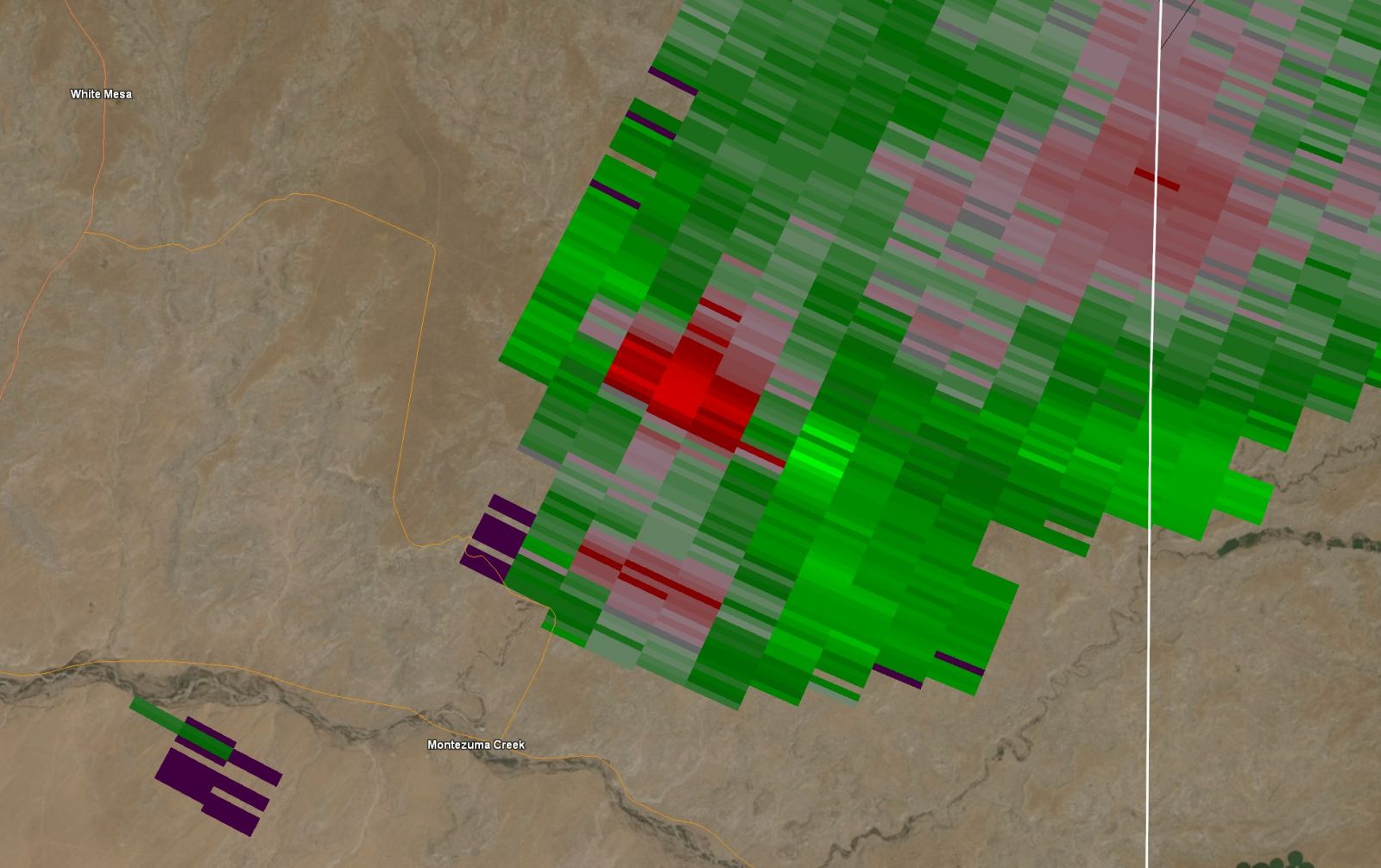
| Radar Reflectivity and Velocity Loop of the storm's lifecycle from about 12:30pm to 1:40pm. | Radar Reflectivity at the time of the tornado's peak strength (roughly 1:10pm). | Radar Velocity at the time of the tornado's peak strength (roughly 1:10pm). | Satellite Image of the storm's clouds as the tornado was ongoing around 12:40pm. |
Photos
 |
 |
 |
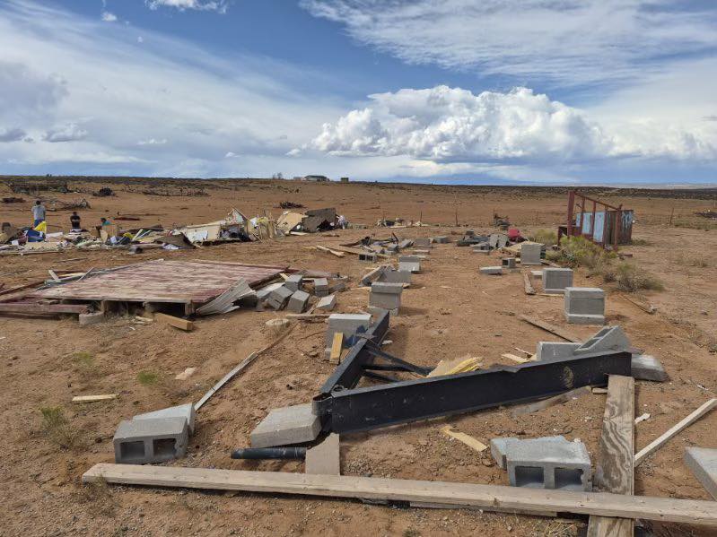 |
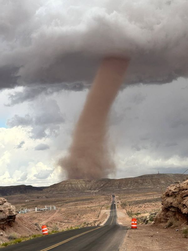
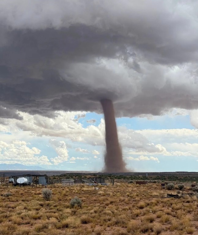
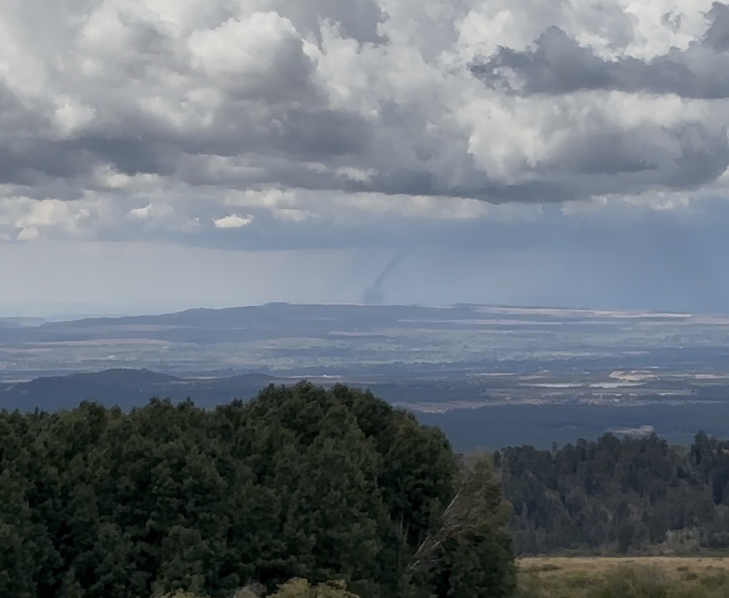
| Photo of the second tornado looking north along UT-262 just north of Montezuma Creek. Photo: San Juan County. | Photo of the second tornado shared via San Juan County. | Photo of the second tornado as seen from the Colorado/Utah border near Sleeping Ute Mountain. Photo: Durango Interagency Dispatch Center. | Multiple homes were completely destroyed near Montezuma Creek. There was also damage to a sheep and cow corral, a barn, two horse trailers, and three vehicles. Photo: Navajo Police Department. |
 |
Media use of NWS Web News Stories is encouraged! Please acknowledge the NWS as the source of any news information accessed from this site. |
|

