Dangerous and extreme heat will remain across portions of the southern U.S. through the weekend. A heat wave over the Southwest U.S. will intensify this week, peaking and expanding into the Intermountain West and northern High Plains this weekend. Multiple rounds of thunderstorms will produce heavy to excessive rainfall with significant flash flooding across portions of southern New England. Read More >
Overview
|
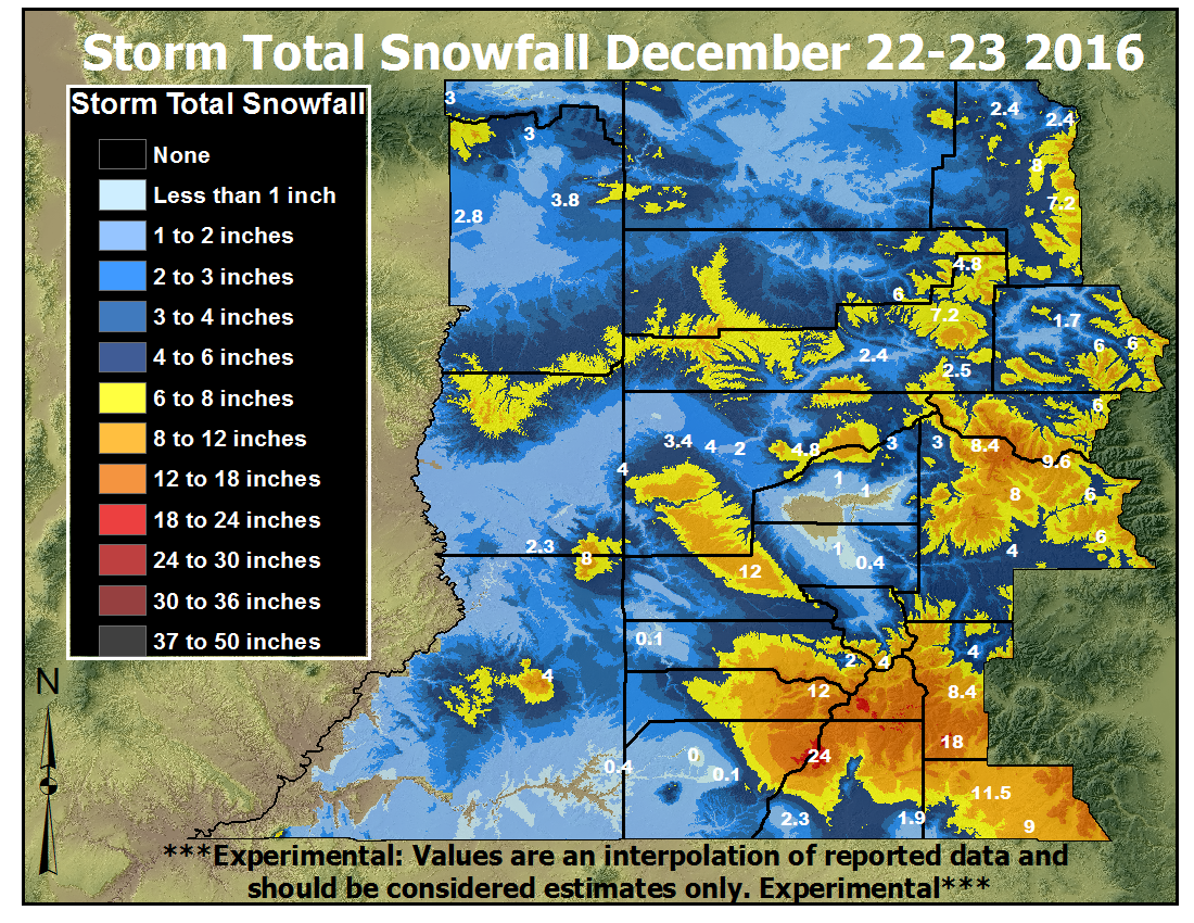
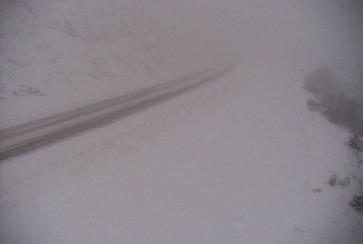
A fast moving winter storm moved into the Great Basin early Thursday morning, December 22 and brought snow to much of eastern Utah and western Colorado through midday Friday, December 23. The southern and central Colorado mountains were favored. Many locations saw a mixed bag of precipitation on Thursday, especially after warm air aloft worked its way into the Four Corners Thursday afternoon, causing snow levels to rise and allowing for some rain to briefly mix in with the snow before transitioning back to all snow Thursday night. Snow even accumulated in the valleys, where 1 to 3 inches was reported. The abundance of low level moisture in wake of snowfall resulted in areas of localized dense fog which created some slick roads and hazardous driving conditions. |
|
Photos & Video:
Header
 |
 |
 |
 |
| Quarry Visitor Center (Credit: Dinosaur National Monument) |
Fog near Rio Blanco Friday Morning (Credit: CDOT) |
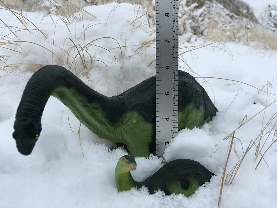
8 inches of fresh snow in Rico (Credit: Kasey Craig) |
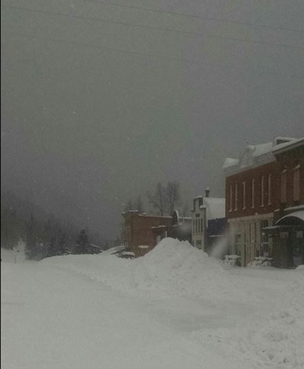
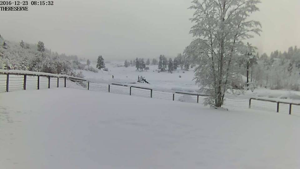
Pagosa Springs Friday Morning (Credit: The Reserve at Pagosa Peak) |
Storm Reports
Preliminary and estimated storm total values are shown. This is
followed by individual storm total reports.

Elkheads & Park Range....  3 to  7 inches
Flat Tops................  5 to  9 inches
Grand Mesa...............  3 to  5 inches; 11 near Park Reservoir
Gore and Elk Range.......  3 to  6 inches
West Elks & Sawatch Range  6 to 10 inches; 17 near Schofield Pass
Uncompahgre Plateau...... 10 to 12 inches
Northwest San Juans......  5 to 11 inches
Southwest San Juans......  8 to 20 inches
Eastern Uintas........... less than an inch
Eastern Tavaputs.........  1 to  2 inches
La Sals and Abajos.......  4 to  8 inches; 12 near Camp Jackson


...Snowfall Reports...

Location                     Amount    Time/Date      Elevation (ft.)
Coal Bank Pass               18.5 in   0947 AM 12/23  10611
Molas Pass                   16.0 in   0946 AM 12/23  10913
Silverton                    13.7 in   0900 AM 12/23   9278
3 S Vallecito                13.5 in   0700 AM 12/23   8200
Pagosa Springs 1.6 SSW       11.5 in   0800 AM 12/23   7401
4 WSW Pagosa Springs         10.0 in   0618 PM 12/22      m
Red Mountain Pass            10.0 in   0946 AM 12/23  11099
5 WNW Chromo                 9.0 in    0830 AM 12/23   7408
7 NE Sawpit                  8.8 in    0800 AM 12/23      m
Durango 4.8 WSW              8.4 in    0700 AM 12/23   7430
Cedaredge 10.5 NNW           8.3 in    0800 AM 12/23  10399
Crested Butte                8.0 in    0831 AM 12/23   8853
Steamboat Springs            8.0 in    0730 AM 12/23   6636
Bayfield 7N                  7.7 in    0700 AM 12/23   7460
Steamboat Springs 1.9 E      7.0 in    0600 AM 12/23   7200
5 NW Chromo                  6.5 in    0630 PM 12/22   7408
Steamboat Springs 1.5 WNW    6.2 in    0700 AM 12/23   6778
4 E Camp Bird                6.0 in    0943 AM 12/23   9438
6 ENE Durango                6.0 in    0442 PM 12/22      m
Meeker                       6.0 in    0934 AM 12/23   6309
Pitkin 1.1 SW                6.0 in    0700 AM 12/23   9139
1 WNW Skyway                 6.0 in    1031 AM 12/23   9338
2 N Avon                     5.8 in    1153 AM 12/23      m
Steamboat Springs 0.7 ESE    5.8 in    0700 AM 12/23   7049
Steamboat Springs 1.2 SE     5.6 in    0620 AM 12/23   7075
Collbran                     5.2 in    0800 AM 12/23   5987
Collbran 0.2 ESE             5.2 in    0700 AM 12/23   6043
Vail 0.9 WNW                 5.2 in    0700 AM 12/23   8172
Vail 2.6 E                   5.2 in    0700 AM 12/23   8389
Gunnison Coop                4.6 in    0800 AM 12/23   7640
17 W Glade Park              4.0 in    0800 AM 12/23   6385
Glenwood Springs             4.0 in    0500 AM 12/23      m
Gunnison 3wsw                4.0 in    0700 AM 12/23   7602
New Castle 5E                4.0 in    1046 AM 12/23   5766
4 S Vallecito                4.0 in    0433 PM 12/22      m
Jensen 0.4 WSW               3.8 in    0700 AM 12/23   4768
Shoshone                     3.7 in    0730 AM 12/23   5930
1 SE Castle Valley           3.6 in    0839 AM 12/23      m
Glenwood Springs .64 S       3.6 in    0700 AM 12/23   5824
Canyonlands - the Neck       3.5 in    0837 AM 12/23   5874
1 E Pagosa Springs           3.5 in    0549 PM 12/22      m
2 WNW Redlands               3.4 in    0700 AM 12/23   4780
Ragged Mtn                   3.0 in    0700 AM 12/23   7047
Valley of the Gods           3.0 in    0600 PM 12/22   5266
Durango 0.8 SSW              2.9 in    0700 AM 12/23   6624
Durango 7.1 N                2.9 in    0800 AM 12/23   6575
Fort Duchesne Coopabc        2.8 in    0710 AM 12/23   5050
3 NE Grand Junction          2.8 in    0503 AM 12/23      m
Palisade                     2.8 in    0834 AM 12/23      m
Fruitvale                    2.7 in    0700 AM 12/23   4715
1 W Fruitvale                2.7 in    0700 AM 12/23   4680
Grand Junction 4.0 W         2.6 in    0700 AM 12/23   4630
Ouray                        2.6 in    0714 AM 12/23   7728
Ouray Spotter                2.6 in    0714 AM 12/23   7727
Redlands                     2.6 in    0835 AM 12/23   4624
2 WNW Cattle Creek           2.5 in    0700 AM 12/23   5942
Craig 33N                    2.5 in    1151 AM 12/23   6460
DeBeque 1.8SSE               2.5 in    0933 AM 12/23   4924
Rifle 3ene                   2.4 in    0700 AM 12/23   5436
Grand Junction 3.9 SSE       2.3 in    0700 AM 12/23   4676
Grand Junction 3.9 WSW       2.3 in    0700 AM 12/23   4667
Hesperus 13.3 SSW            2.3 in    0715 AM 12/23   6686
Moab 3.7 ESE                 2.3 in    0830 AM 12/23   4692
1 E Redlands                 2.3 in    0700 AM 12/23   4653
Vernal                       2.2 in    0630 AM 12/23   5470
Blanding                     2.0 in    0452 PM 12/22   6032
East Junction Ham            2.0 in    0700 AM 12/23   4625
Grand Junction 5.1 ESE       2.0 in    0700 AM 12/23   4638
east entrance of CO NM       2.0 in    0936 AM 12/23   4894
Ignacio Spotter              1.9 in    0700 AM 12/23   6562
Wolcott 2.3 N                1.7 in    0700 AM 12/23   7224
Dinosaur Quarry              1.5 in    0430 PM 12/22   4803
 |
Media use of NWS Web News Stories is encouraged! Please acknowledge the NWS as the source of any news information accessed from this site. |
|