
Flash flooding threatens areas from the Tennessee Valley to the Carolinas as storms repeat along a stalled front. Monsoonal storms may trigger flooding in the Southwest. Dangerous heat expands across the Desert Southwest, Plains, mid-Mississippi Valley and Southern Tier. Critical fire weather for interior Pacific Northwest. Cooler, drier air brings brief relief to the Great Lakes and Northeast. Read More >
Overview
|
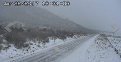
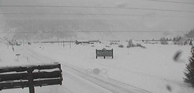
Two separate storm systems affected the Grand Junction forecast area during this timeframe. The first occurred Sunday, January 22nd and ended Monday the 23rd. The second storm started Monday evening and persisted through Wednesday. The first storm was in response to a passing upper level trough that provided enough lift and instability to provide snow across the region. Favorable south to southwest flow also provided enough orographic lift for snow to fall across mountainous areas. A 6 to 12 hour lull occurred late Monday night into Tuesday morning before the next system brought more snow. The second storm was more potent as it tapped into the Pacific Ocean allowing anomalously high moisture to move into the region. Accompanying the moisture was a strong upper level jet which increased instability across the area while providing plenty of lift. The low pressure center of this system started off the Washington State coast and slowly dropped south and east through Tuesday. As this happened, south to southwest facing slopes were favored for snowfall, mainly the San Juans. Once the low moved over Colorado, flow switched to northwesterly allowing snowfall to favor the central and northern mountains through Wednesday afternoon. |
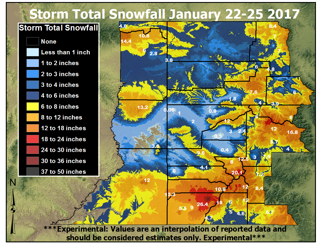 Storm Total Snowfall from January 22 - 25, 2017 |
 |
 |
 |
 |
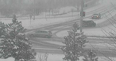
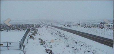
| Durango - Courtesy CDOT | Dove Creek - Courtesy CDOT | McClure Pass - Courtesy CDOT | Gateway - Courtesy CDOT |
 |
 |
 |
 |
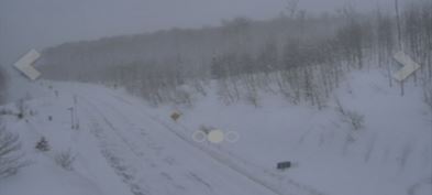
Silverton - Courtesy CDOT |
Silverton - Courtesy CDOT |
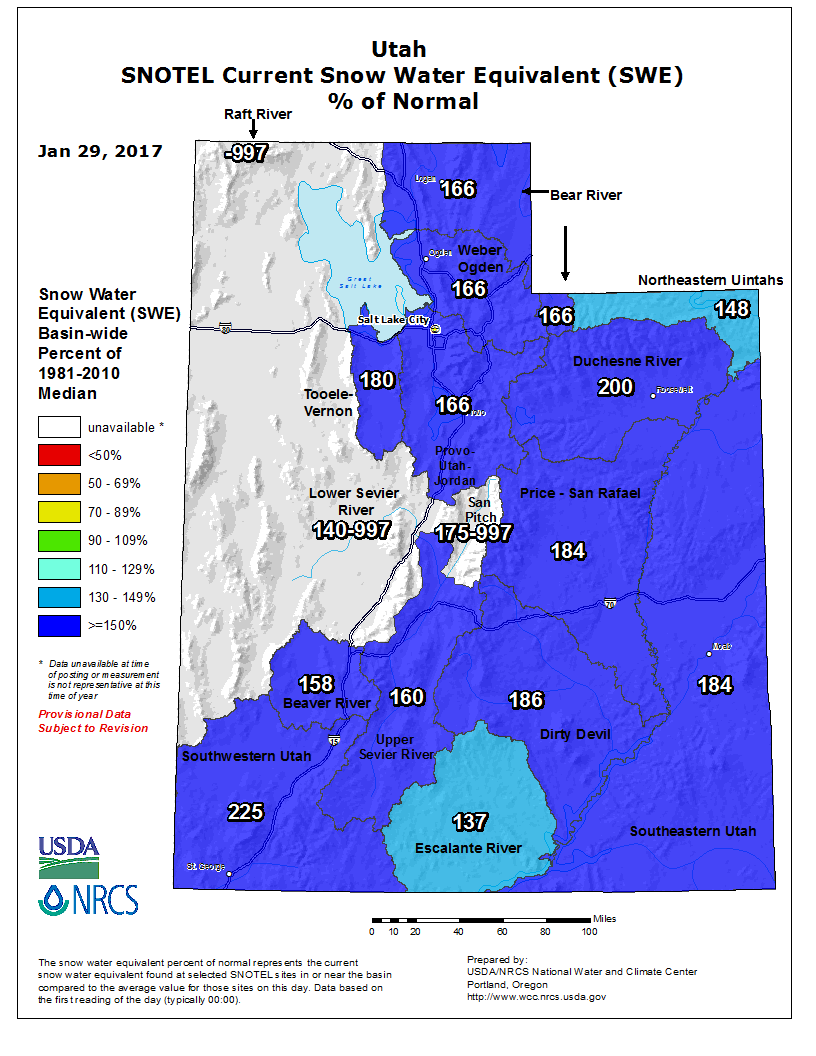
Utah Snowpack - Jan 29, 2017 ( Credit: USDA/NRCS ) |
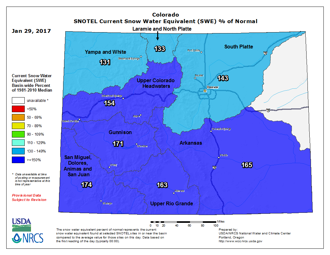
Colorado Snowpack - Jan 29, 2017 ( Credit: USDA/NRCS ) |
Storm Reports
The following reports are preliminary and are considered unofficial. The
first section containing the mountain ranges are mostly from automated
sensors, while the second section is a combination of various reports,
most of which are 72 hour values.

Northwest Colorado Mountains:
Elkhead and Park Ranges.......6 to 16 inches, but 19 at Tower
Flat Tops.....................6 to 10 inches, but 14 at Bison Lake

West Central Colorado Mountains:
Grand Mesa....................8 to 14 inches
Gore and Elk Ranges...........7 to 12 inches
West Elk and Sawatch Ranges...8 to 16 inches, but 26 at Schofield Pass

Southwest Colorado Mountains:
Uncompahgre Plateau...........10 to 12 inches
Northwest San Juan Mountains..8 to 16 inches
Southwest San Juan Mountains..14 to 27 inches

Eastern Utah Mountains:
Eastern Uintas................5 to 15 inches
Eastern Tavaputs..............10 to 15 inches
La Sal and Abajos.............4 to 14 inches


...Snowfall Reports...

Location                     Amount    Time/Date       Elevation (ft.)
Mancos 11 NNE                34.0 in   0700 AM 01/25   msg
Dolores 4.8 ENE              19.8 in   0700 AM 01/25   7132
Ouray Spotter                19.5 in   0705 AM 01/25   7727
Ouray .23 NNW                19.5 in   0705 AM 01/25   7728
6 SSE Sapinero               14.8 in   0800 AM 01/25   msg
Cedaredge 10.5 NNW           13.5 in   0800 AM 01/25   10399
Dove Creek 12.4 SSW          13.3 in   0700 AM 01/25   6604
Dolores 4.0 SSW              13.3 in   0640 AM 01/25   6679
Crested Butte 6.2 N          12.5 in   0700 AM 01/25   9606
Bayfield 7.0 N               11.4 in   0700 AM 01/25   8200
Steamboat Springs 1.9 E      9.9 in    0600 AM 01/25   7200
Montrose 1.2 ESE             9.7 in    0700 AM 01/25   5830
Monticello No. 2             9.5 in    0730 AM 01/25   7083
5 W Vallecito                9.5 in    0700 AM 01/25   8228
Vernal                       9.4 in    0630 AM 01/25   5470
Cortez 11nw                  9.0 in    0700 AM 01/25   6598
Cortez 1.2 SW                9.0 in    0700 AM 01/25   6165
Bayfield 7N                  8.8 in    0700 AM 01/25   7460
Durango 4.8 WSW              8.3 in    0700 AM 01/25   7430
3 SW Colona                  8.0 in    0900 AM 01/25   msg
Steamboat Springs            7.5 in    0730 AM 01/25   6636
Steamboat Springs 0.7 ESE    7.5 in    0700 AM 01/25   7049
Steamboat Springs 1.2 SE     7.4 in    0500 AM 01/25   7075
Pagosa Springs 1.6 SSW       6.7 in    0800 AM 01/25   7401
Steamboat Springs 1.5 WNW    6.7 in    0700 AM 01/25   6778
Pitkin County (ham)          6.5 in    0700 AM 01/25   9259
Vail 0.9 WNW                 6.4 in    0700 AM 01/25   8172
Somerset 12.5 N              6.1 in    0700 AM 01/25   7047
Naples                       5.5 in    0700 AM 01/25   5200
Gunnison                     5.1 in    0800 AM 01/25   7640
Durango 4.9 ESE              5.0 in    0700 AM 01/25   7123
Arboles 5wnw                 5.0 in    0700 AM 01/25   6545
Durango 10 NNE               5.0 in    0700 AM 01/25   6650
Redmesa 4.2 NW               4.7 in    0800 AM 01/25   6771
Bayfield 0.6 WSW             4.6 in    1000 AM 01/25   6932
Doyleville 2.1 W             4.5 in    0842 AM 01/25   8134
Hesperus 13.3 SSW            4.5 in    0730 AM 01/25   6686
Gunnison 3wsw                4.5 in    0700 AM 01/25   7602
Avon 2N                      4.5 in    0600 AM 01/25   8200
Hesperus 9.8 SW              4.3 in    0700 AM 01/25   7035
Durango 0.8 SSW              4.2 in    0705 AM 01/25   6624
Rangely                      4.0 in    0700 AM 01/25   5290
Carbondale 0.5 W             3.5 in    0445 AM 01/25   6171
Dinosaur 0.3 SW              3.4 in    0800 AM 01/25   5872
Ignacio Spotter              3.4 in    0700 AM 01/25   6562
Glenwood Springs .64 S       3.3 in    0700 AM 01/25   5824
Hotchkiss 5.1 WNW            3.0 in    0700 AM 01/25   6311
Paradox                      2.7 in    0600 AM 01/25   5594
Glenwood Springs 5.3 SSE     2.6 in    0700 AM 01/25   5942
17 W Glade Park              2.4 in    0800 AM 01/25   6385
Cedaredge 1.0 NE             1.8 in    0800 AM 01/25   6354
Paonia 2.1 SSE               1.8 in    0700 AM 01/25   6100
Colorado Nat'l Monument      1.7 in    0830 AM 01/25   5780


Observations are collected from a variety of sources with varying
equipment and exposures. Not all data listed are considered official.
 |
Media use of NWS Web News Stories is encouraged! Please acknowledge the NWS as the source of any news information accessed from this site. |
|

