
Numerous severe thunderstorms are expected across a broad region from the Ohio Valley to the Mid-Atlantic and Northeast States today into tonight. Swaths of damaging wind gusts are expected and some tornadoes are possible. Bertha is expected to bring tropical storm conditions to portions of the Gulf Coast from the Florida Panhandle westward to southeastern Louisiana later today and Wednesday. Read More >
Overview
|
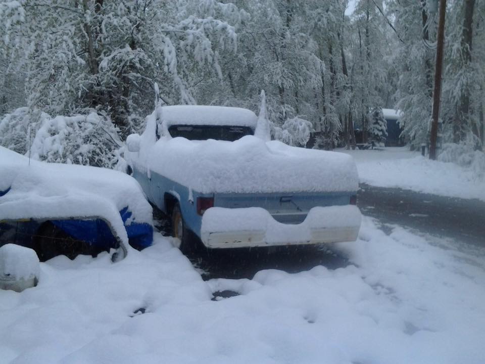
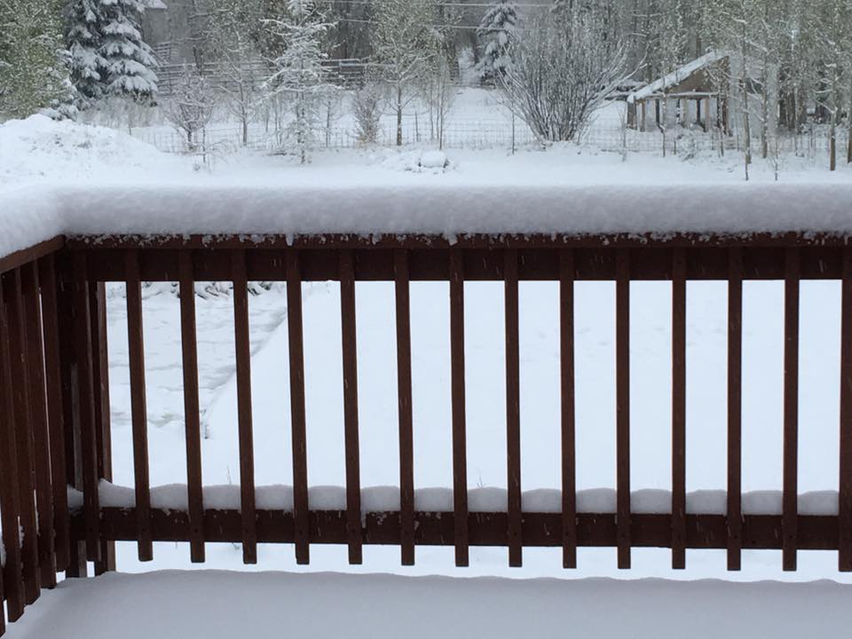
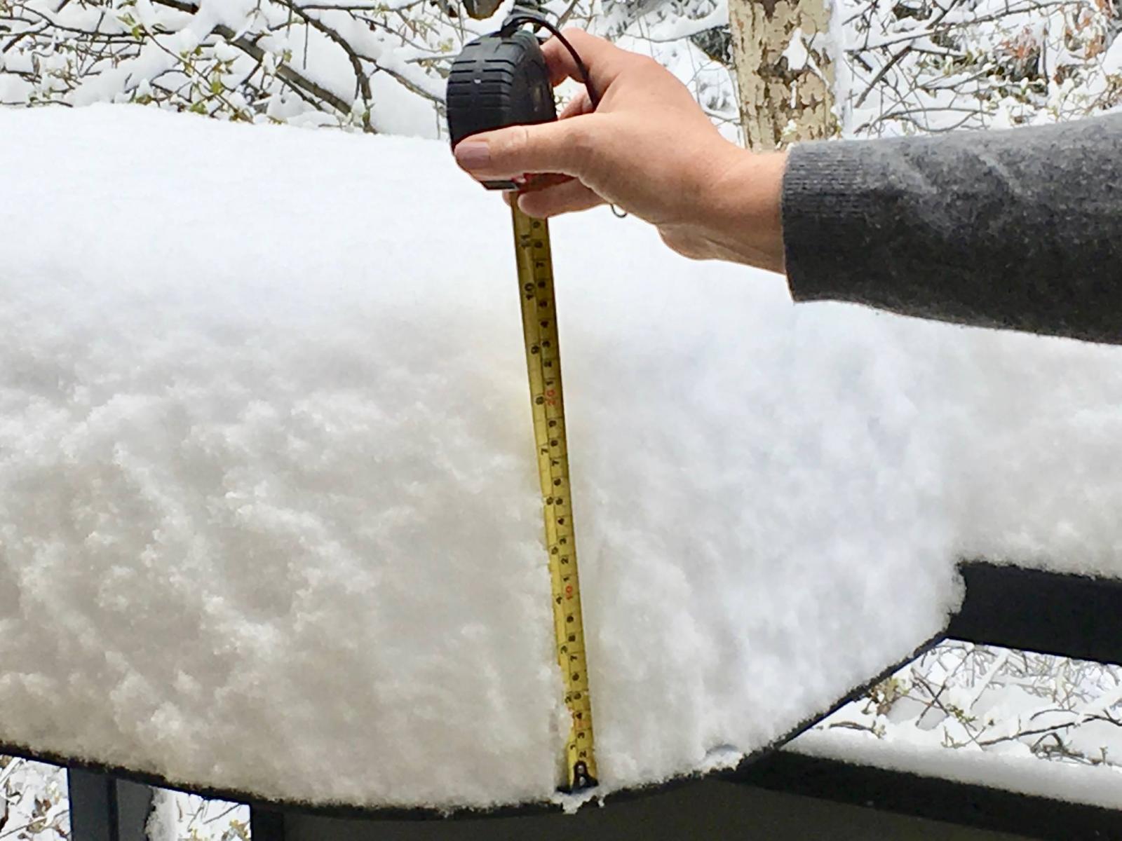
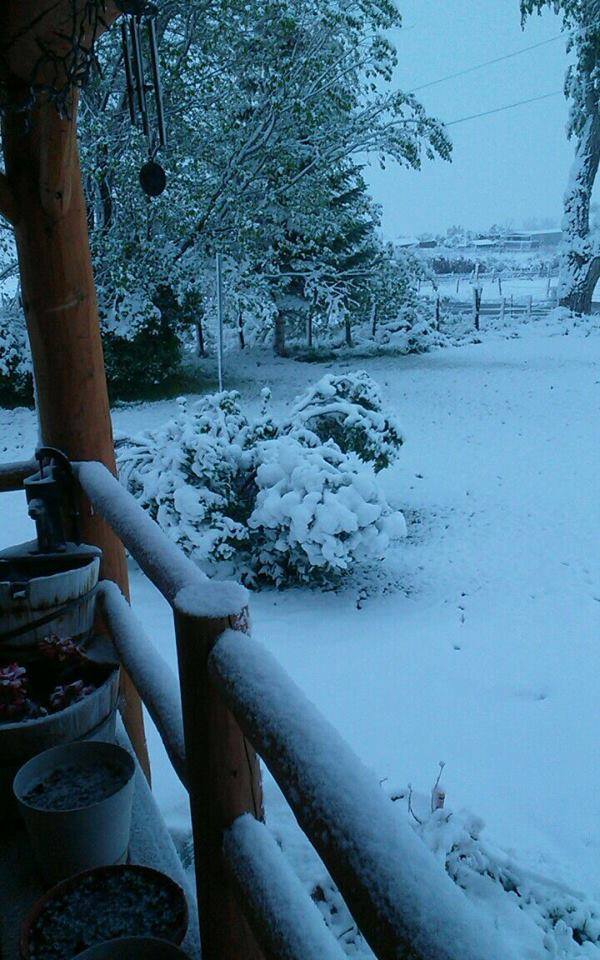
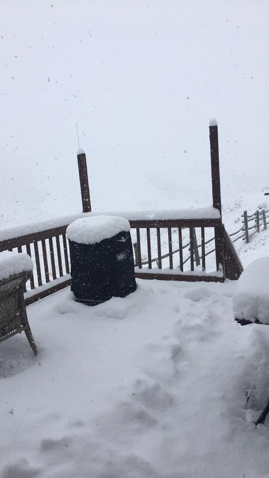
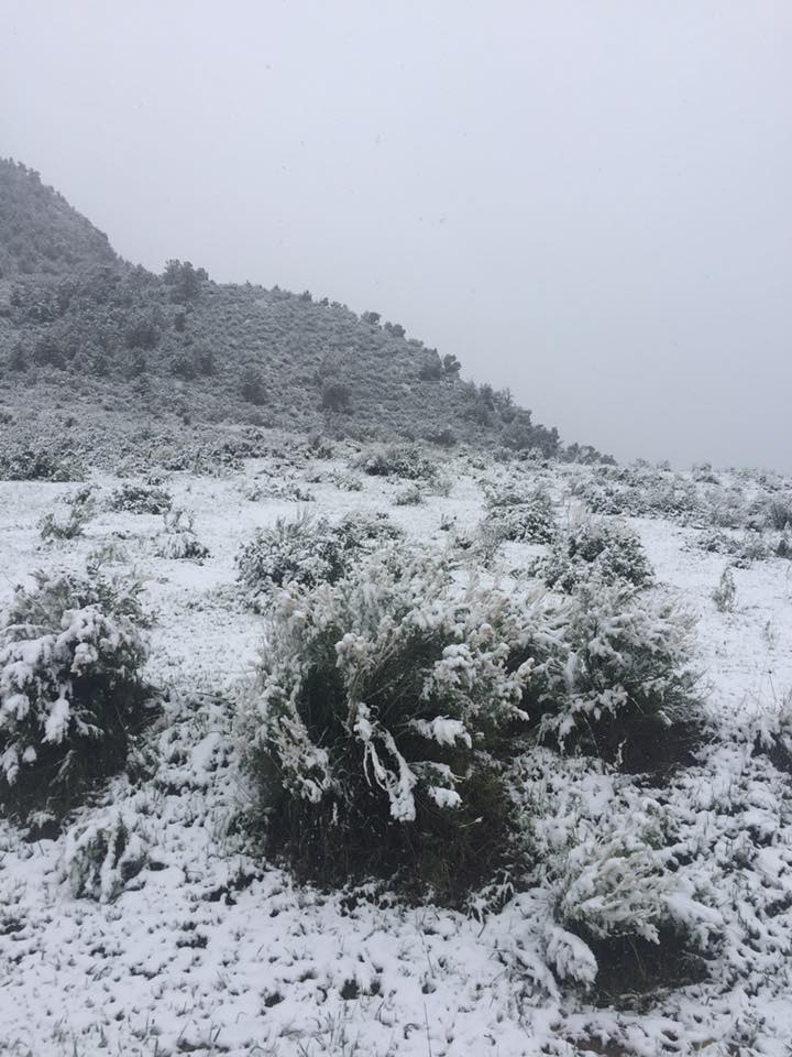
A potent late season winter storm brought winter back in full force for much of the region with significant snowfall in many mountain locations and heavy rainfall to the lower valleys. Plenty of moisture and a powerful cold front accompanied this system which lowered snow levels down to some valley floors including Montrose, Colorado (elevation around 5700 feet) where snowfall amounts of 3 to 6 inches were measured near town. This storm became an intense upslope snowfall event with some of the northern Colorado mountains receiving near or in excess of 2 feet! While the cold front had worked through the region by Thursday morning (May 18), impressive wraparound moisture kept showers falling through Friday evening (May 19) before drier air finally worked into the area from the west. Travel was impacted over a majority of high elevation roads where snowpacked and icy conditions developed with periods of reduced visibility due to blowing snow. Areas along Interstate 70 were greatly impacted with portions of the interstate being closed near Vail Pass due to multiple spun out vehicles. The cold air that filtered into the region behind the front resulted in a drastic decrease in temperatures with daytime highs cooling some 20 degrees and overnight lows plummeting back below freezing for many lower valleys. These subfreezing temperatures were a big wake-up call for early blooming, sensitive vegetation in areas like the Four Corners and Upper Dolores River Basin. |
 Storm Total Snowfall from May 17 - 19, 2017 |
 |
 |
 |
|
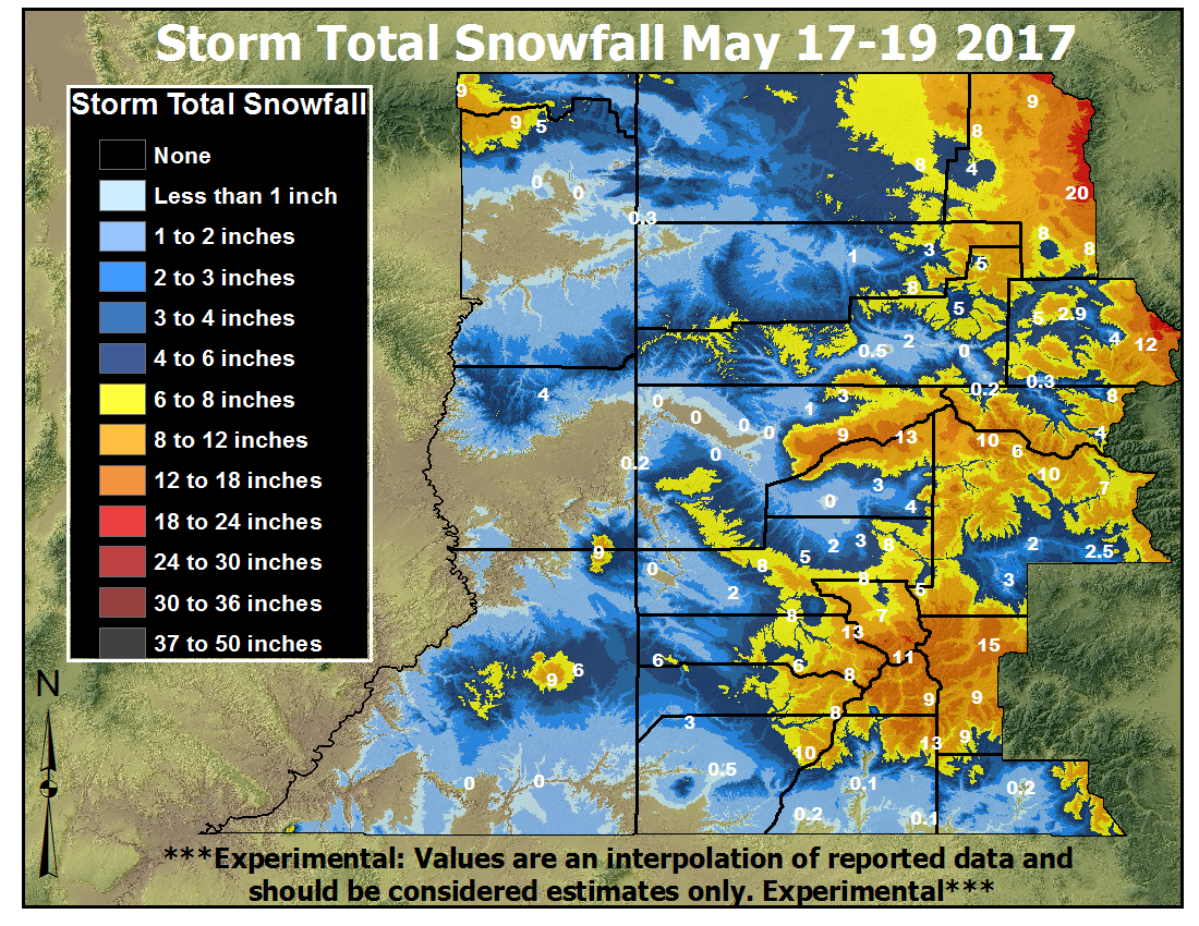
Below Powderhorn Ski Resort, Grand Mesa, CO (Credit: Mike Meyers) |
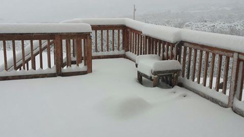
Cedaredge, CO (Credit: Jenn Miller) |
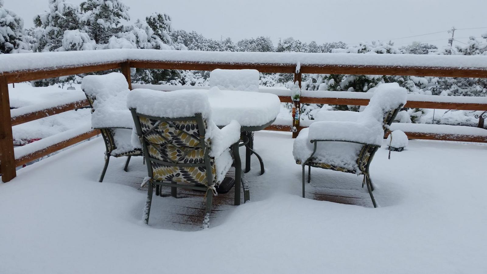
Marble, CO (Credit: Diane Gallagher) |
Photos & Video:
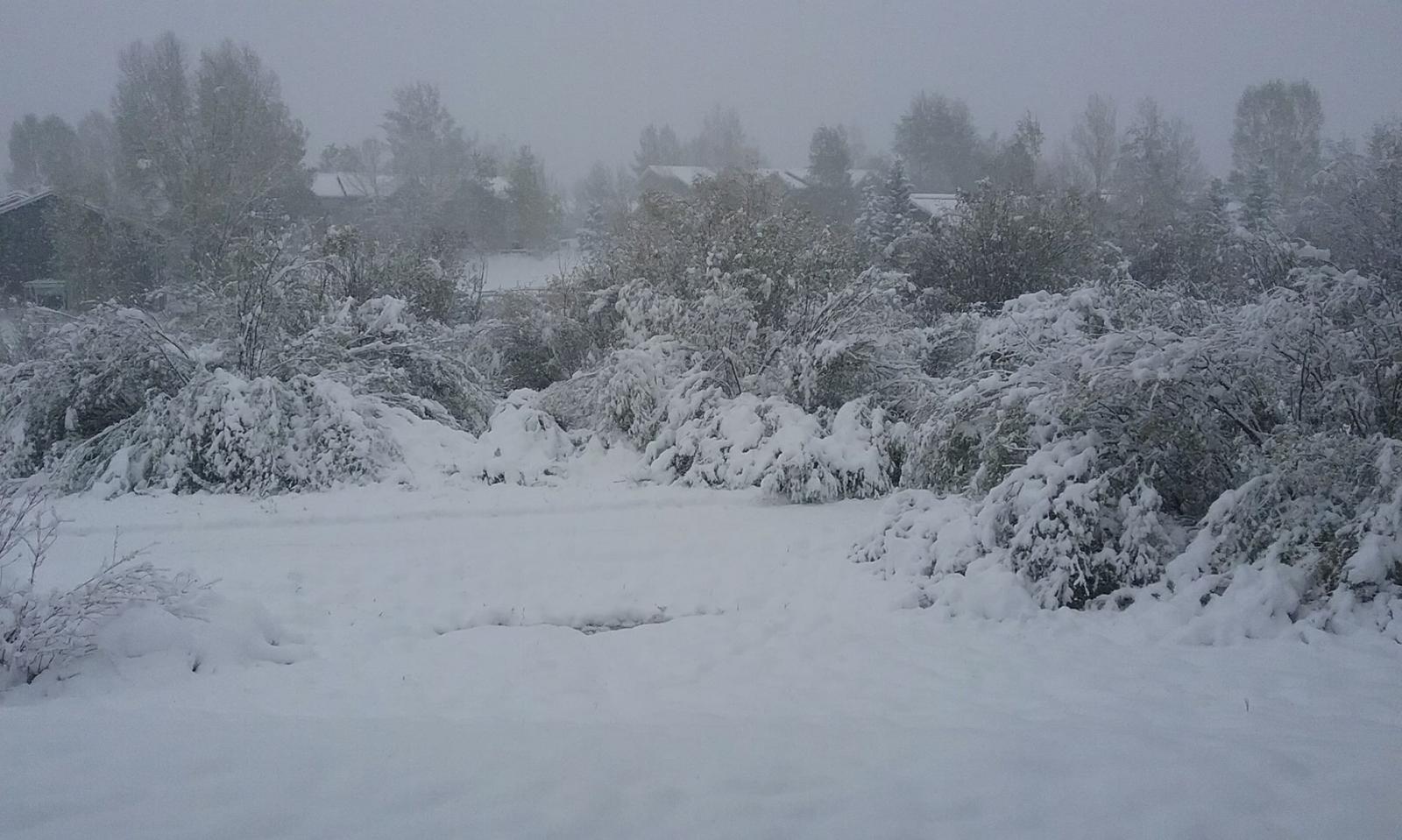
Snow Photos from Around the Region
 |
 |
 |
 |
| Yampa, CO (Credit: Troy/Lisa Bruggink) |
Telluride, CO (Credit: Paula Eisenberg) |
Steamboat Springs Valley (Credit: Tim Metz) |
South of Rifle (Credit: Haleigh Emmett) |
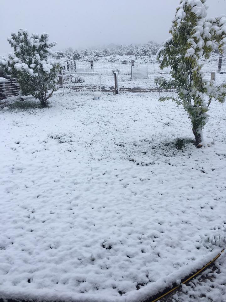
More Snow Photos from Around the Region
 |
 |
 |
 |
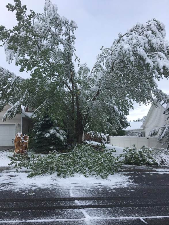
| Montrose, CO Tree Damage (Credit: Leah Braun) |
Collbran, CO (Credit: Doug Lyon) |
North of Hayden, CO (Credit: Susan Clausen) |
Parachute, CO (Credit: Shawn Pinnt) |
Storm Reports
The following are preliminary Storm Total Snowfall and Liquid
Precipitation Reports from eastern Utah and western Colorado
for the strong storm that brought significant snowfall to the mountains
and northwest Colorado valleys and significant rainfall to some of the
lower central and southern valleys. Amounts are in inches.

This storm impacted the area from May 17th through May 19th.
The best snowfall rates and accumulations favored the northern and
central mountains of western Colorado and the northern valleys.

Here are the estimated ranges of storm total snow that fell in the
mountain areas.

Elkhead and Park Range..... 8 to 14 inches, up to 17 at Whiskey Park
                            and 19 at Tower SNOTEL sites
Flat Tops.................. 5 to 13 inches
Grand Mesa................. 12 to 15 inches (8 to 10 at lower sites)
Gore and Elk Range......... 8 to 14 inches, up to 19 east of Vail
West Elks & Sawatch Range.. 6 to 10 inches
Uncompahgre Plateau........ 4 to 8 inches
Northwest San Juans........ 6 to 12 inches, up to 15 at Swamp Angel
Southwest San Juans........ 8 to 16 inches
Eastern Uintas............. 6 to 9 inches
Eastern Tavaputs........... 3 to 4 inches
La Sals and Abajos......... 2 to 5 inches

...Snowfall Reports...

Location                     Amount    Time/Date       Elevation (ft.)

...Colorado...

...Delta County...
Hotchkiss 7.1 WNW            4.6 in    0700 AM 05/20   6600
Eckert 1.1 SW                0.5 in    0700 AM 05/20   5485

...Eagle County...
Vail 2.6 E                   18.7 in   0700 AM 05/20   8389
Vail 0.9 WNW                 13.6 in   0700 AM 05/20   8172
2 ESE Gypsum                 6.1 in    0700 AM 05/20   6660
Wolcott 2.3 N                2.9 in    0700 AM 05/20   7224

...Gunnison County...
Crested Butte 6.2 N          10.0 in   0700 AM 05/20   9606
Gothic                       10.0 in   0700 AM 05/20   9469
Gunnison 6.6 N               4.7 in    0700 AM 05/20   7941
Powderhorn 4.4 NNE           3.0 in    0800 AM 05/20   9065

...La Plata County...
Bayfield 7.0 N               0.5 in    0700 AM 05/20   8200
Durango 4.8 WSW              0.3 in    0700 AM 05/20   7430
Hesperus 13.3 SSW            0.2 in    0715 AM 05/20   6686

...Moffat County...
Dinosaur 0.3 SW              0.3 in    0730 AM 05/20   5872

...Montrose County...
Montrose 7.3 ENE             8.0 in    0700 AM 05/20   6914
Montrose 2.0 E               6.1 in    0700 AM 05/20   5964
Montrose 1.2 ESE             2.6 in    0700 AM 05/20   5830

...Routt County...
Steamboat Springs 0.7 ESE    14.9 in   0700 AM 05/20   7049
Steamboat Springs 2.5 N      14.5 in   0700 AM 05/20   7005
Rabbit Ears Pass 6 W         4.0 in    0200 PM 05/20   9400


...Liquid Precipitation Reports...

Location                     Amount    Time/Date       Elevation (ft.)

...Colorado...

...Archuleta County...
Pagosa Springs 4.2 W         0.38 in   0700 AM 05/20   7640
Sandoval Mesa - 7 NE Arboles 0.32 in   0112 PM 05/20   8491
8 ENE Chromo                 0.15 in   0215 PM 05/20   7941

...Delta County...
2 WSW Paonia                 0.93 in   0700 AM 05/20   5580
Paonia 2.1 SSE               0.83 in   0700 AM 05/20   6100
Jay - 3 NNW Hotchkiss        0.77 in   0252 PM 05/20   6200
Hotchkiss 7.1 WNW            0.71 in   0700 AM 05/20   6600
Paonia                       0.66 in   0759 AM 05/20   5571
Eckert 1.1 SW                0.56 in   0700 AM 05/20   5485
Orchard City                 0.52 in   0200 PM 05/20   5440
1 NNW Cedaredge              0.34 in   0259 PM 05/20   6233

...Eagle County...
Vail 2.6 E                   1.55 in   0700 AM 05/20   8389
Vail 0.9 WNW                 1.25 in   0700 AM 05/20   8172
Gypsum 1.9 SSW               0.78 in   0700 AM 05/20   6531
2 ESE Gypsum                 0.70 in   0700 AM 05/20   6660
Dowd Junction - 1 N Dowd     0.56 in   1256 PM 05/20   9068
Wolcott 2.3 N                0.28 in   0700 AM 05/20   7224
Wolcott 2n                   0.28 in   0700 AM 05/20   7215
Avon                         0.25 in   0310 PM 05/20   8100

...Garfield County...
Glenwood Springs 7.0 NW      1.20 in   0700 AM 05/20   6940
Storm King Mountain - 4 WNW  0.50 in   0258 PM 05/20   8793
3 NNW El Jebel               0.38 in   0725 AM 05/20   7648
Rifle                        0.36 in   0700 AM 05/20   5371
Glenwood Springs             0.36 in   0200 PM 05/20   5701
Rifle Airport                0.33 in   0653 AM 05/20   5532
Glenwood Springs 5.3 SSE     0.22 in   0700 AM 05/20   5942

...Gunnison County...
Crested Butte 6.2 N          0.87 in   0700 AM 05/20   9606
Gothic                       0.87 in   0700 AM 05/20   9469
11 ESE Colona                0.59 in   0200 PM 05/20   8926
1 W Gunnison                 0.56 in   0215 PM 05/20   7655
Almont 1 WSW                 0.53 in   0100 PM 05/20   8006
8 WNW Tincup                 0.52 in   0100 PM 05/20   10134
Powderhorn 4.4 NNE           0.50 in   0800 AM 05/20   9065
4 ENE Somerset               0.47 in   0200 PM 05/20   6480
Taylor Rvr Blo Tayor Park Rs 0.43 in   1200 PM 05/20   9206
Gunnison 6.6 N               0.41 in   0700 AM 05/20   7941
Crested Butte                0.41 in   0200 PM 05/20   8860

...Hinsdale County...
Piedra G.s.                  0.52 in   0100 PM 05/20   7670
Rio Grande Rsvr ucn and coop 0.48 in   0100 PM 05/20   9455
2 SSE Lake City              0.46 in   0159 PM 05/20   8655

...La Plata County...
7 NNE Vallecito              0.70 in   0245 PM 05/20   7906
5 NNE Rockwood               0.69 in   1245 PM 05/20   7984
Trimble                      0.47 in   0146 PM 05/20   7510
Durango 7.1 N                0.43 in   0730 AM 05/20   6575
Bayfield 7.0 N               0.40 in   0700 AM 05/20   8200
Bayfield 0.6 WSW             0.37 in   0700 AM 05/20   6932
Durango 4.9 ESE              0.34 in   0700 AM 05/20   7123
Durango 4.8 WSW              0.31 in   0700 AM 05/20   7430
Durango 0.8 SSW              0.29 in   0700 AM 05/20   6624
3 ESE Bayfield               0.28 in   0310 PM 05/20   6978
4 NE Ignacio                 0.27 in   0245 PM 05/20   6650
Durango Airport              0.27 in   0653 AM 05/20   6685
Durango                      0.26 in   0830 AM 05/20   6742
Hesperus 4.9 SE              0.24 in   0700 AM 05/20   7202
Hesperus 13.3 SSW            0.13 in   0715 AM 05/20   6686
Ignacio Spotter              0.09 in   0700 AM 05/20   6562

...Mesa County...
11 W De Beque                0.71 in   0615 AM 05/20   6232
Grand Junction 3.9 WSW       0.71 in   0700 AM 05/20   4667
Jacks Canyon - 15 NW Escalan 0.70 in   0250 PM 05/20   7840
Pine Ridge - 6 NW Cameo      0.69 in   1234 PM 05/20   6710
1 E Redlands                 0.68 in   0700 AM 05/20   4653
Grand Junction 5.1 ESE       0.63 in   0700 AM 05/20   4638
Glade Park 1.4 NW            0.58 in   0700 AM 05/20   6927
Colorado Nat'l Monument      0.54 in   0844 AM 05/20   5780
Grand Junction 1.0 E         0.54 in   0748 AM 05/20   4751
Whitewater 4.2 SSE           0.51 in   0700 AM 05/20   4984
1 E Redlands                 0.50 in   0700 AM 05/20   4665
1 W Fruitvale                0.48 in   0212 PM 05/20   4674
1 W Fruitvale                0.47 in   0700 AM 05/20   4680
Grand Junction 8 NNW         0.45 in   0700 AM 05/20   4751
Little Dolores - 11 W Glade  0.41 in   1049 AM 05/20   6796
Grand Junction Airport       0.39 in   0653 AM 05/20   4850
17 W Glade Park              0.32 in   0800 AM 05/20   6385

...Moffat County...
Craig Airport                0.60 in   0653 AM 05/20   6198
Ladore - 11 NW Greystone     0.14 in   0723 AM 05/20   5940
2 SW Great Divide            0.09 in   0746 AM 05/20   7240
Dinosaur 0.3 SW              0.06 in   0730 AM 05/20   5872

...Montezuma County...
3 NW Mancos                  0.57 in   0130 PM 05/20   7958
Cortez 1.2 SW                0.37 in   0700 AM 05/20   6165
Mesa Verde National Park Coo 0.35 in   0204 PM 05/20   7070
Cortez 2.3 NW                0.29 in   0700 AM 05/20   6197
Cortez Coop                  0.27 in   1015 AM 05/20   6153
Cortez Airport               0.25 in   0653 AM 05/20   5918

...Montrose County...
Montrose 1.2 WSW             1.20 in   0800 AM 05/20   5887
Montrose 1.2 ESE             0.91 in   0700 AM 05/20   5830
Montrose 2.0 E               0.83 in   0700 AM 05/20   5964
Sanborn Park - 5 NE Norwood  0.75 in   0254 PM 05/20   7895
Montrose 2.9 ESE             0.74 in   0700 AM 05/20   6043
Montrose Airport             0.70 in   0653 AM 05/20   5759
Black Canyon - 9 SW Maher    0.70 in   0857 AM 05/20   8560
Montrose 7.3 ENE             0.59 in   0700 AM 05/20   6914
Paradox                      0.57 in   0600 AM 05/20   5594
Cottonwood Basin - 6 E Escal 0.51 in   0248 PM 05/20   7220
Olathe 3.2 NNE               0.41 in   0600 AM 05/20   5280
Carpenter Ridge - 8 NW Parad 0.41 in   0909 AM 05/20   8088
Montrose 8.1 WNW             0.24 in   0700 AM 05/20   5770

...Ouray County...
1 NNW Ridgway                0.69 in   0200 PM 05/20   6980
2 NNE Red Mtn                0.67 in   0215 PM 05/20   10200
3 NNW Ouray                  0.64 in   0115 PM 05/20   8080
4 NW Ridgway                 0.60 in   0255 PM 05/20   8300
2 WNW Camp Bird              0.45 in   0115 PM 05/20   11149
3 NNW Colona                 0.28 in   0215 PM 05/20   6318
7 NNW Telluride              0.02 in   0115 PM 05/20   9260

...Pitkin County...
The Crown - 2 SSW Emma       0.46 in   0249 PM 05/20   8382
Aspen Airport                0.41 in   0653 AM 05/20   7723
5 W Meridith                 0.15 in   0300 PM 05/20   7793

...Rio Blanco County...
Hunter Creek - 19 W Rio Blan 0.75 in   1018 AM 05/20   7320
Rifle 23 NW                  0.71 in   0700 AM 05/20   7558
Meeker 15 W                  0.49 in   0700 AM 05/20   5789
Meeker Airport               0.49 in   0653 AM 05/20   6421
White River Nr Meeker        0.46 in   0200 PM 05/20   6300
Dead Horse - 13 ENE Buford   0.42 in   1057 AM 05/20   8685
Dragon Road - 13 SSW Rangely 0.33 in   1018 AM 05/20   6290

...Routt County...
Steamboat Springs 0.7 ESE    1.54 in   0700 AM 05/20   7049
Steamboat Springs 2.5 N      1.43 in   0700 AM 05/20   7005
Steamboat Springs 6.9 SW     1.11 in   0700 AM 05/20   7464
Porcupine Creek - 6 ENE Topo 0.65 in   0257 PM 05/20   8941
11 E Slater                  0.42 in   0145 PM 05/20   6880
Hayden                       0.23 in   0555 AM 05/20   6601

...San Miguel County...
Redvale 22.8 SW              0.78 in   0800 AM 05/20   5925

...Utah...

...Daggett County...
Cart Creek - 17 ESE Manila   1.04 in   1028 AM 05/20   6975
Flaming Gorge Rsvr Nr. Upper 0.15 in   0153 PM 05/20   6054

...Grand County...
Moab 1.3 NW                  0.15 in   0800 AM 05/20   3991
Arches Nat'l Park            0.11 in   0800 AM 05/20   4130
Canyonlands/Moab Airport     0.04 in   0653 AM 05/20   4553

...San Juan County...
3 ENE Verdure                0.45 in   0849 AM 05/20   5435
Kane Gulch - 15 ESE Fry Cyn  0.24 in   0842 AM 05/20   6500

...Uintah County...
McCook Ridge - 35 NW Mack    0.35 in   0627 AM 05/20   6722
Wildhorse - 25 E East Carbon 0.33 in   1048 AM 05/20   8250
Upper Sand Wash - 41 SE Rand 0.33 in   0927 AM 05/20   6469
Winter Ridge - 41 WNW Mack   0.23 in   1027 AM 05/20   7378
Upper P.R. Canyon - 28 WNW M 0.15 in   1027 AM 05/20   8269
Jensen 0.4 WSW               0.04 in   0700 AM 05/20   4768
Naples                       0.03 in   0700 AM 05/20   5200
Dinosaur Nat'l Mon - Quarry  0.03 in   0900 AM 05/20   4770
Vernal Airport               0.01 in   0653 AM 05/20   5278

Observations are collected from a variety of sources with varying
equipment and exposures. We thank all volunteer weather observers
for their dedication. Not all data listed are considered official.
 |
Media use of NWS Web News Stories is encouraged! Please acknowledge the NWS as the source of any news information accessed from this site. |
|

