Extremely critical fire weather concerns for portions of the southern High Plans as strong wind and very dry conditions could result in rapid spread of any fires. Meanwhile, severe thunderstorms are expected once again across areas of the Central and Southern Plains, then spreading in the Mississippi Valley regions on Monday. Damaging winds, very large hail and strong tornadoes are possible. Read More >
Overview
|
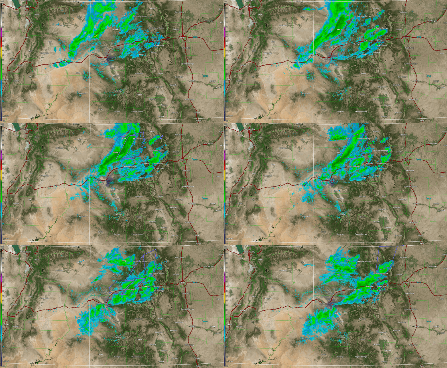
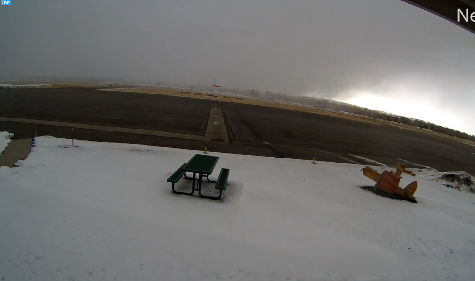
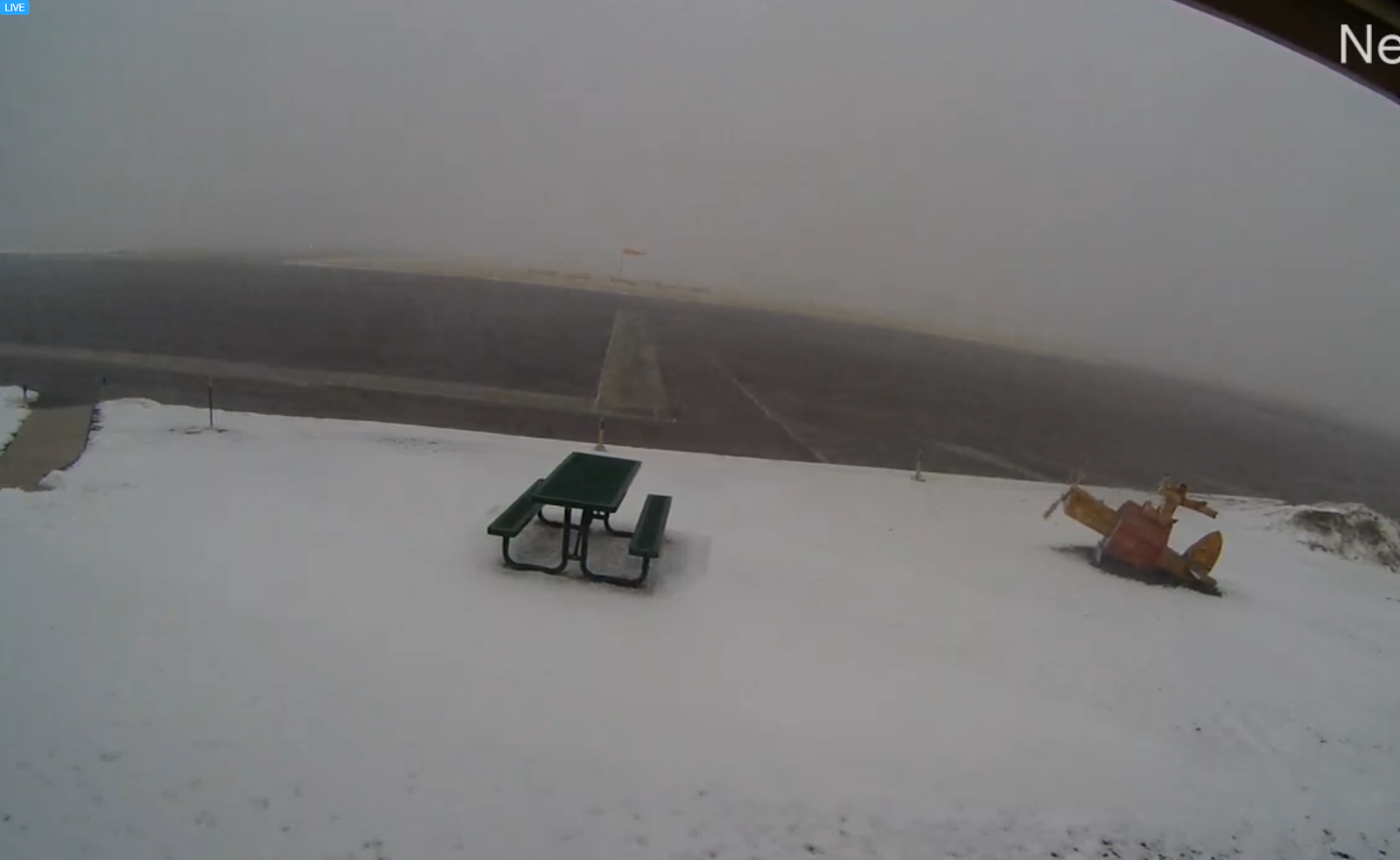
A strong cold front moved across the Western Slope of Colorado on the evening of December 22, 2020. The cold front, combined with a tight pressure gradient, instability aloft, and favorable upper level dynamics, produced strong winds at the surface. This led to the development of a snow squall which progressed through the portions of central Colorado. The National Weather Service defines a snow squall as "an intense, but limited duration, period of moderate to heavy snowfall, accompanied by strong, gusty surface winds". Winds gusted upwards of 50 mph over the course of the snow squall which developed west of Craig, Co. Over the next several hours the snow squall progressed to the east-southeast. Impacts occurred along Highway 40, Interstate 70 and Highway 50. Temperatures ahead of the squall were above freezing which allowed for rain initially in spots. Flash freeze conditions were documented as temperatures quickly dropped below freezing. The squall was particularly strong near Steamboat Springs were lightning and white-out conditions were reported. There were at least 10-20 wrecks and slide-offs up and down the I-70 corridor between Gypsum, Wolcott, and Vail Pass. The webcam at Craig Airport captured the snow squall moving through, and numerous people witnessed this impressive but dangerous phenomenon as it progressed into the evening. |
 KGJX Radar Data Showing Snow Squall Moving Through on December 22, 2020 |
 |
 |
| View of the Snow Squall Before it Moved Through Craig Airport | View of the Snow Squall as it Moved Through Craig Airport |
Photos & Video
| Video 1: View of Snow Squall in Steamboat Springs (Credit: Samantha Tisdall) |
Video 2: View of Snow Squall in Steamboat Springs (Credit: Mike Lane) |
 |
Media use of NWS Web News Stories is encouraged! Please acknowledge the NWS as the source of any news information accessed from this site. |
 |