Extremely dangerous heat will persist from the Midwest to the East Coast into late this week. Monsoonal moisture may produce excessive rain and considerable flash flooding and debris flows, especially near recent burn scar areas in New Mexico and west Texas. Severe storms are possible this evening from the southern/central Plains into the Great Lakes, and the northern/central Plains Tuesday. Read More >
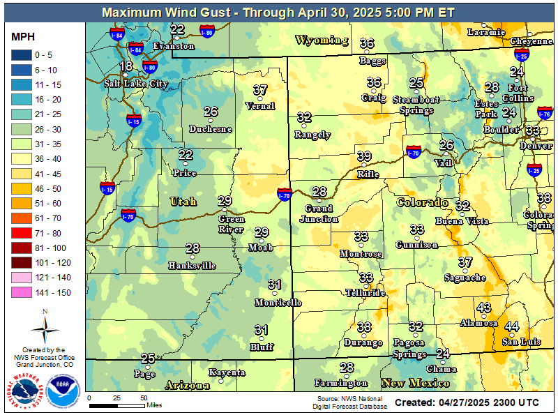
A more organized system will sweep through the area today driving a cold front from north to south during the day. Moisture associated with this system will generate mountain snow favoring the northern ranges where snow levels will lower to mountain bases as colder air filters into the region. Afternoon highs will be markedly cooler across the northeast Utah and northwest Colorado with modest cooling in the Four Corners region. However dry conditions along with gusty winds will create areas of very high fire danger in far southwest Colorado. Wind gusts up to 50 mph are possible across the Grand and Paradox valleys, with wind gusts up to 40 mph in other valleys.
Afternoon humidity will be under 15% in areas near the 4 Corners in southwest Colorado. Combine this dry air with wind gusts over 25 mph and some dry fuels, and critical fire weather conditions are likely. Open burning could lead to fires quickly becoming out of control in these conditions.
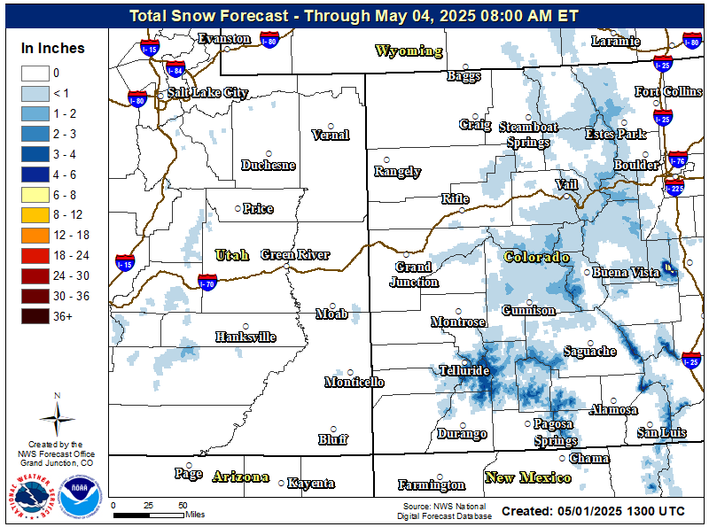
An approaching Pacific storm system will push the cold front through northern portions of Utah and Colorado Tuesday. This will bring cooler temperatures to the region while producing snow over the northern and central Colorado mountains throughout the day.

High Temperatures today will fall by 15 to 20 degrees across northeast Utah and northwest Colorado. Farther south cooling will be more modest with afternoon highs only dropping by around 5 degrees as cold air doesn't arrive until late in the day.

The northern mountains can expect 2 to 6 inches of new snow with higher amounts possible in the Park Range by early Wednesday morning. If planning travel today, be prepared for winter driving conditions over the higher moutain roadways. However this time of year many roadways may stay mainly wet during the daylight hours as the snow falls.