
Dangerous heat will expand from the Gulf Coast into the Southern Plains and Desert Southwest through week's end. Additional extreme heat impacting the Pacific Northwest will shift to the northern Plains by the weekend. Tropical Storm Bertha is expected to continue to impact portions of the northern Gulf Coast from the western Florida Panhandle to southeastern Louisiana through tonight. Read More >
Overview
|
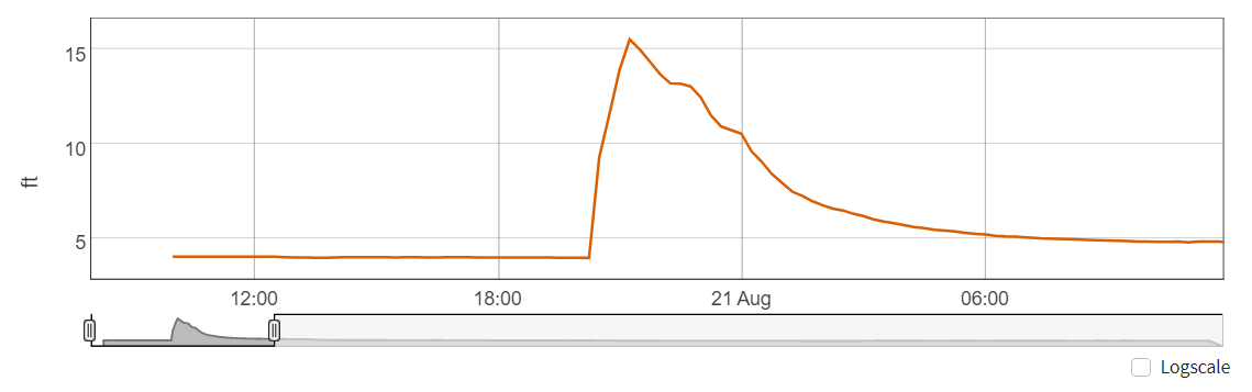
On the evening of August 20th a system moving through the region triggered strong storms across portions of east central Utah. Due to rich monsoon moisture in place these storms produced heavy rainfall. Clouds cleared out of the area by early afternoon, which allowed the instability to become maximized. As a result the storms developed very rapidly. The sounding that morning from the Grand Junction NWS had a precipitable water value of 0.93", which is 125 to 175 percent of normal. There were two automated gauges located in Spanish Valley where the some of the highest rainfall amounts occurred. Over the course of an hour (7-8 MDT) one of the gauges measured 1.42" and the other 1.71". Lighter rain did continue for another 1-1.5 hours. These rainfall amounts yielded 50 year Average Return Intervals (ARIs) in Moab, UT and surrounding areas experiencing 100 year ARI. This heavy rainfall and widespread flash flooding resulted in numerous road closures due to flash flooding and debris flows. Numerous homes and businesses had upwards of 7 inches of water and debris inside resulting in significant property damage. Mill Creek in Moab rose roughly 11.6 ft in about one hour. The rise started around 8:15, which was not long after the heavy rain fell. Below are the USGS hydrographs for Mill Creek below Pack Creek in Moab. |
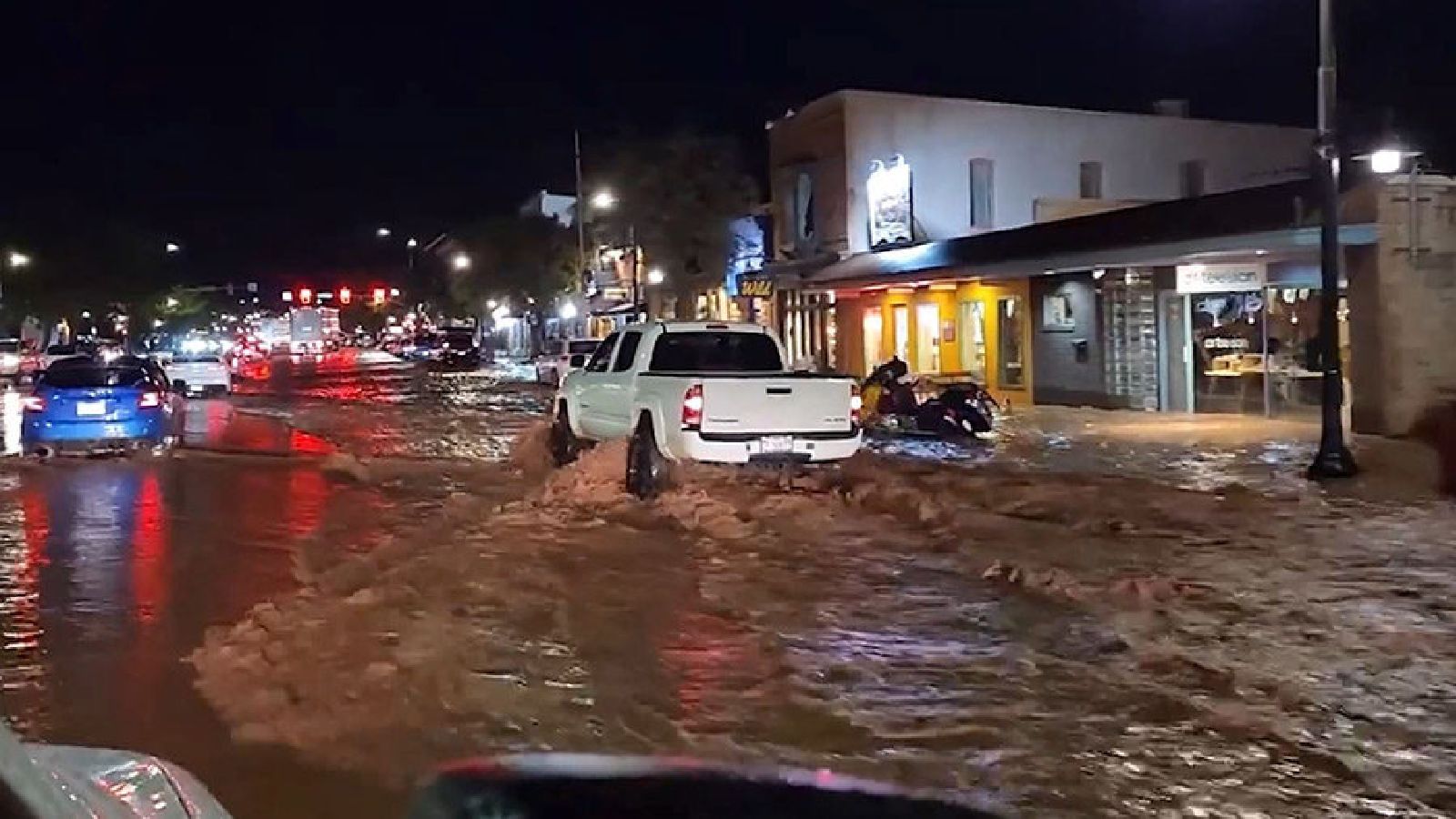 Flooding in Downtown Moab (Credit: Salt Lake Tribune) |
Photos & Video:
 |
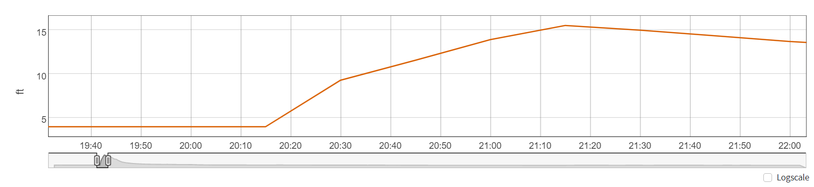 |
| River Gauge at Mill Creek in Moab (Credit: USGS) |
River Gauge at Mill Creek in Moab (Credit: USGS) |
Video 2 (Twitter credit: @Neildos)
Video 3 (Twitter credit: @Neildos)
Video 4 (Twitter credit: Deweys)
Video 5 (Twitter credit: @tarebear)
Video 6 (YouTube credit: Michael Grindstaff)
Radar:
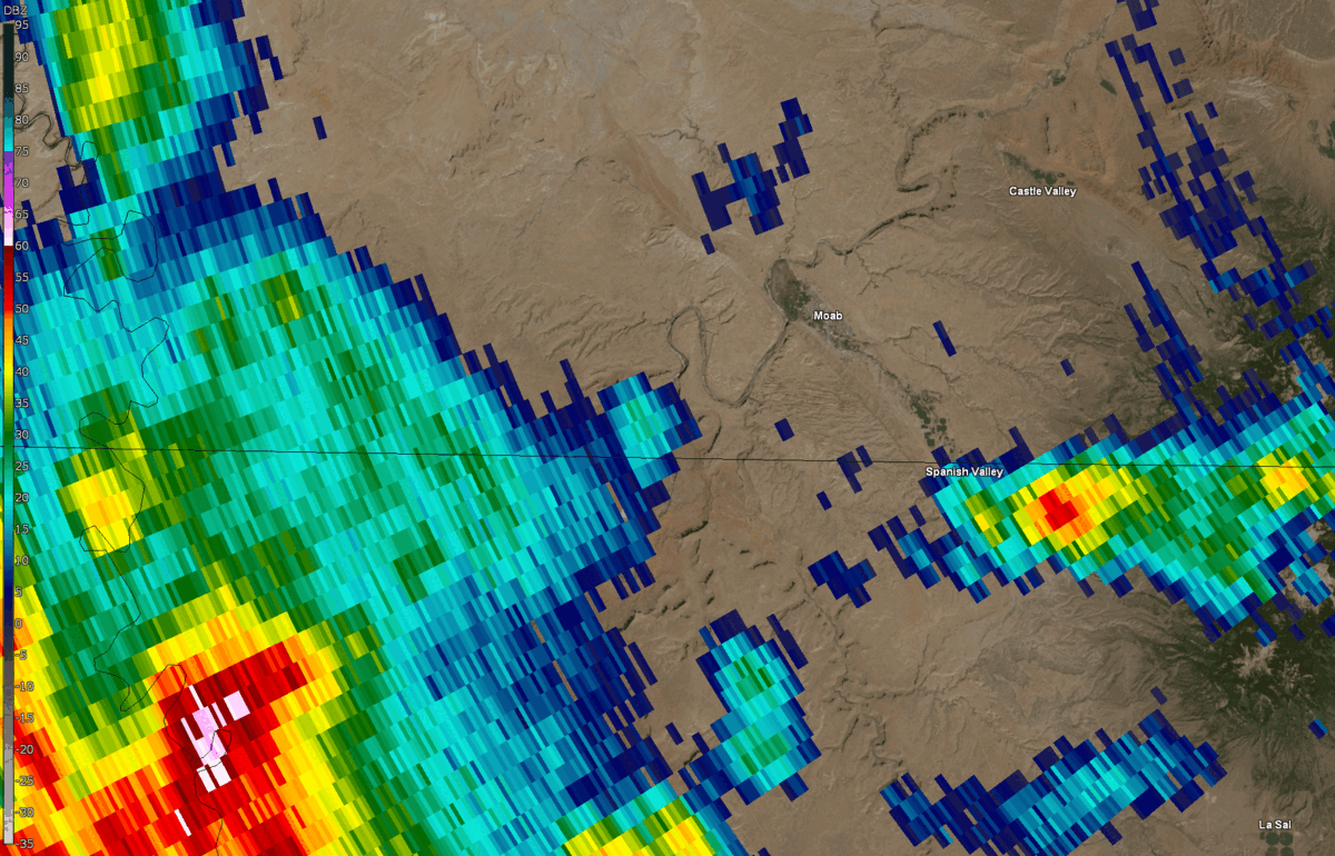 |
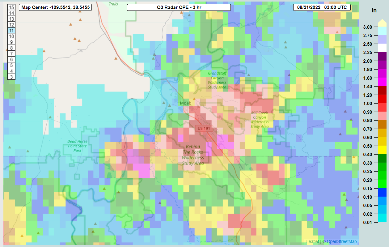 |
| Radar Loop (KGJX) | Estimated Rainfall Amounts (MRMS) |
Storm Reports
| County | City | Magnitude / Remarks |
| Grand | 4 NW Grand Co Airport | Video shared on social media of several feet of water flowing through a neighborhood |
| Grand | 4 ESE Moab | 1.75 inches of rain in less than an hour. Pack Creek and Mill Creek overflowed their banks and flooding downtown. Road graders out all night. |
| San Juan | 8 NW Canyonlands NP | White Rim Road was washed out and there is a vehicle hanging over the edge. |
| San Juan | 5 NE Canyonlands NP | Debris flow on Shafer Basin Road. There is still a lot of debris on the road making for dangerous travel. |
| Grand | 2 W Moab | Debris from Mill Creek visible in the Colorado River (large tree branches) |
| Grand | Moab | Sewage backup in park. Mud inundated much of downtown from 200N to 300S and from Mill Creek. Bulk of flooding, debris appear to be confined within the 100 year flood plain. |
| Grand | Moab | 9 to 12 inches of mud and debris inside Deweys Restaurant resulting in 3+ day closure and an estimated $100,000 in damage (not including lost sales) |
| Grand | Moab | Flash flooding evident at 300S Road and Mill Creek, with damage to bridge railing 145 to 20 feet above normal creek channel. |
| Grand | 2 SE Moab | Water and debris piled up over park bridge (approximately 10 to 15 feet above normal creek channel) |
| Grand | 2 SE Moab | Damage to dam, soil erosion, ~18 inch diversion pipe cracked and filled with sand. |
| Grand | 2 SE Moab | Damage to neighborhood from flash flooding, walking path destroyed. |
| Grand | 3 SE Moab | Debris backed up on culverts, resulting in significant overland flooding. |
 |
Media use of NWS Web News Stories is encouraged! Please acknowledge the NWS as the source of any news information accessed from this site. |
|

