
A heat wave over the Southwest will intensify this week, peaking and expanding into the Intermountain West and northern High Plains this weekend. Severe thunderstorms and heavy rainfall are expected over parts of the Upper Midwest to mid-Mississippi Valley today. Critical to extremely critical fire weather conditions from the Northwest and the northern Great Basin on Saturday and Sunday. Read More >
Overview
|
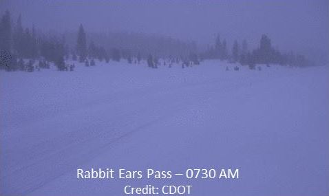
A disturbance in northwest flow generated snow and blowing snow over the Elkhead and Park Ranges, along with a portion of the Gore Range from the 27th through the 28th of December. This modest winter storm produced an average of 4 to 8 inches across these areas with locally higher amounts at Tower where close to 11 inches was recorded. Average wind gusts were in the 30s throughout the day which limited visibility over Rabbit Ears Pass and other locations in the higher elevations. |
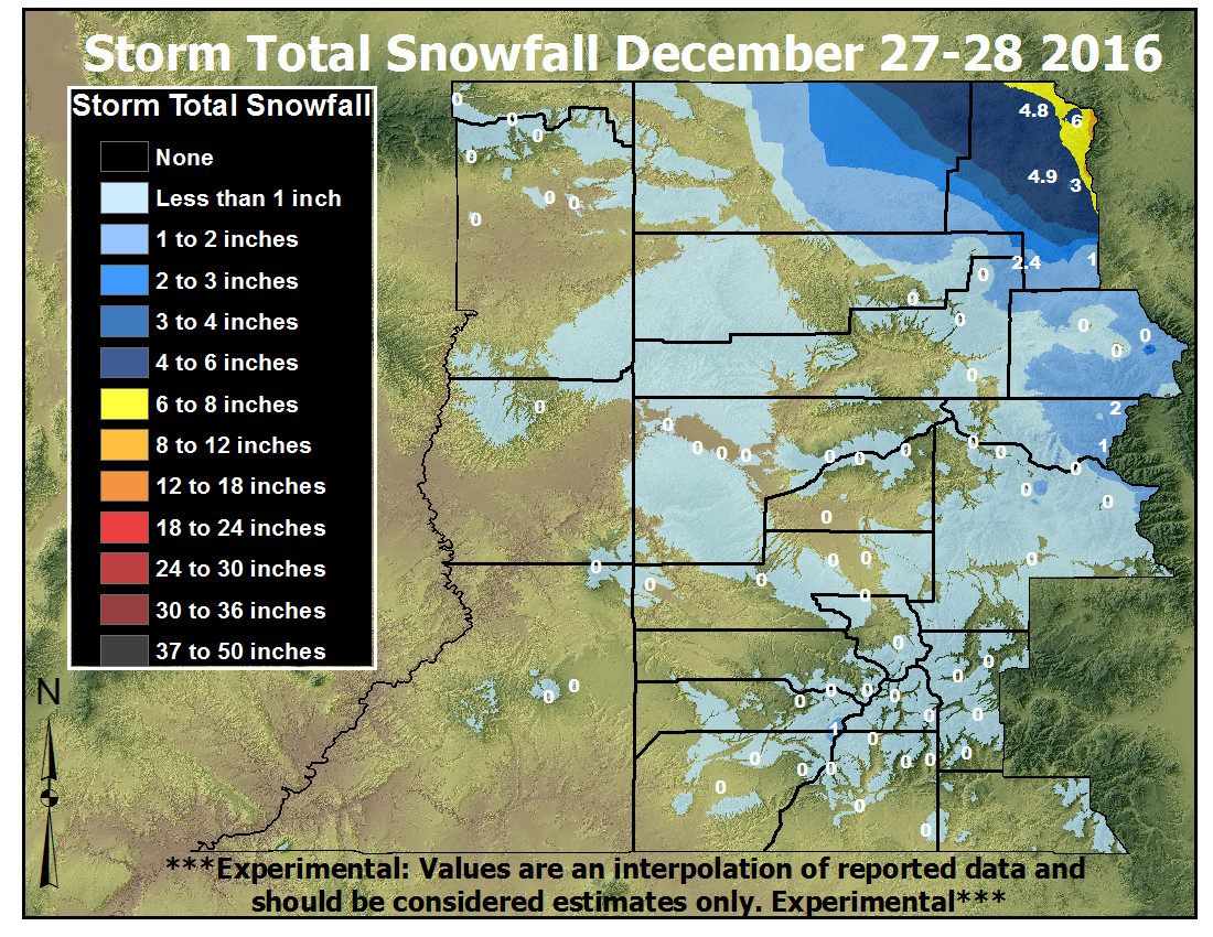 Total Snowfall from the December 27-28, 2016 Winter Storm |
 |
 |
 |
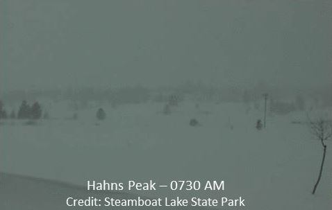
| Snow and blowing snow over Hahn's Peak at 730 AM MST Wednesday morning, 12/28/2016. Credit: Steamboat Lake State Park |
Snow and blowing snow over Rabbit Ear's Pass at 730 AM MST, Wednesday morning, 12/28/2016. Credit: CDOT |
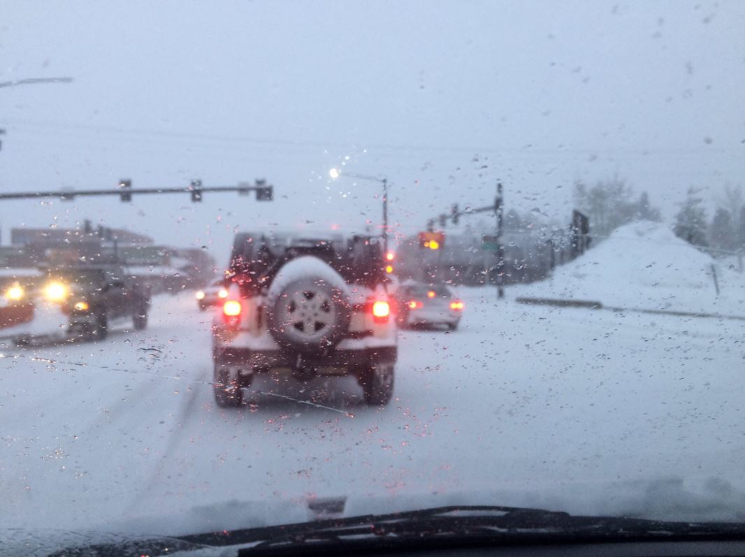
The morning commute in Steamboat Springs the morning of 12/28/2016. Credit: John Overstreet |
Storm Reports
Estimated storm total snowfall values for the mountains are shown,
followed by preliminary individual reports.
A small disturbance has moved across the northern mountains, bringing
decent snow accumulations. Estimated snowfall values for the mountains
so far are shown, followed by preliminary individual reports.

Elkhead and Park Mountains... 3 to 8 inches; 11 near Tower (10500`)

...Snowfall Reports...

Location                     Amount    Time/Date       Elevation (ft.)
Steamboat Springs 0.1 NNE    3.5 in    0700 AM 12/28   6743
Steamboat Springs 1.1 E      3.3 in    0700 AM 12/28   7130
2 ESE Steamboat Springs      3.0 in    0914 AM 12/28   null
Steamboat Springs 1.5 WNW    3.0 in    0715 AM 12/28   6778
Steamboat Springs 0.6 NNW    3.0 in    0700 AM 12/28   6812
Steamboat Springs 0.7 ESE    2.9 in    0700 AM 12/28   7049
Steamboat Springs 7.9 WNW    1.2 in    0800 AM 12/28   6653
Oak Creek 5.5 E              0.5 in    0700 AM 12/28   7334
Steamboat Springs 1.9 E      0.4 in    0600 AM 12/28   7200
Steamboat Springs 1.2 SE     0.2 in    0522 AM 12/28   7075

Observations are collected from a variety of sources with varying
equipment and exposures. Not all data listed are considered official.

$$

NWS Grand Junction CO
IRIS System
 |
Media use of NWS Web News Stories is encouraged! Please acknowledge the NWS as the source of any news information accessed from this site. |
|

