
Flash flooding threatens areas from the Tennessee Valley to the Carolinas as storms repeat along a stalled front. Monsoonal storms may trigger flooding in the Southwest. Dangerous heat expands across the Desert Southwest, Plains, mid-Mississippi Valley and Southern Tier. Critical fire weather for interior Pacific Northwest. Cooler, drier air brings brief relief to the Great Lakes and Northeast. Read More >
Overview
|
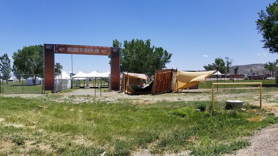
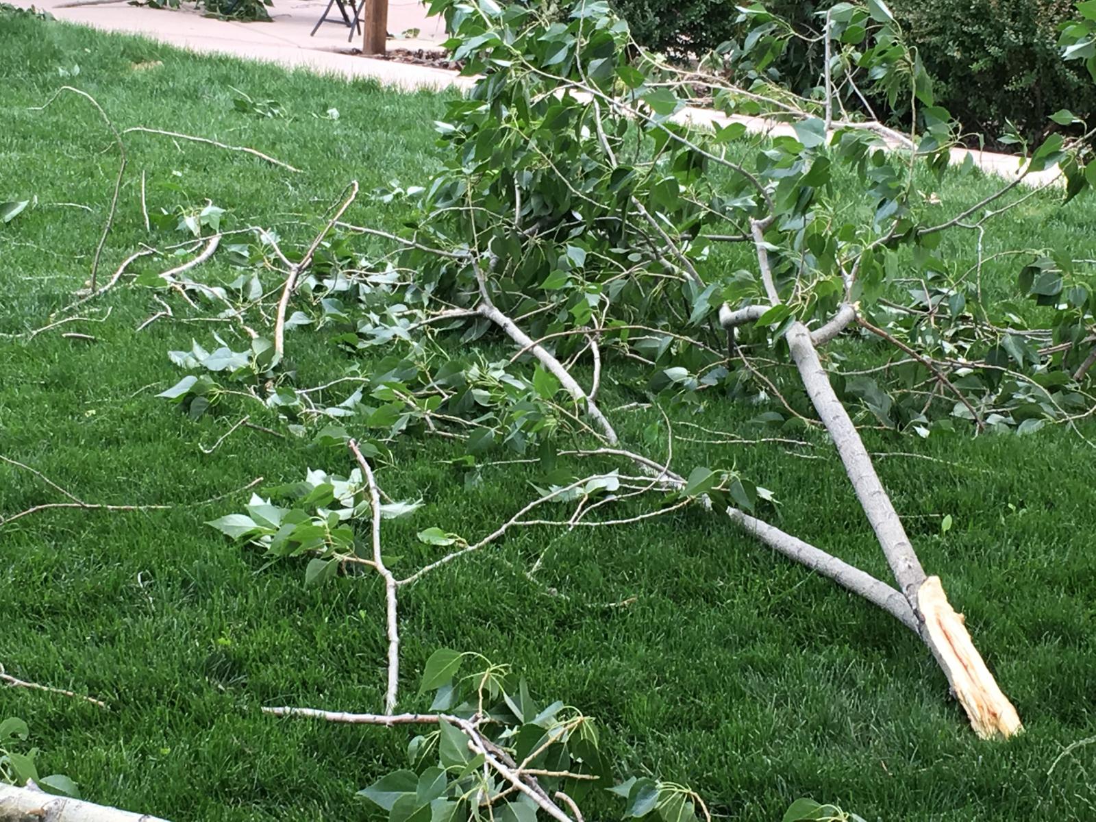
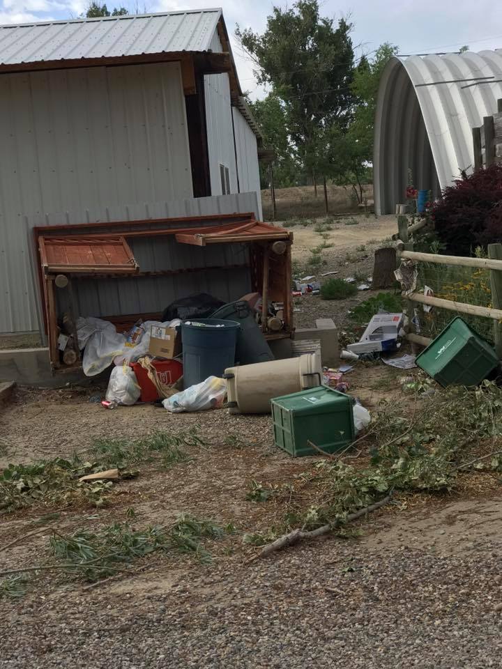
A dry microburst was reported in northern parts of Grand Junction and in Loma, CO on Wednesday June 21, 2017. A microburst is a downdraft (sinking air) in a thunderstorm that is less than 2.5 miles in scale. Though thunder was not present during most of these "storms", wind gusts up to 71 mph were recorded, the greatest at Grand Junction Regional Airport at 5:24pm. The Jam Ranch out in Loma, Colorado received damage to tents and outbuildings. Tree damage occurred in Grand Junction in neighborhoods near the airport. Other areas received sudden, strong winds, but no damage was reported outside of the Grand Valley. |
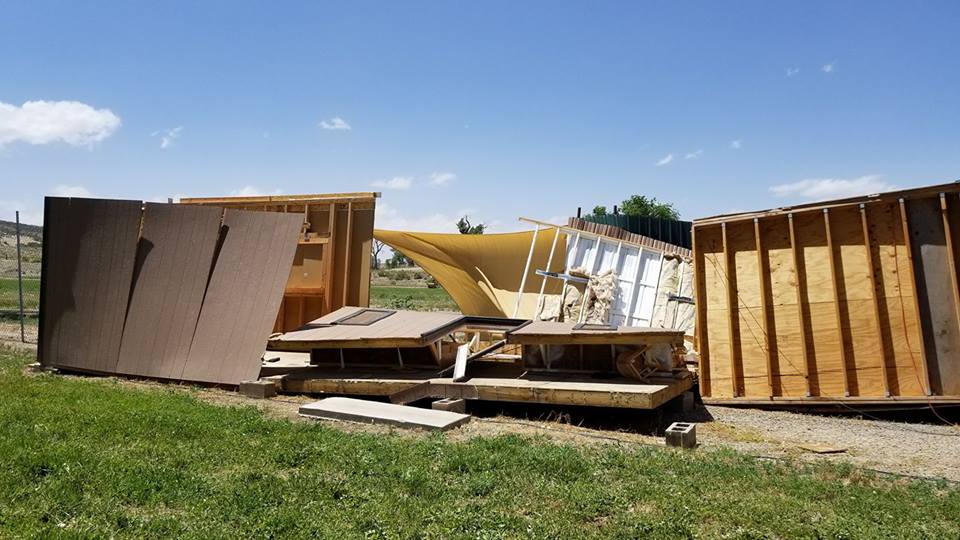 Damage to outbuildings at Jam Ranch in Loma, CO. Photo courtesy Luke Dobbs. |
 |
 |
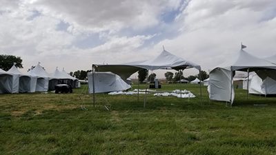 |
| Damage to structures at Jam Ranch in Loma, CO. Photo courtesy Luke Dobbs. | Tree damage near Grand Junction airport. Photo courtesy Libby Pelletier. | Damage to tents at Jam Ranch in Loma, CO. Photo courtesy Luke Dobbs. |
 |
 |
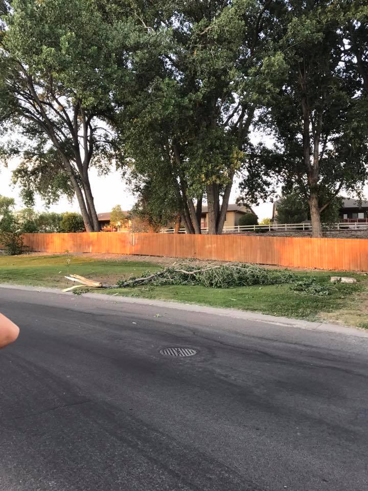 |
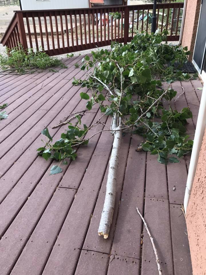
| Damage to trees on 23 Rd between I and J Rd in Grand Junction, CO. Photo courtesy Camille Chapman. | 23 Rd between I and J Rd in Grand Junction, CO. Photo courtesy Camille Chapman. | Tree damage at 25 1/2 & G 1/2 Rd. Photo courtesy Nicolle Lewis. |
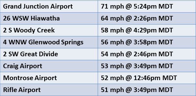
Highest Convective Wind Gusts:
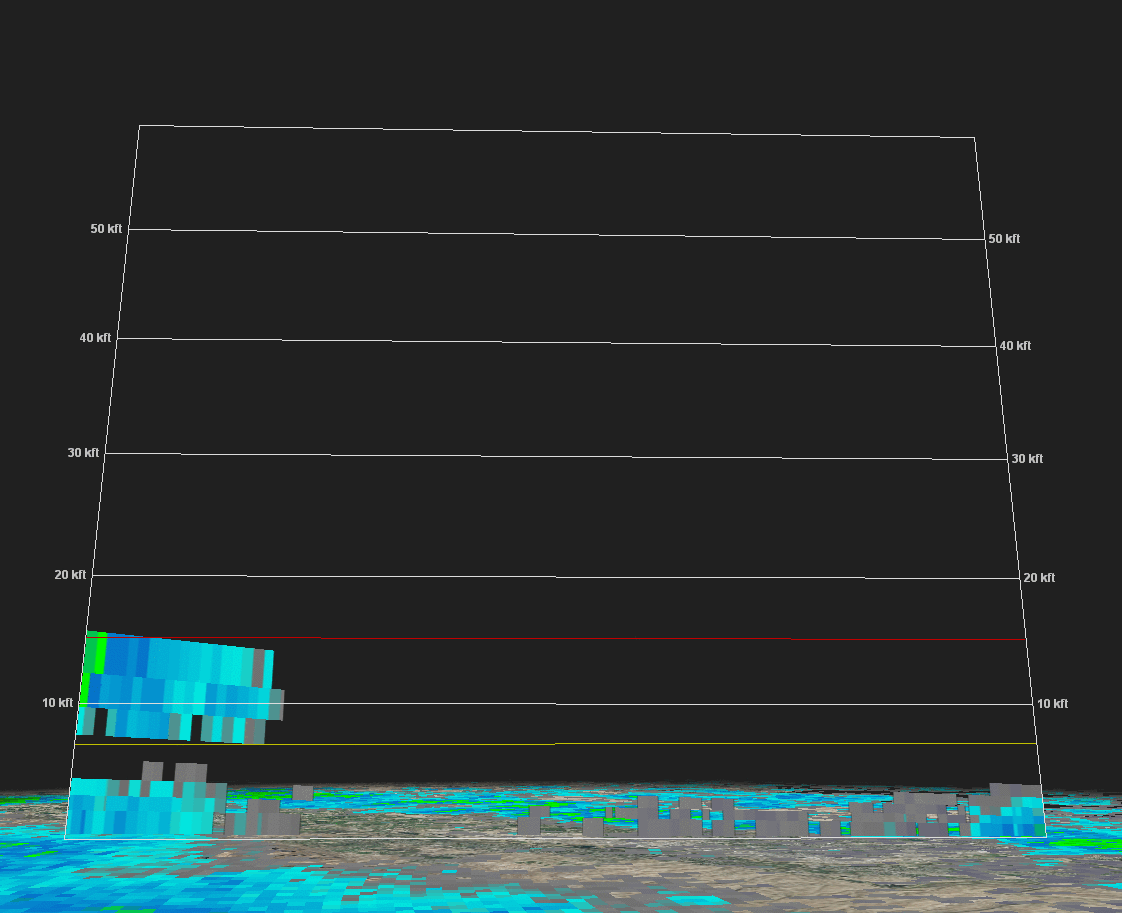
Radar Imagery from Dry Microburst on June 21st
 |
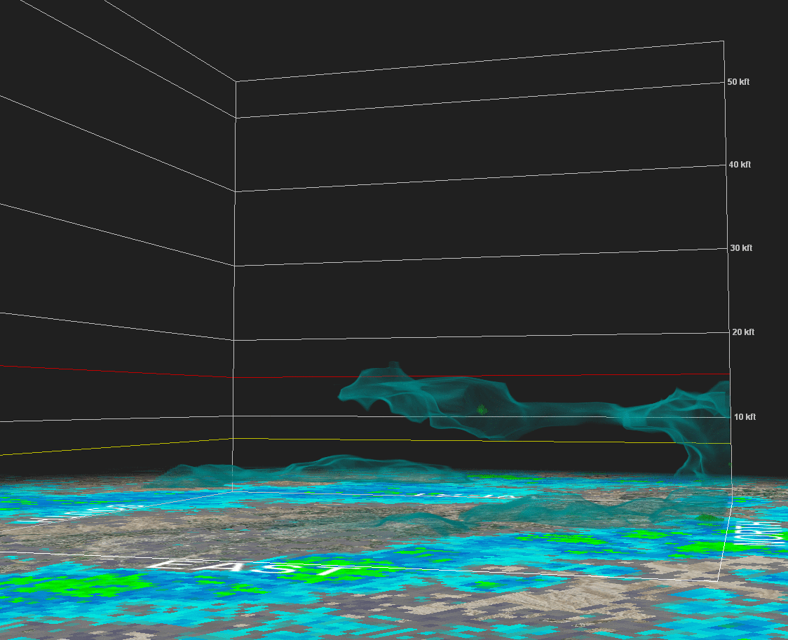 |
| The first is a vertical west-east slice along I-70. You can see the 'core' of the storm (very low dBZ, but a core nonetheless) form aloft and descend downward. The arrow marks the location of the horizon drive exit/airport, and shows up when the wind gust occurred. | This volume scan shows three reflective shells: 1dBZ (blue), 5 dBZ (light green) and 30 dBZ (dark green). The view is looking southwest across the airport and over the valley, from approximately the perspective of Mt. Garfield. You can see the cell form aloft to the west and watch the core of higher reflectivity descend. Again, the black arrow pops up at the airport and at the time of the wind observation. |
 |
Media use of NWS Web News Stories is encouraged! Please acknowledge the NWS as the source of any news information accessed from this site. |
|

