
A slow moving storm system over the northern Gulf Coast will continue periods of showers and thunderstorms over much of the Southeast U.S. through this weekend. The risk for heavy to excessive rainfall increases on Sunday as a surge of increased moisture moves over parts of northern Florida into southern Georgia. Read More >
Grand Junction, CO
Weather Forecast Office
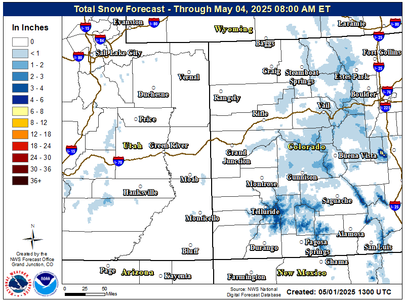
Snow showers will continue this morning as an unseasonably cold and moist low pressure system exits the region. Showers will taper off from west to east with activity persisting over the higher terrain along the Continental Divide and adjacent valleys through mid this morning. From then onwards light, isolated snow showers will continue over the southern and central Colorado mountains before dissipating by mid afternoon. Snowfall accumulations will taper off after sunrise. In the wake of this storm, bitterly cold and dry northwest flow aloft will prevail through the end of the week.
Winter Weather Warnings / Watches / Advisories Issued: 05/06/2025 02:14:37 PM UTC
Latest Weather Map

Forecast Snowfall Totals
Hazards
Detailed Hazards Viewer
Outlooks
Winter Storm Severity Index
Transportation Decision Support
National Briefing
Current Conditions
Observations
Radar
Satellite
Snow Cover
Snowfall Analysis
Precip Analysis
Social Dashboard
Forecasts
Forecast Discussion
Local Area
Activity Planner
Aviation Weather
Fire Weather
Severe Weather
Winter Weather
Hurricane Center
Hydrology
Recreational River Report
Rivers and Lakes
Weather Safety
Preparedness
NOAA Weather Radio
StormReady
SkyWarn
Spotter Training Calendar
US Dept of Commerce
National Oceanic and Atmospheric Administration
National Weather Service
Grand Junction, CO
2844 Aviators Way
Grand Junction, CO 81506-8644
970-243-7007
Comments? Questions? Please Contact Us.

