
Strong to severe thunderstorms capable of producing large to very large hail, damaging wind gusts and a few strong tornadoes are likely from the Midwest to the Mid-Atlantic tonight. Moderate Risk (level 4 of 5) of severe thunderstorms is outlooked for the Midwest. A widespread heat wave will peak in the South and East on Friday, with many temperature records expected to be broken. Read More >
Grand Junction, CO
Weather Forecast Office
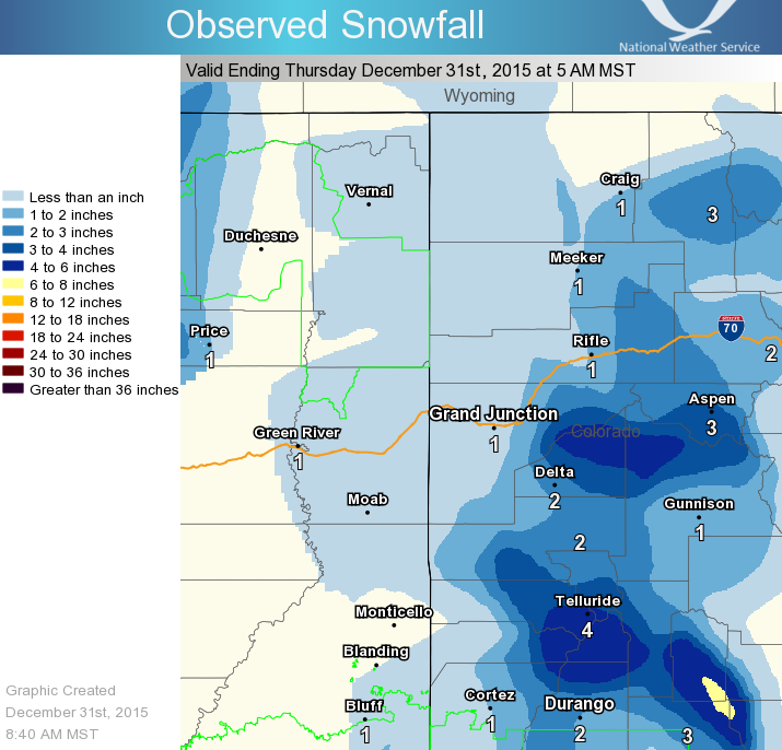
Snow fell over much of eastern Utah and western Colorado last night. Accumulations were generally light with values ranging from 3 to 6 inches in the mountains while the valleys saw anywhere from nothing up to 2 inches. Dry weather will be returning to the area this afternoon with cold temperatures holding in place. In fact, low temperatures tonight will be dropping back down a few degrees from what we had last night. So a good 5 degrees cooler in most locations.
High Pressure moves in this weekend with only isolated mountain snow showers expected Saturday afternoon and again Sunday afternoon. The weather pattern looks to undergo another change by early next week as we see a series of wet Pacific storms work across the southwest U.S. This will bring the potential for widespread snow and possibly, significant accumulations! Stay tuned!!!
Below is a graphic showing Observed Snowfall from last night ending at 5 am MST this morning.
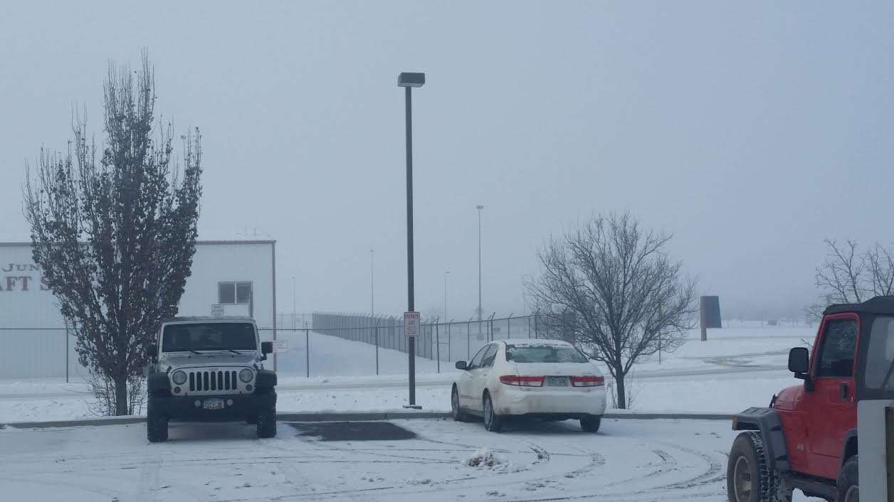
Here is a photo of fog approaching the airport here in Grand Junction. The fog is expected to dissipate by late this morning with sunny skies returning to the Grand Valley.
And finally, the High temperatures forecast for this afternoon. You can see that much of the region will be remaining below freezing for another day with the coldest conditions across northeast Utah and northwest Colorado. Stay warm!

Hazards
Detailed Hazards Viewer
National Briefing
Outlooks
Transportation Decision Support
Winter Storm Severity Index
Forecasts
Aviation Weather
Fire Weather
Forecast Discussion
Forecast Points
Local Area
Severe Weather
Soaring Forecast
Winter Weather
Hydrology
Recreational River Report
River Forecast
Weather Safety
Preparedness
NOAA Weather Radio
StormReady
SkyWarn
US Dept of Commerce
National Oceanic and Atmospheric Administration
National Weather Service
Grand Junction, CO
2844 Aviators Way
Grand Junction, CO 81506-8644
970-243-7007
Comments? Questions? Please Contact Us.

