
A heat wave over the Southwest will intensify this week, peaking and expanding into the Intermountain West and northern High Plains this weekend. Critical to extremely critical fire weather conditions are forecast from the Northwest and the northern Great Basin this weekend. Particularly Dangerous Situation Red Flag Warnings have been issued. Read More >
Grand Junction, CO
Weather Forecast Office
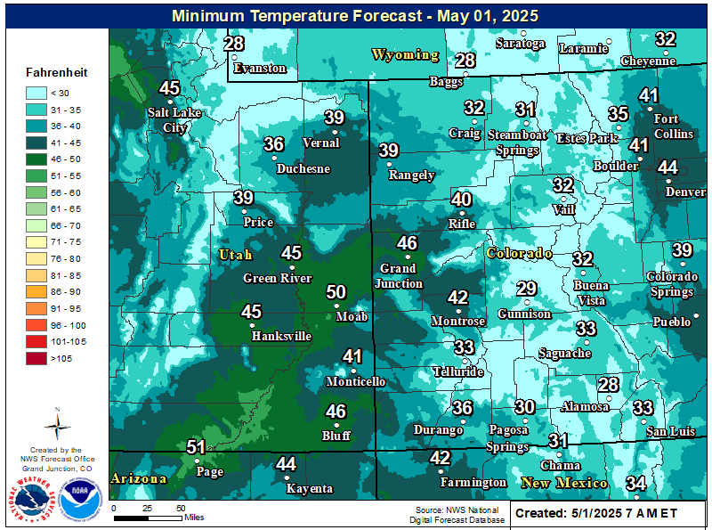
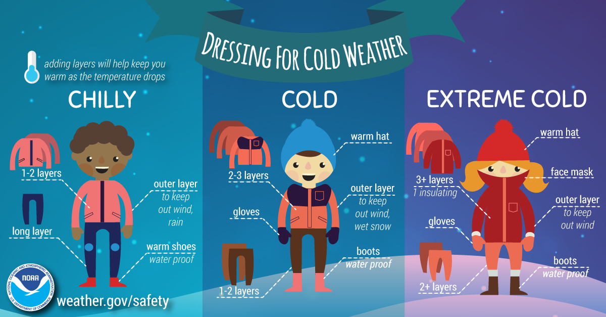
An arctic airmass will remain over eastern Utah and western Colorado through today (Halloween), resulting in abnormally cold temperatures. Daytime highs today will be 15 to 25 degrees below normal across the board under mostly sunny skies and dry northwest flow aloft. Be sure to bundle up during prime trick-or-treating hours this evening as temperatures drop into the mid to upper 20s and lower 30s across the southern and central valleys and into the upper teens further north between 6 and 9 PM. Another round of record cold low temperatures will occur tonight/Friday morning.
Temperatures will warm up Friday onwards.
Forecast High Temperatures Today

Forecast Low Temperatures Tonight/Friday Morning
Dressing for Cold Weather
Hazards
Detailed Hazards Viewer
National Briefing
Outlooks
Transportation Decision Support
Winter Storm Severity Index
Forecasts
Aviation Weather
Fire Weather
Forecast Discussion
Forecast Points
Local Area
Severe Weather
Soaring Forecast
Winter Weather
Hydrology
Recreational River Report
River Forecast
Weather Safety
Preparedness
NOAA Weather Radio
StormReady
SkyWarn
US Dept of Commerce
National Oceanic and Atmospheric Administration
National Weather Service
Grand Junction, CO
2844 Aviators Way
Grand Junction, CO 81506-8644
970-243-7007
Comments? Questions? Please Contact Us.

