
A heat wave over the Southwest will intensify this week, peaking and expanding into the Intermountain West and northern High Plains this weekend. Severe thunderstorms and heavy rainfall are expected over parts of the Upper Midwest to mid-Mississippi Valley today. Critical to extremely critical fire weather conditions from the Northwest and the northern Great Basin on Saturday and Sunday. Read More >
Overview
|
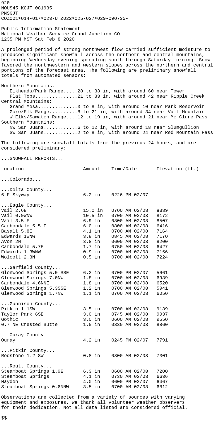
A prolonged period of strong northwest flow carried sufficient moisture from a decaying atmospheric river and produced significant snow over the mountains of western Colorado, as well as some northern and central valleys. Snow favored the northwestern and western slopes across the northern and central portions of the forecast area with over 3 feet of snow falling in some areas. Showers began in earnest on Wednesday night, February 5 and into Thursday with heavy snow continuing through Friday before activity diminished Friday night, February 7. Wind gusts with this storm exceeded 50 MPH, resulting in hazardous travel with reduced visibility in blowing snow. Additionally, snow rates approached 2 inches per hour at times. This severely impacted travel, particularly along I-70 with Vail Pass closing several times throughout the event, often for an extended period of time. Additionally, the heavy snow led to treacherous backcountry conditions and the increased threat for avalanches with the Colorado Avalanche Information Center (CAIC) having to issue numerous Avalanche Warnings during the event. |
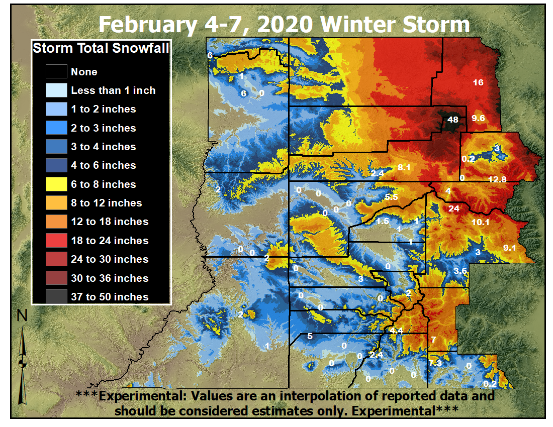 Storm Total Snowfall: February 4-7, 2020 |
 |
 |
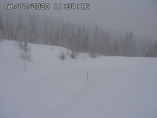 |
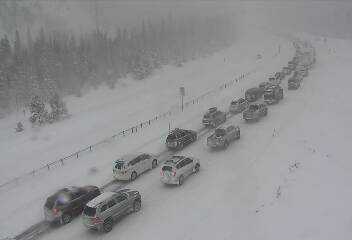
| Rabbit Ears Pass on February 7, 2020 (Credit: CDOT) | Vail Pass on February 7, 2020 (Credit: CDOT) | Gore Pass on February 7, 2020 (Credit: CDOT) |
Photos & Video
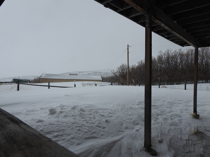
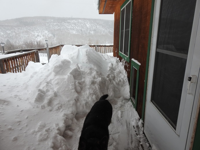
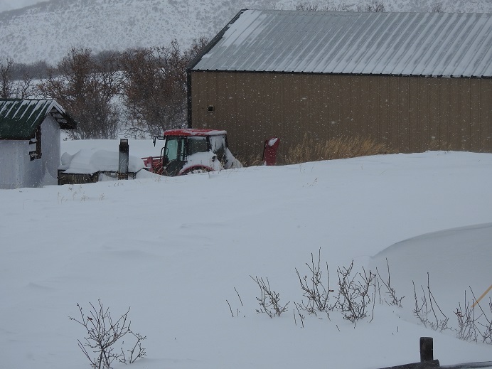
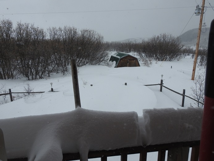
Heavy snow fell across the Upper Yampa River Basin
 |
 |
 |
 |
| Near Oak Creek (Credit: Steve Strickler) |
Near Oak Creek (Credit: Steve Strickler) |
Near Oak Creek (Credit: Steve Strickler) |
Near Oak Creek (Credit: Steve Strickler) |
Storm Reports
 |
Media use of NWS Web News Stories is encouraged! Please acknowledge the NWS as the source of any news information accessed from this site. |
|

