
Dangerous and extreme heat will remain across portions of the Central U.S. this week, persisting across the Mid to Lower Mississippi Valleys, Gulf Coast, Southern Plains and portions of Texas. A heat wave over the Southwest will intensify late this week. Severe thunderstorms and flash flooding will spread from the Great Lakes/Ohio Valley to the Mid-Atlantic and Northeast the next few days. Read More >
Grand Junction, CO
Weather Forecast Office
Overview
A strong winter storm will result in another prolonged period of unsettled weather to end 2022 and begin 2023. Moderate to heavy snow is expected for the mountains of eastern Utah and western Colorado as well as some adjacent valleys through Monday. Be prepared for rapidly changing winter driving conditions and snow-packed, icy roads when traveling this holiday weekend. Mild temperatures in the lower valleys will lead to rain or a rain/snow mix initially before cooler air arrives later in the weekend.
Multiple winter highlights have been issued for this storm. Please see the map below for the latest highlights. Stay up to date on this system by visiting www.weather.gov/gjt/ for the latest details.

| Click on any area for more detailed information on each Warning, Watch or Advisory. |
(Click on any Point on the Map for the latest Forecast)
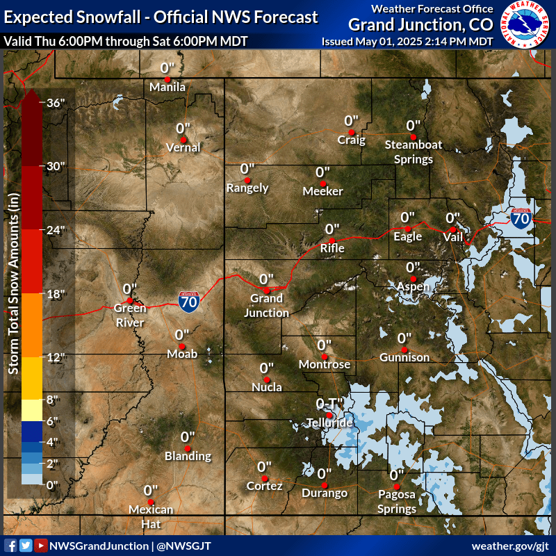
Expected Snowfall
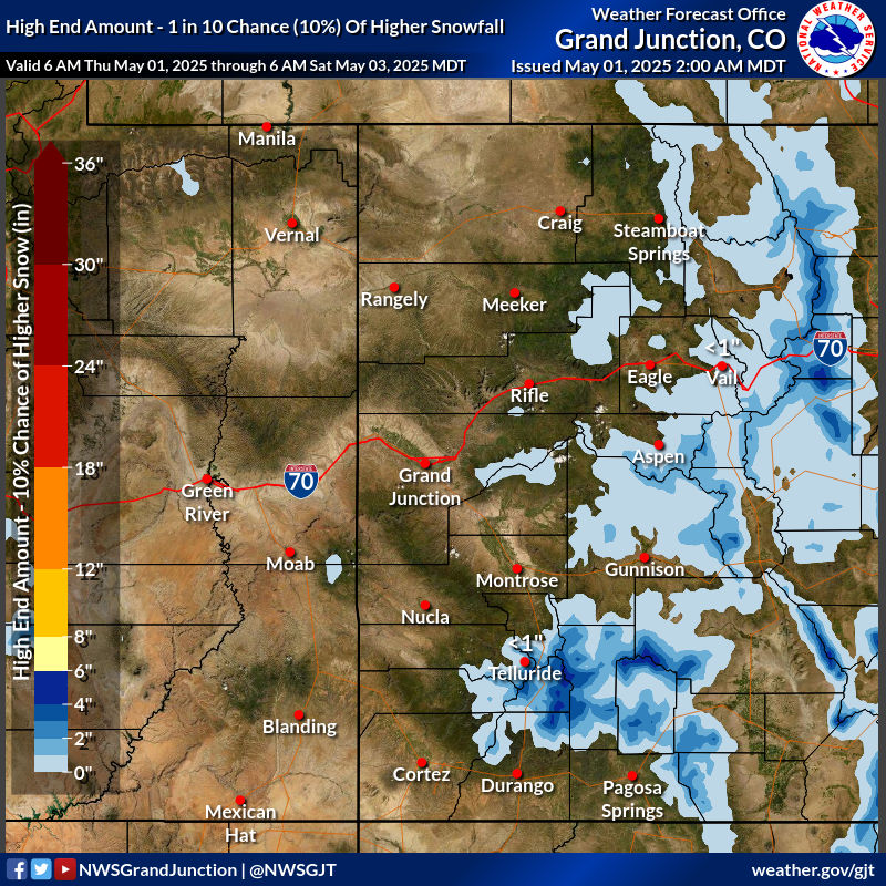
High End Amounts
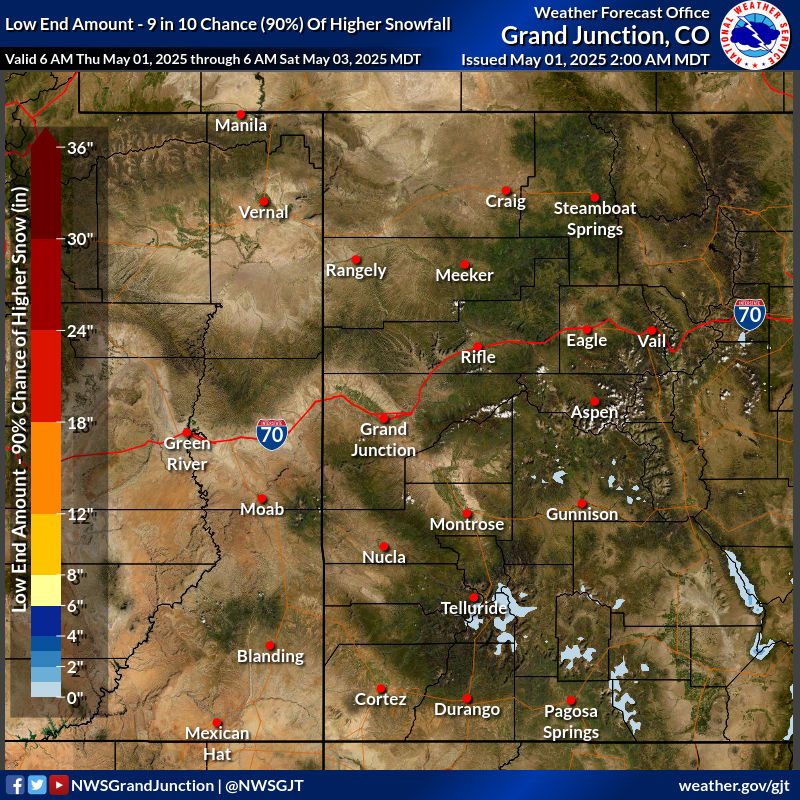
Low End Amounts
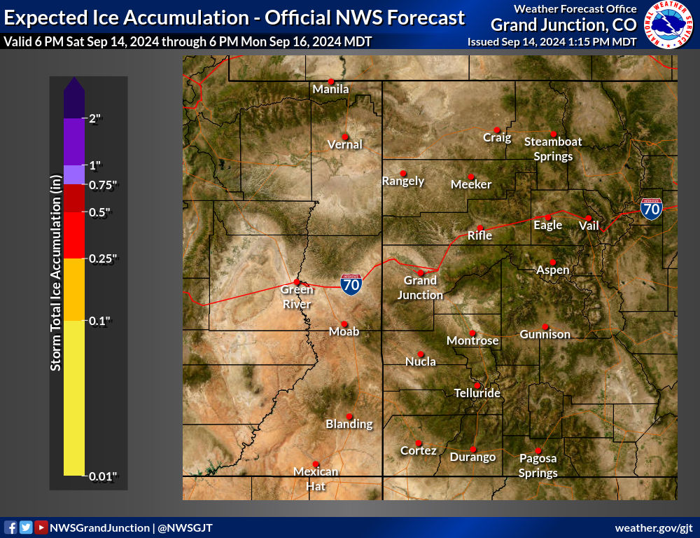
Ice Accumulations
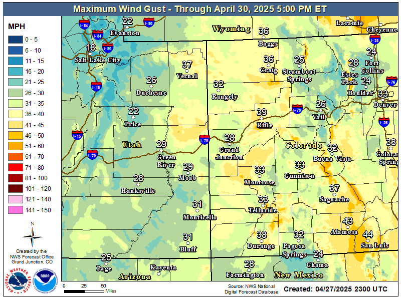
Expected Wind Gusts
Travel Conditions
Travel Conditions
Safety Tips

Hazards
Detailed Hazards Viewer
National Briefing
Outlooks
Transportation Decision Support
Winter Storm Severity Index
Forecasts
Aviation Weather
Fire Weather
Forecast Discussion
Forecast Points
Local Area
Severe Weather
Soaring Forecast
Winter Weather
Hydrology
Recreational River Report
River Forecast
Weather Safety
Preparedness
NOAA Weather Radio
StormReady
SkyWarn
US Dept of Commerce
National Oceanic and Atmospheric Administration
National Weather Service
Grand Junction, CO
2844 Aviators Way
Grand Junction, CO 81506-8644
970-243-7007
Comments? Questions? Please Contact Us.

