
Heavy to excessive rainfall will continue through tonight from the Texas Big Bend region into southern Oklahoma. Scattered damaging wind gusts and a few tornadoes may accompany a line of severe thunderstorms that is expected across the Mid-Atlantic into New England Friday. A Typhoon Watch continues for Guam and CNMI as Tropical Storm Champi will strengthen and approach the islands this weekend. Read More >
Overview
On the night of October 2nd, 2017, at least one significant supercell thunderstorm moved across Gove County, Kansas. This storm initially developed in Wichita County near the town of Leoti, KS. Over the next 2 hours, the storm progressed northeast across northern Scott County and eventually into Gove County. In Scott County, this storm produced three tornadoes, one of which moved into Gove County. An additional 3 tornadoes occurred over Gove County, impacting areas near Gove City and within the town of Quinter. These storms also produced significant rainfall, resulting in numerous roads being closed due to flash flooding.
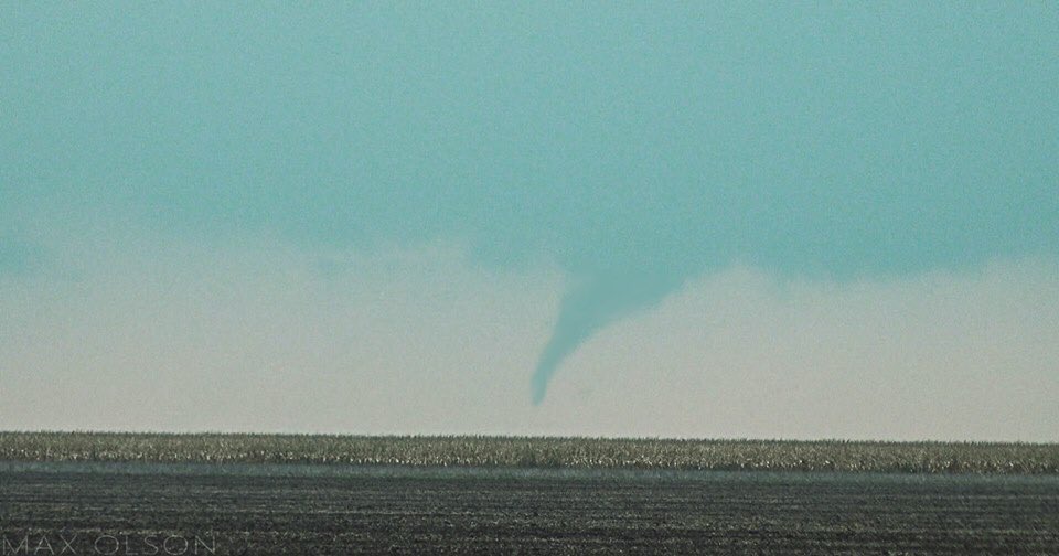
One other supercell thunderstorm progressed across Greeley County, Kansas. This storm did produce one tornado in southeastern portions of the county (7 miles south-southeast of Selkirk, Kansas).
 |
 |
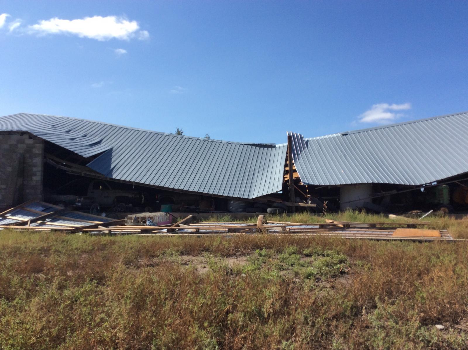 |
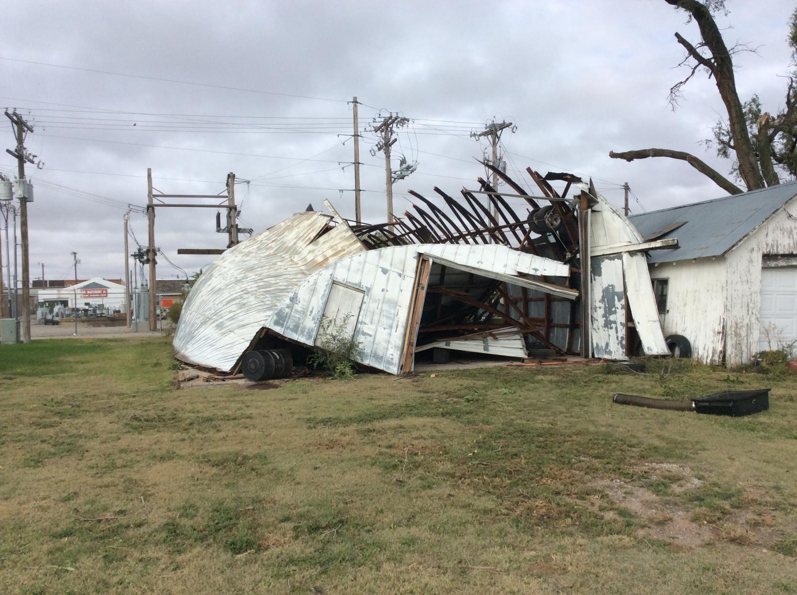
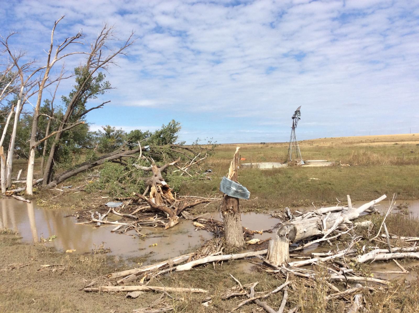
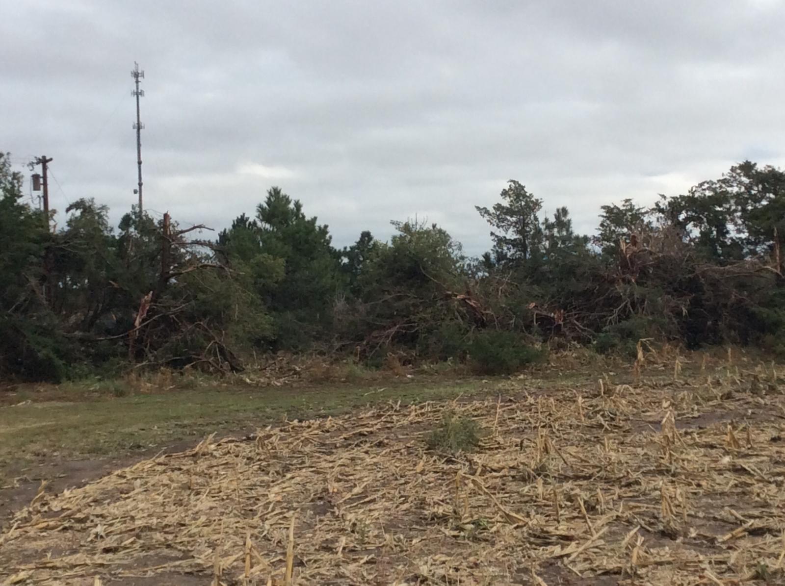
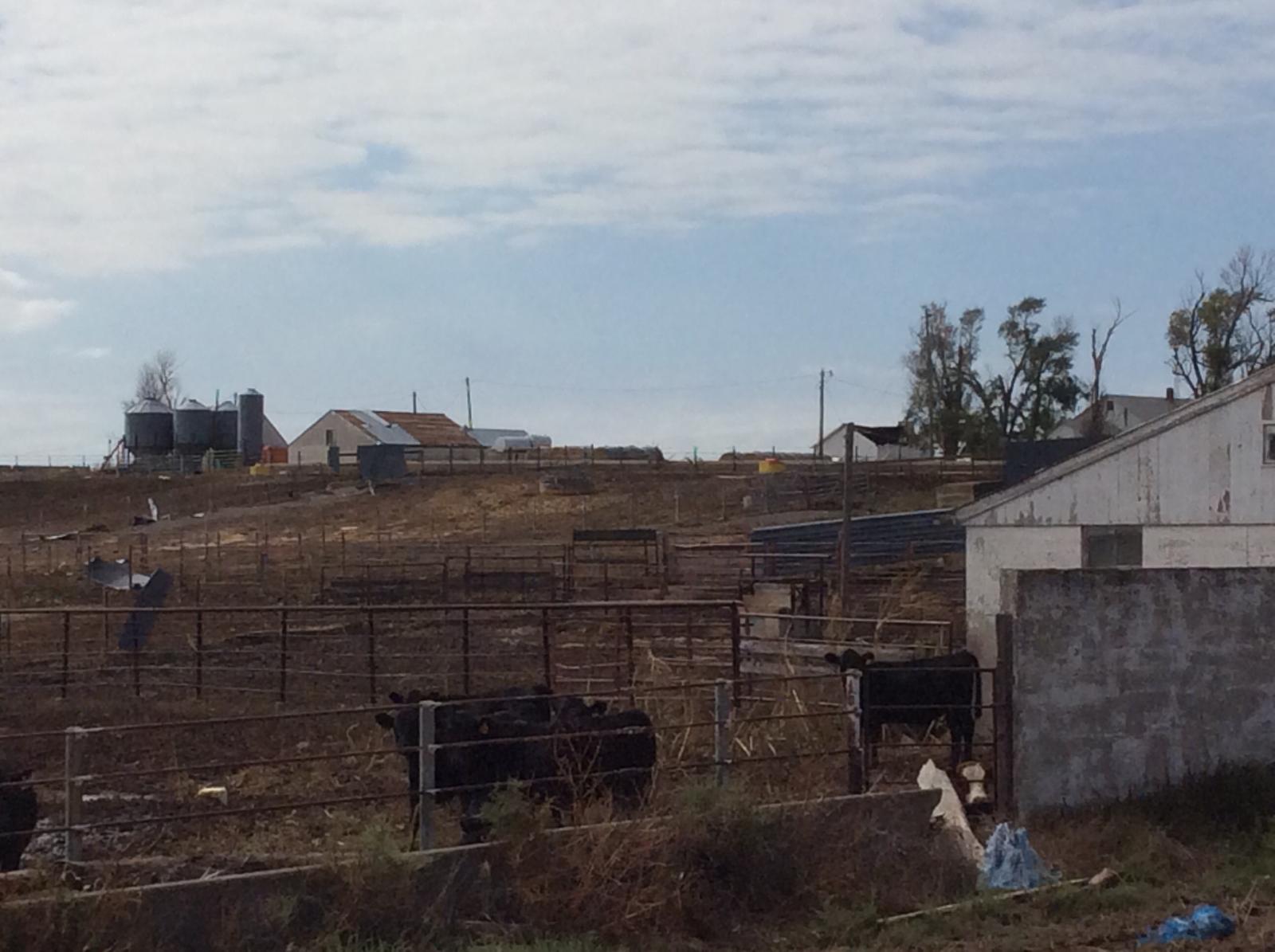
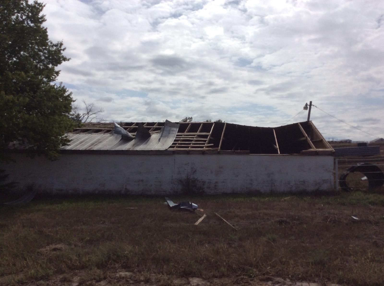
| Farm structure destroyed in Quinter, KS. | Tree damage southwest of Gove City, KS. | Farm structure collapsed east-southeast of Gove City, KS. |
 |
 |
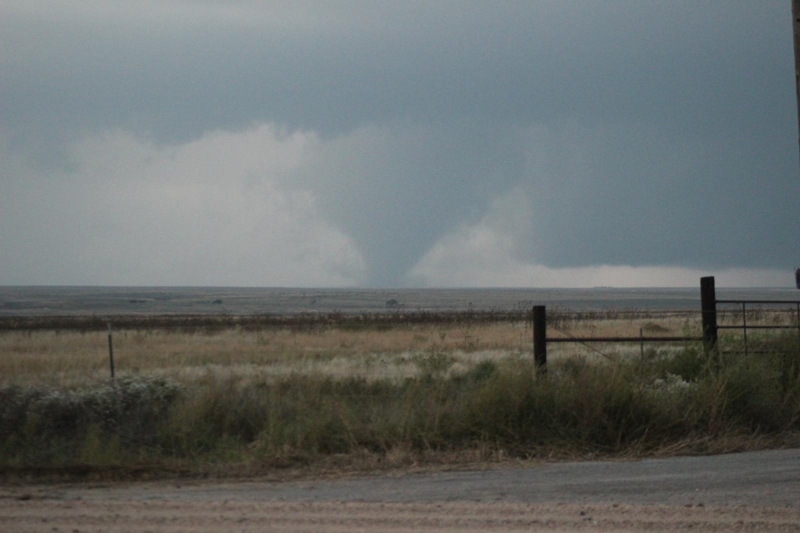 |
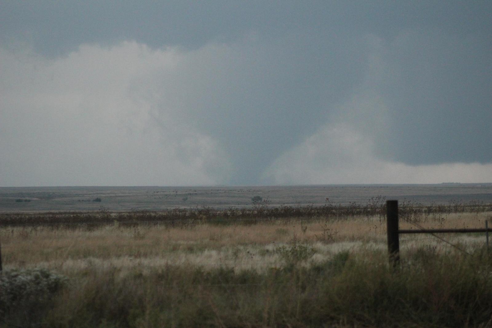
| Tornado in southeastern Greeley County. Image Courtesy: Max Olson | Tornado in southwestern Gove County. Image Courtesy: Brandon Shahan | Tornado in southwestern Gove County. Image Courtesy: Brandon Shahan |
Tornadoes (Surveyed by NWS Goodland):
|
Tornado - 5 S Scott State Lake to 5 NE Monument Rocks, KS
Track Map 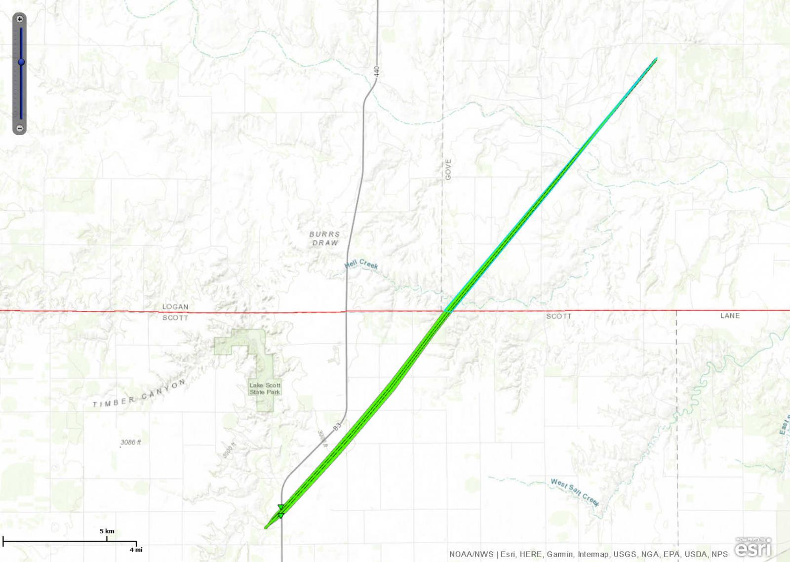 
|
||||||||||||||||
|
Tornado - 10 SSW Gove City, KS
Track Map 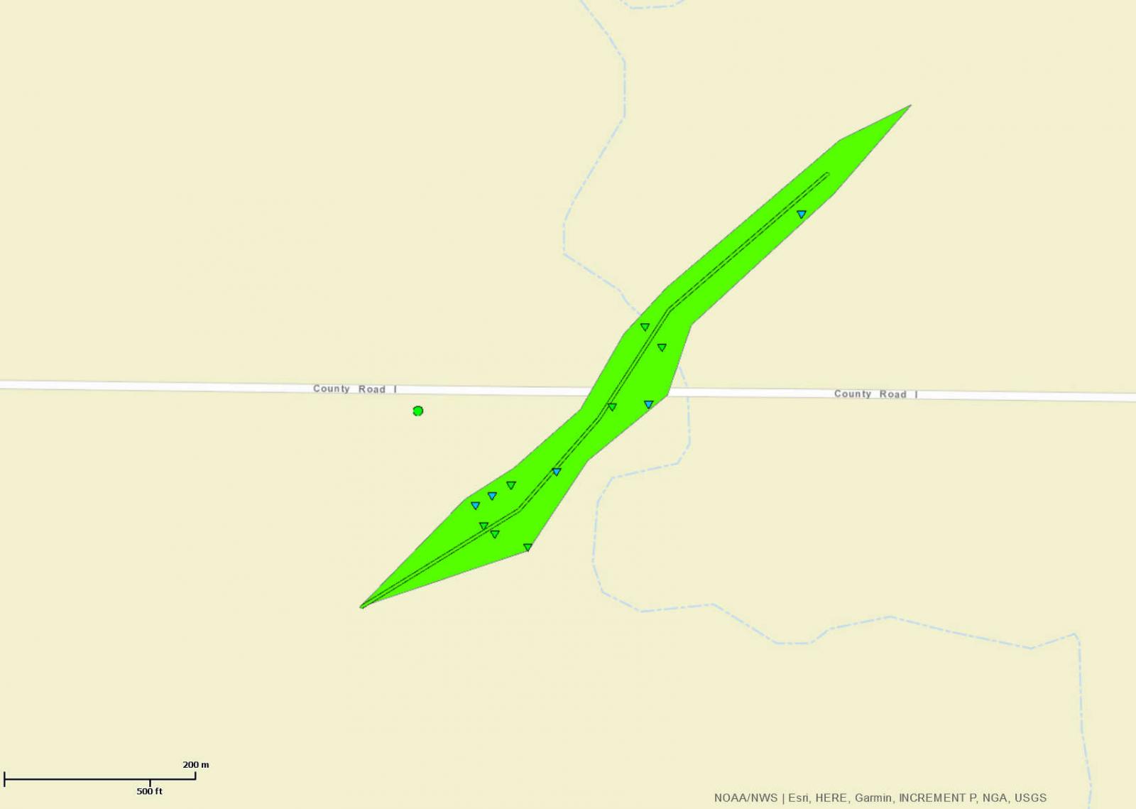
|
||||||||||||||||
|
Tornado - 5 ESE Gove City, KS
Track Map 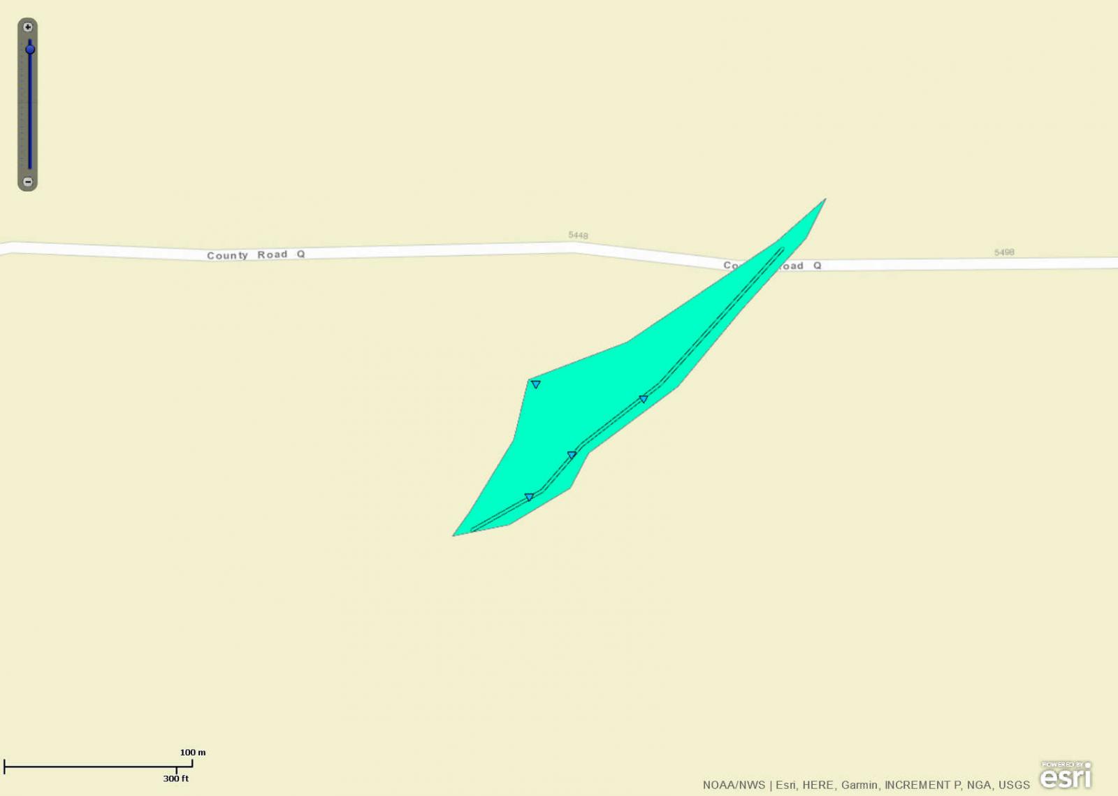
|
||||||||||||||||
|
Tornado - Quinter, KS
Track Map 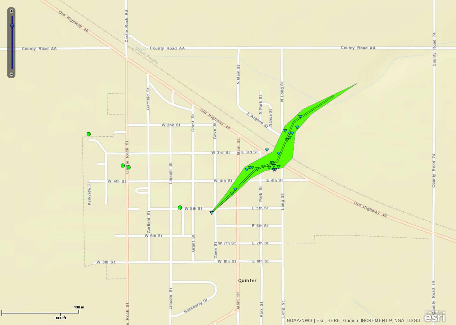
|
||||||||||||||||
The Enhanced Fujita (EF) Scale classifies tornadoes into the following categories:
| EF0 Weak 65-85 mph |
EF1 Moderate 86-110 mph |
EF2 Significant 111-135 mph |
EF3 Severe 136-165 mph |
EF4 Extreme 166-200 mph |
EF5 Catastrophic 200+ mph |
 |
|||||
Photos & Video:
Header
|
 |
 |
 |
| Damaged farming structure in Quinter. (NWS Damage Survey) |
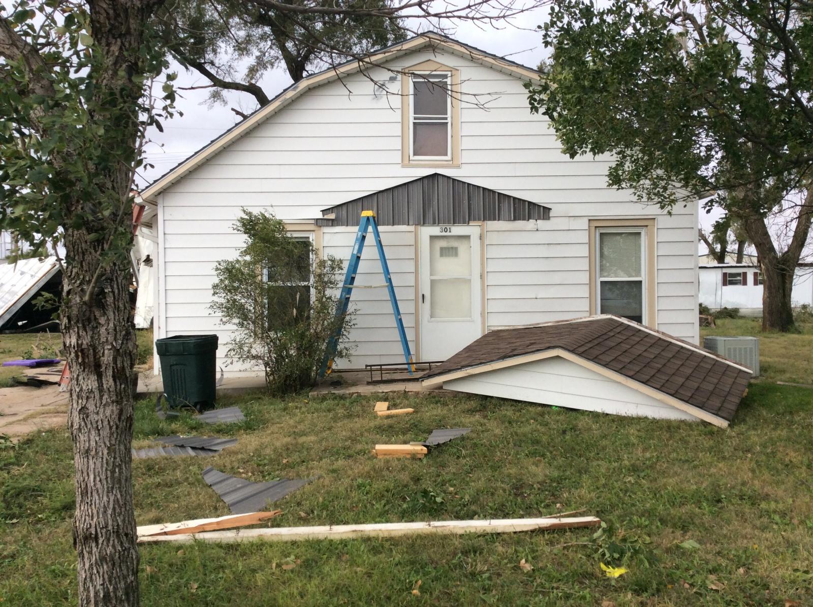
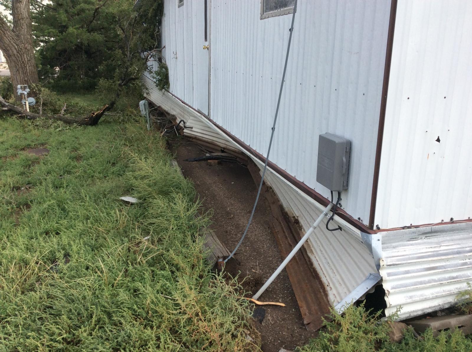
Damaged home in Quinter. (NWS Damage Survey) |
Damaged home in Quinter. (NWS Damage Survey) |
Damage to a wind break in Quinter. Clear evidence of a tornado moved through the middle of the trees. (NWS Damage Survey) |
|
 |
 |
|
| Tree damage near a farm southwest of Gove City. (NWS Damage Survey) |
Damage to a farm southwest of Gove City. (NWS Damage Survey) |
Damage to a farm southwest of Gove City. (NWS Damage Survey) |
Damage to a farm building east-southeast of Gove City. (NWS Damage Survey) |
Radar:
Header
 |
 |
 |
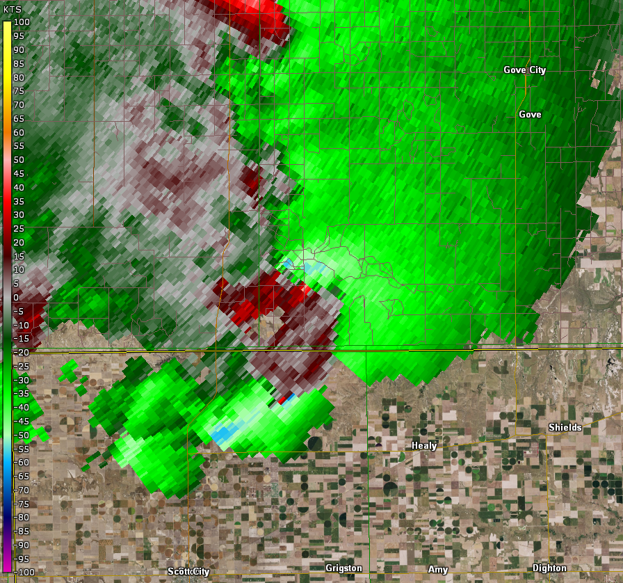 |
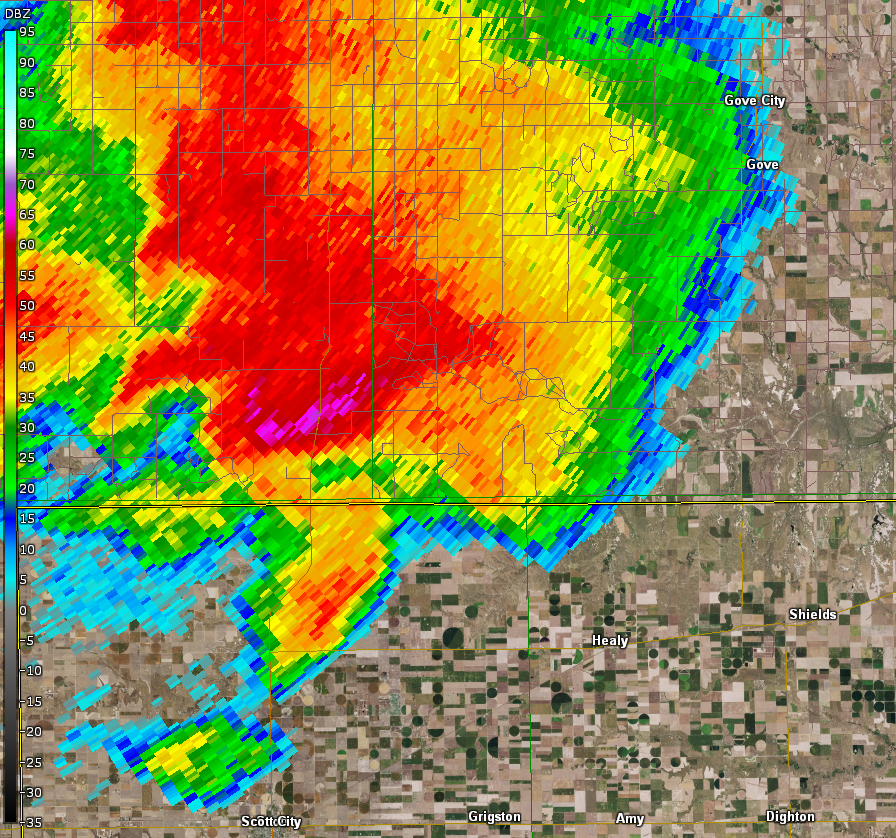
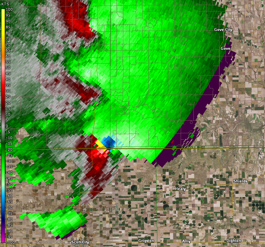
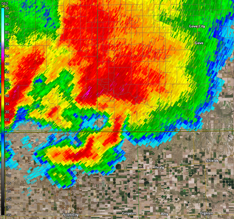
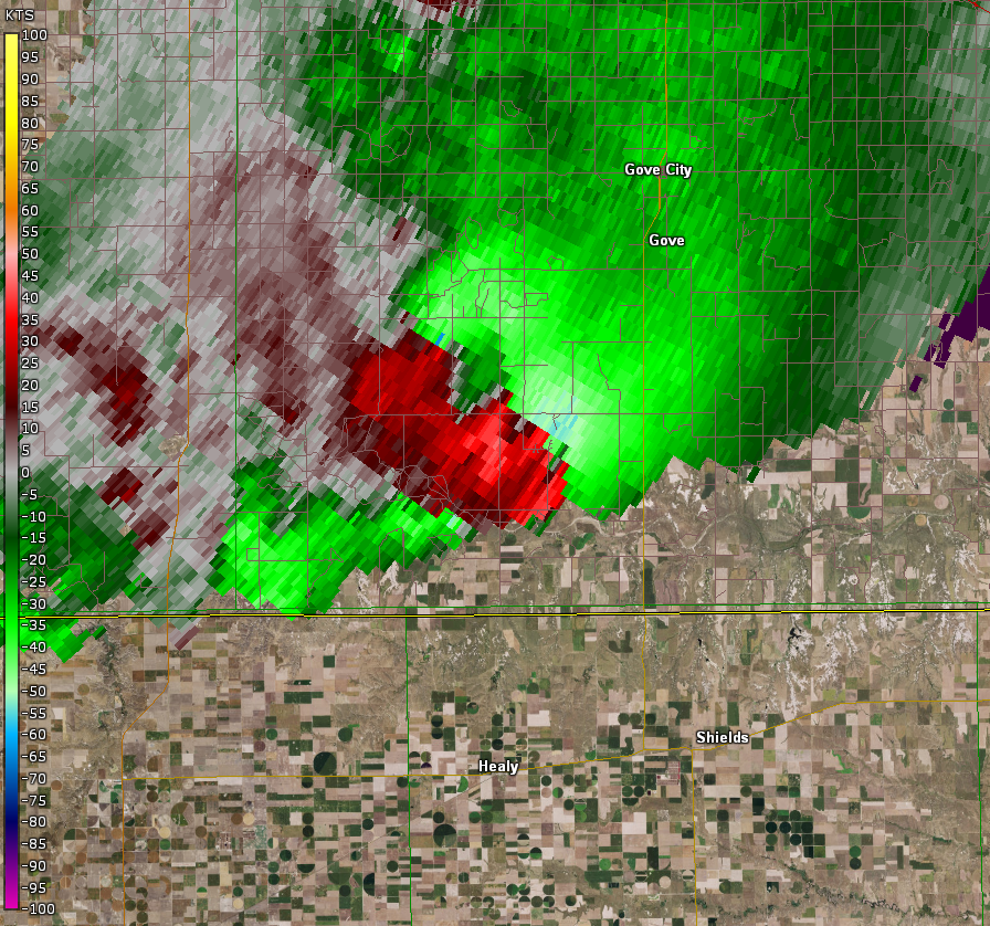
| Radar reflectivity at time of tornado crossing from Scott County into Gove County. | Radar storm-relative velocity at time of tornado crossing from Scott County into Gove County. | Radar reflectivity as tornado continues across Gove County. | Radar storm-relative velocity as tornado continues across Gove County. |
 |
 |
.4.png) |
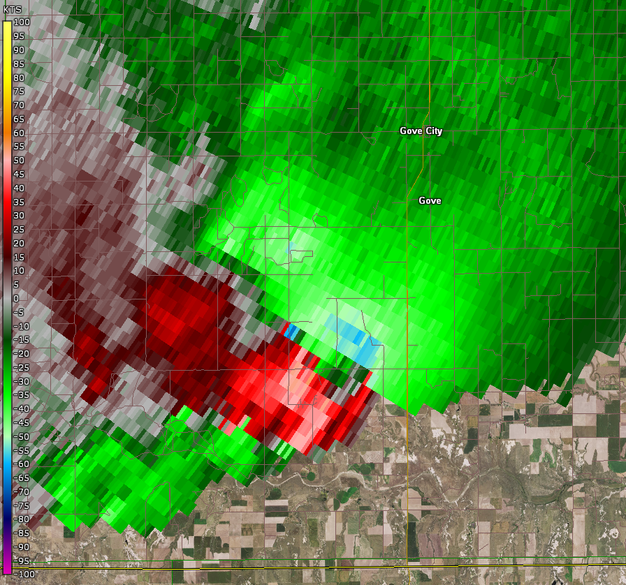 |
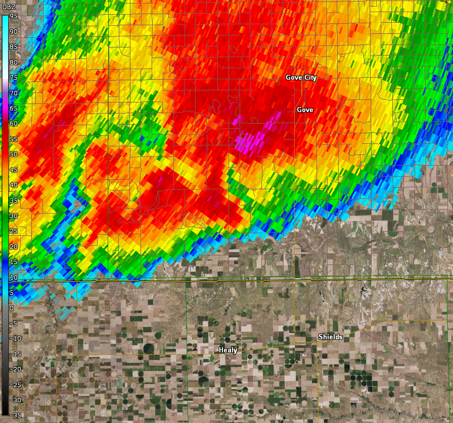
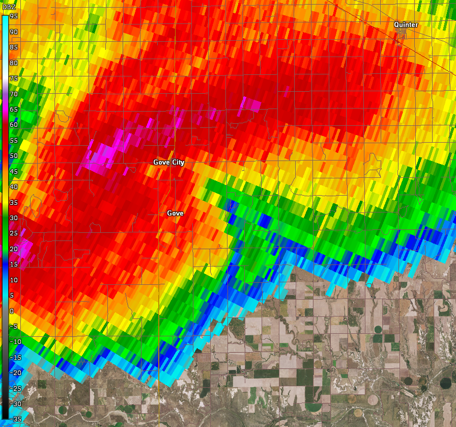
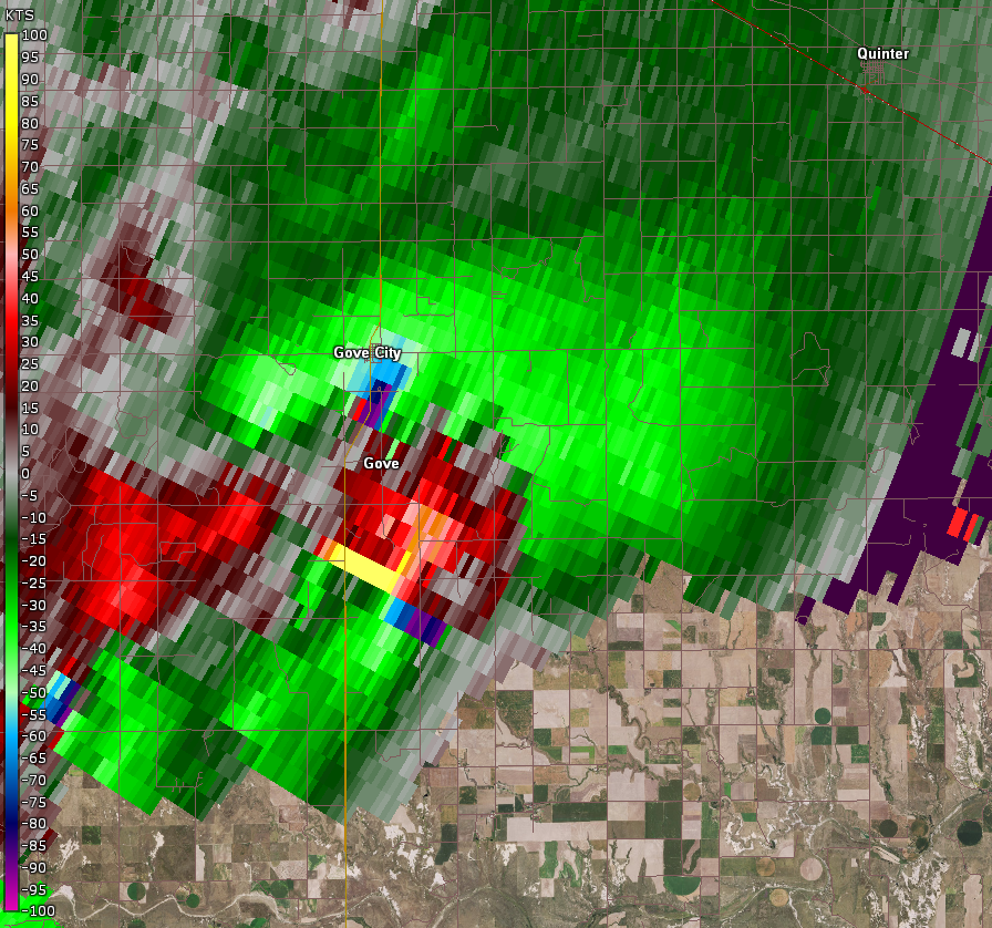
| Radar reflectivity of supercell remaining quite intense with at least two circulations. | Radar storm-relative velocity of supercell remaining quite intense with at least two circulations. | Radar reflectivity at time of tornado occurring 10 miles south-southwest of Gove City, KS. | Radar storm-relative velocity at time of tornado occurring 10 miles south-southwest of Gove City, KS. |
 |
 |
 |
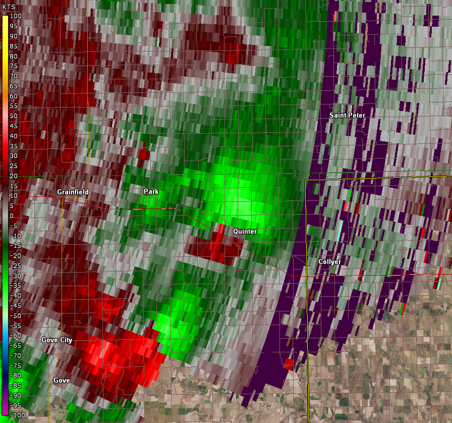 |
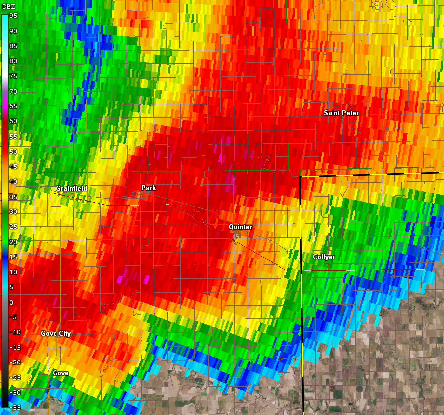
| Radar reflectivity at time of tornado occurring 5 miles east-southeast of Gove City, KS. | Radar storm-relative velocity at time of tornado occurring 5 miles east-southeast of Gove City, KS. | Radar reflectivity at time of tornado occurring in Quinter, KS. | Radar storm-relative velocity at time of tornado occurring in Quinter, KS. |
Storm Reports
 |
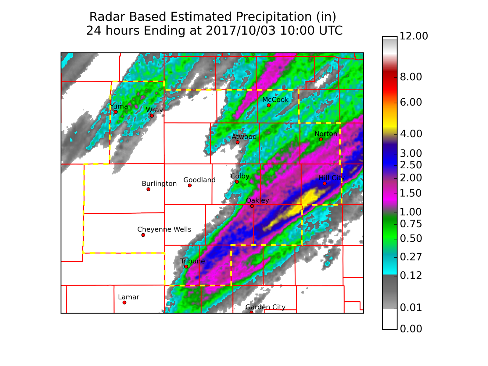 |
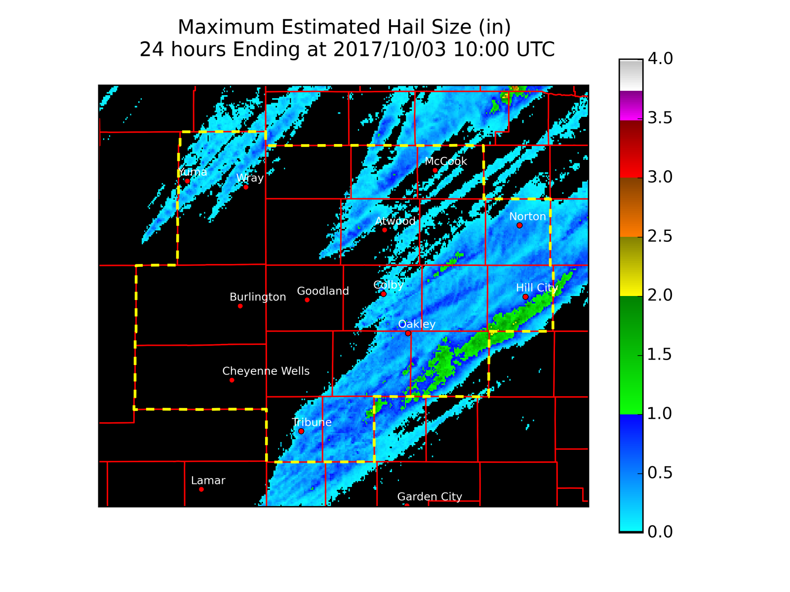
| Radar estimated hail swaths from the storms. | Radar estimated precipitation from the storms. |
PRELIMINARY LOCAL STORM REPORT...SUMMARY
NATIONAL WEATHER SERVICE GOODLAND KS
1246 PM MDT WED OCT 04 2017

..TIME...   ...EVENT...      ...CITY LOCATION...     ...LAT.LON...
..DATE...   ....MAG....      ..COUNTY LOCATION..ST.. ...SOURCE....
            ..REMARKS..

0507 PM     FUNNEL CLOUD     13 SSE TRIBUNE          38.29N 101.69W
10/02/2017                   GREELEY            KS   STORM CHASER

            REPORTED VIA SOCIAL MEDIA, TIME AND LOCATION RADAR
            ESTIMATED.

0634 PM     HAIL             STRATTON NE             40.15N 101.23W
10/02/2017  M1.00 INCH       HITCHCOCK          NE   TRAINED SPOTTER

0643 PM     TORNADO          10 SSW GOVE             38.83N 100.56W
10/02/2017                   GOVE               KS   NWS EMPLOYEE

            NWS DAMAGE SURVEY CONFIRMS A TORNADO. DELAYED LSR.

0651 PM     HAIL             6 S GOVE                38.88N 100.51W
10/02/2017  M1.00 INCH       GOVE               KS   TRAINED SPOTTER

            ALSO REPORTED ESTIMATED 50 MPH WINDS.

0658 PM     TORNADO          5 ESE GOVE              38.93N 100.40W
10/02/2017                   GOVE               KS   NWS STORM SURVEY

            NWS DAMAGE SURVEY CONFIRMS TORNADO. DELAYED LSR.

0700 PM     HAIL             CULBERTSON              40.23N 100.84W
10/02/2017  M2.00 INCH       HITCHCOCK          NE   PUBLIC

            REPORT RECEIVED VIA SOCIAL MEDIA.

0701 PM     HAIL             3 W GOVE                38.96N 100.55W
10/02/2017  E0.88 INCH       GOVE               KS   TRAINED SPOTTER

0703 PM     HAIL             CULBERTSON              40.23N 100.84W
10/02/2017  E1.00 INCH       HITCHCOCK          NE   EMERGENCY MNGR

0710 PM     HAIL             3 W GOVE                38.96N 100.55W
10/02/2017  M1.00 INCH       GOVE               KS   TRAINED SPOTTER

            SPOTTER REPORTS THAT POWER IS OUT AT THE MOMENT.

0718 PM     HAIL             1 SE GRAINFIELD         39.11N 100.46W
10/02/2017  M1.75 INCH       GOVE               KS   EMERGENCY MNGR

0720 PM     HAIL             3 ESE YUMA              40.11N 102.67W
10/02/2017  M0.88 INCH       YUMA               CO   TRAINED SPOTTER

0721 PM     HAIL             3 W GOVE                38.96N 100.55W
10/02/2017  E1.75 INCH       GOVE               KS   TRAINED SPOTTER

0721 PM     HEAVY RAIN       3 W GOVE                38.96N 100.55W
10/02/2017  M2.50 INCH       GOVE               KS   TRAINED SPOTTER

            THIS RAIN OCCURRED IN A VERY SHORT TIME.

0724 PM     TORNADO          QUINTER                 39.07N 100.23W
10/02/2017                   GOVE               KS   EMERGENCY MNGR

            DAMAGE REPORTED ON THE EAST SIDE OF QUINTER. A QUONSET
            BUILDING WAS DESTROYED AND THE ROOF WAS PEELED BACK FROM
            THE CITY SHOP BUILDING AT FIFTH AND LONG ST. A SEMI
            TRAILER WAS OVERTURNED AND BLOWN INTO THE ROAD AT OLD 40
            AND LONG.

0724 PM     TSTM WND GST     QUINTER                 39.07N 100.23W
10/02/2017  E75.00 MPH       GOVE               KS   NWS STORM SURVEY

            REPORTS OF UPROOTED TREES AND 4 TO 6 INCH TREE BRANCHES.
            IN ADDITION...SOME ROOFING TO A FARM STRUCTURE WAS BLOWN
            OFF. THIS OCCURRED ON THE NORTHEAST SIDE OF QUINTER.

0724 PM     TORNADO          QUINTER                 39.07N 100.23W
10/02/2017                   GOVE               KS   NWS STORM SURVEY

            NWS DAMAGE SURVEY CONFIRMS TORNADO. DELAYED LSR.

0734 PM     HAIL             5 ESE PARK              39.08N 100.28W
10/02/2017  M1.50 INCH       GOVE               KS   EMERGENCY MNGR

0755 PM     FLASH FLOOD      10 SW GOVE              38.86N 100.62W
10/02/2017                   GOVE               KS   NWS STORM SURVEY

            DELAYED LSR. FLASH FLOODING CONFIRMED BY NWS STORM SURVEY
            AND EMERGENCY MANAGEMENT. MANY ROADS ACROSS GOVE COUNTY
            WERE CLOSED. TIME ESTIMATED FROM RADAR.

0855 PM     FLASH FLOOD      4 N GOVE                39.01N 100.48W
10/02/2017                   GOVE               KS   NWS STORM SURVEY

            DELAYED LSR. NUMEROUS ROADS IN GOVE COUNTY WERE FLOODED
            DUE TO HEAVY RAINFALL ACROSS THE COUNTY. WATER WENT OVER
            HWY 23 NORTH OF ROAD W. EMERGENCY MANAGER REPORTED THIS
            FLOODING THE NIGHT IT OCCURRED.

0855 PM     FLASH FLOOD      5 N GOVE                39.03N 100.48W
10/02/2017                   GOVE               KS   EMERGENCY MNGR

            WATER IS FLOWING OVER KS23 BETWEEN MILE MARKER 155 AND
            156. ROAD IS CLOSED.

0915 PM     FLASH FLOOD      1 E HILL CITY           39.36N 99.83W
10/02/2017                   GRAHAM             KS   TRAINED SPOTTER

            ONE AND A HALF FEET OF WATER FLOWING ACROSS 280TH AVENUE
            1 MILE EAST OF HILL CITY.

0915 PM     FLASH FLOOD      1 E HILL CITY           39.36N 99.83W
10/02/2017                   GRAHAM             KS   TRAINED SPOTTER

            DUPLICATE REPORT...ONE AND A HALF FEET OF WATER FLOWING
            ACROSS 280TH AVENUE 1 MILE EAST OF HILL CITY.

0945 PM     HEAVY RAIN       QUINTER                 39.07N 100.23W
10/02/2017  M3.65 INCH       GOVE               KS   PUBLIC

            THIS RAINFALL AMOUNT IS FROM 8PM TO 1045PM CDT. THE
            REPORT ALSO STATED THAT THERE WAS FLOODING IN THE FRONT
            YARD OF THE HOUSE. REPORT RECEIVED VIA SOCIAL MEDIA.

1128 PM     HEAVY RAIN       1 E HILL CITY           39.37N 99.83W
10/02/2017  M4.37 INCH       GRAHAM             KS   CO-OP OBSERVER
 |
Media use of NWS Web News Stories is encouraged! Please acknowledge the NWS as the source of any news information accessed from this site. |
|



 Follow us on X
 Follow us on Facebook
 Follow us on YouTube
 GLD RSS Feed