Overview
Thunderstorms developed across northeast Colorado Saturday afternoon, September 17, 2016. As the storms moved east, they produced reports of hail, severe winds to 66 mph, and a few tornadoes. At least 3 landspout tornadoes were observed near the Colorado border. The first two occurred around Cheyenne Wells, Colorado in Cheyenne County Colorado. The third tornado occurred south of Weskan in Wallace County, Kansas.
Tornadoes:
|
Tornado #1 - 3 miles WNW Cheyenne Wells, CO to 1 mile SE of Cheyenne Wells, CO
Track Map 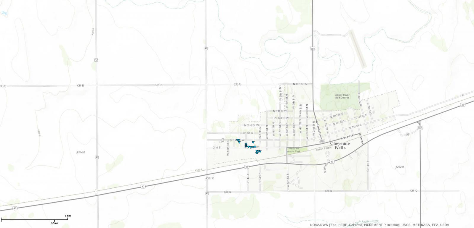 
|
||||||||||||||||
|
Tornado #2 - 4 miles NW of Cheyenne Wells, CO to 2 miles N of Cheyenne Wells, CO
|
||||||||||||||||
|
Tornado #3 - 4 miles S of Weskan, KS to 4 miles SE of Weskan, KS
|
||||||||||||||||
The Enhanced Fujita (EF) Scale classifies tornadoes into the following categories:
| EF0 Weak 65-85 mph |
EF1 Moderate 86-110 mph |
EF2 Significant 111-135 mph |
EF3 Severe 136-165 mph |
EF4 Extreme 166-200 mph |
EF5 Catastrophic 200+ mph |
 |
|||||
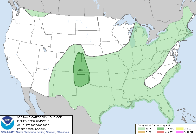
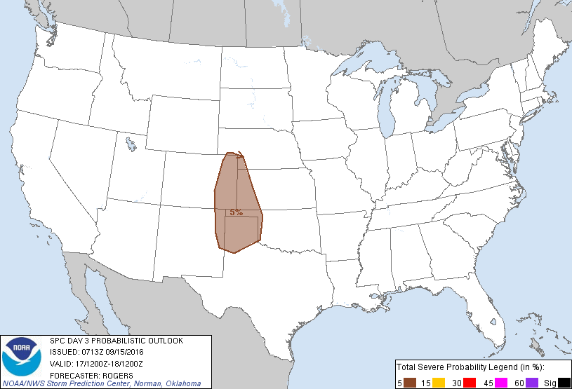
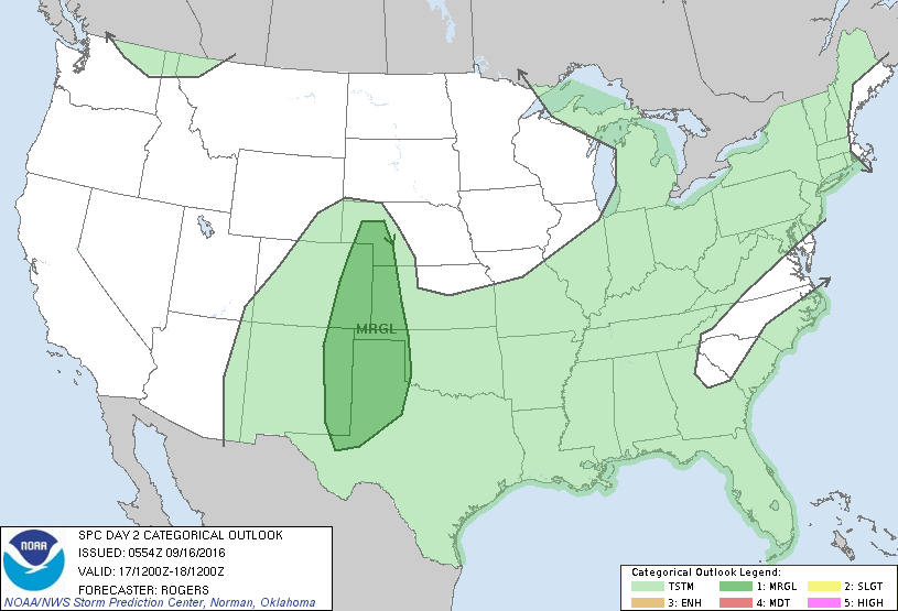
Additional Information: SPC Outlooks
 |
 |
 |
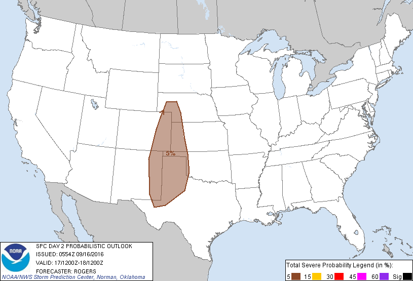 |
| SPC Day 3 Categorical Outlook | SPC Day 3 Probabilistic Outlook | SPC Day 2 Categorical Outlook | SPC Day 2 Probabilistic Outlook |
 |
 |
 |
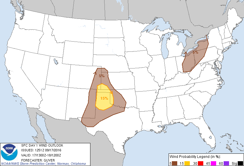 |
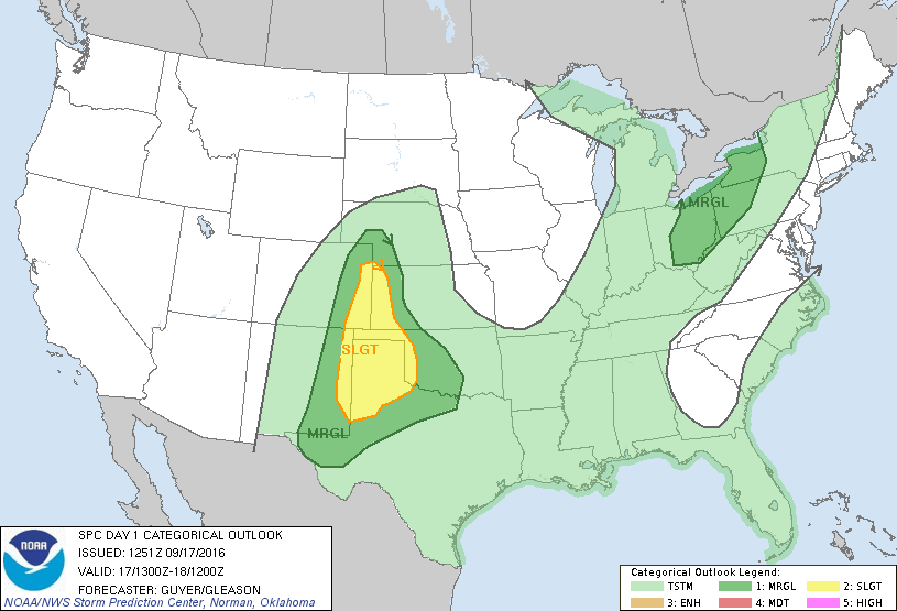
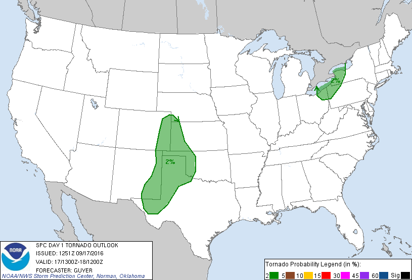
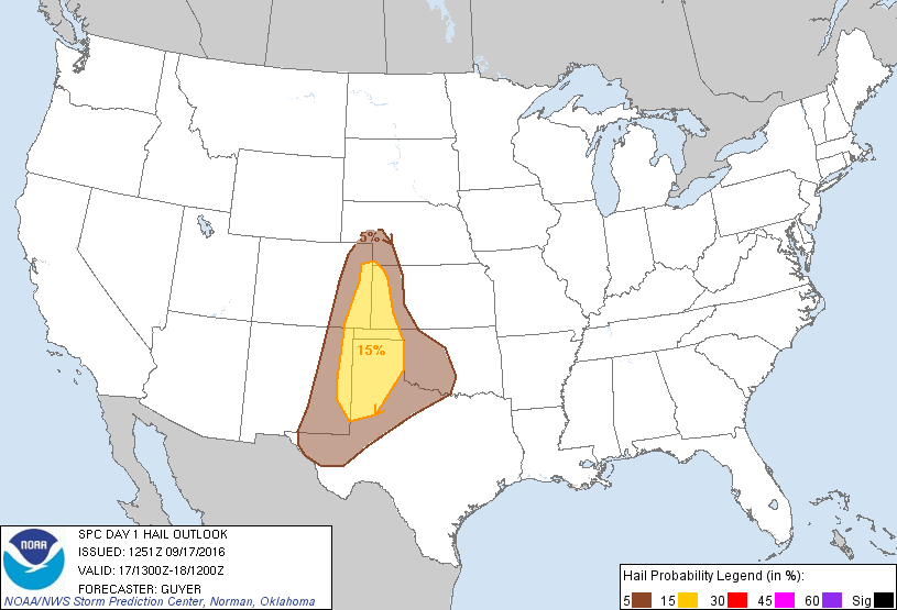
| SPC Day 1 Categorical Outlook | SPC Day 1 Tornado Outlook | SPC Day 1 Hail Outlook | SPC Day 1 Wind Outlook |
Photos & Video:
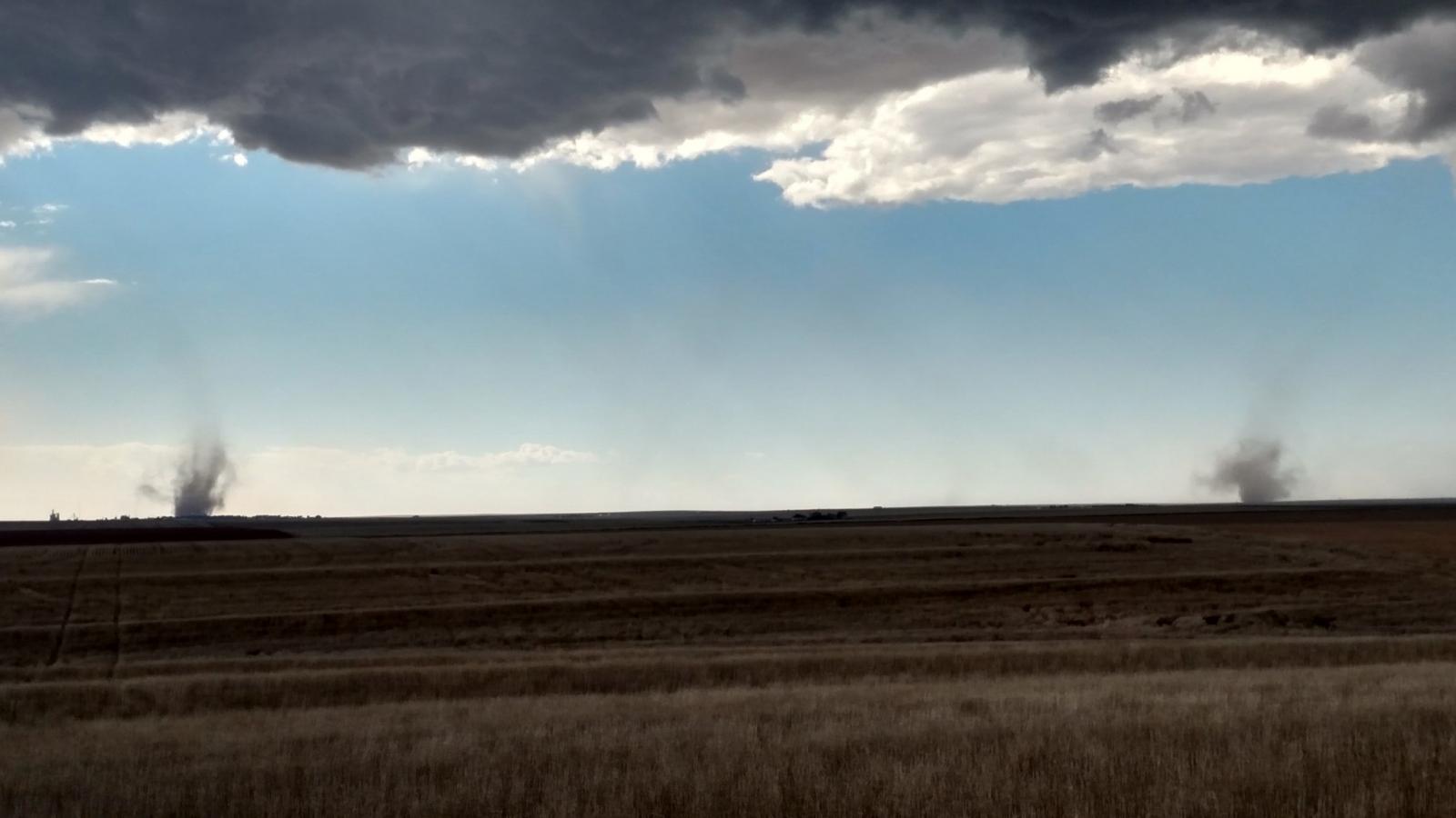
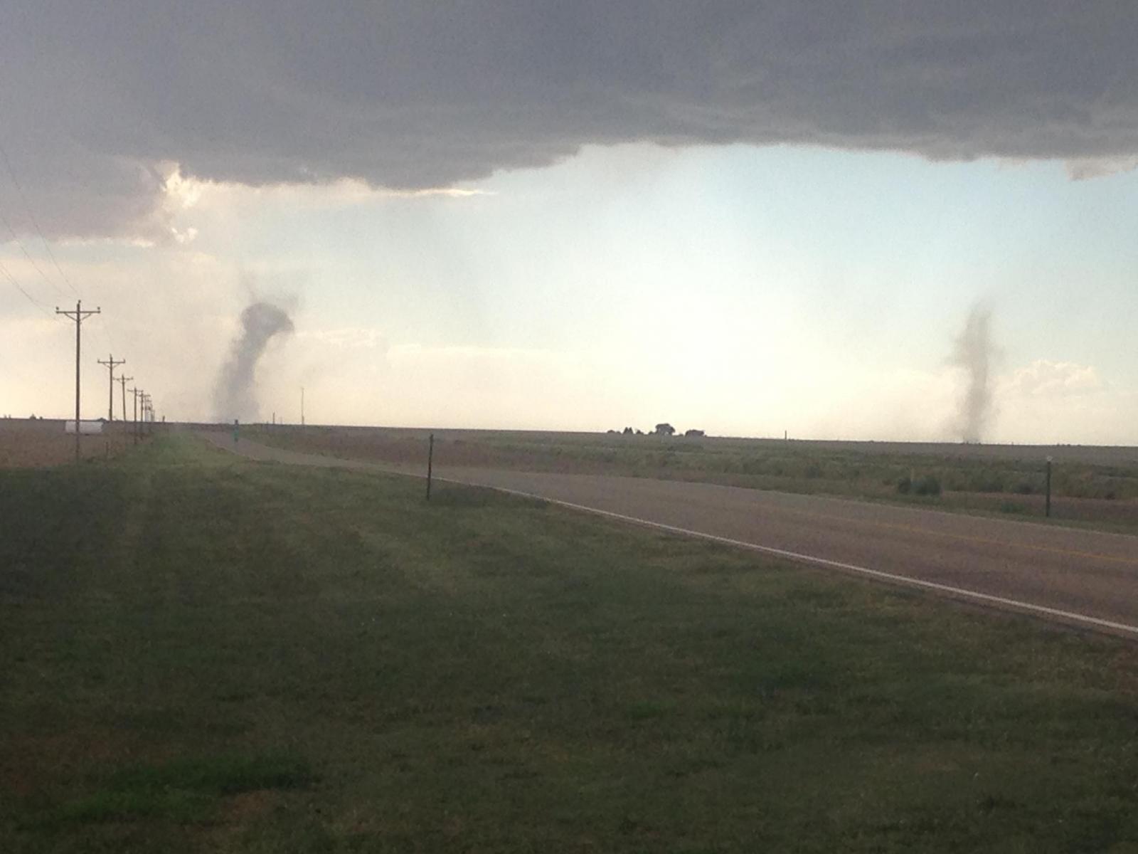
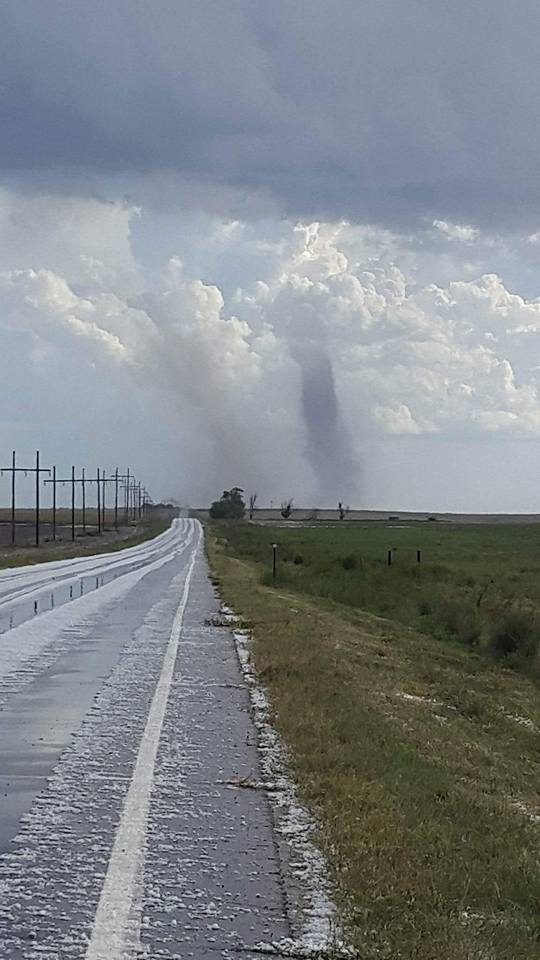
Tornado Images:
 |
 |
 |
 |
| Two landspout tornadoes near Cheyenne Wells, Colorado Courtesy: Phill Knudsen |
Two landspout tornadoes near Cheyenne Wells, Colorado Courtesy Andrew Heyl |
Landspout Tornado near Cheyenne Wells, Colorado Courtesy: Phil Knudsen |
Two landspout tornadoes near Cheyenne Wells, Colorado Courtesy: Clarence Heckens |
Storm Reports
PRELIMINARY LOCAL STORM REPORT...SUMMARY
NATIONAL WEATHER SERVICE GOODLAND KS
857 PM MDT SAT SEP 17 2016

..TIME...   ...EVENT...      ...CITY LOCATION...     ...LAT.LON...
..DATE...   ....MAG....      ..COUNTY LOCATION..ST.. ...SOURCE....
            ..REMARKS..

0200 PM     HAIL             1 W YUMA                40.12N 102.74W
09/17/2016  E0.88 INCH       YUMA               CO   PUBLIC

            HAIL RANGED FROM PEA TO NICKEL SIZE. LASTED 10 MINUTES.

0206 PM     HAIL             YUMA                    40.12N 102.72W
09/17/2016  E0.50 INCH       YUMA               CO   PUBLIC

            DIME SIZE HAIL.

0310 PM     HAIL             6 NW RULETON            39.40N 101.96W
09/17/2016  E1.50 INCH       SHERMAN            KS   TRAINED SPOTTER

            LASTED 10 MINUTES.

0320 PM     HAIL             4 N GOODLAND            39.41N 101.71W
09/17/2016  E1.75 INCH       SHERMAN            KS   EMERGENCY MNGR

            DIME SIZE HAIL WITH SOME GOLF BALL MIXED IN.

0320 PM     HAIL             4 N GOODLAND            39.41N 101.71W
09/17/2016  E0.50 INCH       SHERMAN            KS   NWS EMPLOYEE

            DIME SIZE HAIL. LASTED 5 MINUTES.

0328 PM     TSTM WND GST     8 N GOODLAND            39.47N 101.71W
09/17/2016  E60.00 MPH       SHERMAN            KS   EMERGENCY MNGR

            LARGE DARK WALL OF DIRT BLEW AT VEHICLE. ABOUT BLEW
            VEHICLE OFF HIGHWAY 27.

0338 PM     HAIL             14 NNE GOODLAND         39.53N 101.59W
09/17/2016  E1.00 INCH       SHERMAN            KS   PUBLIC

            BETWEEN NICKEL AND QUARTER SIZE HAIL. JUST STOPPING AT
            TIME OF EVENT.

0350 PM     TORNADO          CHEYENNE WELLS          38.82N 102.35W
09/17/2016                   CHEYENNE           CO   EMERGENCY MNGR

            LANDSPOUT TORNADO DAMAGE REPORTED. 6 CAR GARAGE LEVELED.
            PROPERTY DAMAGE TO 4 OR 5 HOUSES INCLUDING SHINGLES OFF
            ROOF AND DOWNED FENCES. TIME APPROXIMATED BASED ON
            PREVIOUS LSRS.

0350 PM     TORNADO          2 N CHEYENNE WELLS      38.85N 102.35W
09/17/2016                   CHEYENNE           CO   TRAINED SPOTTER

            TWO LANDSPOUTS SEEN. THIS IS THE NORTHERN ONE. LASTED 10
            MINUTES.

0350 PM     TORNADO          1 W CHEYENNE WELLS      38.82N 102.37W
09/17/2016                   CHEYENNE           CO   TRAINED SPOTTER

            TWO LANDSPOUTS SEEN. THIS ONE IS THE SOUTHERN LANDSPOUT.
            LASTED 10 MINUTES.

0400 PM     TORNADO          4 S WESKAN              38.80N 101.96W
09/17/2016                   WALLACE            KS   TRAINED SPOTTER

            LANDSPOUT ROUGHLY 3-5 MILES SOUTH OF WESKAN. LASTED 15
            MINUTES AND SLOWLY MOVED NORTH-NORTHEAST.

0407 PM     TORNADO          4 E CHEYENNE WELLS      38.82N 102.28W
09/17/2016                   CHEYENNE           CO   LAW ENFORCEMENT

            LANDSPOUT 4-5 MILES EAST OF CHEYENNE WELLS ON HIGHWAY 40.
            LASTED 10 MINUTES.

0417 PM     TSTM WND GST     2 N ATWOOD              39.84N 101.05W
09/17/2016  M66.00 MPH       RAWLINS            KS   MESONET

0430 PM     HAIL             ATWOOD                  39.81N 101.04W
09/17/2016  E0.88 INCH       RAWLINS            KS   PUBLIC
 |
Media use of NWS Web News Stories is encouraged! Please acknowledge the NWS as the source of any news information accessed from this site. |
|

