Overview
On the evening of September 1st, an intense microburst formed near the Burlington Colorado airport. The strong winds associated with this microburst then spread to the north, impacting the eastern portions of the community of Burlington. This storm produced a swath of damage in excess of 4 miles long, with the most intense damage occurring between the airport and Interstate 70.Storm Survey Results:
|
Wind Damage - Burlington Colorado
Track Map 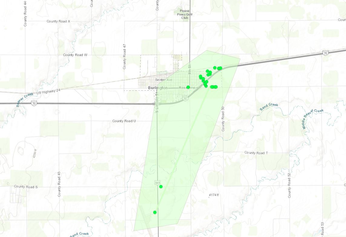 
Downloadable KMZ File (Coming Soon) |
||||||||||||||
Photos
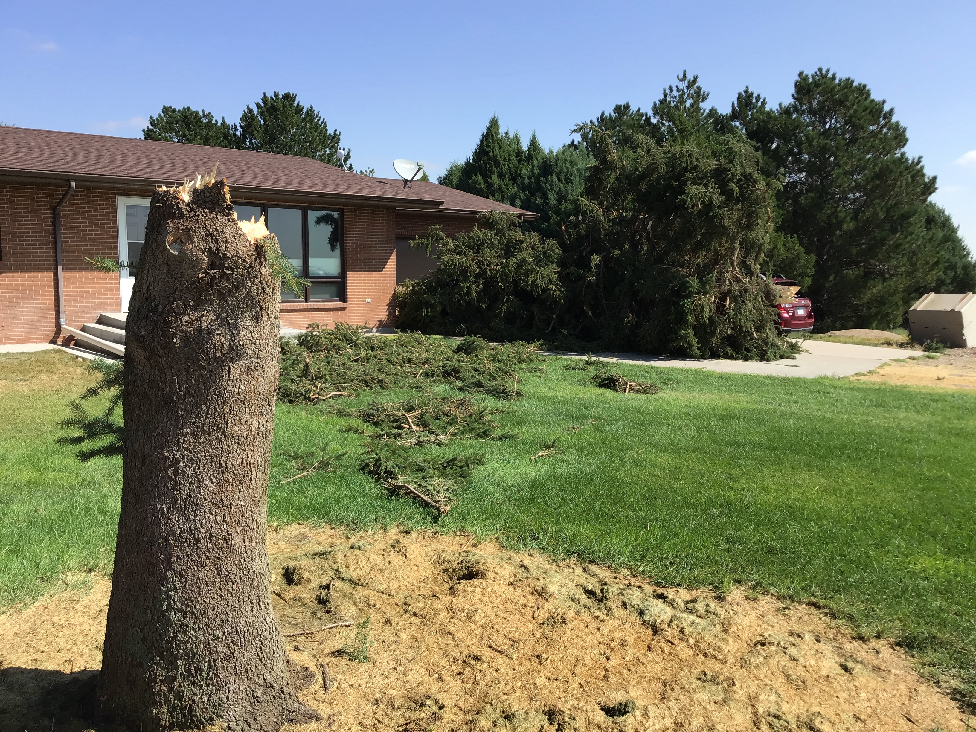
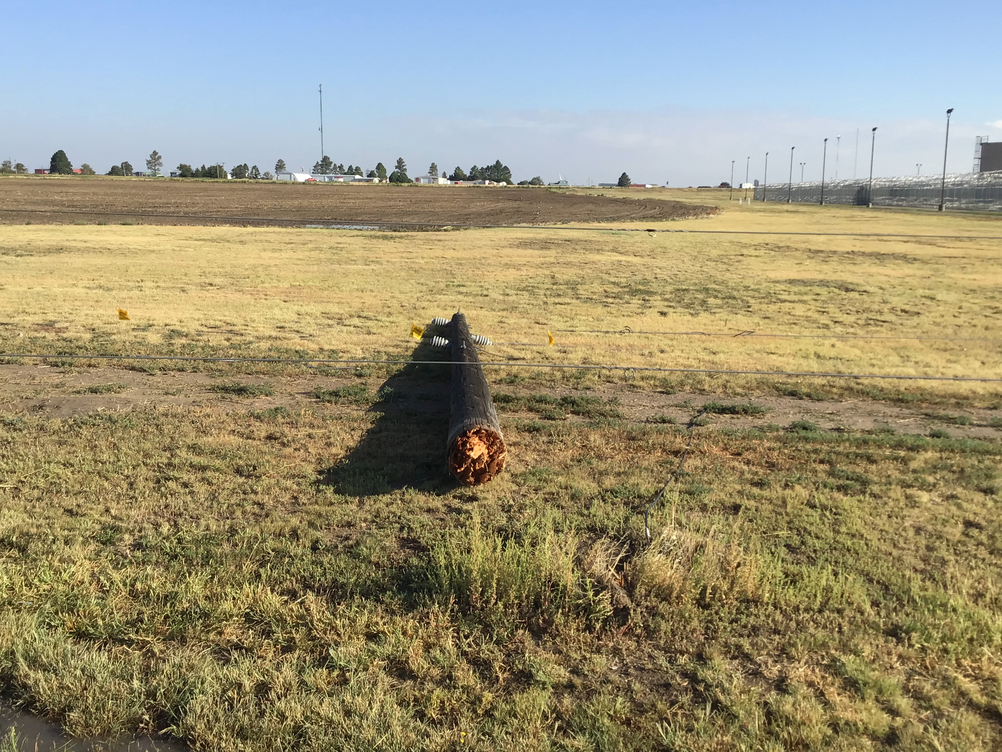
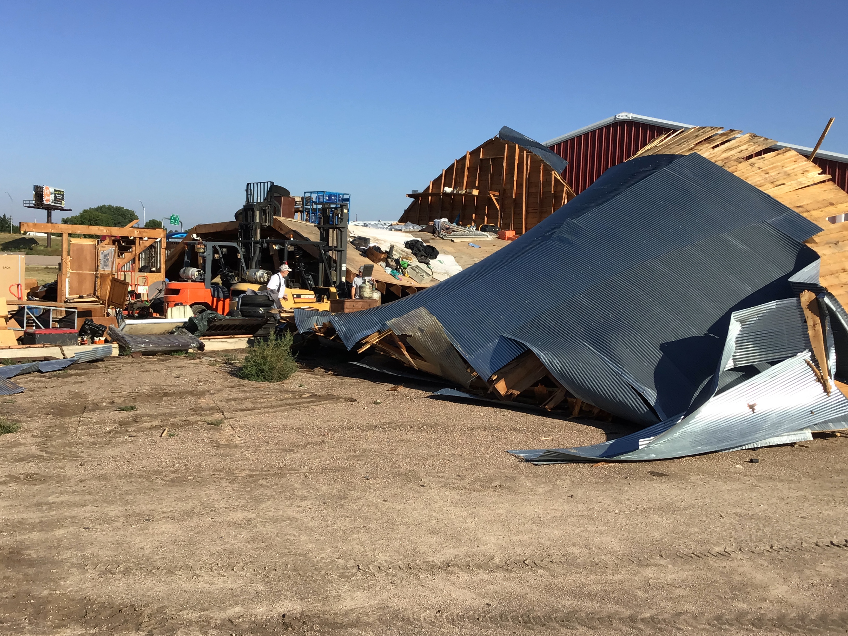
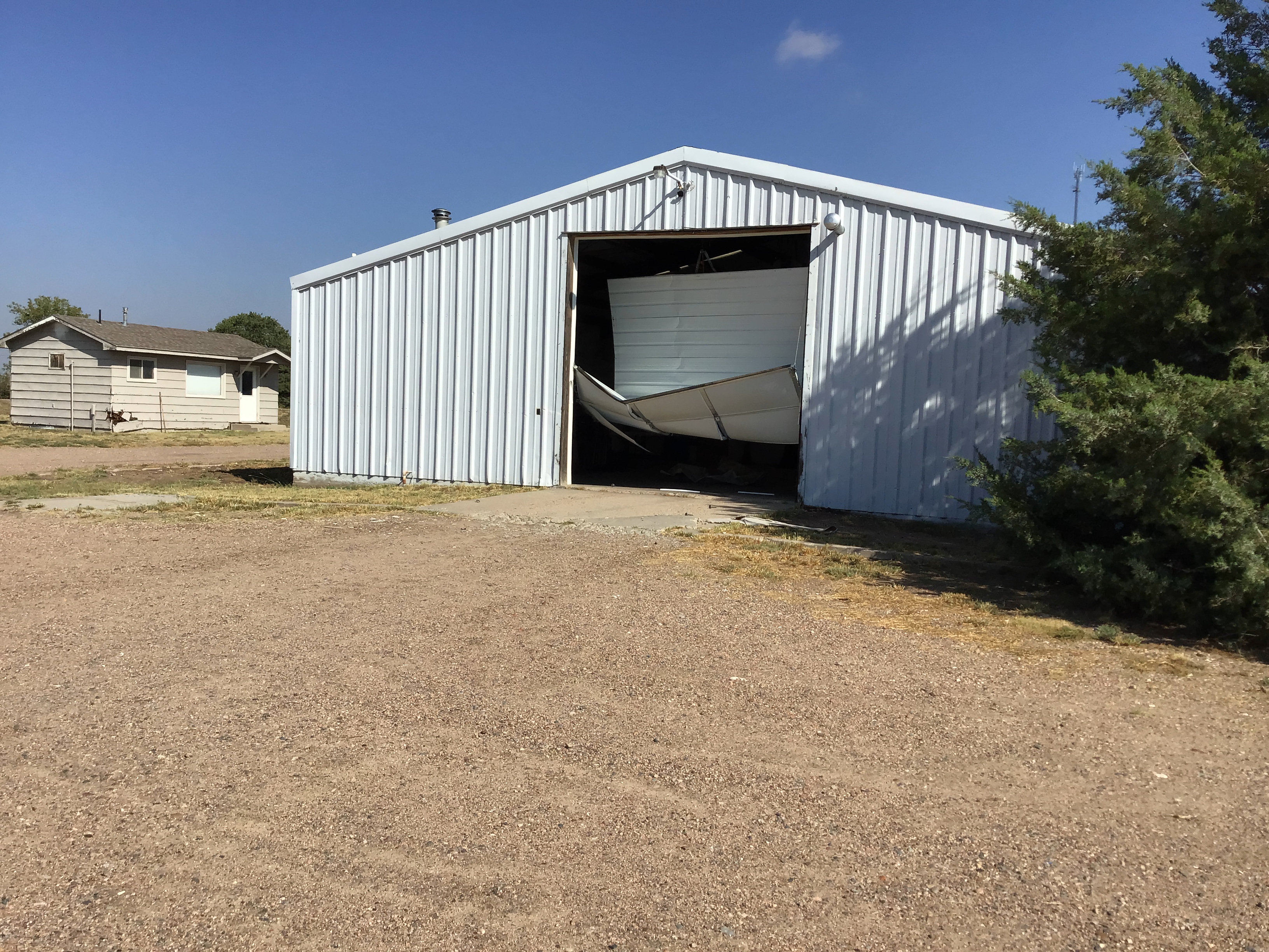
Pictures from the Burlington area from damage survey. Photos taken by NWS meteorologists.
 |
 |
 |
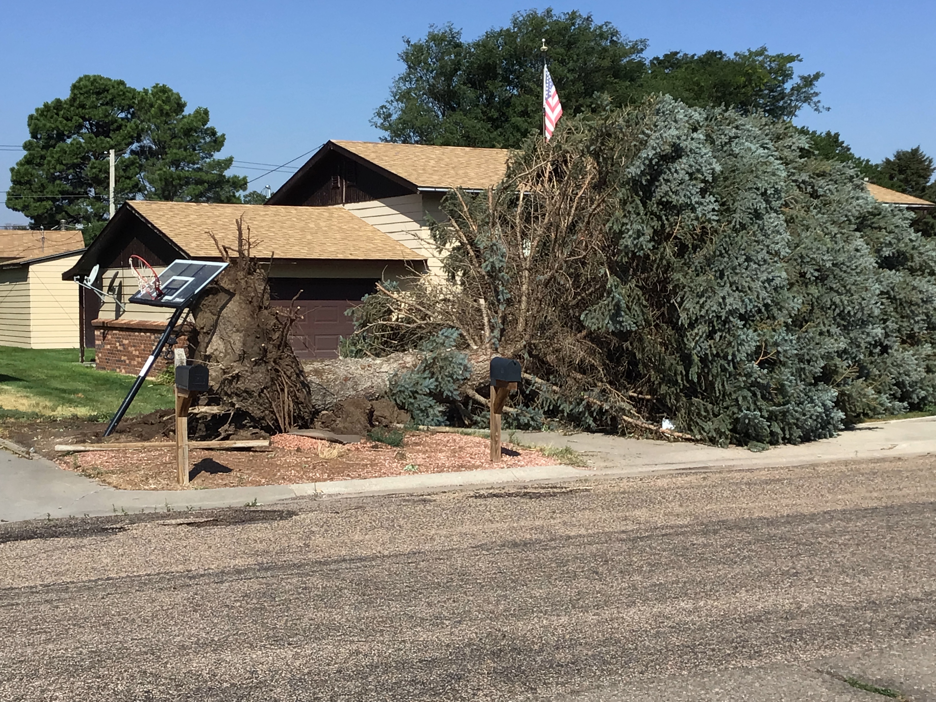 |
| Large evergreen tree trunk snapped and thrown 20 feet | One of 4 power poles snapped. | Outbuilding destroyed | Large tree uprooted in Burlington |
 |
 |
||
| Door to building blown in. Nearby winds measured at 76 mph. | Trailer flipped over. |
Storm Reports
PRELIMINARY LOCAL STORM REPORT...SUMMARY NATIONAL WEATHER SERVICE GOODLAND KS 1102 PM MDT WED SEP 1 2021 ...SUMMARY OF STORM REPORTS ACROSS THE TRI-STATE AREA DURING THE AFTERNOON AND EVENING ON WEDNESDAY SEPTEMBER 01, 2021... NOTE: REPORTS ARE LISTED IN CHRONOLOGICAL ORDER. ================================================================== ..TIME... ...EVENT... ...CITY LOCATION... ...LAT.LON... ..DATE... ....MAG.... ..COUNTY LOCATION..ST.. ...SOURCE.... ..REMARKS.. ================================================================== 0641 PM TSTM WND DMG SAINT FRANCIS 39.77N 101.80W 09/01/2021 CHEYENNE KS PUBLIC REPORT FROM MPING: 1-INCH TREE LIMBS BROKEN; SHINGLES BLOWN OFF. 0648 PM TSTM WND GST 1 SSE SAINT FRANCIS 39.76N 101.79W 09/01/2021 M69 MPH CHEYENNE KS AWOS 0812 PM TSTM WND GST 4 S BURLINGTON 39.25N 102.28W 09/01/2021 M50 MPH KIT CARSON CO ASOS THE ASOS WENT DOWN AFTER THIS OBSERVATION WAS TAKEN. IT IS UNKNOWN IF THIS WAS THE PEAK WIND GUST WITH THE STORM THAT MOVED THROUGH. 0818 PM TSTM WND DMG BURLINGTON 39.31N 102.27W 09/01/2021 KIT CARSON CO 911 CALL CENTER DISPATCH REPORTED THAT MUCH OF BURLINGTON IS WITHOUT POWER. THERE ARE DOWNED TREES AND POWER LINES. MOBILE HOMES ALSO SUSTAINED DAMAGE TO WINDOWS. |
Media use of NWS Web News Stories is encouraged! Please acknowledge the NWS as the source of any news information accessed from this site. |
|

