Overview
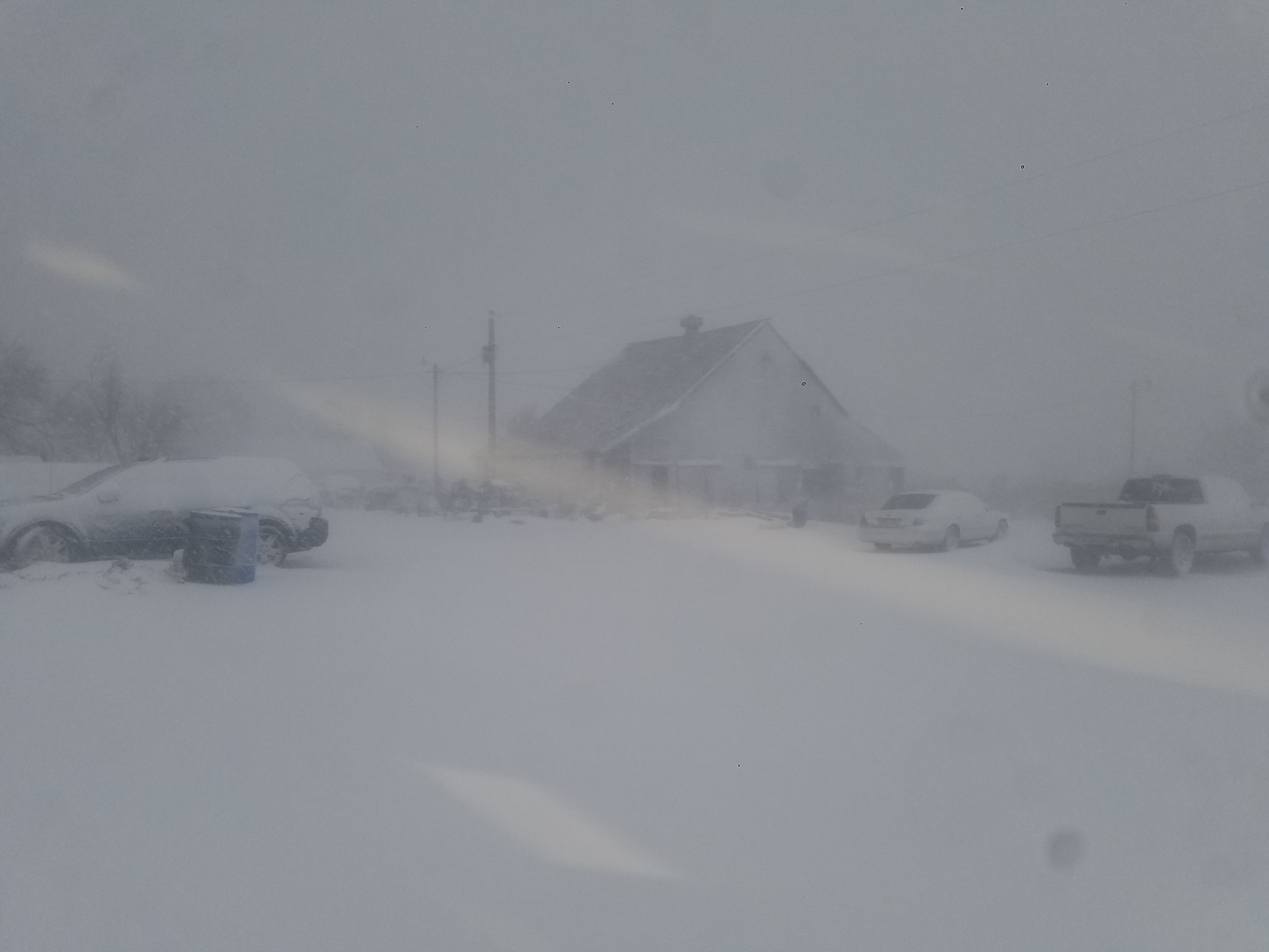
A significant blizzard impacted the region with freezing rain, snow, and strong winds on January 21st and 22nd. Power outages were reported in Colby as sleet and wet snow combined with gusty north winds. Widespread reports of near zero to zero visibility were received with snowfall rates at or above one inch per hour during the periods of heaviest snowfall. The first reports of one quarter mile or less visibility began coming in around 2:40PM in Yuma County, spreading eastward and southeastward through the remainder of the afternoon and evening. Blizzard conditions continued overnight Sunday, peaking in intensity early Monday morning. Most, if not all, area highways closed as there were reports of anything from stranded motorists to jackknifed semi-trucks blocking the roadways. Snowfall ended from west to east through the day on Monday; however, blowing and drifting snow persisted, making several area roads temporarily impassable.
Blizzard Summary
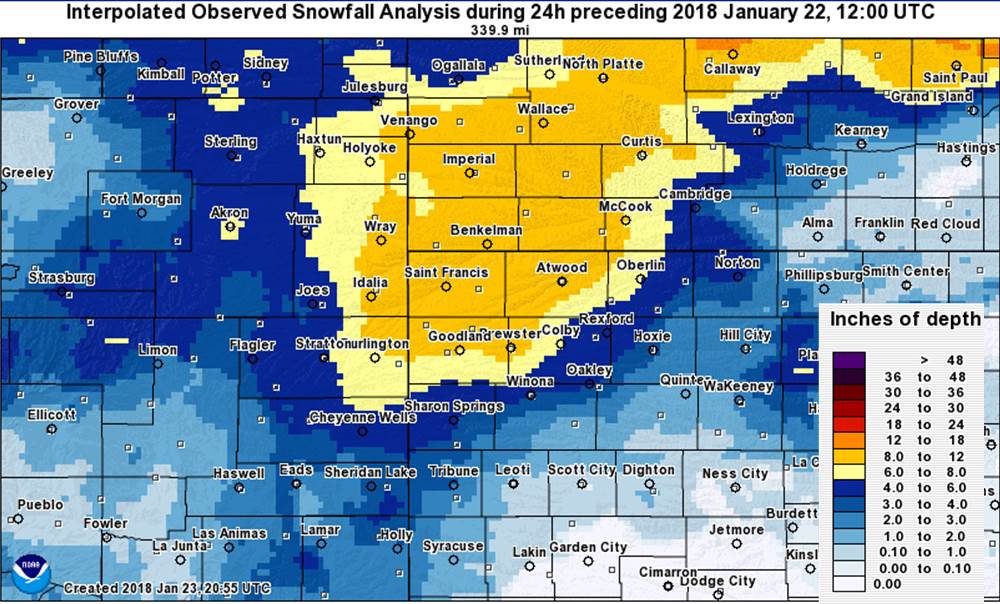
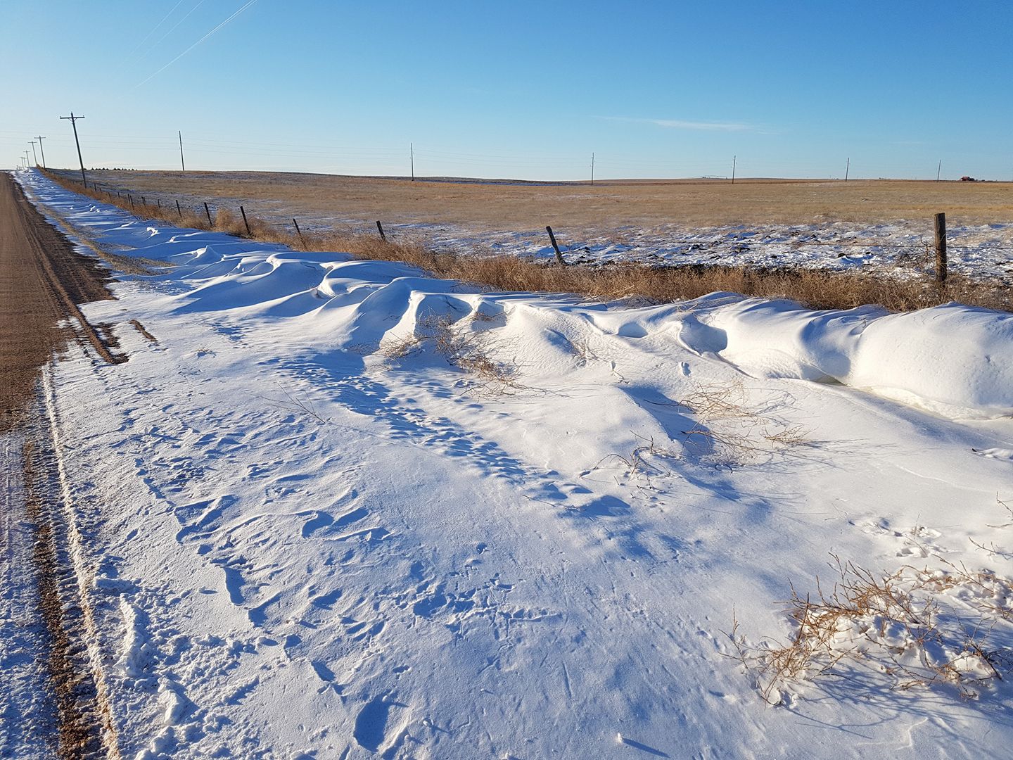
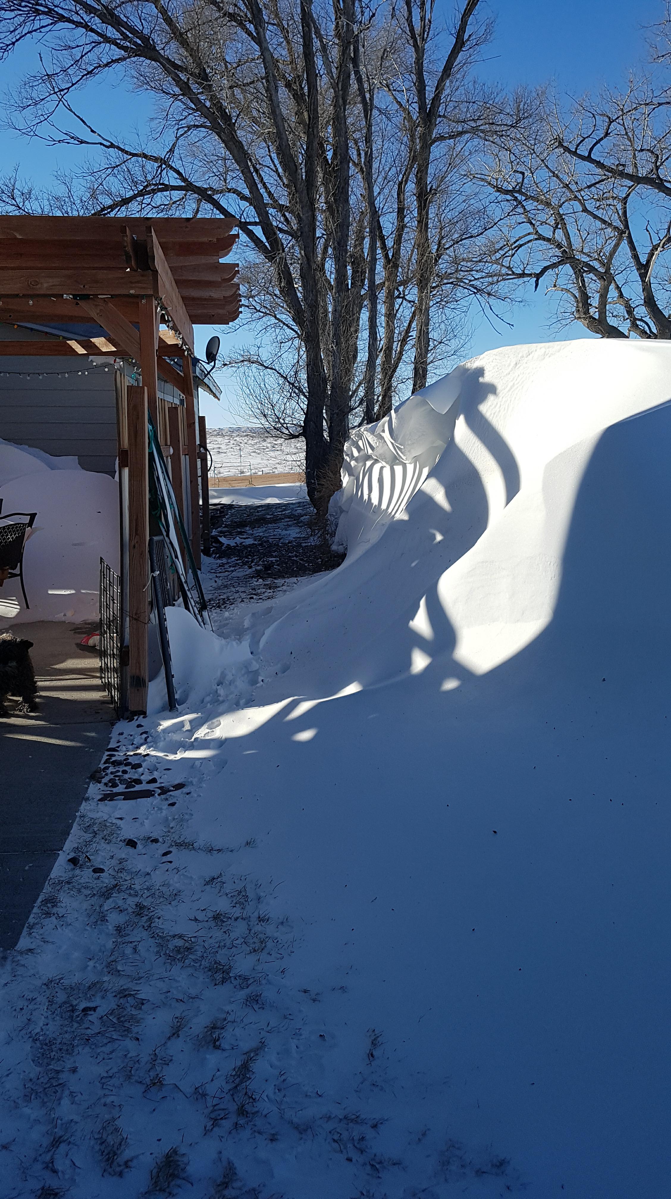
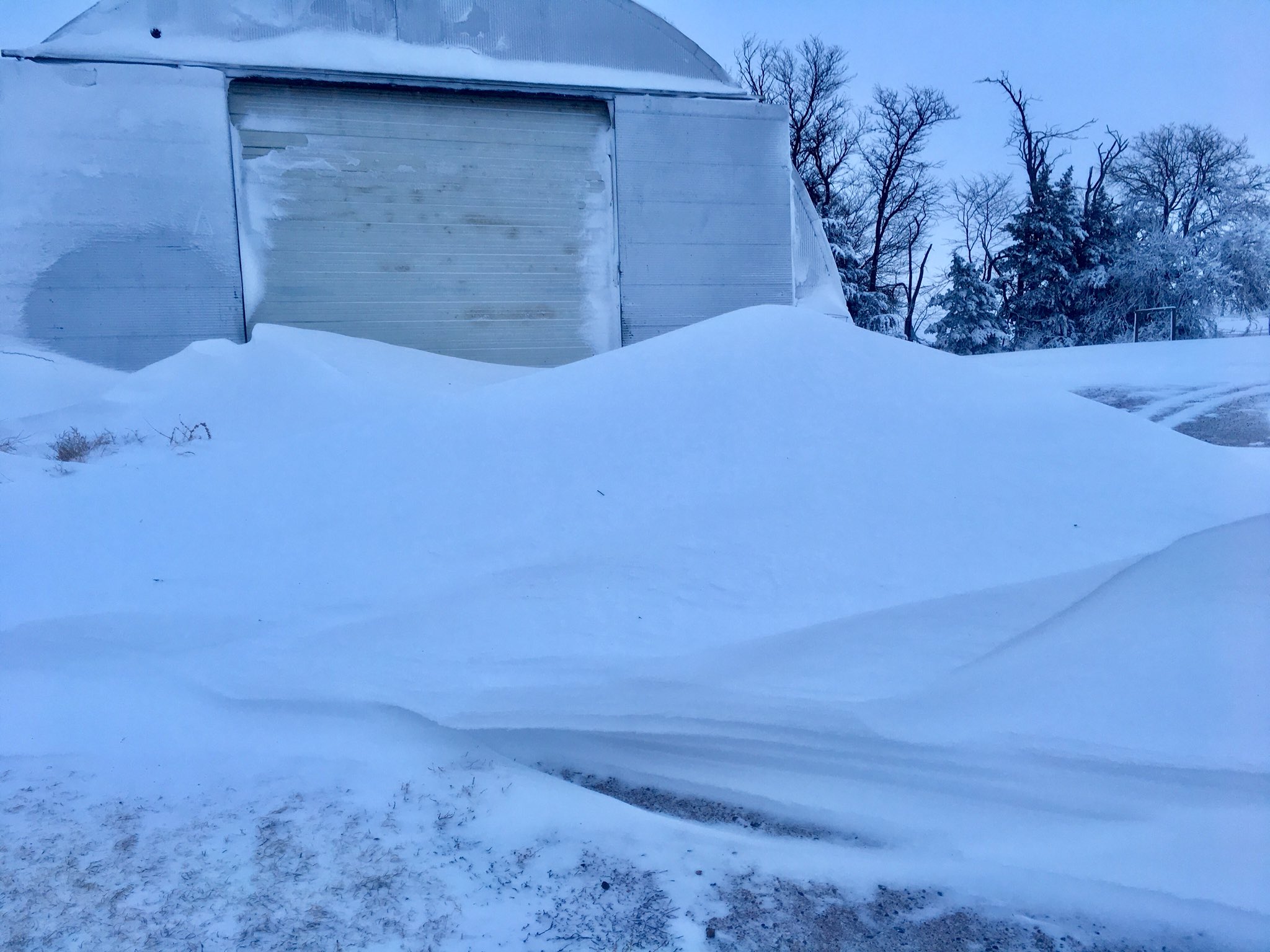
A potent area of low pressure moved out of the central Rockies on Sunday, January 21st. The system was well advertised with good model agreement regarding the track and strength. Most areas observed freezing rain Sunday morning through around midday, when precipitation began transitioning to snow from northwest to southeast. A series of strong snow bands, some convective, formed and slowly moved eastward through Sunday evening and into the overnight hours into Monday. Snowfall rates of one inch per hour or higher were common along with strong north winds. Sustained winds were around 40 miles per hour with the highest gust of 58 miles per hour reported by the ASOS station in Goodland, KS. Snowfall amounts of one to three inches were reported in the eastern portions of the region near Hill City with slightly higher amounts in Norton. Further west, much higher amounts ranging from 9 to 14 inches were reported with the highest amounts occurring north of Interstate 70. Blowing and drifting snow was common and drifts of 3 to 5 feet were reported in several locations, especially in northwest Sherman County and much of Cheyenne County in Kansas. Snow continued to blow and drift long after the snow ended from west to east on Monday.
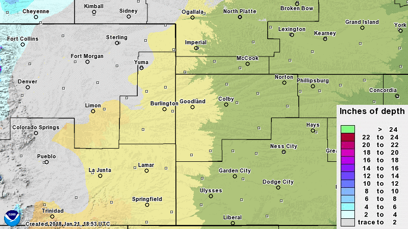
Here is an image depicting the estimated storm total snowfall from this blizzard:
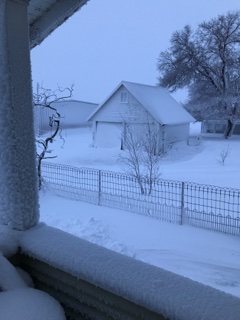
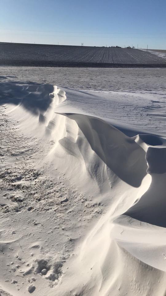
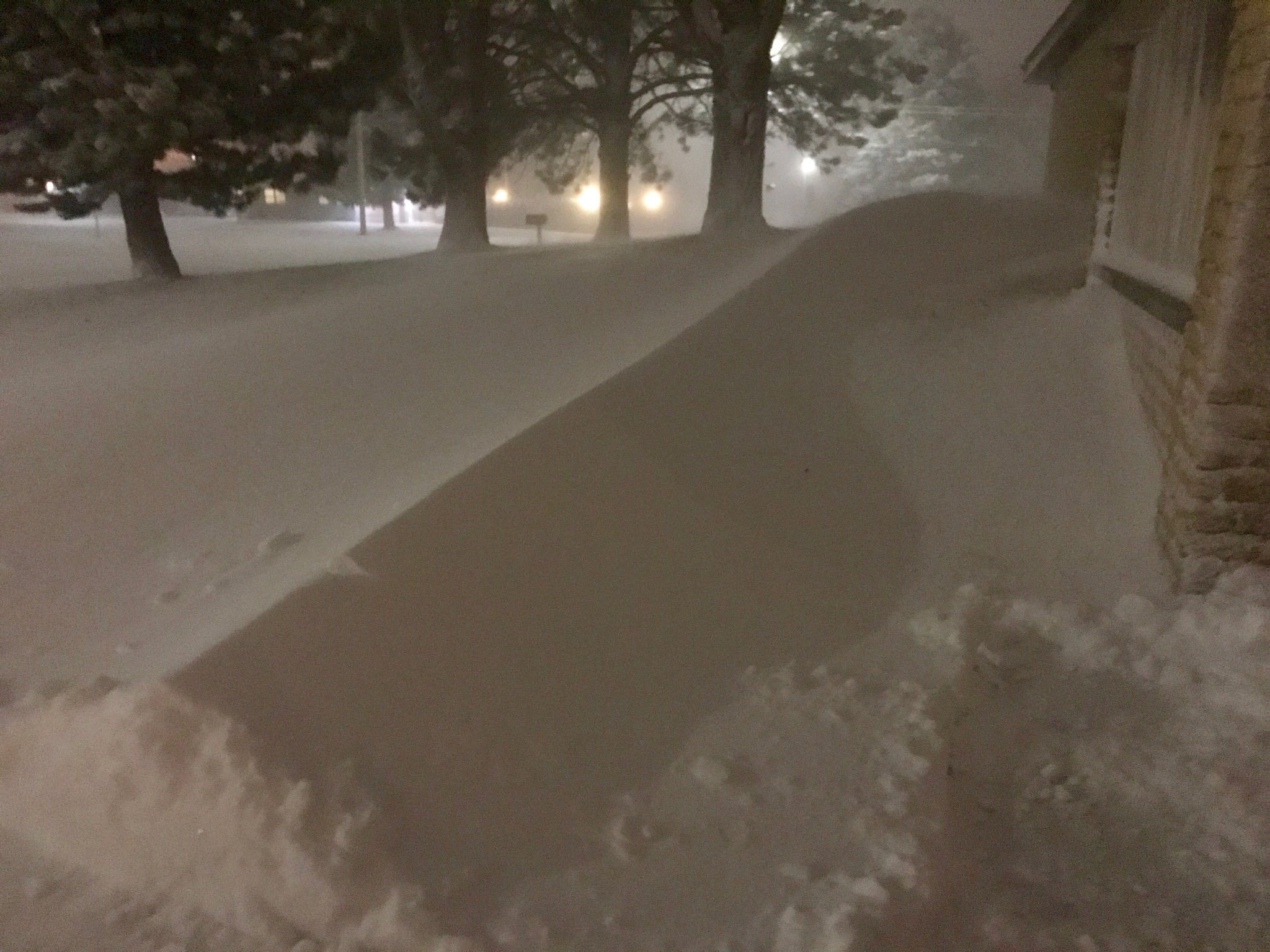
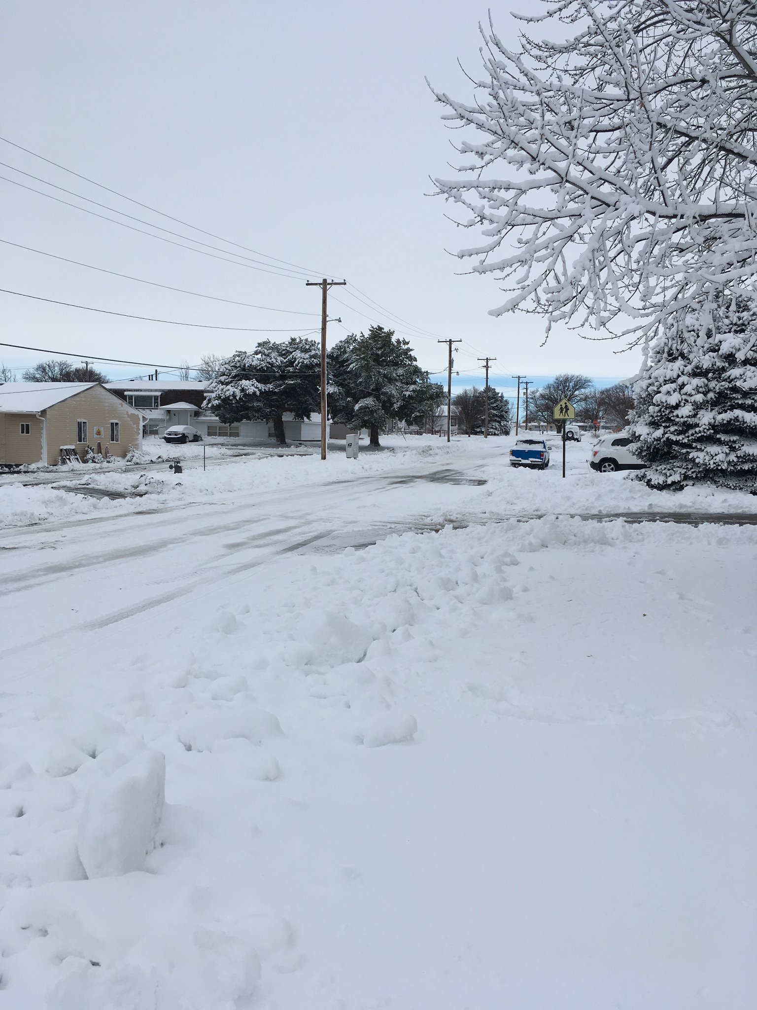
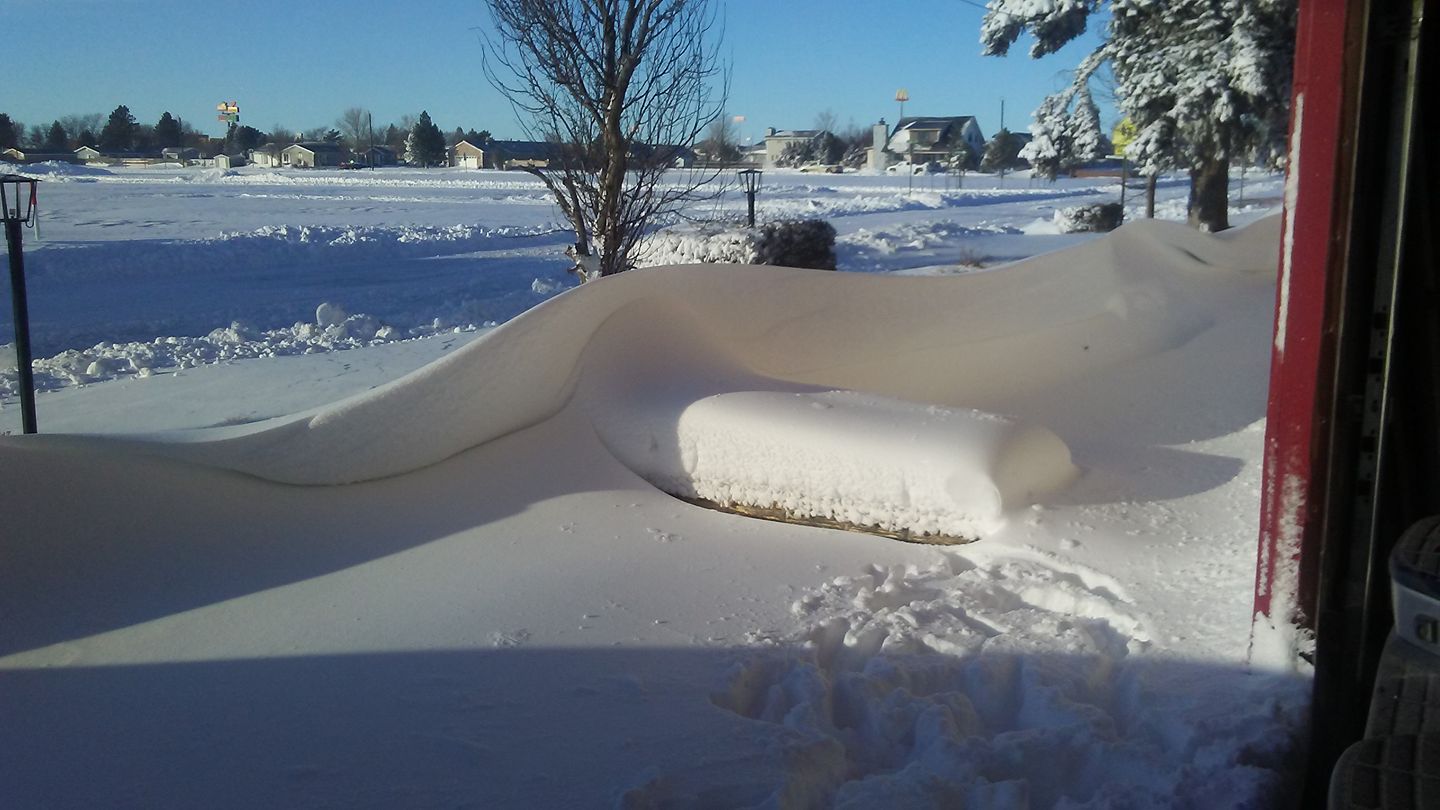
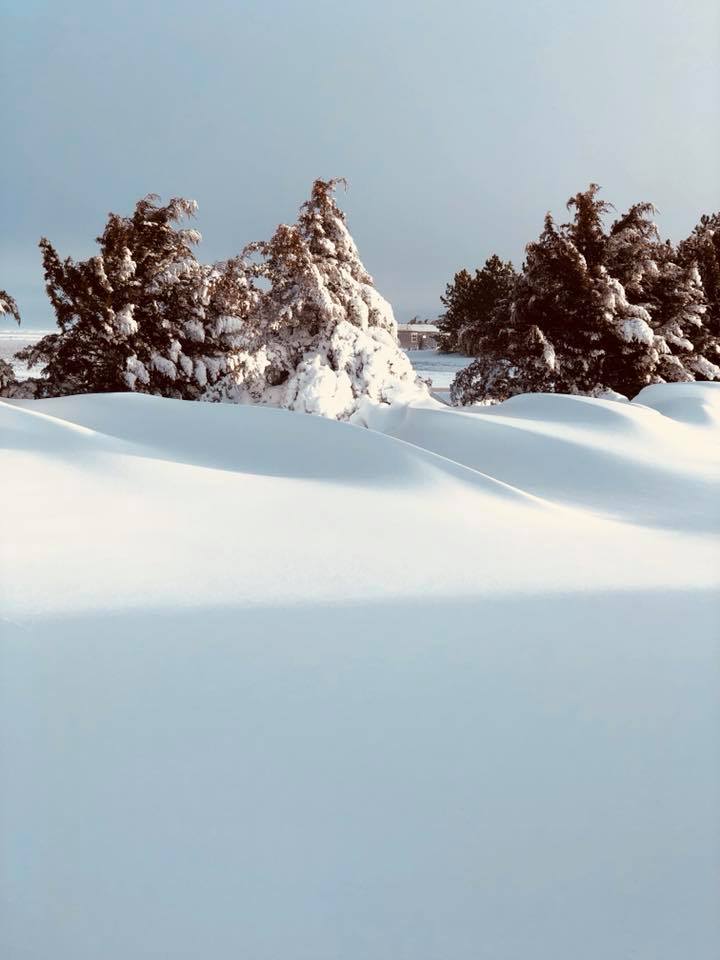
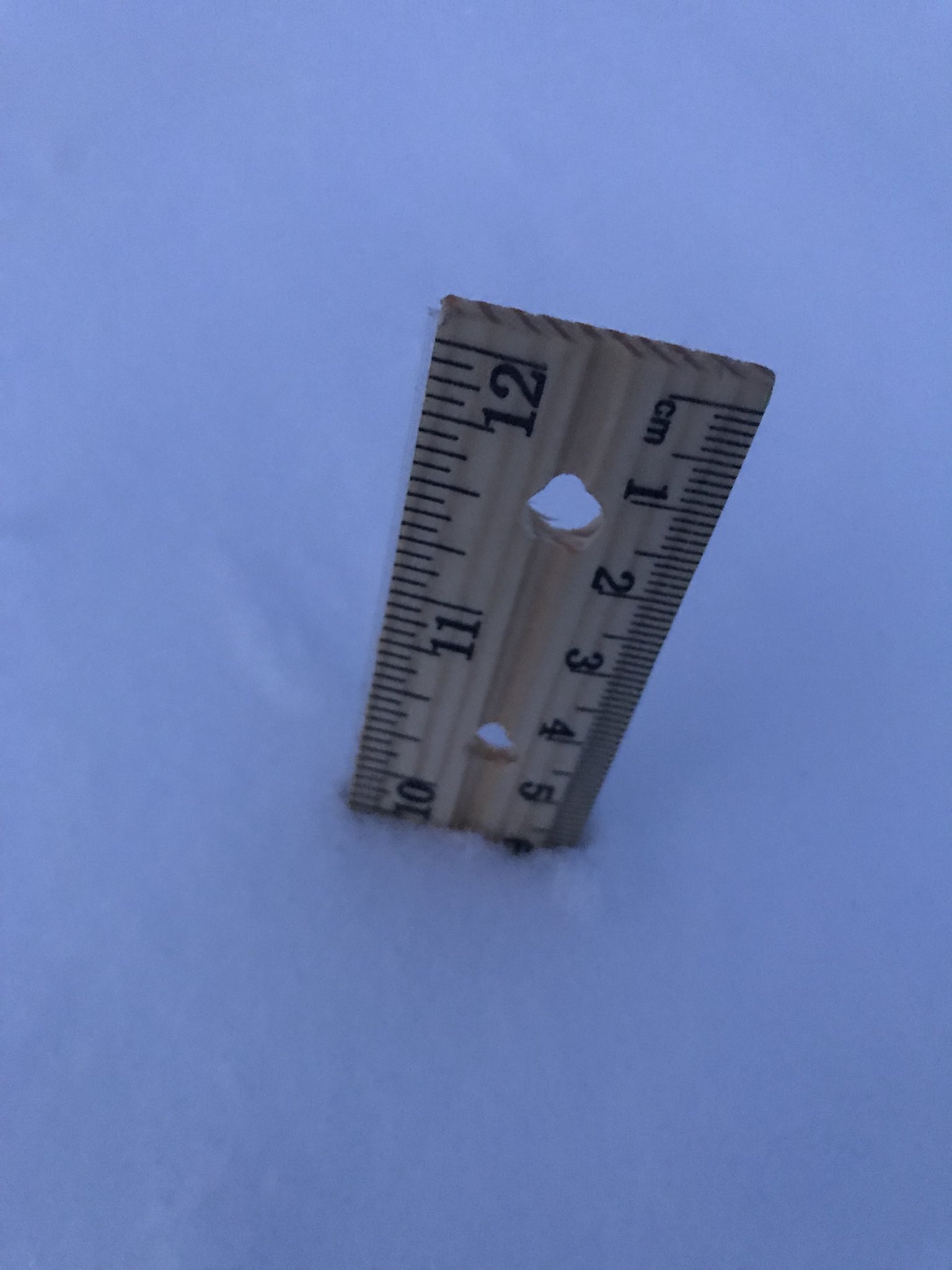
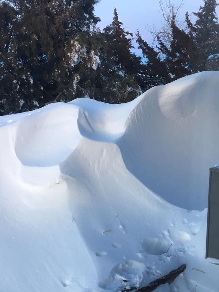
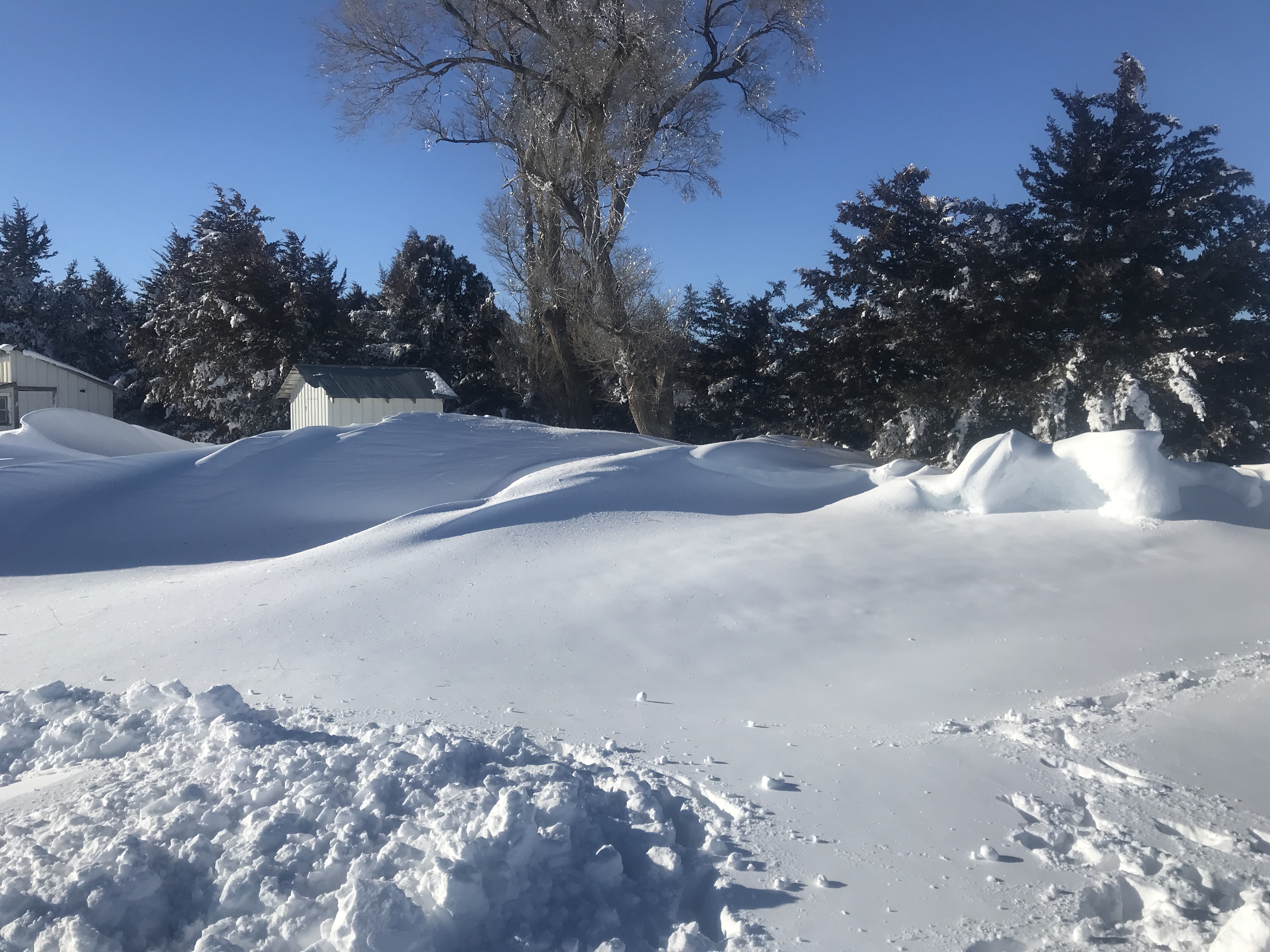
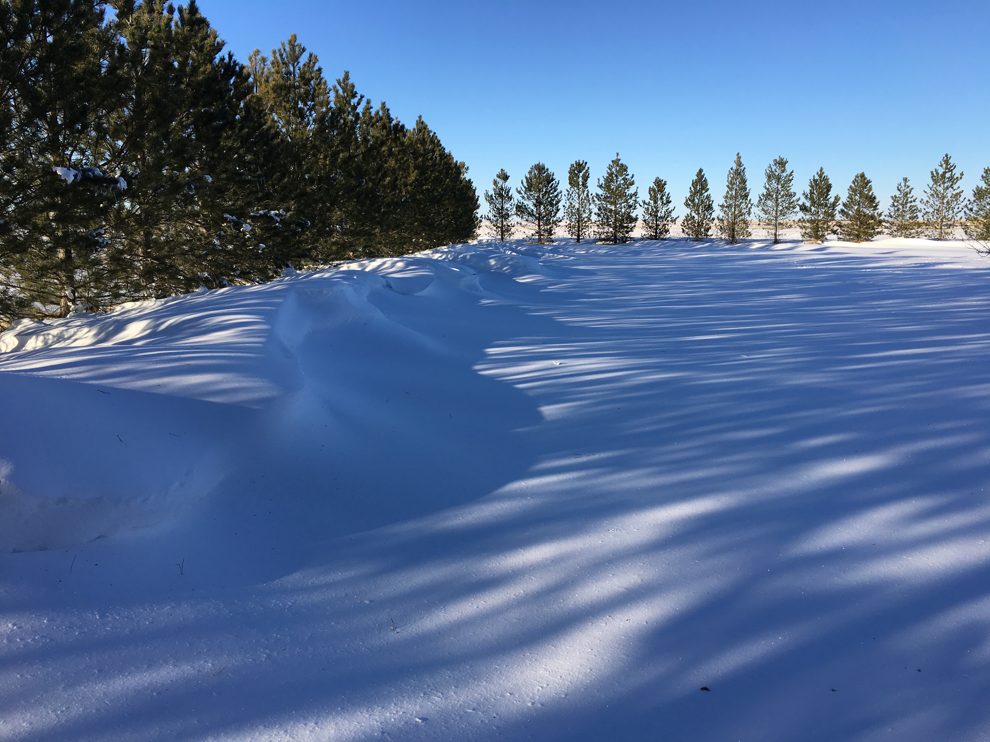
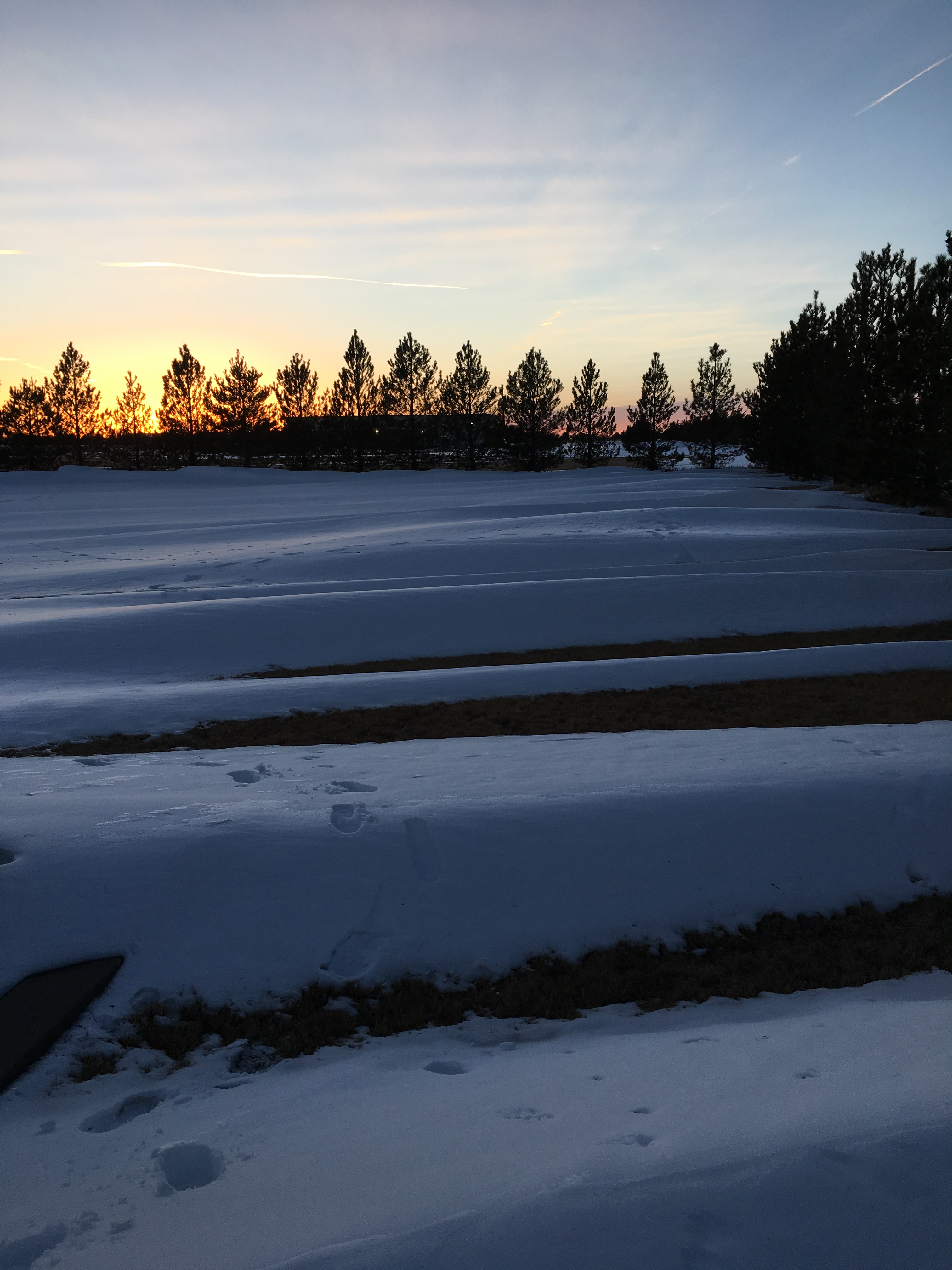
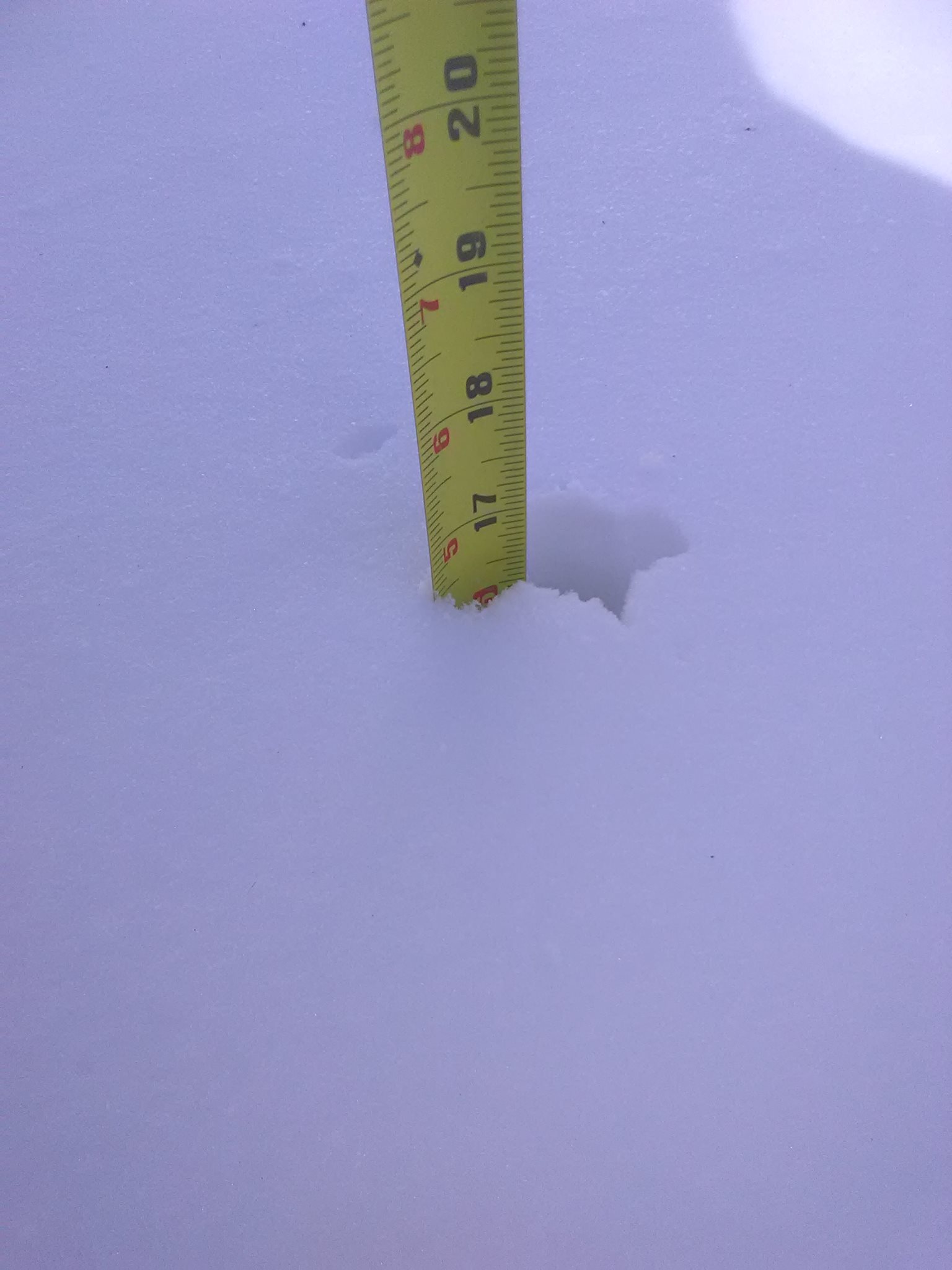
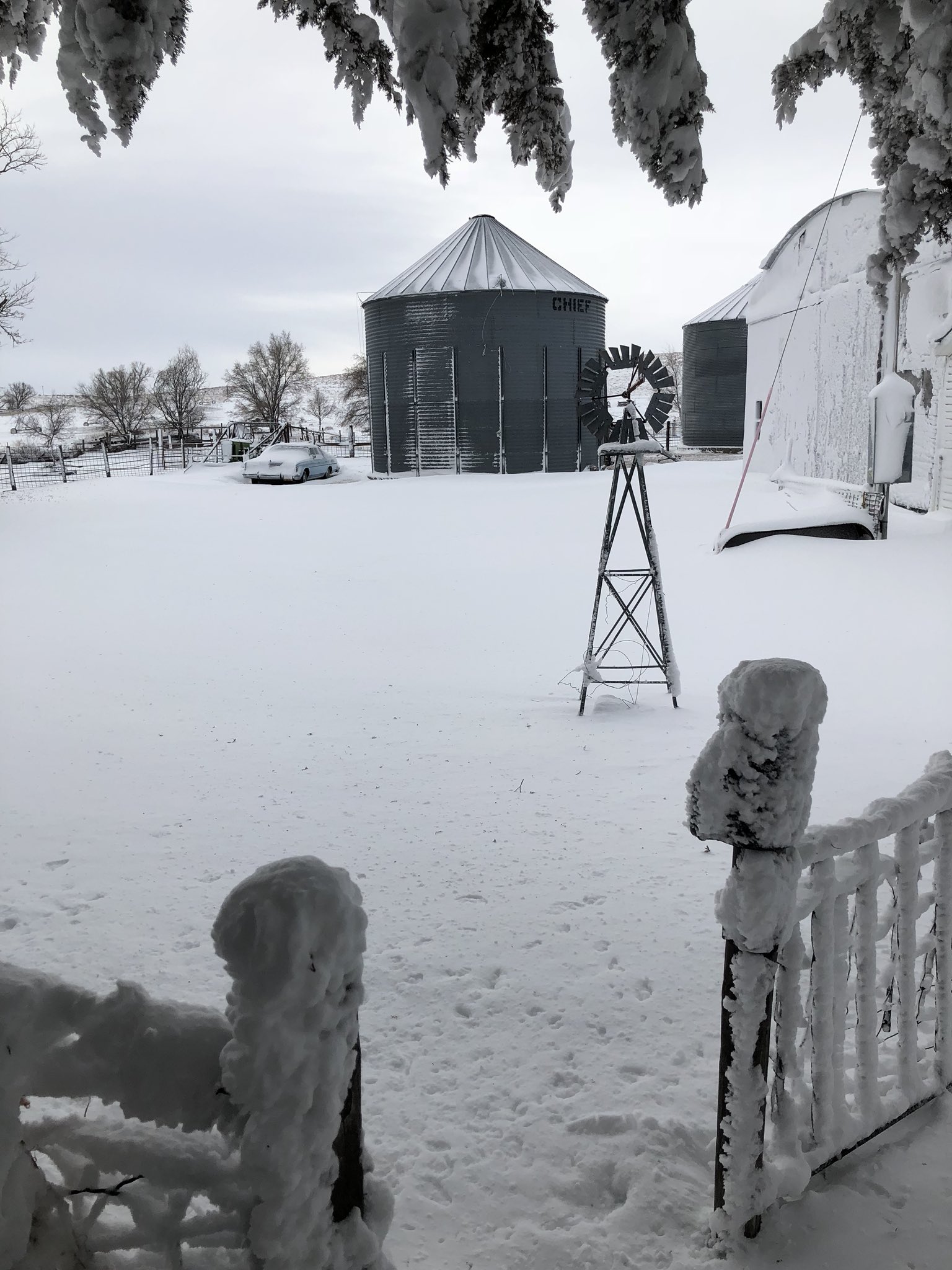
Photos & Video:
 |
%206-10%20inches%20Deb%20Stamm%20can%20use.jpg) |
 |
| East of Trenton, NE Courtesy: Mary Williams |
Benkelman, NE Courtesy: Deb Stamm |
10S Brewster, KS Courtesy: Bonnie Holm |
 |
 |
 |
| Goodland, KS Courtesy: Brandon Vincent |
Norton, KS Courtesy: Caleb Wilson |
Burlington, CO Courtesy: Cyndi Myrick |
 |
 |
 |
| 4W Colby, KS Courtesy: Dustin & Brittany Kibel |
Wray, CO Courtesy: Jennifer Jones |
5E McDonald, KS Courtesy: Lacy Sremek |
 |
 |
 |
| 12NNW Ruleton, KS Courtesy: Micheal leonard |
NWS Goodland, KS Courtesy: Timothy Lynch |
NWS Goodland, KS Courtesy: Timothy Lynch |
 |
 |
 |
| 7SW Yuma, CO Courtesy: Peggi Fulton |
NE Yuma County, CO Courtesy: Shanda McAllister |
2E Max, NE Courtesy: Stephanie S. |
 |
 |
 |
| NW Cheyenne County, KS Courtesy: Christopher Warner |
Angelus, KS Courtesy: Tabbiy Anne |
3W Culbertson, NE Courtesy: William Hanke |
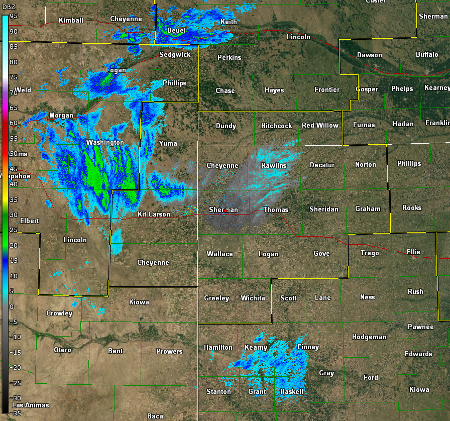
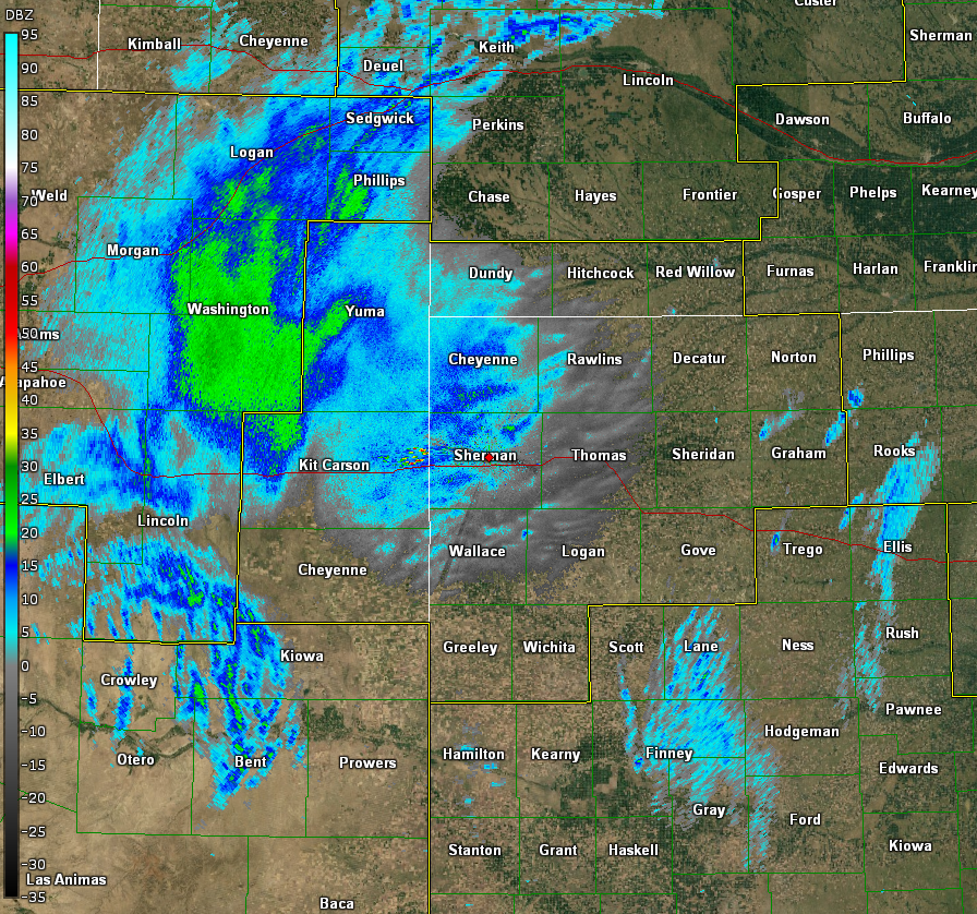
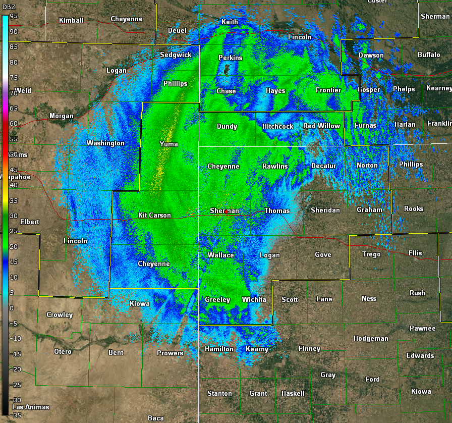
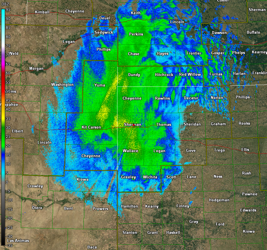
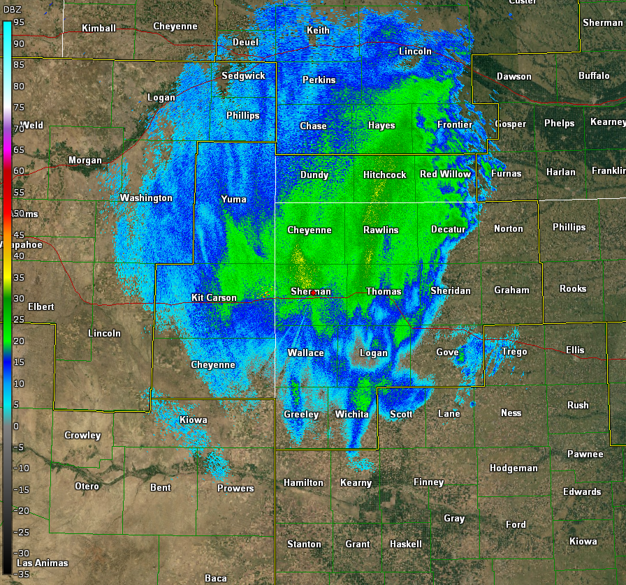
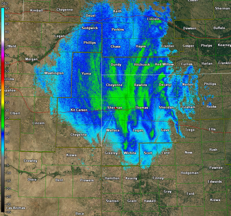
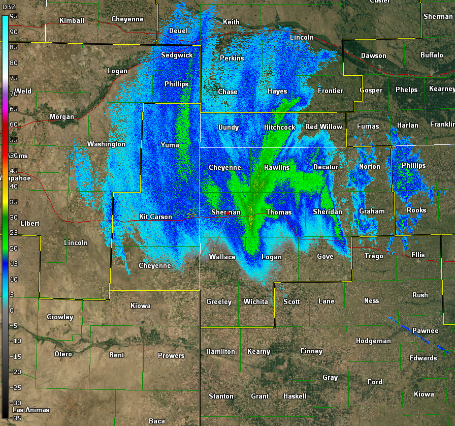
Radar and Satellite:
 |
 |
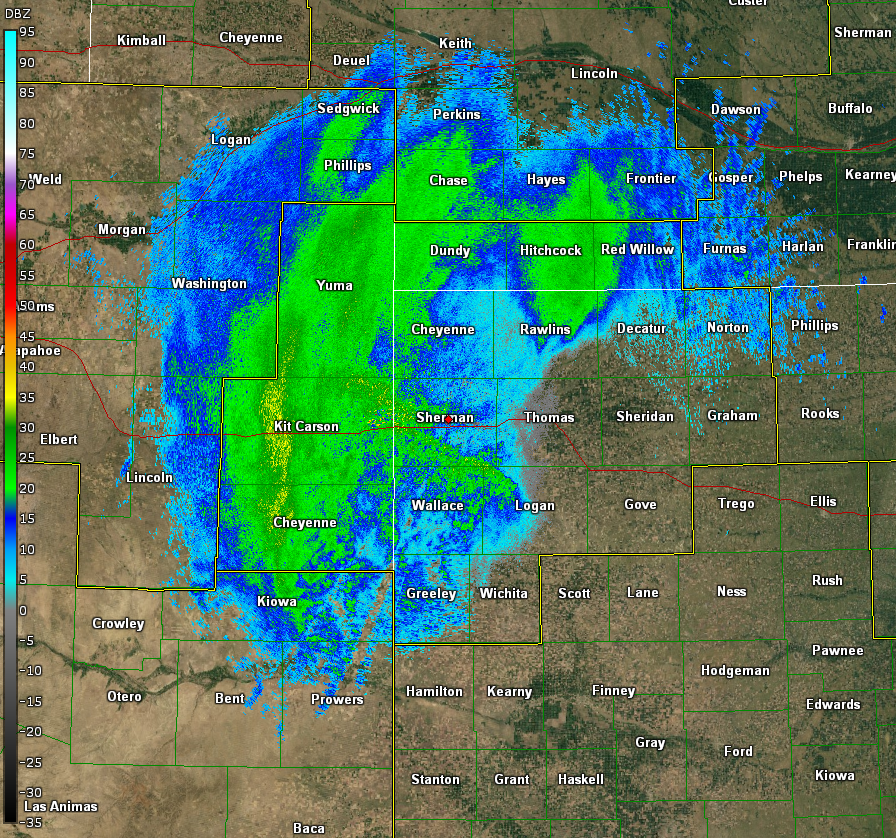 |
| Light snow and freezing drizzle begins. 1/21 at 6:23 am MST |
Light snow and freezing drizzle expands. 1/21 at 9:51 am MST |
Band of moderate snow beginning to shape up. 1/21 at 1:31 pm MST |
 |
 |
 |
| Band of moderate to heavy snow expanding. 1/21 at 3:33 pm MST |
Widespread moderate to heavy snow. 1/21 at 5:00 pm MST |
Snow not as heavy, but blizzard conditions observed. 1/21 at 8:34 pm MST |
 |
 |
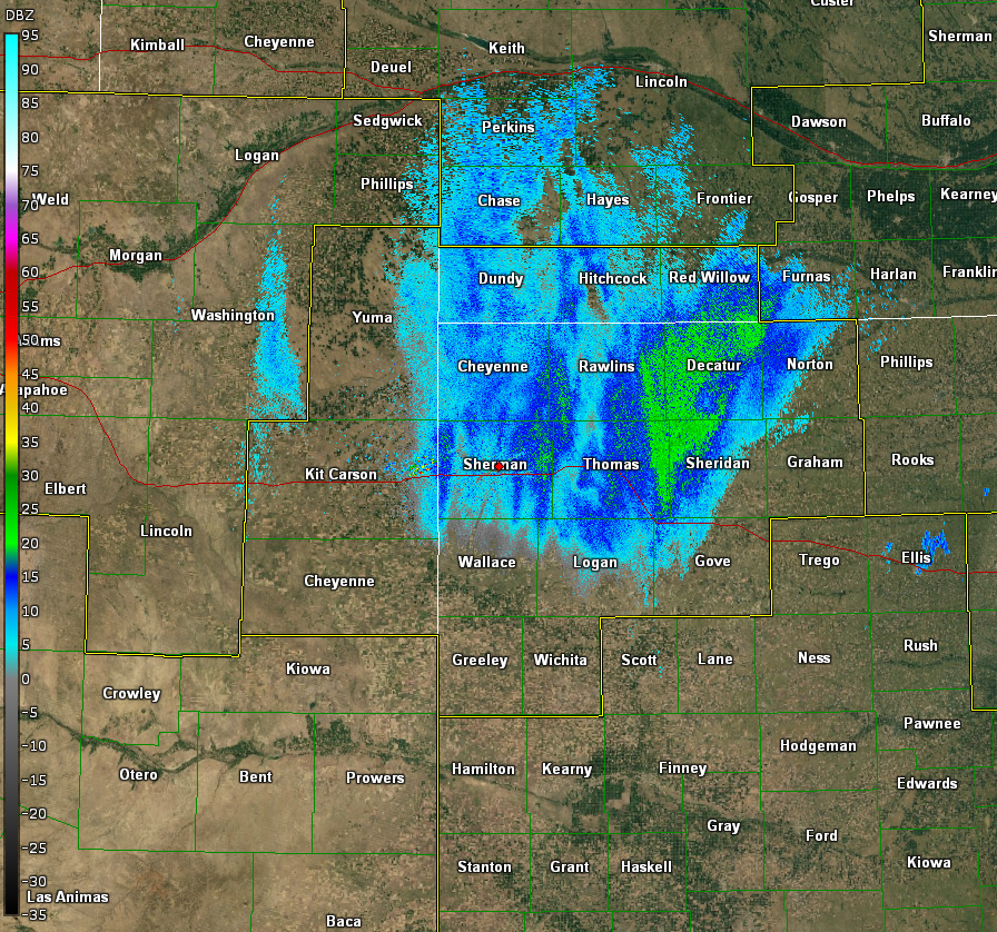 |
| Light snow and blizzard conditions persist. 1/21 at 11:31 pm MST |
Snow decreasing in intensity. 1/22 at 2:27 am MST |
Storm begins winding down. 1/22 at 5:32 am MST |
 |
| Loop of estimated snow depth. |
Storm Reports
PRELIMINARY LOCAL STORM REPORTS...SUMMARY
NATIONAL WEATHER SERVICE GOODLAND KS
510 AM MST SUN JAN 21 2018

..TIME...   ...EVENT...      ...CITY LOCATION...     ...LAT.LON...
..DATE...   ....MAG....      ..COUNTY LOCATION..ST.. ...SOURCE....
            ..REMARKS..

0508 AM     FREEZING RAIN    OAKLEY                  39.13N 100.85W
01/21/2018  U0.00 INCH       LOGAN              KS   EMERGENCY MNGR

            LIGHT FREEZING DRIZZLE COATING EVERYTHING IN TOWN. 27F
            CURRENTLY.

1006 AM     NON-TSTM WND GST BURLINGTON              39.31N 102.27W
01/21/2018  M53 MPH          KIT CARSON         CO   ASOS

1126 AM     FREEZING RAIN    1 N GOODLAND            39.36N 101.71W
01/21/2018  M0.10 INCH       SHERMAN            KS   ASOS

            MEASURED BY ICE ACCUMULATION SENSOR AT GOODLAND ASOS.
            MANUAL OBSERVATION BY NWS CONFIRMS AMOUNTS ON ELEVATED
            SURFACES.UNTREATED SIDEWALKS AND ROADS COVERED WITH LAYER
            OF ICE.

1223 PM     FREEZING RAIN    1 E ST. FRANCIS         39.77N 101.78W
01/21/2018  E0.38 INCH       CHEYENNE           KS   TRAINED SPOTTER

            3/8 INCH OF ICE ESTIMATED ON TREES.

1242 PM     SNOW             YUMA                    40.12N 102.72W
01/21/2018  M3.0 INCH        YUMA               CO   EMERGENCY MNGR

0140 PM     FREEZING RAIN    ST. FRANCIS             39.77N 101.80W
01/21/2018  E0.25 INCH       CHEYENNE           KS   TRAINED SPOTTER

            1/4 INCH ICE ACCUMULATION ESTIMATED. RELAYED BY EMERGENCY
            MANAGER. ALSO REPORTED POWER FLICKERING.

0145 PM     SNOW             4 W ST. FRANCIS         39.77N 101.88W
01/21/2018  M2.0 INCH        CHEYENNE           KS   TRAINED SPOTTER

0240 PM     SNOW             YUMA                    40.12N 102.72W
01/21/2018  M5.5 INCH        YUMA               CO   EMERGENCY MNGR

            ONE QUARTER MILE VISIBILITY AT BEST.

0330 PM     SNOW             GOODLAND                39.35N 101.71W
01/21/2018  M1.0 INCH        SHERMAN            KS   COCORAHS

            ONE INCH OF SNOWFALL IN THE PAST 60 MINUTES. VISIBILITY
            ONE QUARTER MILE OR LESS AT TIME OF OBSERVATION.

0357 PM     SNOW             1 E ST. FRANCIS         39.77N 101.78W
01/21/2018  E4.0 INCH        CHEYENNE           KS   PUBLIC

            RELAYED VIA SOCIAL MEDIA.

0423 PM     SNOW             YUMA                    40.12N 102.72W
01/21/2018  M7.0 INCH        YUMA               CO   EMERGENCY MNGR

            SOME DRIFTING REPORTED.

0424 PM     SNOW             BENKELMAN               40.05N 101.54W
01/21/2018  M3.8 INCH        DUNDY              NE   PUBLIC

            RELAYED VIA SOCIAL MEDIA.

0430 PM     SNOW             GOODLAND                39.35N 101.71W
01/21/2018  M2.2 INCH        SHERMAN            KS   COCORAHS

            2.2 INCHES OF SNOW ON GROUND. 1.2 INCHES OF SNOW IN THE
            LAST HOUR. VISIBILITY APPROXIMATELY ONE HALF MILE.

0500 PM     BLIZZARD         10 S HAIGLER            39.87N 101.94W
01/21/2018                   CHEYENNE           KS   PUBLIC

            ONE QUARTER MILE OR LESS VISIBILITY. RELAYED VIA SOCIAL
            MEDIA WITH PICTURE.

0535 PM     SNOW             1 E ST. FRANCIS         39.77N 101.78W
01/21/2018  E6.0 INCH        CHEYENNE           KS   PUBLIC

            ESTIMATED 5 TO 6 INCHES OF SNOW. LARGEST DRIFT IN YARD IS
            16 INCHES.

0602 PM     BLIZZARD         BURLINGTON              39.31N 102.27W
01/21/2018                   KIT CARSON         CO   FIRE DEPT/RESCUE

            VISIBILITY IS ABOUT 1 TO 2 CITY BLOCKS AT BEST.

0615 PM     BLIZZARD         COLBY                   39.39N 101.05W
01/21/2018                   THOMAS             KS   EMERGENCY MNGR

            COMBINATION OF WET SNOW AND SLEET IN COLBY. POWER OUTAGES
            HAVE OCCURRED IN PORTIONS OF COLBY.

0637 PM     SNOW             9 NNE KIT CARSON        38.88N 102.73W
01/21/2018  M4.0 INCH        CHEYENNE           CO   CO-OP OBSERVER

0640 PM     BLIZZARD         ST. FRANCIS             39.77N 101.80W
01/21/2018                   CHEYENNE           KS   LAW ENFORCEMENT

            NEAR ZERO VISIBILITY IN CHEYENNE COUNTY, KANSAS. RELAYED
            BY EMERGENCY MANAGEMENT.

0700 PM     SNOW             ST. FRANCIS             39.77N 101.80W
01/21/2018  M7.5 INCH        CHEYENNE           KS   EMERGENCY MNGR

            2 FOOT DRIFTS WITH SOME APPROACHING 3 FEET.

0740 PM     SNOW             BENKELMAN               40.05N 101.54W
01/21/2018  M6.0 INCH        DUNDY              NE   PUBLIC

            RELAYED VIA SOCIAL MEDIA.

0813 PM     SNOW             OAKLEY                  39.13N 100.85W
01/21/2018  E1.5 INCH        LOGAN              KS   EMERGENCY MNGR

            1.5 INCH OF SNOW AND SLEET ACCUMULATION. MODERATE SNOW
            FALLING AT TIME OF OBSERVATION.

0841 PM     NON-TSTM WND GST 9 NNE KIT CARSON        38.88N 102.73W
01/21/2018  M40 MPH          CHEYENNE           CO   MESONET

0925 PM     SNOW             13 NNW EDSON            39.50N 101.63W
01/21/2018  M6.5 INCH        SHERMAN            KS   NWS EMPLOYEE

0941 PM     BLIZZARD         ST. FRANCIS             39.77N 101.80W
01/21/2018                   CHEYENNE           KS   EMERGENCY MNGR

            EMERGENCY MANAGER REPORTED THAT HE HAS RECEIVED MULTIPLE
            REPORTS ZERO VISIBILITY IN CHEYENNE AND RAWLINS COUNTIES
            IN KANSAS.

0945 PM     SNOW             11 NNW ST. FRANCIS      39.92N 101.88W
01/21/2018  E14.0 INCH       CHEYENNE           KS   EMERGENCY MNGR

            EMERGENCY MANAGER RECEIVED AN UNCONFIRMED REPORT OF 14
            INCHES OF SNOW.

1055 PM     NON-TSTM WND GST WRAY                    40.08N 102.23W
01/21/2018  M40.00 MPH       YUMA               CO   AWOS

1129 PM     NON-TSTM WND GST 9 WNW ST. FRANCIS       39.81N 101.97W
01/21/2018  M37.00 MPH       CHEYENNE           KS   MESONET

1256 AM     NON-TSTM WND GST LEOTI                   38.48N 101.36W
01/22/2018  M49.00 MPH       WICHITA            KS   MESONET

0102 AM     NON-TSTM WND GST GOODLAND                39.35N 101.71W
01/22/2018  M58.00 MPH          SHERMAN         KS   ASOS

0200 AM     SNOW             NORTON                  39.84N 99.89W
01/22/2018  M2.5 INCH        NORTON             KS   PUBLIC

            SOCIAL MEDIA REPORT FROM PUBLIC OF 2.5 INCHES OF SNOW IN
            NORTON, KANSAS AS OF 3AM CST / 2AM MST.

0307 AM     SNOW             1 E ST. FRANCIS         39.77N 101.78W
01/22/2018  M11.0 INCH       CHEYENNE           KS   PUBLIC

            REPORT VIA SOCIAL MEDIA STATING, 1 MILE EAST OF ST.
            FRANCIS 11 INCHES OF SNOWFALL ON THE GROUND WITH SNOW
            DRIFTS UPWARDS OF 3 FT AT 307 AM MST / 407 AM CST.

0312 AM     NON-TSTM WND GST 3 SE WESKAN             38.82N 101.93W
01/22/2018  M53 MPH          WALLACE            KS   MESONET

0315 AM     NON-TSTM WND GST 8 NNW STRATTON NE       40.26N 101.28W
01/22/2018  M34.00 MPH       HITCHCOCK          NE   MESONET

0319 AM     NON-TSTM WND GST ATWOOD                  39.81N 101.04W
01/22/2018  M52.00 MPH       RAWLINS            KS   AWOS

0319 AM     BLIZZARD         GOODLAND                39.35N 101.71W
01/22/2018                   SHERMAN            KS   ASOS

            AT 319 AM MST, ASOS AT WFO GOODLAND REPORTED A SUSTAINED
            WIND OF 40 MPH, GUSTS TO 58 MPH, AND 1/4 MILE VISIBILITY.

0359 AM     NON-TSTM WND GST OBERLIN                 39.82N 100.53W
01/22/2018  M33.00 MPH       DECATUR            KS   AWOS

0431 AM     NON-TSTM WND GST MCCOOK                  40.20N 100.62W
01/22/2018  M54.00 MPH       RED WILLOW         NE   ASOS

0439 AM     NON-TSTM WND GST 9 SSE SHARON SPRINGS    38.77N 101.68W
01/22/2018  M50.00 MPH       WALLACE            KS   MESONET

0442 AM     NON-TSTM WND GST 4 N COLBY               39.45N 101.05W
01/22/2018  M46.00 MPH       THOMAS             KS   MESONET

0448 AM     NON-TSTM WND GST 3 S DANBURY             40.00N 100.40W
01/22/2018  M46.00 MPH       DECATUR            KS   MESONET

0520 AM     SNOW             CULBERTSON              40.23N 100.84W
01/22/2018  M10.0 INCH       HITCHCOCK          NE   TRAINED SPOTTER

            BLIZZARD CONDITIONS STILL ONGOING. LOW VISIBILITY.

0528 AM     SNOW             OAKLEY                  39.13N 100.85W
01/22/2018  M4.0 INCH        LOGAN              KS   EMERGENCY MNGR

            STORM TOTAL SO FAR

0529 AM     BLIZZARD         OAKLEY                  39.13N 100.85W
01/22/2018                   LOGAN              KS   EMERGENCY MNGR

            HIGHWAYS 83 AND 40 ARE CLOSED. SEMI TRUCK BLOCKING BOTH
            LANES ON HIGHWAY 83. STRANDED MOTORIST ON HIGHWAY 40
            AFTER CLOSURE. LOGAN COUNTY WITH ABOUT 400 PEOPLE NO
            POWER.

0533 AM     SNOW             GOODLAND                39.35N 101.71W
01/22/2018  M9.0 INCH        SHERMAN            KS   NWS EMPLOYEE

            MEASURED AT NWS GOODLAND

0550 AM     NON-TSTM WND GST NORTON                  39.84N 99.89W
01/22/2018  M41.00 MPH       NORTON             KS   AWOS

0559 AM     NON-TSTM WND GST 5 E TRIBUNE             38.47N 101.66W
01/22/2018  M48.00 MPH       GREELEY            KS   MESONET

0600 AM     SNOW             4 W GOVE                38.96N 100.56W
01/22/2018  M1.4 INCH        GOVE               KS   CO-OP OBSERVER

0600 AM     SNOW             GRAINFIELD              39.11N 100.47W
01/22/2018  M1.0 INCH        GOVE               KS   CO-OP OBSERVER

0600 AM     SNOW             DRESDEN                 39.62N 100.42W
01/22/2018  E2.0 INCH        DECATUR            KS   CO-OP OBSERVER

0600 AM     SNOW             2 N DENSMORE            39.67N 99.74W
01/22/2018  E2.0 INCH        NORTON             KS   CO-OP OBSERVER

0600 AM     SNOW             4 W OAKLEY              39.13N 100.93W
01/22/2018  M5.0 INCH        LOGAN              KS   CO-OP OBSERVER

0600 AM     SNOW             1 E HILL CITY           39.37N 99.83W
01/22/2018  M2.0 INCH        GRAHAM             KS   CO-OP OBSERVER

0623 AM     NON-TSTM WND GST HILL CITY               39.37N 99.85W
01/22/2018  M54.00 MPH       GRAHAM             KS   ASOS

0640 AM     SNOW             9 NNE KIT CARSON        38.88N 102.73W
01/22/2018  M4.5 INCH        CHEYENNE           CO   CO-OP OBSERVER

            4.5 INCHES OF SNOW FALL AT 640 AM MST.

0640 AM     SNOW             QUINTER                 39.07N 100.23W
01/22/2018  M2.0 INCH        GOVE               KS   CO-OP OBSERVER

            2 INCHES OF SNOW MEASURED.

0700 AM     SNOW             6 SSW VONA              39.22N 102.79W
01/22/2018  M6.0 INCH        KIT CARSON         CO   COCORAHS

0700 AM     SNOW             8 NNE BURLINGTON        39.41N 102.21W
01/22/2018  M8.0 INCH        KIT CARSON         CO   COCORAHS

0700 AM     SNOW             6 NW PARK               39.17N 100.44W
01/22/2018  M10.0 INCH       SHERIDAN           KS   COCORAHS

0700 AM     SNOW             NE OAKLEY               39.13N 100.85W
01/22/2018  M4.0 INCH        LOGAN              KS   COCORAHS

0700 AM     SNOW             NNW COLBY               39.39N 101.05W
01/22/2018  M6.0 INCH        THOMAS             KS   COCORAHS

0700 AM     SNOW             10 WNW GOODLAND         39.40N 101.88W
01/22/2018  M8.5 INCH        SHERMAN            KS   COCORAHS

0700 AM     SNOW             11 NNE GOODLAND         39.50N 101.63W
01/22/2018  M8.0 INCH        SHERMAN            KS   COCORAHS

0700 AM     SNOW             NNW TRAER               39.93N 100.65W
01/22/2018  M2.5 INCH        DECATUR            KS   COCORAHS

0700 AM     SNOW             NORTON                  39.84N 99.89W
01/22/2018  M6.8 INCH        NORTON             KS   PUBLIC

0700 AM     SNOW             SHARON SPRINGS          38.89N 101.75W
01/22/2018  M5.0 INCH        WALLACE            KS   CO-OP OBSERVER

0700 AM     SNOW             IDALIA                  39.70N 102.30W
01/22/2018  M8.1 INCH        YUMA               CO   CO-OP OBSERVER

0700 AM     SNOW             N STRATTON              39.30N 102.60W
01/22/2018  M5.0 INCH        KIT CARSON         CO   COCORAHS

0700 AM     SNOW             4 E VERNON              39.93N 102.24W
01/22/2018  M10.0 INCH       YUMA               CO   CO-OP OBSERVER

0700 AM     SNOW             1 W TRIBUNE             38.47N 101.77W
01/22/2018  E5.0 INCH        GREELEY            KS   CO-OP OBSERVER

0700 AM     SNOW             WALLACE                 38.91N 101.59W
01/22/2018  M3.2 INCH        WALLACE            KS   CO-OP OBSERVER

0700 AM     SNOW             6 N WILD HORSE          38.91N 103.00W
01/22/2018  M2.0 INCH        CHEYENNE           CO   CO-OP OBSERVER

0700 AM     SNOW             6 NW PARKS              40.10N 101.81W
01/22/2018  M10.0 INCH       DUNDY              NE   COCORAHS

0713 AM     NON-TSTM WND GST 5 ESE GOVE              38.93N 100.40W
01/22/2018  M53.00 MPH       GOVE               KS   MESONET

0800 AM     SNOW             MCCOOK                  40.20N 100.62W
01/22/2018  M10.0 INCH       RED WILLOW         NE   CO-OP OBSERVER

0925 AM     SNOW             13 NNW EDSON            39.50N 101.63W
01/22/2018  M10.0 INCH       SHERMAN            KS   NWS EMPLOYEE

1000 AM     SNOW             7 NW ATWOOD             39.88N 101.13W
01/22/2018  M11.2 INCH       RAWLINS            KS   PUBLIC

1020 AM     SNOW             4 E HOXIE               39.36N 100.36W
01/22/2018  E4.0 INCH        SHERIDAN           KS   PUBLIC

            ESIMATED 3 TO 5 INCHES OF SNOW.

1115 AM     SNOW             8 NNW STRATTON NE       40.26N 101.28W
01/22/2018  M13.0 INCH       HITCHCOCK          NE   TRAINED SPOTTER

1130 AM     SNOW             3 W CULBERTSON          40.23N 100.90W
01/22/2018  M10.0 INCH       HITCHCOCK          NE   TRAINED SPOTTER

0358 PM     SNOW             12 NNW RULETON          39.50N 101.97W
01/22/2018  M13.0 INCH       SHERMAN            KS   TRAINED SPOTTER

            13 INCHES OF SNOW. LIQUID EQUIVALENT 1.03 INCHES. DRIFTS
            AROUND 5 FEET TALL.
 |
Media use of NWS Web News Stories is encouraged! Please acknowledge the NWS as the source of any news information accessed from this site. |
|

