Overview
On the afternoon of July 26, 2022, strong to severe storms developed along a stationary frontal boundary across eastern Colorado. Storms initially fired across southern Yuma County, but then proceeded to build southwest along the boundary. Atmospheric instability was high on this day, with SBCape in excess of 3000 j/kg by the afternoon hours to go along with low level lapse rates in excess of 9 C/km. Wind shear was also heightened on this day with 0-6 km Effective Bulk Shear of 30-40 kts, and surface vorticity was maximized along the boundary which is favorable for landspout tornado development. As the afternoon progressed and storms matured, tornadoes occurred in eastern Colorado, and as far as we can tell, there were 4 distinct tornadoes in Kit Carson County. In addition, one hail report was received with this event.
Tornadoes:
|
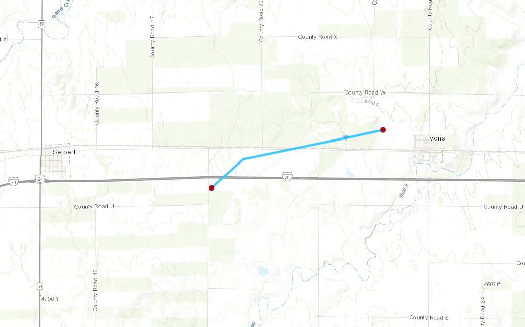
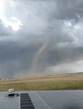
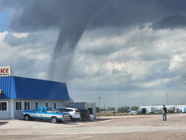
Tornado - West of Vona, CO
|
||||||||||||||||
|
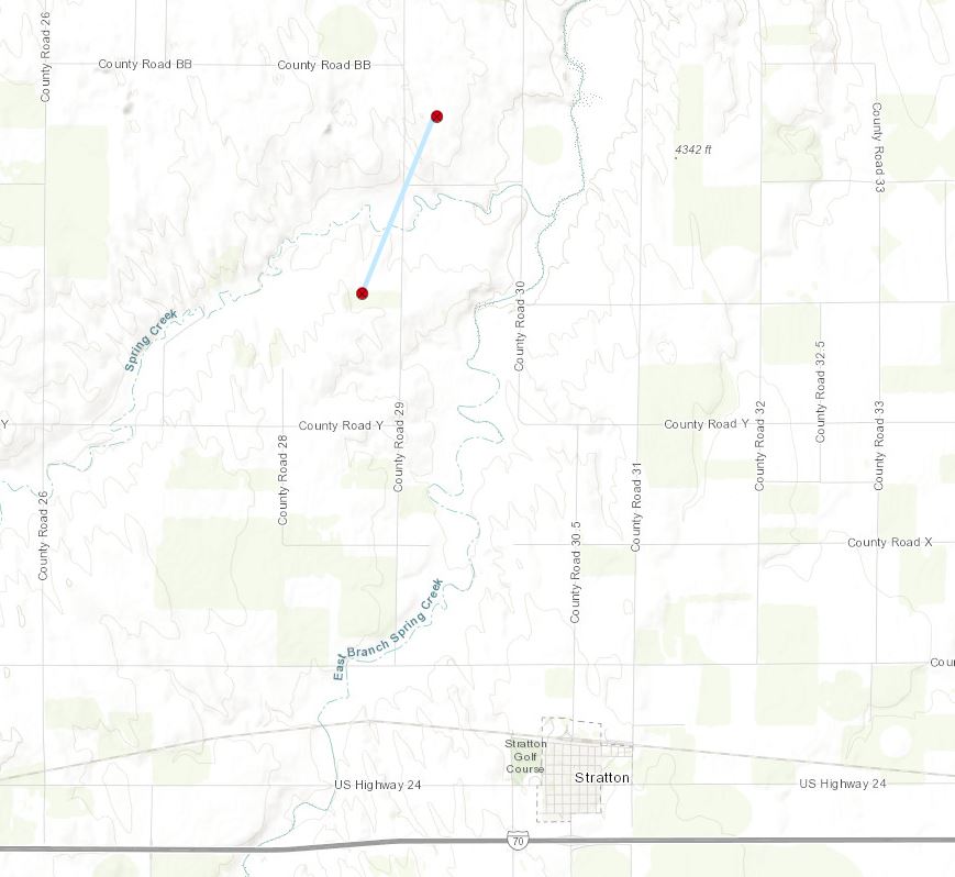
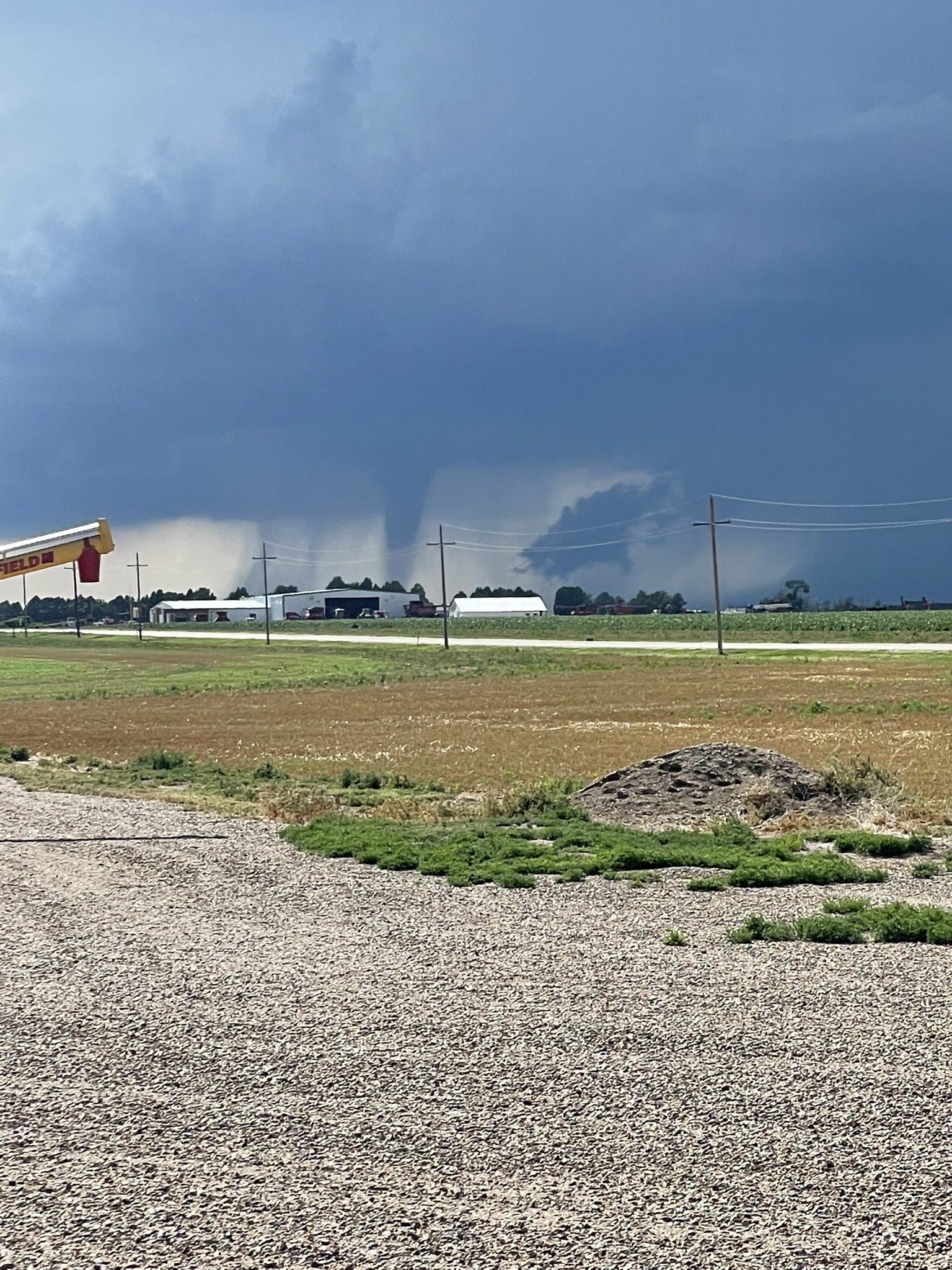
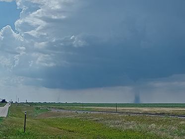
Tornado - North of Stratton, CO
|
||||||||||||||||
|
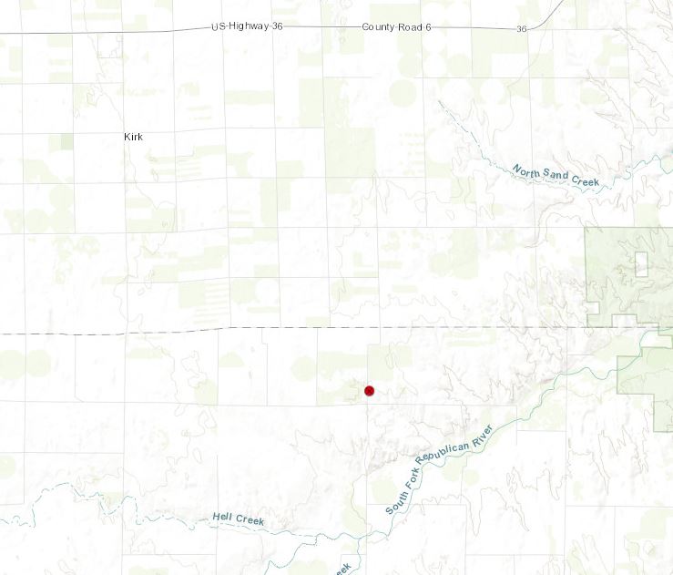
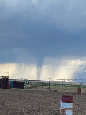
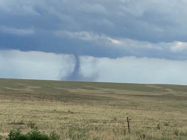
Tornado - Southeast of Kirk, CO
|
||||||||||||||||
|
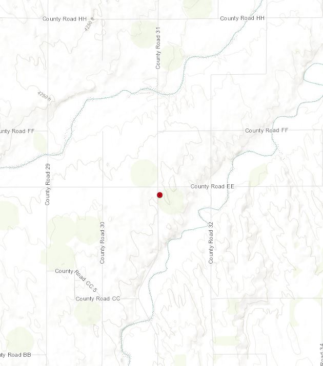
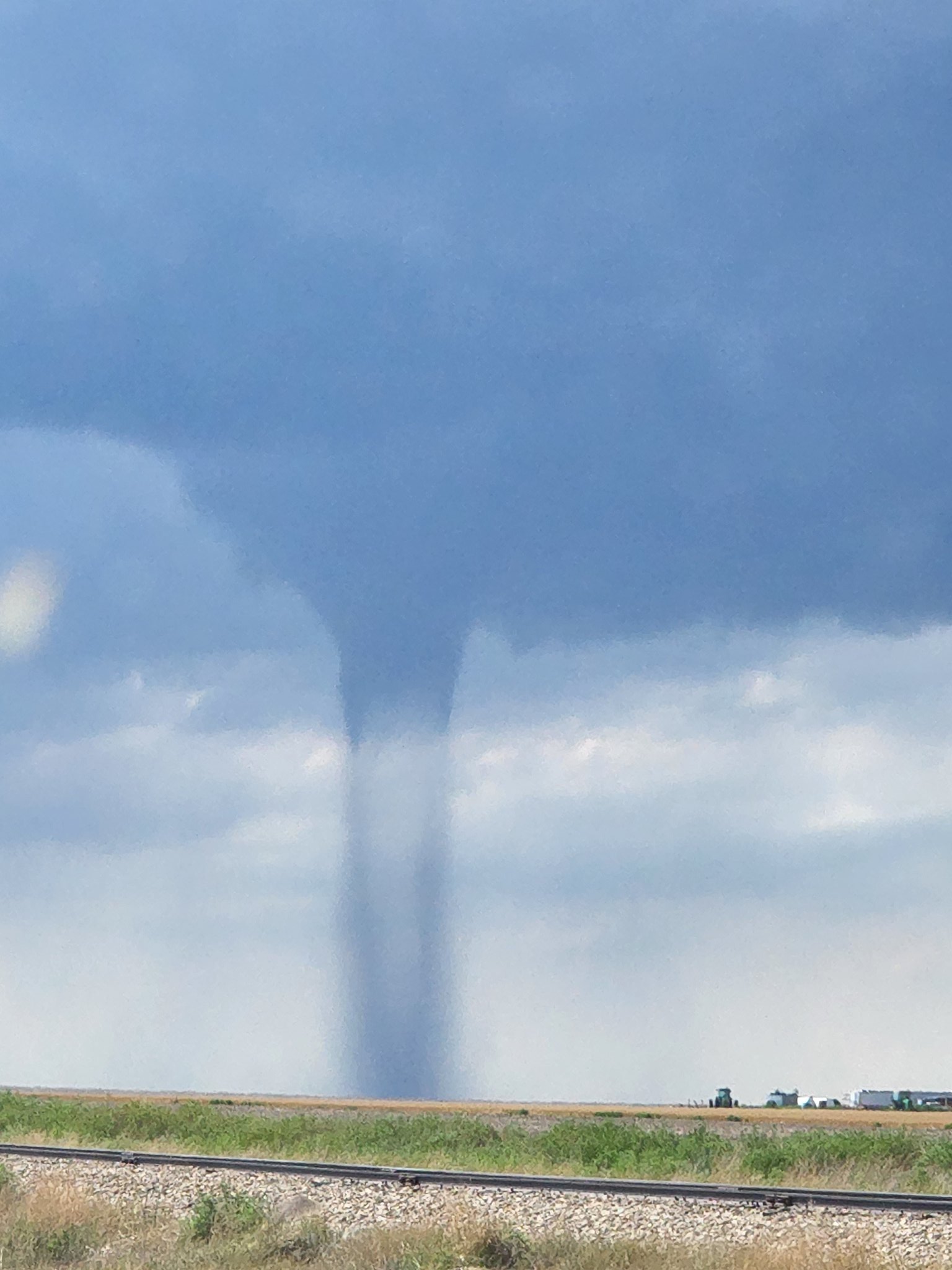
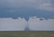
Tornado - North of Stratton, CO
|
||||||||||||||||
The Enhanced Fujita (EF) Scale classifies tornadoes into the following categories:
| EF0 Weak 65-85 mph |
EF1 Moderate 86-110 mph |
EF2 Significant 111-135 mph |
EF3 Severe 136-165 mph |
EF4 Extreme 166-200 mph |
EF5 Catastrophic 200+ mph |
 |
|||||
Photos & Video
Header
 |
 |
 |
 |
| Tornado near Seibert, CO Courtesy: Angela Herman Cordell | Tornado seen from Burlington, CO Courtesy: Aubrey Mill Mari | Tornado seen from Burlington, CO Courtesy: Clay Smith | Tornado north of Stratton, CO Courtesy: David Baxter |
 |
 |
 |
 |
| Tornado north of Stratton, CO Courtesy: John Strothman | Tornado seen from of Burlington, CO Courtesy: Stefan Klein | Tornado northwest of Seibert, CO Courtesy: Timothy McHenry | Tornado northwest of Seibert, CO Courtesy: Timothy McHenry |
Radar
Header
 |
 |
 |
| Radar reflectivity of tornado beginning north of Stratton, CO around 4:02 pm MDT | Radar reflectivity of tornado north-northwest of Stratton, CO around 4:10 pm MDT | Radar reflectivity of tornado ending northwest of Stratton, CO around 4:16 pm MDT |
 |
 |
 |
| Radar velocity of tornado beginning north of Stratton, CO around 4:02 pm MDT | Radar velocity of tornado north-northwest of Stratton, CO around 4:10 pm MDT | Radar velocity of tornado ending northwest of Stratton, CO around 4:16 pm MDT |
 |
 |
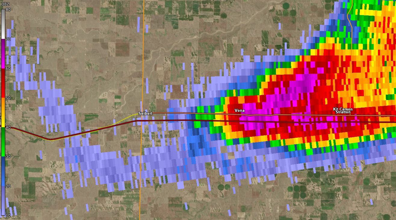 |
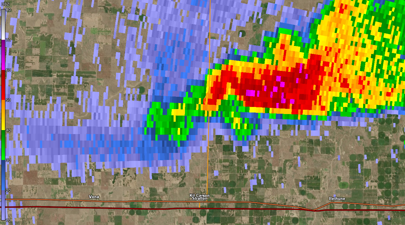
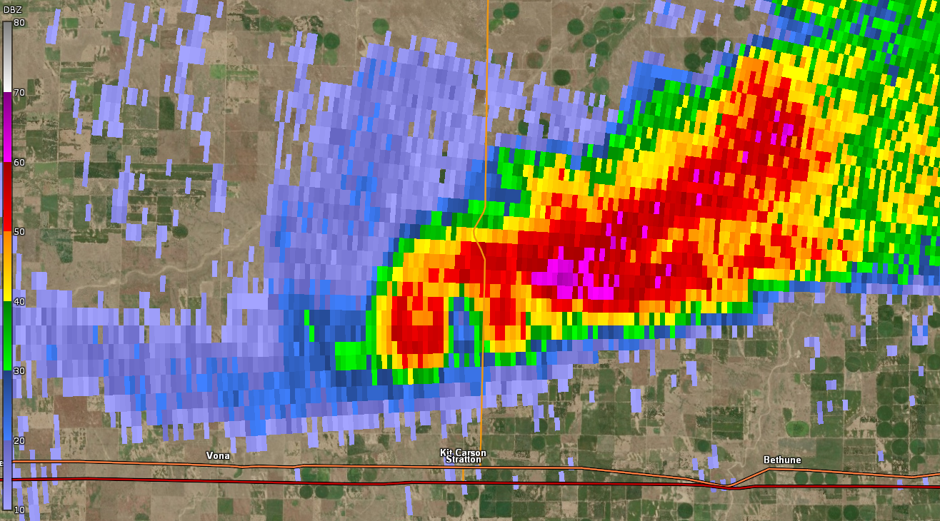
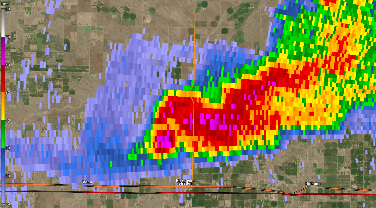
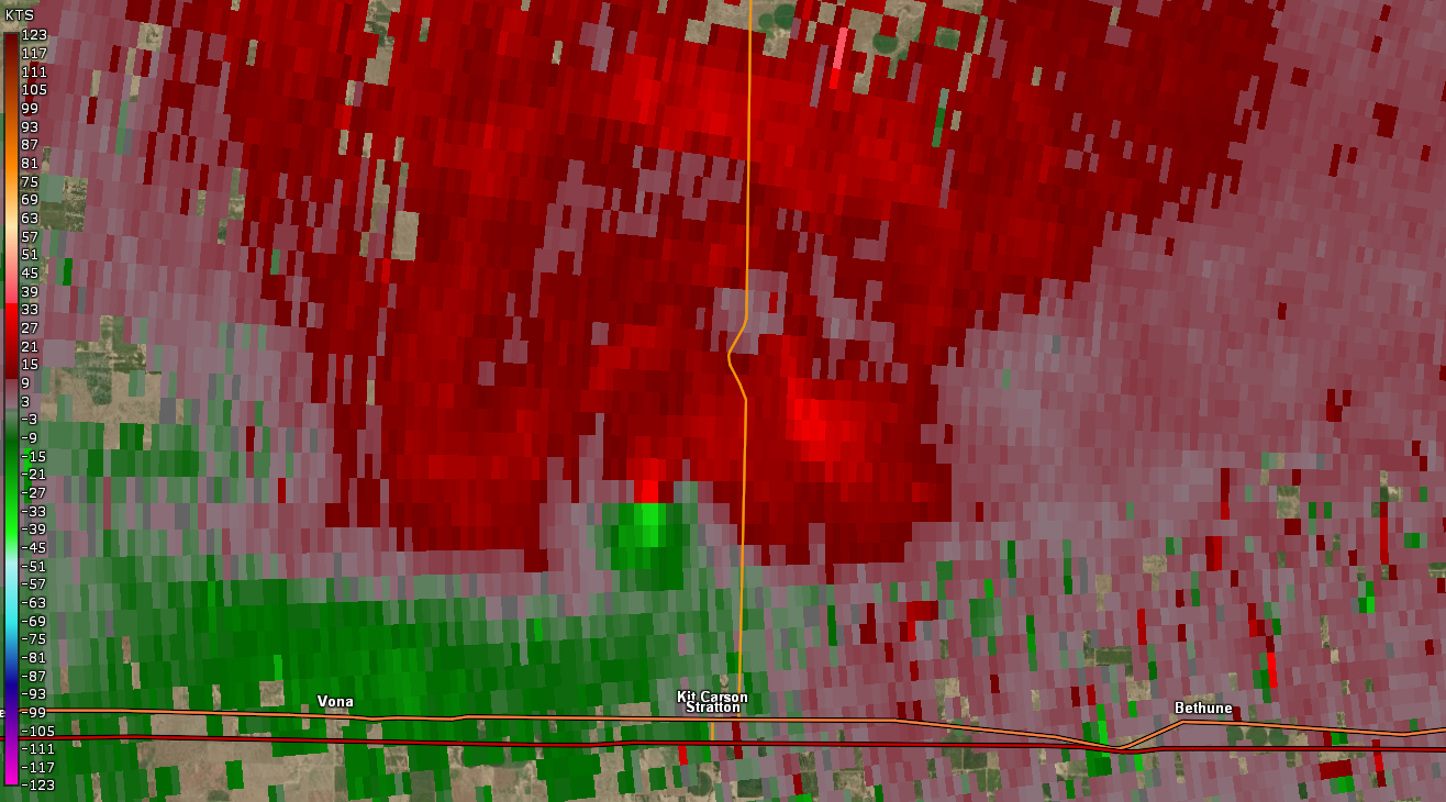
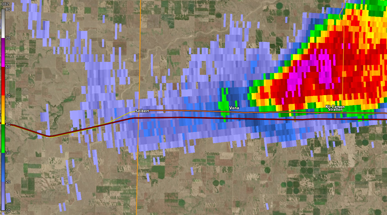
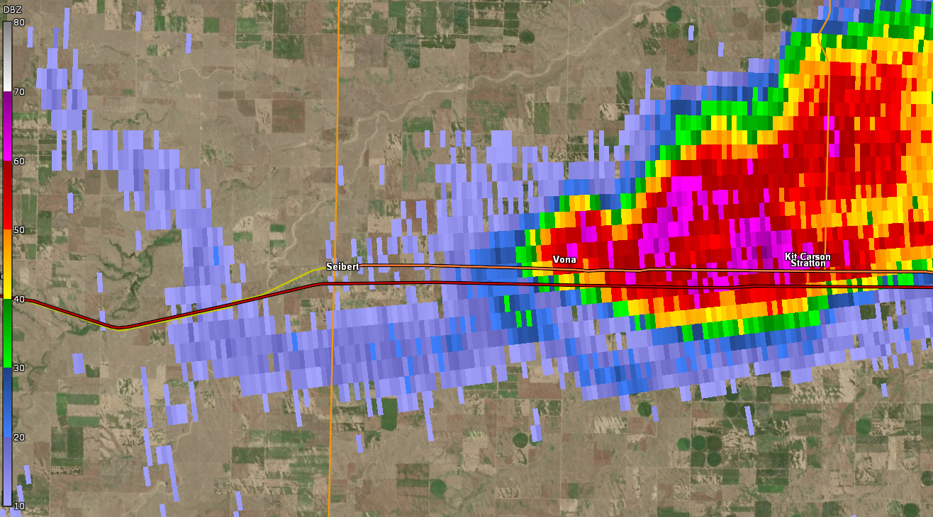
| Radar reflectivity of tornado beginning just west of Vona, CO around 4:29 pm MDT | Radar reflectivity of tornado just north of Interstate 70, between Vona and Seibert at 4:36 pm MDT | Radar reflectivity of tornado ending just south of Interstate 70 southeast of Seibert, CO at 4:41 pm MDT |
 |
 |
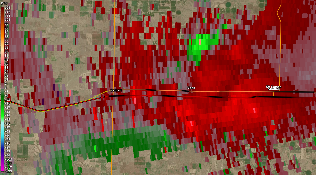 |
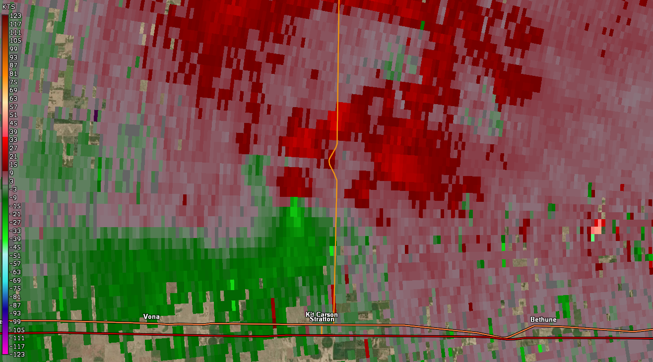
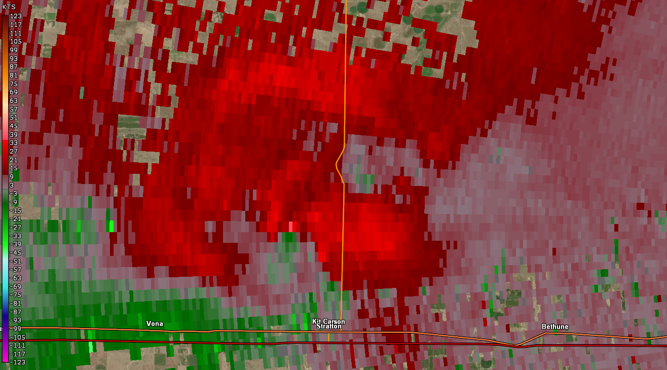
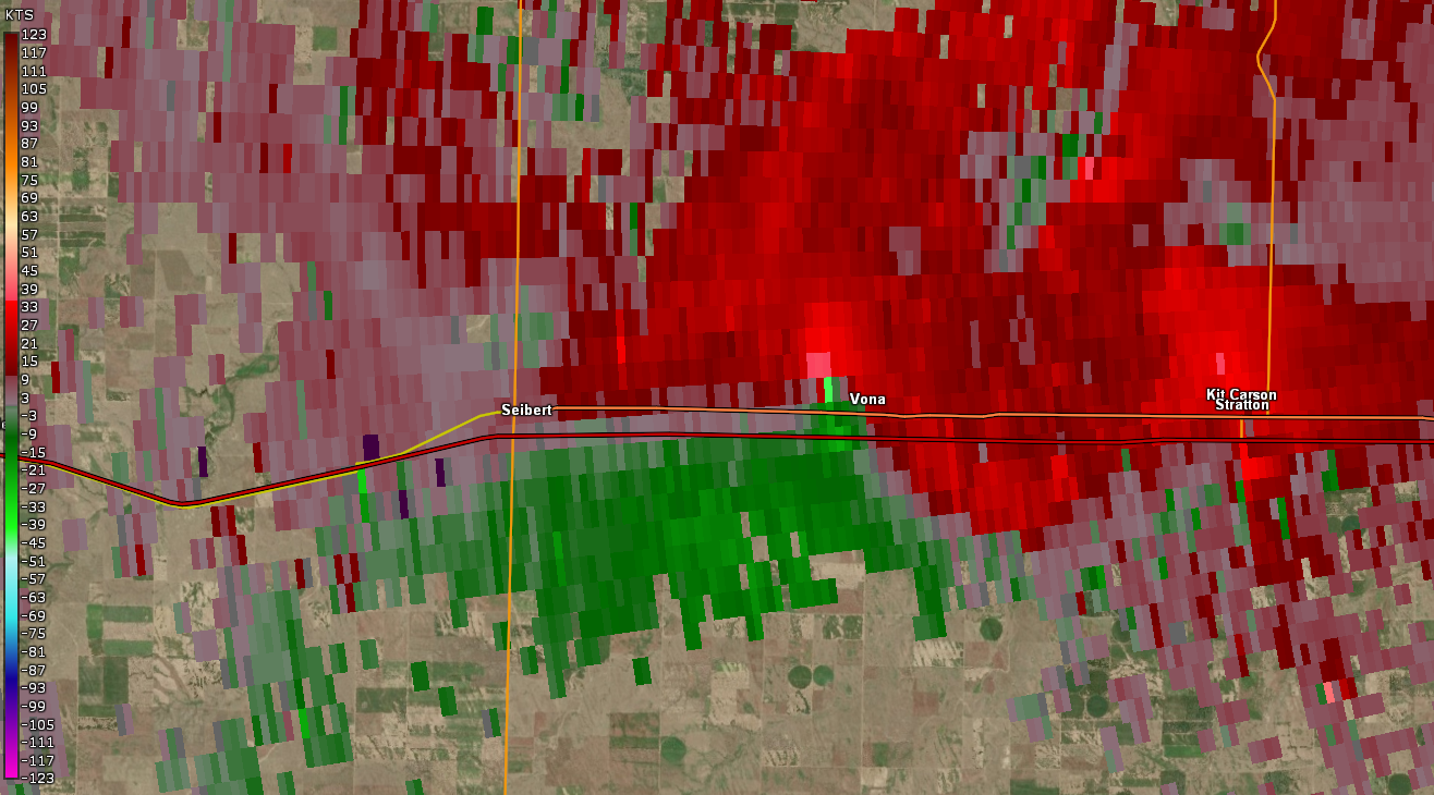
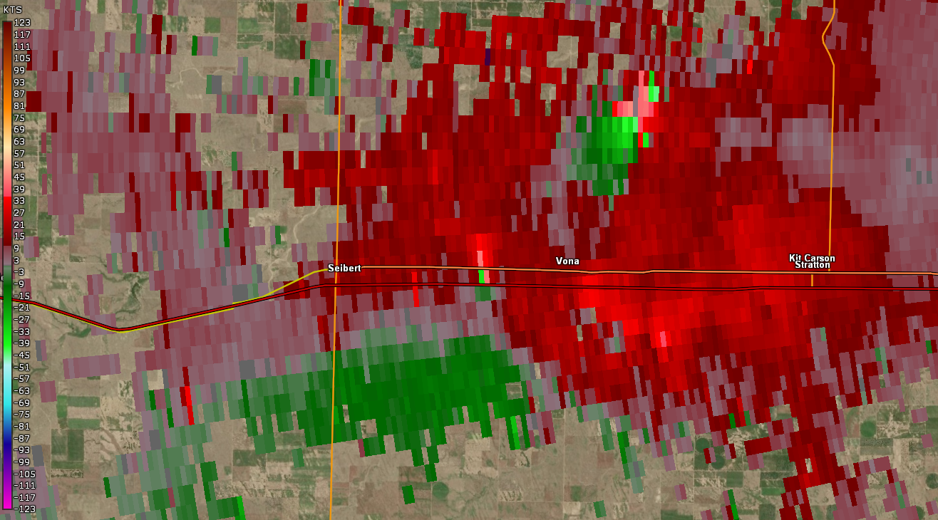
| Radar velocity of tornado beginning just west of Vona, CO around 4:29 pm MDT | Radar velocity of tornado just north of Interstate 70, between Vona and Seibert at 4:36 pm MDT | Radar velocity of tornado ending just south of Interstate 70 southeast of Seibert, CO at 4:41 pm MDT |
 |
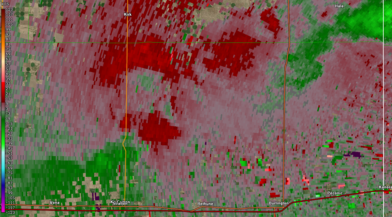 |
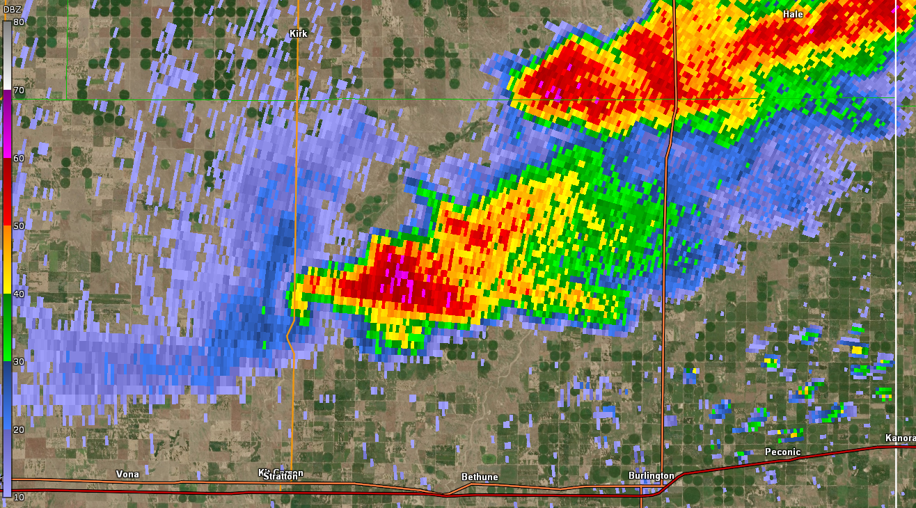
| Radar reflectivity around the time two simulataneous landspout tornadoes occurred southeast of Kirk, CO and north of Stratton, CO, image from 3:53 pm MDT | Radar velocity around the time two simulataneous landspout tornadoes occurred southeast of Kirk, CO and north of Stratton, CO, image from 3:53 pm MDT |
Storm Reports
..TIME... ...EVENT... ...CITY LOCATION... ...LAT.LON...
..DATE... ....MAG.... ..COUNTY LOCATION..ST.. ...SOURCE....
..REMARKS..
0330 PM FUNNEL CLOUD 11 NNW BETHUNE 39.46N 102.46W
07/26/2022 KIT CARSON CO PUBLIC
REPORT OF A FUNNEL ABOUT A QUARTER OF THE
WAY DOWN. LOCATION ESTIMATED.
0351 PM TORNADO 4 SE KIRK 39.58N 102.55W
07/26/2022 YUMA CO PUBLIC
LASTED FOR THREE MINUTES. ESTIMATED
LOCATION.
0353 PM TORNADO 11 N STRATTON 39.46N 102.60W
07/26/2022 KIT CARSON CO PUBLIC
PUBLIC REPORTED A 20-30 SECOND DURATION
LANDSPOUT TORNADO BETWEEN STRATTON AND KIRK,
CO. FUNNEL WAS SEEN FROM THE GROUND TO CLOSE
TO OR ALL THE WAY TO THE CLOUD BASE.
LOCATION AND TIMING ARE ESTIMATED.
0400 PM FUNNEL CLOUD 7 N BETHUNE 39.41N 102.40W
07/26/2022 KIT CARSON CO PUBLIC
FUNNEL CLOUD REPORTED WITH A PICTURE
PROVIDED VIA SOCIAL MEDIA. LOCATION
ESTIMATED.
0402 PM TORNADO 8 N STRATTON 39.42N 102.60W
07/26/2022 KIT CARSON CO PUBLIC
TORNADO.
0407 PM TORNADO 7 N STRATTON 39.40N 102.59W
07/26/2022 KIT CARSON CO PUBLIC
LASTED ROUGHLY 10 MINUTES. ROUGHLY NEAR CR
CC AND CR 31.
0407 PM TORNADO 7 N STRATTON 39.40N 102.60W
07/26/2022 KIT CARSON CO PUBLIC
TORNADO LASTED 10 MINUTES. FORMED NEAR CR CC
AND CR 31 NORTH OF STRATTON.
0407 PM TORNADO 7 N STRATTON 39.40N 102.59W
07/26/2022 KIT CARSON CO PUBLIC
TORNADO LASTED 10 MINUTES. FORMED AT CR CC
STRAIGHT NORTH OF STRATTON.
0408 PM TORNADO 7 N STRATTON 39.40N 102.59W
07/26/2022 KIT CARSON CO TRAINED SPOTTER
TRAINED SPOTTER REPORTS TORNADO. LOCATION IS
ESTIMATED. SPOTTER IS WEST OF BURLINGTON
LOOKING WEST-NORTHWEST.
0410 PM TORNADO 4 NNW STRATTON 39.36N 102.63W
07/26/2022 KIT CARSON CO PUBLIC
DELAYED PUBLIC REPORT VIA PHOTO ON SOCIAL
MEDIA OF A TORNADO 4 MILES NORTH-NORTHWEST
OF STRATTON, CO. TIMING AND LOCATION ARE
ESTIMATED.
0410 PM TORNADO 2 NW STRATTON 39.33N 102.63W
07/26/2022 KIT CARSON CO LAW ENFORCEMENT
KIT CARSON COUNTY DEPUTIES REPORTED A
TORNADO.
0411 PM TORNADO 2 NNE STRATTON 39.33N 102.59W
07/26/2022 KIT CARSON CO PUBLIC
PUBLIC REPORT OF A VIDEO SHOWING A TORNADO.
VIDEO TAKEN FROM A VEHICLE LEAVING STRATTON
HEADING EAST. LOCATION AND TIMING ARE
ESTIMATED.
0412 PM TORNADO 4 N STRATTON 39.36N 102.61W
07/26/2022 KIT CARSON CO PUBLIC
REPORTED VIA SOCIAL MEDIA.
0413 PM TORNADO 2 NW STRATTON 39.33N 102.63W
07/26/2022 KIT CARSON CO PUBLIC
PUBLIC REPORTED A PHOTO OF A TORNADO VIA
SOCIAL MEDIA 2 MILES NORTHWEST OF STRATTON,
CO. LOCATION AND TIMING ARE ESTIMATED.
0420 PM TORNADO 2 ENE SEIBERT 39.31N 102.83W
07/26/2022 KIT CARSON CO PUBLIC
PUBLIC REPORTED A TORNADO VIA THREE PICTURES
ON SOCIAL MEDIA. LOCATION WAS ESTIMATED TO
BE 30 MILES WEST OF BURLINGTON, CO. LOCATION
AND TIMING ARE ESTIMATED.
0432 PM TORNADO 1 W VONA 39.30N 102.75W
07/26/2022 KIT CARSON CO EMERGENCY MNGR
HALF MILE WEST OF VONA PRODUCING DEBRIS.
0436 PM TORNADO VONA 39.30N 102.75W
07/26/2022 KIT CARSON CO EMERGENCY MNGR
TORNADO DAMAGE REPORTED ROUGHLY HALF A MILE
WEST OF VONA. DAMAGE WAS TO A HOME AND
GARAGE.
0436 PM TORNADO 1 SW STRATTON 39.29N 102.62W
07/26/2022 KIT CARSON CO EMERGENCY MNGR
EM REPORTED VIA PHONE ROTATION AND FLYING
DEBRIS WEST OF STRATTON, CO. LOCATION IS
ESTIMATED.
0436 PM TORNADO 1 W VONA 39.30N 102.75W
07/26/2022 KIT CARSON CO EMERGENCY MNGR
CORRECTS PREVIOUS FUNNEL CLOUD REPORT FROM 1
W VONA. .5 MILE DEBRIS FLYING DEBRIS
REPORTED VIA PHONE BY KIT CARSON, CO EM
ABOUT TO CROSS HWY 24.
0440 PM TORNADO 2 S VONA 39.27N 102.74W
07/26/2022 KIT CARSON CO PUBLIC
VIDEO SHOWING TORNADO 2 MILES SOUTH OF VONA,
CO. REPORT VIA SOCIAL MEDIA. LOCATION AND
TIMING ARE ESTIMATED.
0442 PM TORNADO 1 W SEIBERT 39.30N 102.89W
07/26/2022 KIT CARSON CO PUBLIC
PUBLIC REPORT VIA PICTURE ON SOCIAL MEDIA OF
A TORNADO 1 MILE WEST OF SEIBERT, CO.
0445 PM HAIL 2 E VONA 39.30N 102.71W
07/26/2022 E1.25 INCH KIT CARSON CO PUBLIC
DELAYED REPORT VIA PHONE OF HALF DOLLAR HAIL
AT 4:45 (MDT) 2 MILES EAST OF VONA, CO. SIZE
AND TIMING ARE ESTIMATED.
0445 PM HAIL 3 E VONA 39.31N 102.69W
07/26/2022 E0.25 INCH KIT CARSON CO TRAINED SPOTTER
ACCUMULATING PEA SIZED HAIL. A 40 MPH WIND
GUST WAS ALSO REPORTED.
0445 PM TORNADO 3 E SEIBERT 39.29N 102.82W
07/26/2022 KIT CARSON CO DEPT OF HIGHWAYS
TORNADO OBSERVED ALONG I-70 EAST OF SIEBERT
VIA COLORADO DOT CAMERA. TIME AND LOCATION
ESTIMATED.
0450 PM HAIL 6 SSW STRATTON 39.22N 102.64W
07/26/2022 E1.00 INCH KIT CARSON CO STORM CHASER
ESTIMATED TIME OF REPORT.
0715 PM HAIL 6 SSW LEOTI 38.40N 101.40W
07/26/2022 E0.88 INCH WICHITA KS PUBLIC
DELAYED PUBLIC REPORT OF NICKEL SIZED HAIL,
50 MPH WINDS, AND 1.4 INCHES OF RAIN
(MEASURED). TIMING AND MAGNITUDE ARE
ESTIMATED. TIMING COULD BE +/- 15 MINUTES.
0720 PM HAIL 9 NW LYDIA 38.36N 101.42W
07/26/2022 E0.25 INCH WICHITA KS PUBLIC
PUBLIC PHONE REPORT OF PEA SIZED HAIL AND 40
MPH WINDS. TIMING AND MAGNITUDE ARE
ESTIMATED.
0728 PM TSTM WND GST 7 SSW LEOTI 38.39N 101.40W
07/26/2022 E55 MPH WICHITA KS TRAINED SPOTTER
TRAINED SPOTTER REPORT OF 55 MPH (ESTIMATED)
WIND GUSTS, PEA AND DIME SIZED HAIL, AND
HEAVY RAIN. IMPACTS WERE ONGOING DURING THE
CALL.
 |
Media use of NWS Web News Stories is encouraged! Please acknowledge the NWS as the source of any news information accessed from this site. |
|