
Dangerous heat expands across the Desert Southwest, Plains, Mississippi Valley and Midwest. Critical fire weather for portions of the Intermountain West. Risk for severe thunderstorms and flash flooding across the Upper Midwest/Great Lakes, Ohio Valley, and portions of the mid-Atlantic. Active monsoonal moisture fuels thunderstorms over the Southwest. Hurricane Fausto in the Pacific, should weaken Read More >
Overview
|
An unusually strong supercell thunderstorm moved south across parts of Northwest Kansas during the afternoon and early evening hours. Dust storm conditions were reported ahead of the thunderstorm due to winds moving into the thunderstorm of 50-70 MPH. Wind gusts of 90-100 MPH were measured with the thunderstorm. |
Wind
Except for the barndominium, all the damage surveyed was directed to the southwest. Some of the damage with the barndominium was directed southwest, however most of the damage was directed southeast. There was no evidence of a tornado due to all the debris being directed in a straight-line away from the source. The peak wind speed estimated based on damage was 132 MPH at Shaltz Field.
 |
 |
 |
 |
| Aircraft hanger destroyed at Shaltz Field | Tipped boxcars in Colby | Machine Shed damaged in Colby | Treed uprooted in Colby |
|
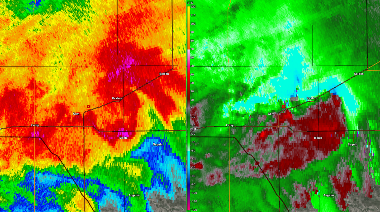
Radar
Reflectivity is the left pane, speed/direction is shown on the right pane. Speed is measured in relation to the radar; cooler colors show movement toward the radar, warmer colors show movement away from the radar. Brighter colors indicate higher wind speeds.
 |
 |
 |
 |
| Radar imagery when tornado occurred SE of Ludell at 5:18 PM CT. | Radar image when 100 MPH winds impacted Colby at 6:34 PM CT. | Radar imagery when Barndominium was damaged north of Rexford at 6:44 PM CT. | Thunderstorm complex moving SE at 7:02 PM CT. |
 |
Media use of NWS Web News Stories is encouraged! Please acknowledge the NWS as the source of any news information accessed from this site. |
|


