Overview
A significant storm moved across Cheyenne County Colorado and Wallace County Kansas on the evening of June 21, 2019. This storm produced powerful wind gusts and hail ranging from quarter size to tennis ball size. Sporadic wind damage occurred with this storm along with damage associated with wind-driven hail.
A widespread swath of sporadic wind damage occurred last night across Cheyenne County Colorado and Wallace County Kansas. Damage consisted of many tree branches down and tree trunks snapped. Many power poles were downed, especially in Wallace County. There was also some damage to structures. A large grain bin was shifted 3 to 4 inches in Cheyenne Wells, in addition to two structures losing metal roofs. In Arapahoe, some minor roof damage occurred to a few structures while one home lost the entire garage building. From the west central portion of Wallace County to around Sharon Springs, more significant wind damage was noted. Numerous irrigation pivots were overturned across the county. A few farmsteads were hit harder, with one in particular losing two large farm structures due to wind. Just west of Sharon Springs, another two buildings were collapsed from the winds.
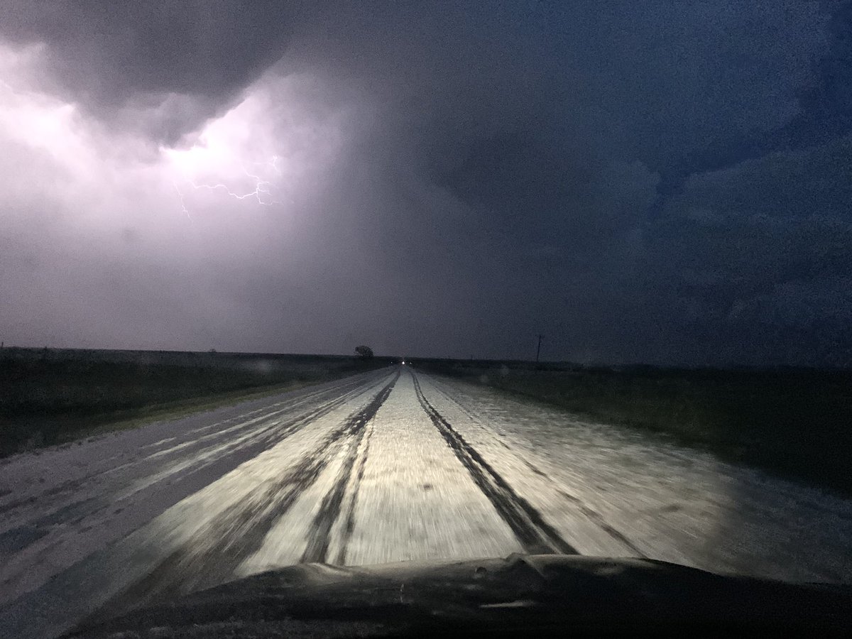
What was interesting about this event was the varying directions of the wind. In some areas, the debris was blown east as expected. However, winds in other areas blew the debris either north or west. This is likely due to the significant circulation with this supercell thunderstorm and the varying inflows and outflows. It was reported in Weskan that the winds gusted around 60 mph from the south just prior to the storm, shifting to the northwest at around 80 mph as the storm arrived.
Interactive Map (under construction):
|
|
||||||||||
|
||||||||||
Photos & Video
 |
 |
 |
 |
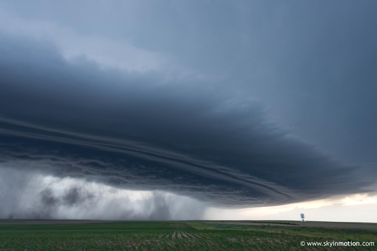
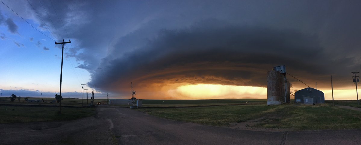
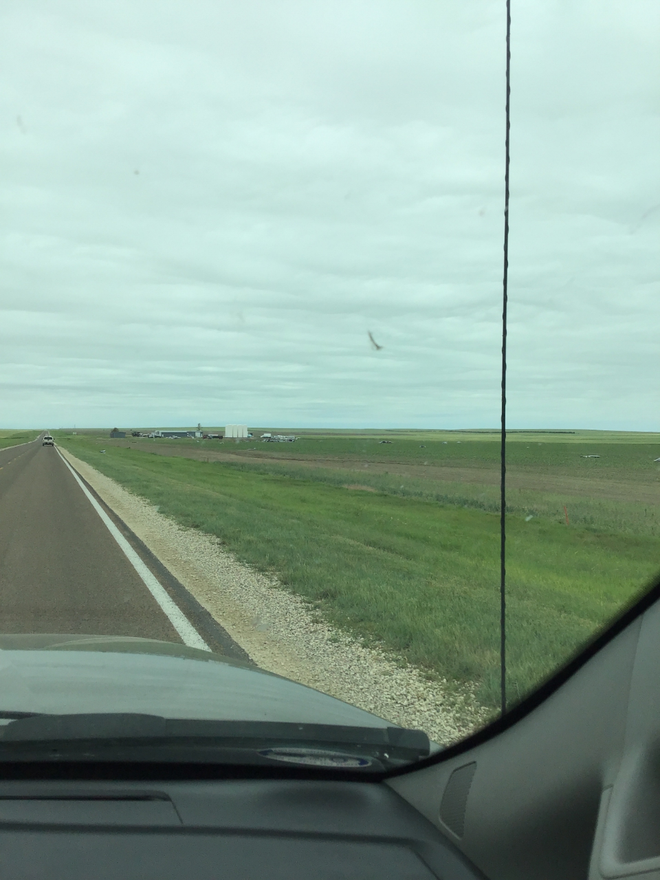
| Storm Structure near Weskan, KS (Image Courtesy: Brett Roberts) |
Storm approaching Arapahoe, CO (Image Courtesy: Felicia Mireles) |
Wind Damage and Hail in Arapahoe, CO (Image Courtesy: Felicia Mireles) |
Hail 2 E of Sharon Springs, KS (Image Courtesy: Colin Davis) |
 |
 |
 |
 |
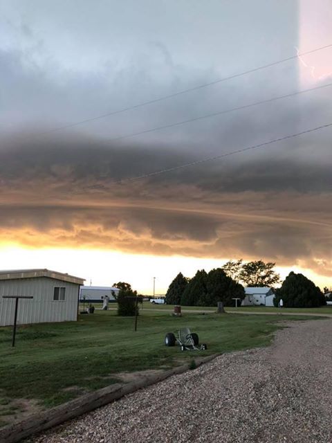
| Storm Structure near Weskan, KS (Image Courtesy: Winston Wells) |
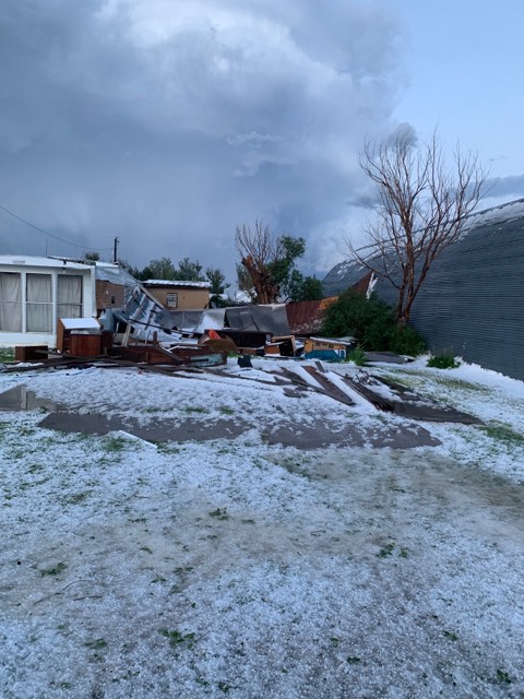
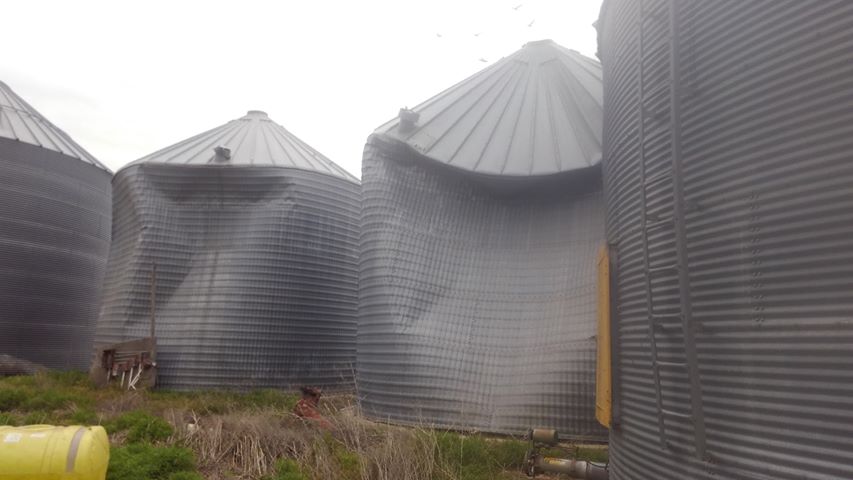
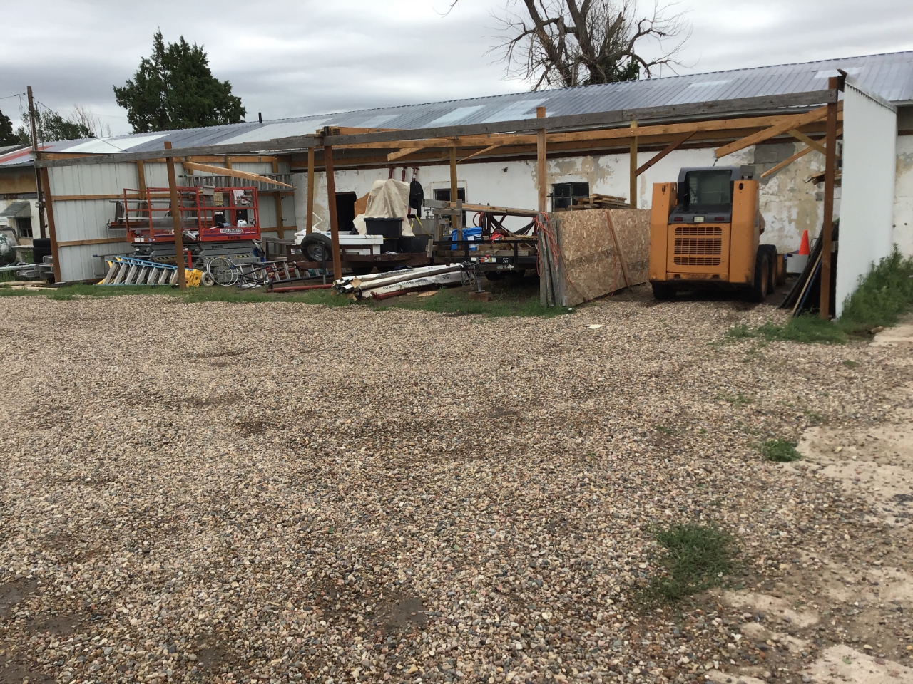
Damage to Grain Bins (Image Courtesy: Ron Blaesi) |
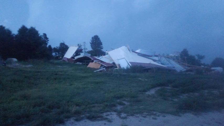
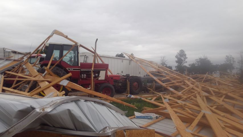
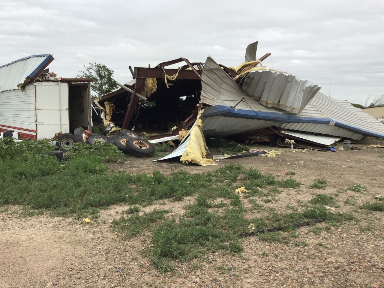
Damage to Farm Structure (Image Courtesy: Ron Blaesi) |
Damage to Farm Structure (Image Courtesy: Ron Blaesi) |
 |
 |
 |
 |
| Damage near Sharon Springs, KS (Image Courtesy: NWS Storm Survey) |
Damage near Sharon Springs, KS, debris blown into field at least 1 mile away at times (Image Courtesy: NWS Storm Survey) |
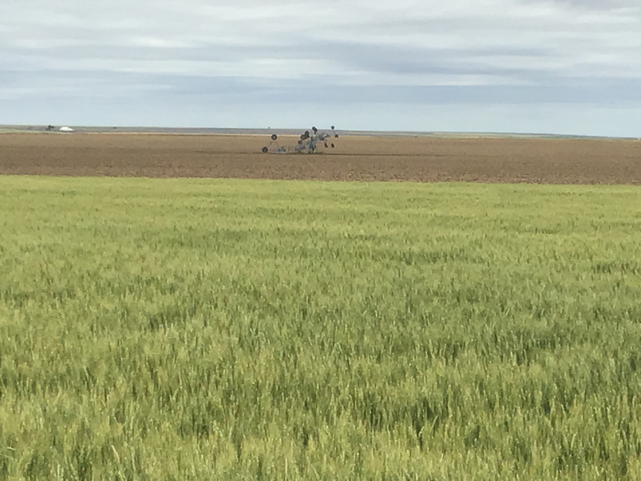
Irrigation Pivot turned over and destroyed, a common sight across Wallace County after the storm (Image Courtesy: NWS Storm Survey) |
Loss of roof on structure, blown over the building and across the street over 100 yards away (Image Courtesy: NWS Damage Survey) |
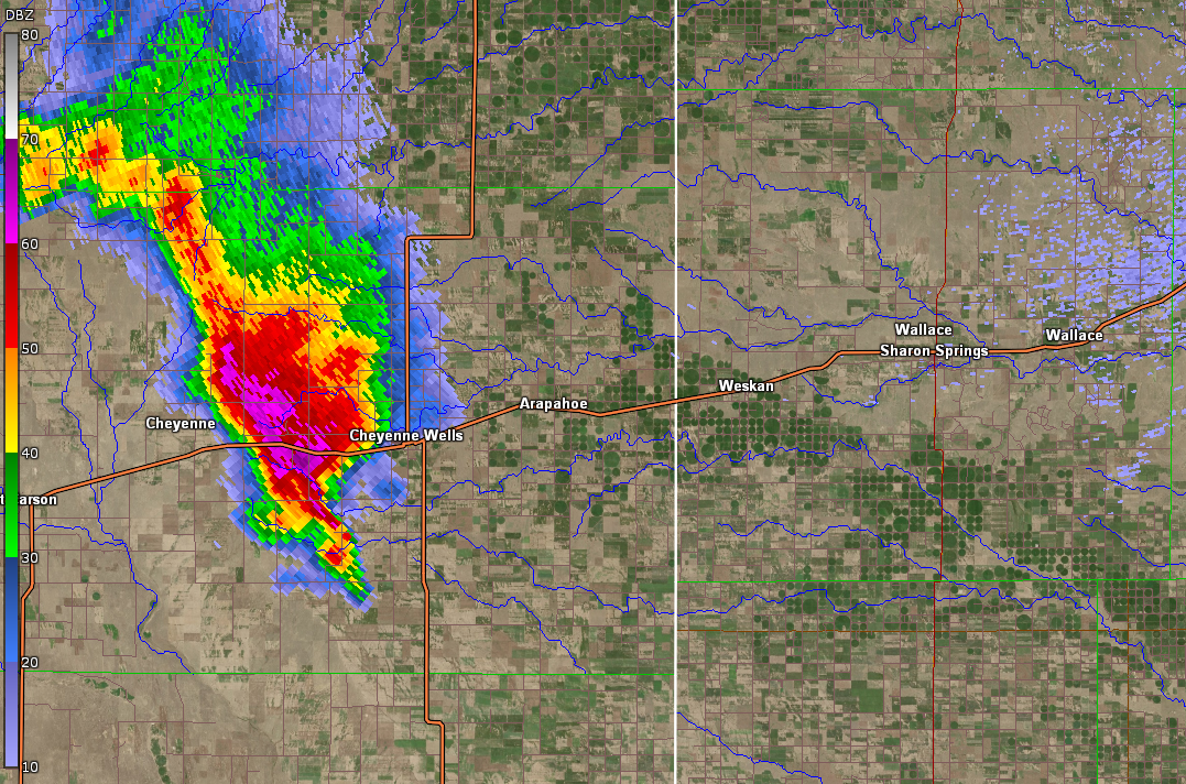
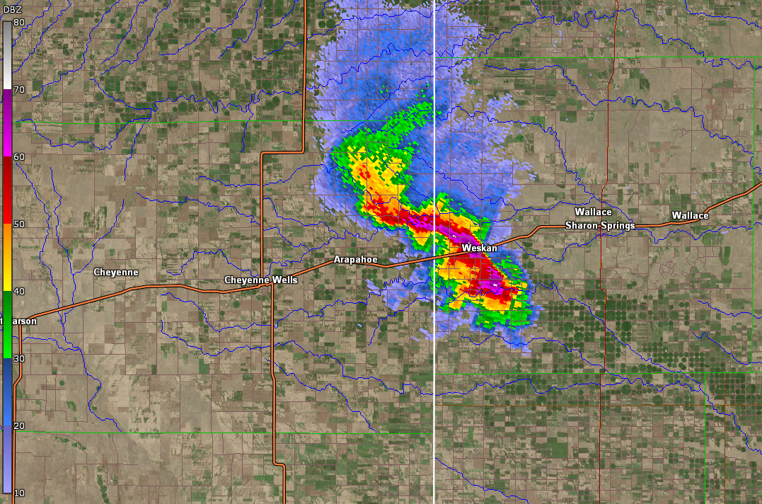
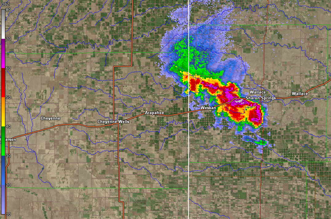
Radar
 |
 |
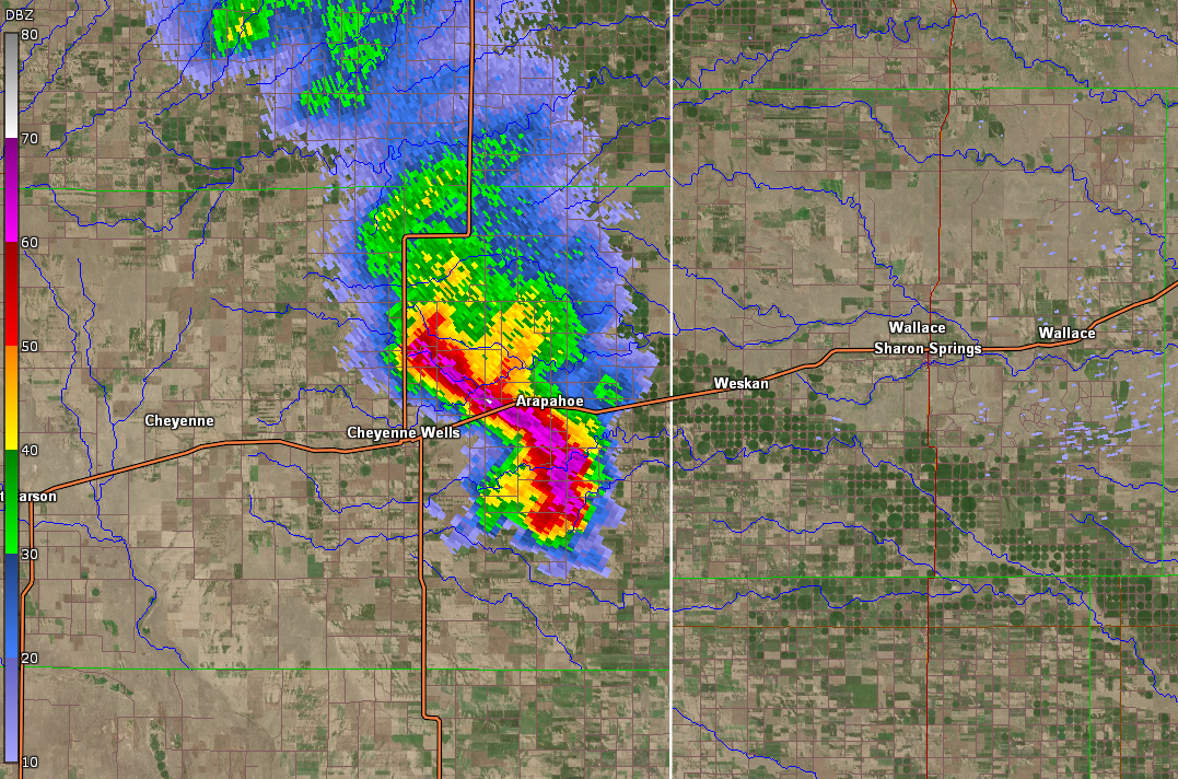 |
| Storm as it begins producing more significant wind gusts. | Storm as it produces damage in Cheyenne Wells and a measured 95 mph wind gust south of town. | Storm as it moves through Arapahoe. |
 |
 |
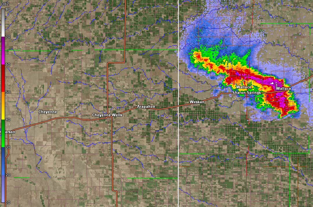 |
| Storm passing through Weskan, producing damage in town as well as widespread damage southeast of town. | Storm moving into Sharon Springs, producing wind gusts up to 100 mph, which led to the collapse of at least two farm structures just west of town. | Storm as it weakens in terms of wind gusts as it moved through the town of Wallace, where little to no wind damage was reported. |
Storm Reports
..TIME...   ...EVENT...      ...CITY LOCATION...     ...LAT.LON...
..DATE...   ....MAG....      ..COUNTY LOCATION..ST.. ...SOURCE....
            ..REMARKS..

0750 PM     TSTM WND GST     8 S CHEYENNE WELLS      38.70N 102.35W
06/21/2019  E95 MPH          CHEYENNE           CO   STORM CHASER


0748 PM     TSTM WND GST     9 S CHEYENNE WELLS      38.69N 102.35W
06/21/2019  M95 MPH          CHEYENNE           CO   STORM CHASER

            MEASURED WITH A DAVIS VANTAGE VUE WHILE
            STATIONARY.

0834 PM     TSTM WND GST     2 WNW SHARON SPRINGS    38.90N 101.78W
06/21/2019  M94 MPH          WALLACE            KS   MESONET


0832 PM     TSTM WND GST     SHARON SPRINGS          38.90N 101.75W
06/21/2019  E80 MPH          WALLACE            KS   PUBLIC

            REPORT RECEIVED VIA SOCIAL MEDIA.

0734 PM     TSTM WND GST     1 SW FIRSTVIEW          38.81N 102.55W
06/21/2019  M63 MPH          CHEYENNE           CO   MESONET


0800 PM     TSTM WND GST     4 SW ARAPAHOE           38.80N 102.22W
06/21/2019  M62 MPH          CHEYENNE           CO   MESONET

            MESONET STATION FW2420 ARAPAHOE.

0756 PM     TSTM WND GST     CHEYENNE WELLS          38.82N 102.35W
06/21/2019  E62 MPH          CHEYENNE           CO   TRAINED SPOTTER


0720 PM     TSTM WND GST     KIT CARSON              38.76N 102.80W
06/21/2019  E60 MPH          CHEYENNE           CO   PUBLIC


0920 PM     HAIL             5 SE WINONA             39.01N 101.18W
06/21/2019  E2.50 INCH       LOGAN              KS   EMERGENCY MNGR

            SECOND HAND REPORT FROM THE EM.

0837 PM     HAIL             2 ENE SHARON SPRINGS    38.91N 101.72W
06/21/2019  E1.75 INCH       WALLACE            KS   STORM CHASER


0832 PM     HAIL             SHARON SPRINGS          38.90N 101.75W
06/21/2019  E1.75 INCH       WALLACE            KS   PUBLIC

            REPORT RECEIVED VIA SOCIAL MEDIA.

0830 PM     HAIL             SHARON SPRINGS          38.90N 101.75W
06/21/2019  E1.50 INCH       WALLACE            KS   PUBLIC


0730 PM     HAIL             1 N KIT CARSON          38.78N 102.80W
06/21/2019  E1.25 INCH       CHEYENNE           CO   PUBLIC


0713 PM     HAIL             3 W KIT CARSON          38.76N 102.85W
06/21/2019  E1.25 INCH       CHEYENNE           CO   PUBLIC


0949 PM     HAIL             6 S CAMPUS              39.04N 100.74W
06/21/2019  E1.00 INCH       GOVE               KS   TRAINED SPOTTER


0756 PM     HAIL             2 S CHEYENNE WELLS      38.79N 102.35W
06/21/2019  E1.00 INCH       CHEYENNE           CO   PUBLIC


0750 PM     HAIL             5 SW ARAPAHOE           38.80N 102.24W
06/21/2019  E1.00 INCH       CHEYENNE           CO   PUBLIC


0750 PM     HAIL             CHEYENNE WELLS          38.82N 102.35W
06/21/2019  E1.00 INCH       CHEYENNE           CO   PUBLIC

            PUBLIC REPORTED 1 INCH HAIL IN DOWNTOWN
            CHEYENNE WELLS. DELAYED REPORT FROM LAST
            NIGHTS STORM. TIME ESTIMATED BASED ON RADAR
            AND OTHER REPORTS.

0746 PM     HAIL             CHEYENNE WELLS          38.82N 102.35W
06/21/2019  E1.00 INCH       CHEYENNE           CO   PUBLIC

            EST 60 PLUS MPH WINDS. PUBLIC SENT PICTURE
            OF DAMAGE TO HOUSE.

0720 PM     HAIL             KIT CARSON              38.76N 102.80W
06/21/2019  E1.00 INCH       CHEYENNE           CO   PUBLIC


0720 PM     HAIL             7 WSW FIRSTVIEW         38.76N 102.65W
06/21/2019  E1.00 INCH       CHEYENNE           CO   PUBLIC

            PICTURE SHARED ON TWITTER. TIME ESTIMATED BY
            RADAR.

0756 PM     HAIL             CHEYENNE WELLS          38.82N 102.35W
06/21/2019  E0.88 INCH       CHEYENNE           CO   TRAINED SPOTTER


0751 PM     HAIL             CHEYENNE WELLS          38.82N 102.35W
06/21/2019  E0.88 INCH       CHEYENNE           CO   TRAINED SPOTTER


0715 PM     HAIL             KIT CARSON              38.76N 102.80W
06/21/2019  E0.88 INCH       CHEYENNE           CO   PUBLIC


0745 PM     HAIL             1 W CHEYENNE WELLS      38.82N 102.37W
06/21/2019  E0.70 INCH       CHEYENNE           CO   PUBLIC


0908 PM     TSTM WND DMG     9 S SHARON SPRINGS      38.76N 101.75W
06/21/2019                   WALLACE            KS   PUBLIC

            SHARON SPRINGS HAS TREES DOWN AND CAR
            WINDOWS BROKEN. POWER OUT IN PARTS OF SHARON
            SPRINGS.

0838 PM     TSTM WND DMG     1 NNW WESKAN            38.87N 101.97W
06/21/2019                   WALLACE            KS   PUBLIC

            REPORT OF WIND DAMAGE IN THE TOWN OF WESKAN,
            KS. LARGE BRANCHES BROKEN AND ONE LARGE TREE
            UPROOTED.

0832 PM     TSTM WND DMG     SHARON SPRINGS          38.89N 101.75W
06/21/2019                   WALLACE            KS   PUBLIC

            TREE FELL ON A TRUCK. EST GOLF BALL SIZE
            HAIL AND 80 PLUS MPH WIND GUSTS.

0829 PM     DOWNBURST        6 ESE WESKAN            38.81N 101.86W
06/21/2019                   WALLACE            KS   TRAINED SPOTTER

            CORRECTS PREVIOUS DOWNBURST REPORT FROM 6
            ESE WESKAN. CORRECTS PREVIOUS TSTM WND GST
            REPORT FROM 6 ESE WESKAN. ESTIMATE WIND OVER
            60 MPH. SPOTTER CALLED BACK REPORTING THAT
            THE DOWNBRUST TOOK OUT A 60 X 120 MORTON
            BUILDING.

0750 PM     TSTM WND DMG     CHEYENNE WELLS          38.82N 102.35W
06/21/2019                   CHEYENNE           CO   PUBLIC

            DELAYED REPORT FROM LAST NIGHTS STORM.
            PUBLIC REPORTED THUNDERSTORM WIND DAMAGE IN
            DOWNTOWN CHEYENNE WELLS. DAMAGE INCLUDES THE
            ROOF BLOWN OFF OF A HOTEL, AN OLD GRAIN
            ELEVATOR BLOWN OVER, AND SEVERAL INSTANCES
            OF SIDING DAMAGE FROM WIND BLOWN HAIL. TIME
            ESTIMATED BASED ON RADAR.

0745 PM     TSTM WND DMG     ARAPAHOE                38.85N 102.17W
06/21/2019                   CHEYENNE           CO   PUBLIC

            PARTS OF A HOUSE WAS STRIPPED TO THE
            CONCRETE.
 |
Media use of NWS Web News Stories is encouraged! Please acknowledge the NWS as the source of any news information accessed from this site. |
|

