Overview
|
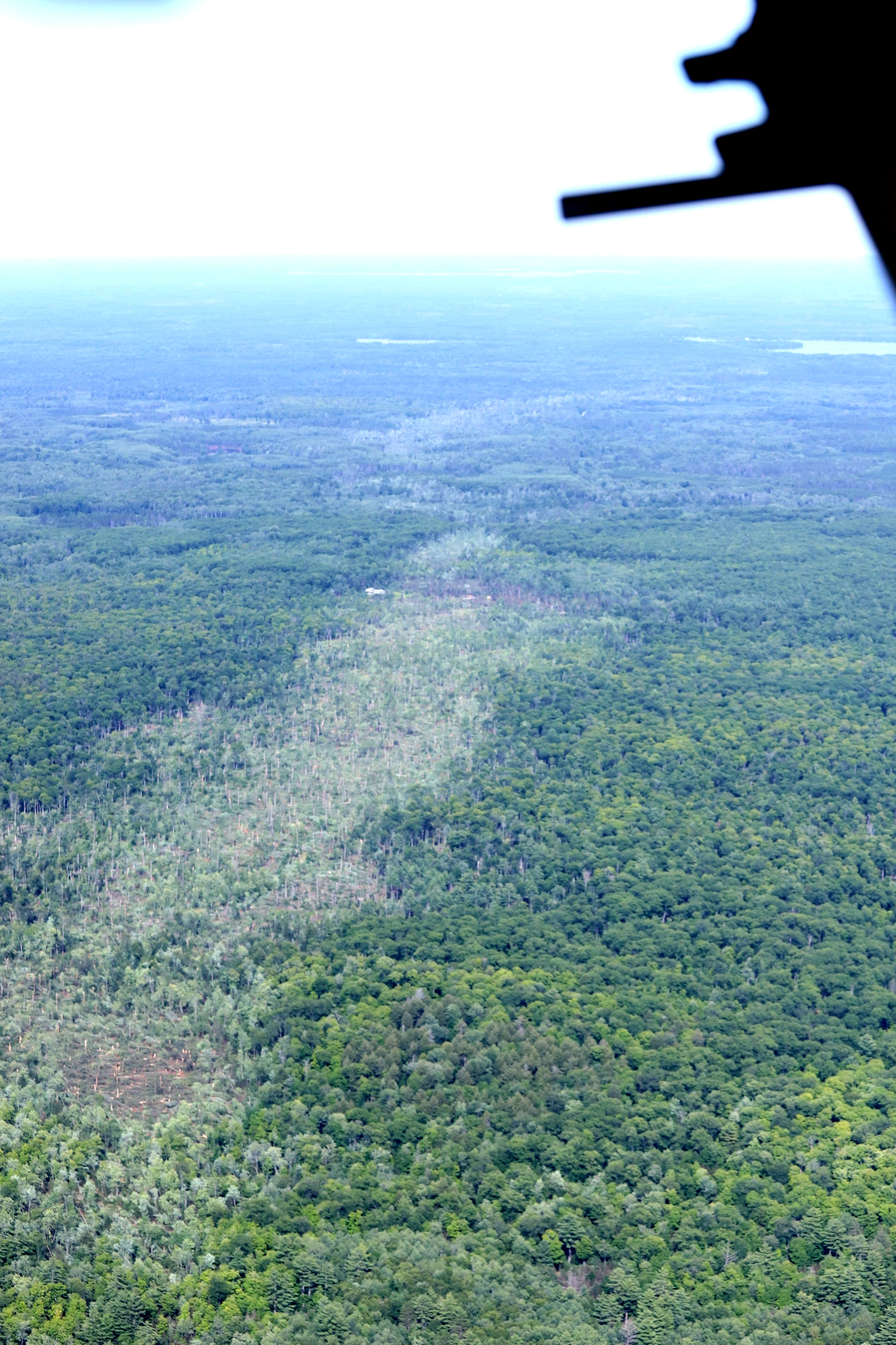
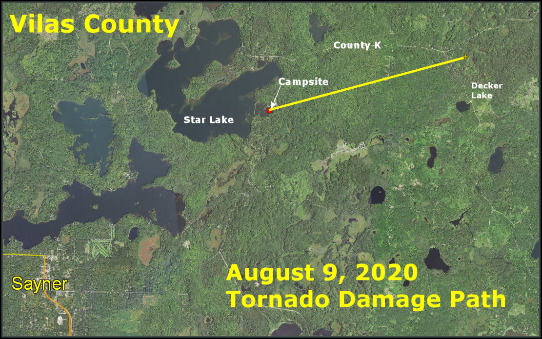
A tornado touched down on the evening of August 9th, 2020. An eye witness recorded a funnel skipping off of Star Lake before touching down offshore of East Star Lake campground. The tornado downed numerous trees and power lines on its way across the campsite, blocking off many of the nearby roadways. It then continued northeast, across county road N, uprooting and snapping many additional trees, before crossing county Road K and dissipating over the Upper Bucktabon Spring State Natural Area. Fortunately, despite a 70 percent occupancy at the campsite, no injuries or fatalities were reported. Preliminary damage surveys for the tornado found damage consistent with an EF1 tornado. The tornado was on the ground approximately 15 minutes, and traveled around 6 miles. The average width of the damage track was around 300 yards, with a few areas of damage as wide as 400 yards. See the photo to the right for an areal shot near the beginning of the damage track looking ENE with Stormy Lake in the upper right: |
Photo Courtesy of the Wisconsin Department of Natural Resources (DNR) |
Tornado:
|
Tornado
|
The Enhanced Fujita (EF) Scale classifies tornadoes into the following categories:
| EF0 Weak 65-85 mph |
EF1 Moderate 86-110 mph |
EF2 Significant 111-135 mph |
EF3 Severe 136-165 mph |
EF4 Extreme 166-200 mph |
EF5 Catastrophic 200+ mph |
 |
|||||
Radar:
NWS Green Bay
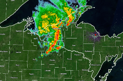 |
(Left) Radar animation overview showing the complex of storms as viewed from the WFO Marquette radar (KMQT). Timing of this animation is roughly from 7 PM to 8 PM CDT. |
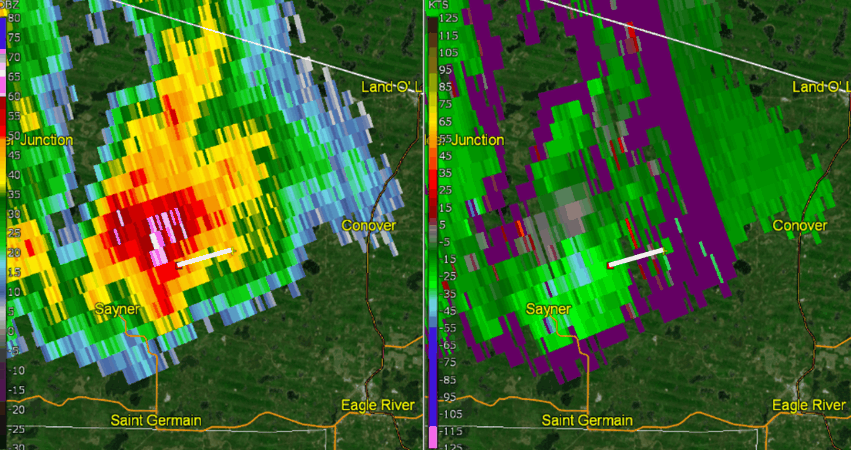 |
| (Above) Close-up of storm during the time period it produced a tornado. Reflectivity (left panel) and velocity (right panel). The white line denotes the approximate damage path based on aerial survey, courtesy of the Department of Natural Resources (DNR). Note the velocity couplet (seen in the right panel) appears to be located north of where the actual damage occurred. This is because the storm was located about 90 nm from the WFO Marquette (KMQT) radar and the height of the lowest elevation slice is nearly 9500 ft above the ground. The radar is only able to detect the broader parent mesocyclone at this distance, and not the actual tornadic circulation near the ground. |
 |
Media use of NWS Web News Stories is encouraged! Please acknowledge the NWS as the source of any news information accessed from this site. |
|