Overview
|
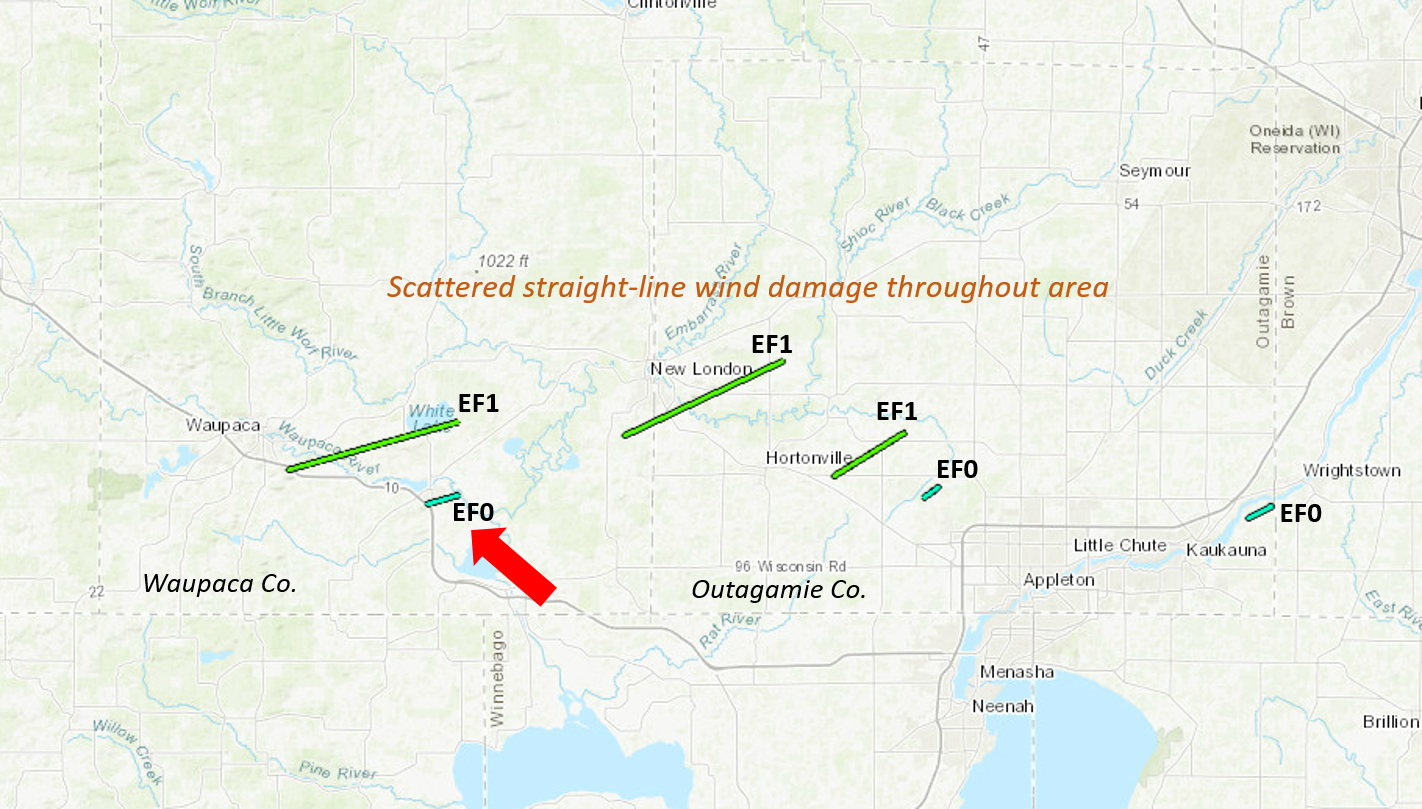
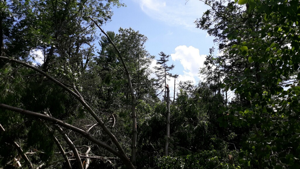
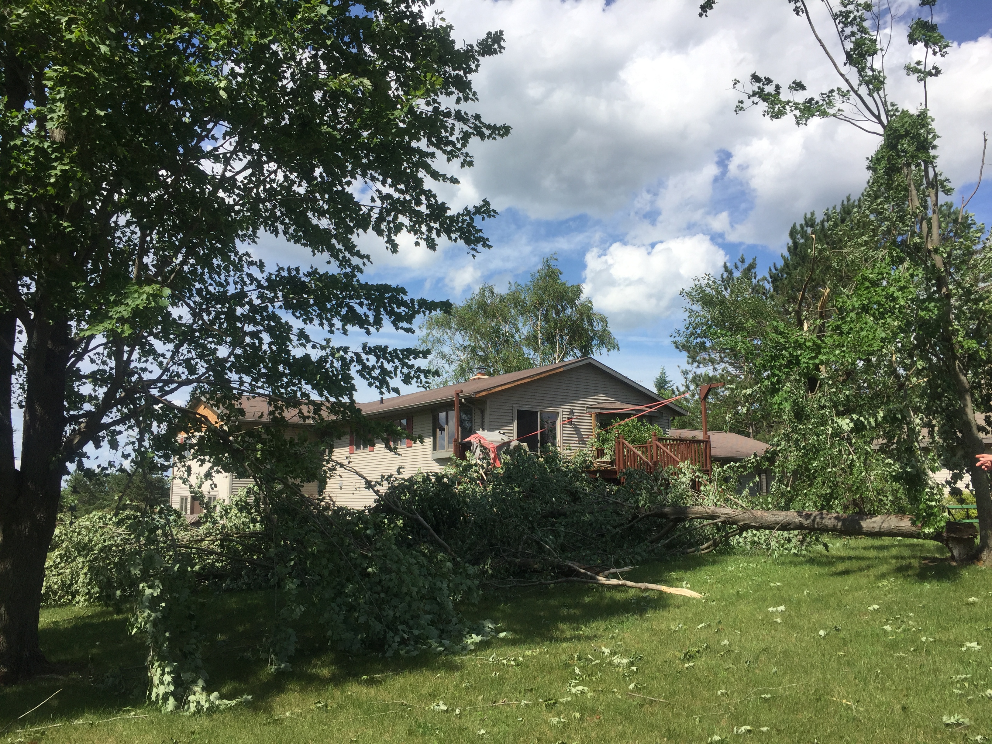
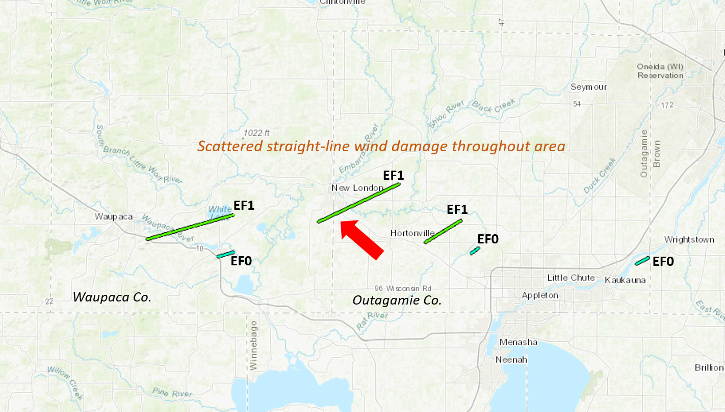
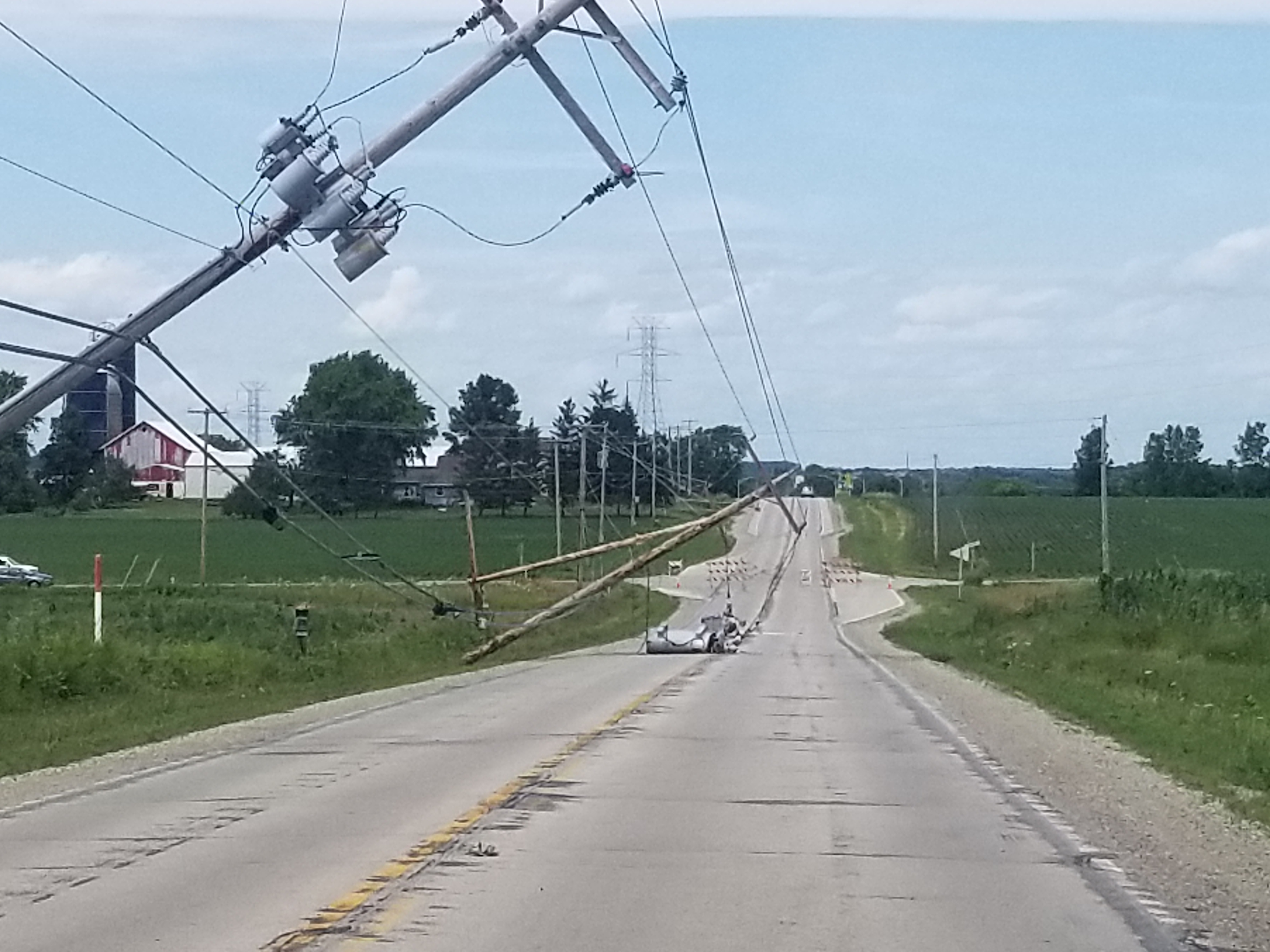
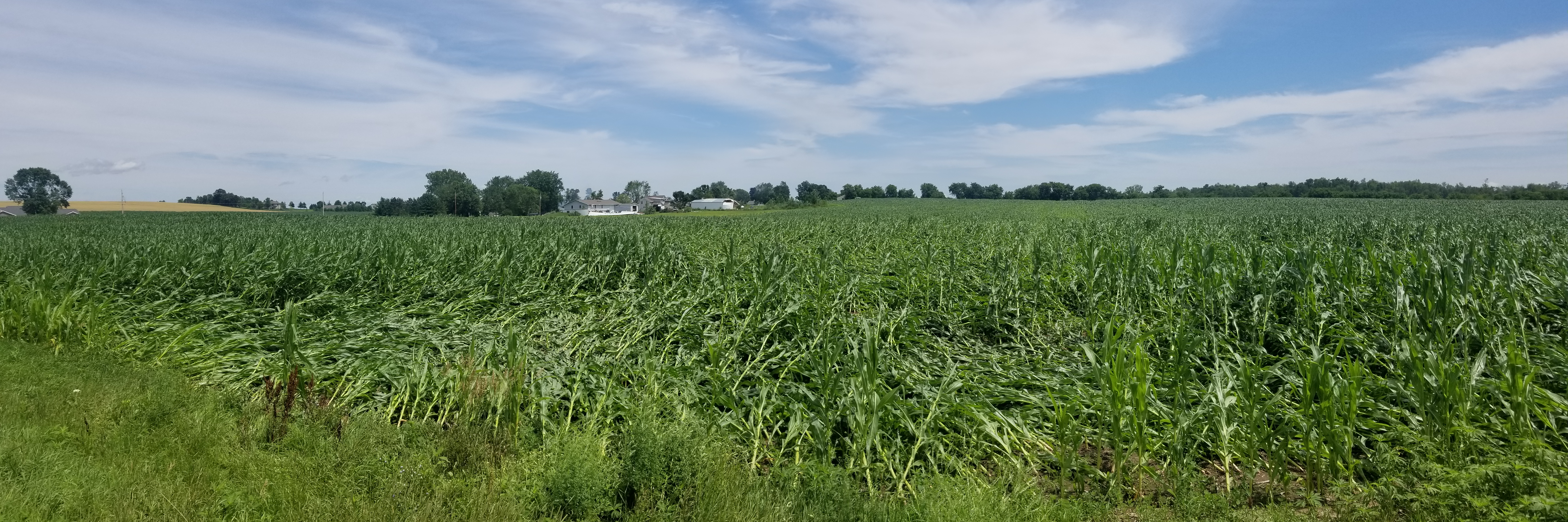
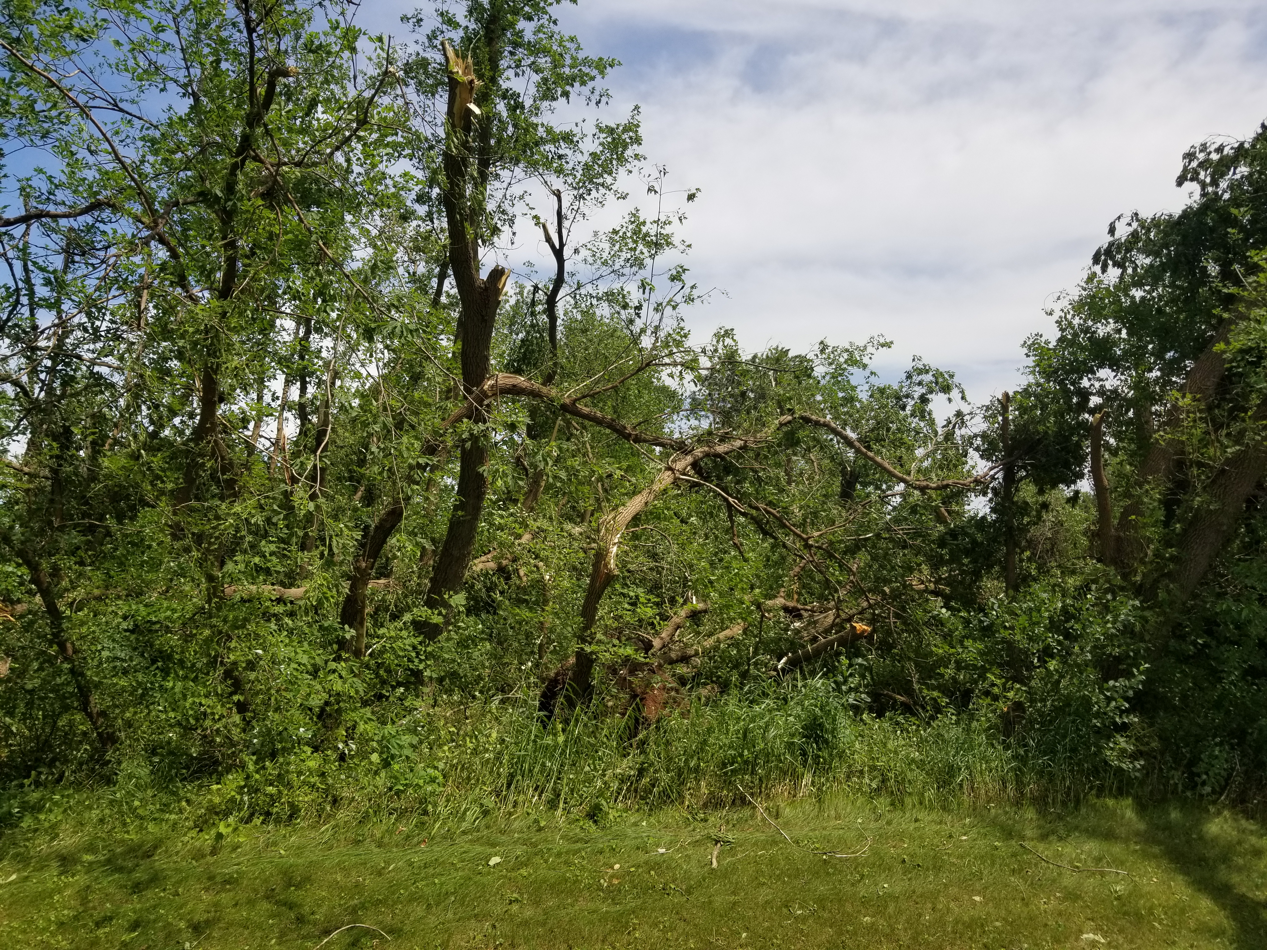
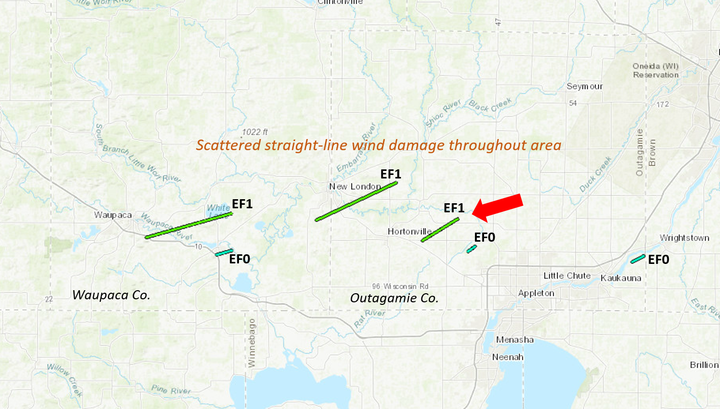
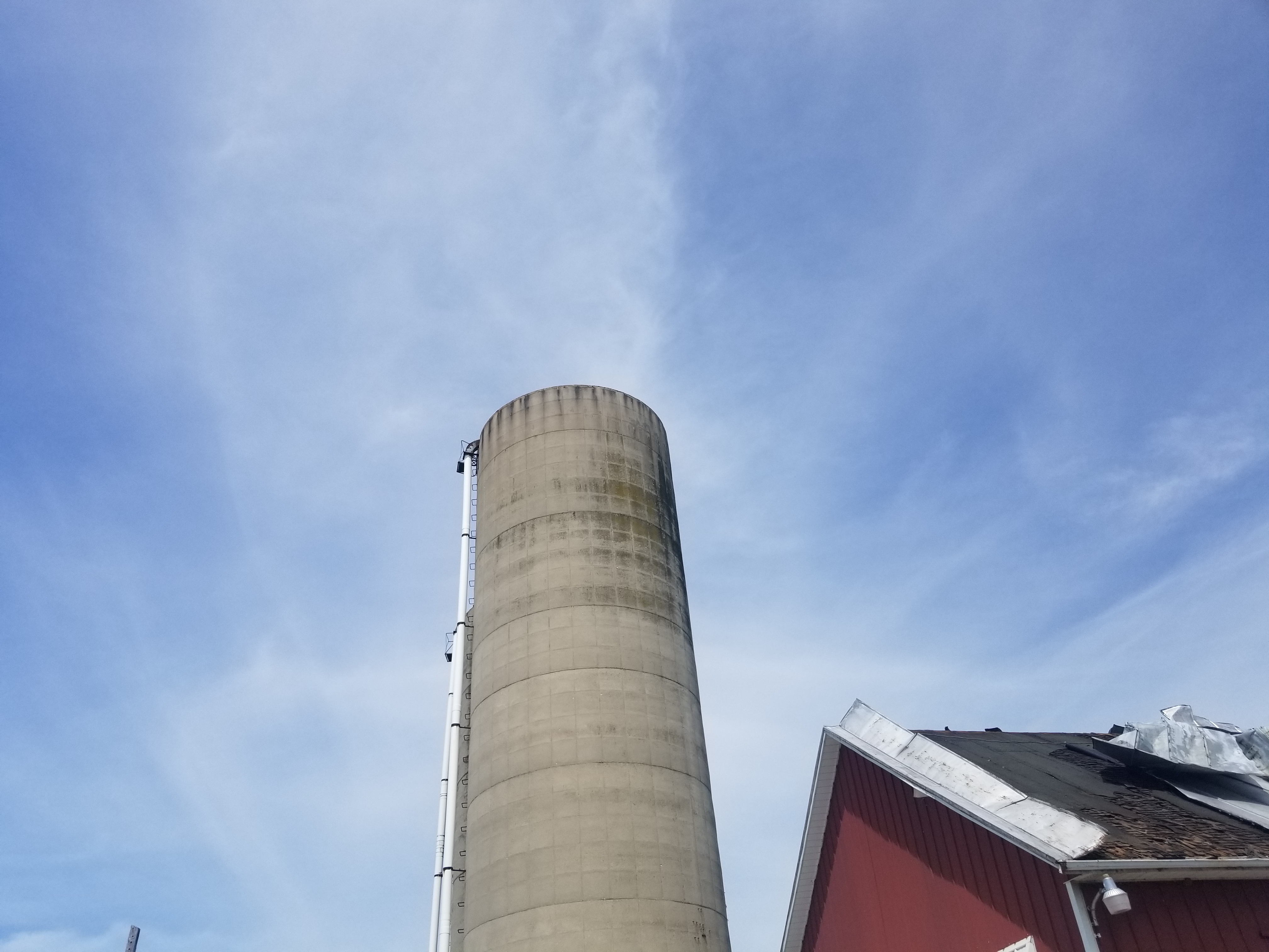
Severe thunderstorms moved across northern Wisconsin the previous evening. Just over 12 hours later, a line of severe thunderstorms moved across much of central and east-central WI during the late morning and early afternoon hours on July 20, 2019. Widespread tree and power line damage was reported. The worst damage occurred from Wood/Portage counties eastward into the Fox Valley and lakeshore. Trees were uprooted or snapped and several structures were damaged as a result of straight-line winds and six weak, fast-moving tornadoes. Please see the tabs below for more information.
|
 |
Tornadoes:
|
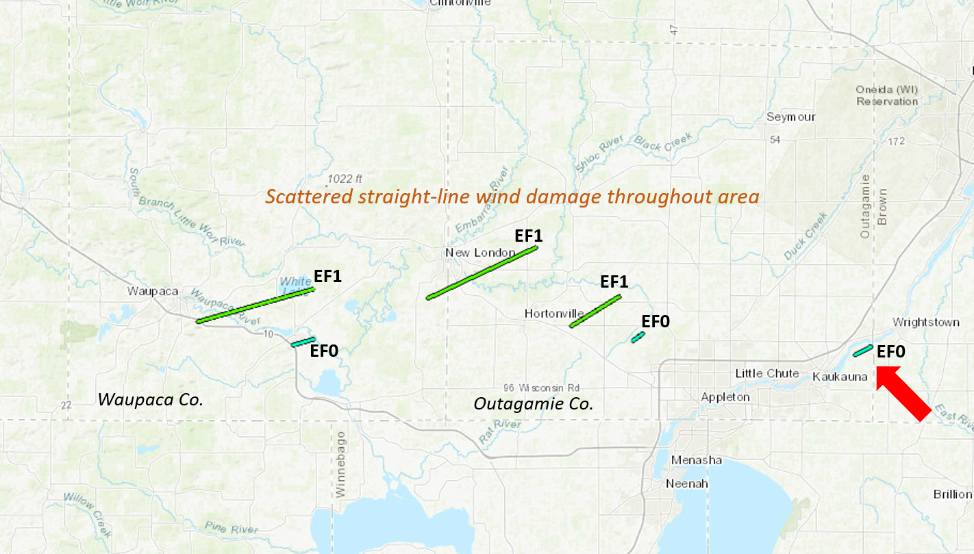
Waupaca
Track Map
|
|||||||||||||||||||
|
Weyauwega
Track Map
|
|||||||||||||||||||
|
New London
Track Map
|
|||||||||||||||||||
|
Hortonville
Track Map
|
|||||||||||||||||||
|
Greenville
Track Map
|
||||||||||||||||||
|
E Kaukauna
Track Map
|
||||||||||||||||||
The Enhanced Fujita (EF) Scale classifies tornadoes into the following categories:
| EF0 Weak 65-85 mph |
EF1 Moderate 86-110 mph |
EF2 Significant 111-135 mph |
EF3 Severe 136-165 mph |
EF4 Extreme 166-200 mph |
EF5 Catastrophic 200+ mph |
 |
|||||
Wind and Flooding Reports:
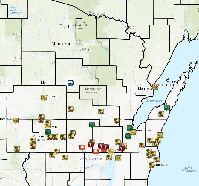 |
|
| Storm reports on July 20 |
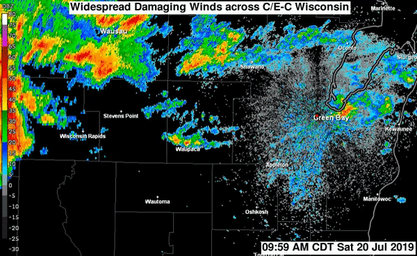
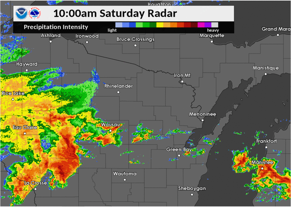
Radar:
.gif) |
| Radar Reflectivity (15 minute intervals) from 8:00 AM to 1:48 PM July 20, 2019 |
|
Radar Reflectivity (2-4 minute intervals including SAILS scans) from 10:00 AM to 12:14 PM July 20, 2019 |
Preliminary Storm Reports
PRELIMINARY LOCAL STORM REPORT...SUMMARY
NATIONAL WEATHER SERVICE GREEN BAY WI
346 PM CDT SAT JUL 20 2019

..TIME...   ...EVENT...      ...CITY LOCATION...     ...LAT.LON...
..DATE...   ....MAG....      ..COUNTY LOCATION..ST.. ...SOURCE....
            ..REMARKS..

1011 AM     TSTM WND GST     MARSHFIELD              44.66N 90.16W
07/20/2019  M64.00 MPH       WOOD               WI   ASOS

1011 AM     TSTM WND GST     MARSHFIELD              44.66N 90.16W
07/20/2019  M58.00 MPH       WOOD               WI   ASOS

1025 AM     TSTM WND DMG     WISCONSIN RAPIDS        44.40N 89.84W
07/20/2019                   WOOD               WI   TRAINED SPOTTER

            BRANCHES DOWN BLOCKING THE ROAD ON A RESIDENTIAL STREET.
            BRANCHES AS BIG AS 5 INCHES IN DIAMETER AND 10 FEET LONG.
            MAY BE LARGER DOWN THE ROAD.

1026 AM     TSTM WND DMG     WISCONSIN RAPIDS        44.40N 89.84W
07/20/2019                   WOOD               WI   TRAINED SPOTTER

            TREES DOWN IN WISCONSIN RAPIDS. ONE AT CANAL STREET
            ANOTHER AT FISHER STREET.

1026 AM     TSTM WND DMG     BABCOCK                 44.29N 90.13W
07/20/2019                   WOOD               WI   TRAINED SPOTTER

            SPORADIC DOWN TREES.

1026 AM     TSTM WND DMG     STEVENS POINT           44.51N 89.56W
07/20/2019                   PORTAGE            WI   TRAINED SPOTTER

            MANY TREES DOWN AT AN APARTMENT COMPLEX. ESTIMATED ABOUT
            1 FOOT IN DIAMETER.

1029 AM     TSTM WND GST     PLOVER                  44.45N 89.53W
07/20/2019  M86.30 MPH       PORTAGE            WI   CO-OP OBSERVER

            MEASURED GUSTS AT COOP STATION PLOW3. ALSO REPORTED ON
            DAMAGE TO MENARDS IN TOWN AND DOORS BLOWN OUT OF THE
            STORE.

1030 AM     TSTM WND DMG     ALMOND                  44.26N 89.40W
07/20/2019                   PORTAGE            WI   CO-OP OBSERVER

            NUMEROUS TREE LIMBS DOWN AND ONE TREE DOWN. DIAMETER
            LARGER THAN ONE FOOT.

1032 AM     TSTM WND DMG     PORT EDWARDS            44.33N 89.84W
07/20/2019                   WOOD               WI   TRAINED SPOTTER

            TREES AND POWER LINES DOWN ON HIGHWAY 54

1036 AM     TSTM WND DMG     WISCONSIN RAPIDS        44.40N 89.84W
07/20/2019                   WOOD               WI   STORM CHASER

            LOTS OF POWER LINES DOWN ON FISHER ROAD

1038 AM     TSTM WND DMG     PLAINFIELD              44.21N 89.48W
07/20/2019                   WAUSHARA           WI   LAW ENFORCEMENT

            TREES DOWN. TIME ESTIMATED.

1038 AM     TSTM WND DMG     STEVENS POINT           44.51N 89.56W
07/20/2019                   PORTAGE            WI   TRAINED SPOTTER

            TREES DOWN. ALL TREES APPEAR TO HAVE FALLEN IN THE SAME
            DIRECTION. DELAYED REPORT. TIME ESTIMATED.

1040 AM     TSTM WND DMG     PLOVER                  44.45N 89.53W
07/20/2019                   PORTAGE            WI   TRAINED SPOTTER

            UPROOTED TREES ADN TREE DAMAGE IN TRAILER PARK ON HAYES
            AVENUE. SIDING IS OFF SOME TRAILERS.

1042 AM     TSTM WND GST     6 N STEVENS POINT       44.60N 89.56W
07/20/2019  M56.00 MPH       PORTAGE            WI   TRAINED SPOTTER

            VEHICLE PULLED OVER ON INTERSTATE 39 NORTH OF STEVENS
            POINT. ALSO TORRENTIAL RAIN AND WIND ROCKING VEHICLE.

1043 AM     TSTM WND DMG     1 SSW DANCY             44.67N 89.69W
07/20/2019                   PORTAGE            WI   TRAINED SPOTTER

            LAKE DUBAY COUNTY PARK. NUMEROUS TREES DOWN. ESTIMATED
            WINDS OF 70 MPH.

1045 AM     TSTM WND DMG     AMHERST                 44.45N 89.28W
07/20/2019                   PORTAGE            WI   TRAINED SPOTTER

            NEAR AMHERST. TREES DOWN ABOUT 5 INCHES IN DIAMETER AND
            BLOWING DEBRIS.

1046 AM     TSTM WND DMG     ARNOTT                  44.45N 89.43W
07/20/2019                   PORTAGE            WI   TRAINED SPOTTER

            TREES DOWN. ESTIMATED WINDS OF 90 MPH.

1047 AM     TSTM WND DMG     8 N STEVENS POINT       44.63N 89.56W
07/20/2019                   PORTAGE            WI   TRAINED SPOTTER

            LARGE TREE DOWN ON INTERSTATE 39 SOUTHBOUND LANE ABOUT 8
            MILES NORTH OF STEVENS POINT.

1049 AM     TSTM WND DMG     WILD ROSE               44.18N 89.25W
07/20/2019                   WAUSHARA           WI   LAW ENFORCEMENT

            TREES DOWN. TIME ESTIMATED.

1057 AM     TSTM WND DMG     ARNOTT                  44.45N 89.43W
07/20/2019                   PORTAGE            WI   TRAINED SPOTTER

            UPDATE TO PREVIOUS REPORT. ROOF DAMAGE TO SOME BUILDINGS.
            NUMEROUS TREES DOWN.

1100 AM     TSTM WND DMG     SCANDINAVIA             44.46N 89.13W
07/20/2019                   WAUPACA            WI   TRAINED SPOTTER

            TREES DOWN ON HOMES, ROADS, WIRES ACROSS THE TOWN. TIME
            ESTIMATED

1100 AM     TSTM WND DMG     3 NNW WAUPACA           44.40N 89.10W
07/20/2019                   WAUPACA            WI   PUBLIC

            DOZENS OF TREES DOWN FROM THUNDERSTORM WINDS ESTIMATED
            75 TO 80 MPH.

1101 AM     TSTM WND GST     WAUSAU                  44.96N 89.63W
07/20/2019  M74.00 MPH       MARATHON           WI   ASOS

1101 AM     TSTM WND DMG     AMHERST                 44.45N 89.28W
07/20/2019                   PORTAGE            WI   TRAINED SPOTTER

            DEBRIS FLYING ACROSS ROAD. ESTIMATED 80 MPH WINDS.

1103 AM     FUNNEL CLOUD     WEYAUWEGA               44.31N 88.93W
07/20/2019                   WAUPACA            WI   LAW ENFORCEMENT

1105 AM     TSTM WND DMG     IOLA                    44.50N 89.11W
07/20/2019                   WAUPACA            WI   TRAINED SPOTTER

            LARGE TREE DOWN, ABOUT ONE FOOT IN DIAMETER.

1106 AM     TSTM WND DMG     WITTENBERG              44.81N 89.15W
07/20/2019                   SHAWANO            WI   LAW ENFORCEMENT

            TREES DOWN. TIME ESTIMATED.

1110 AM     TSTM WND DMG     NEW LONDON              44.38N 88.75W
07/20/2019                   WAUPACA            WI   TRAINED SPOTTER

            TIME ESTIMATED BY RADAR. NUMEROUS TREES DOWN WITHIN THE
            TOWN. MAJOR DAMAGE REPORTED. MANY STREETS COVERED WITH
            DOWNED TREES AND LIMBS. POWER IS OUT.

1114 AM     FUNNEL CLOUD     DALE                    44.26N 88.68W
07/20/2019                   OUTAGAMIE          WI   LAW ENFORCEMENT

1115 AM     TSTM WND DMG     KNOWLTON                44.71N 89.68W
07/20/2019                   MARATHON           WI   TRAINED SPOTTER

            TREES DOWN ON HIGHWAY 34 AND OTHER AREAS.

1117 AM     FUNNEL CLOUD     GREENVILLE              44.29N 88.53W
07/20/2019                   OUTAGAMIE          WI   LAW ENFORCEMENT

1120 AM     TSTM WND DMG     NE APPLETON             44.26N 88.40W
07/20/2019                   OUTAGAMIE          WI   TRAINED SPOTTER

            A COUPLE OF ROAD SIGNS DOWN OVER 441 SOUTHBOUND. POWER
            POLE BENT OVER NEAR 41 AND BALLARD. A COUPLE OTHER ROAD
            SIGNS BLOWN OVER AND TREE DAMAGE AS WELL.

1122 AM     TSTM WND GST     APPLETON                44.26N 88.40W
07/20/2019  M60.00 MPH       OUTAGAMIE          WI   AWOS

1123 AM     TSTM WND DMG     NEENAH                  44.18N 88.44W
07/20/2019                   WINNEBAGO          WI   EMERGENCY MNGR

            TREES DOWN. DELAYED REPORT. TIME ESTIMATED.

1123 AM     TSTM WND DMG     APPLETON                44.26N 88.40W
07/20/2019                   OUTAGAMIE          WI   TRAINED SPOTTER

            2 TREES UPROOTED AND HOUSE DAMAGE.

1125 AM     TSTM WND GST     APPLETON                44.26N 88.40W
07/20/2019  M67.00 MPH       OUTAGAMIE          WI   TRAINED SPOTTER

            MEASURED GUST AT PERKINS AND COLLEGE AVENUE.

1125 AM     FUNNEL CLOUD     APPLETON                44.26N 88.40W
07/20/2019                   OUTAGAMIE          WI   LAW ENFORCEMENT

1128 AM     TSTM WND DMG     APPLETON                44.26N 88.40W
07/20/2019                   OUTAGAMIE          WI   PUBLIC

            TREE LIMBS DOWN

1131 AM     TSTM WND GST     SHERWOOD                44.17N 88.27W
07/20/2019  M59.00 MPH       CALUMET            WI   TRAINED SPOTTER

1132 AM     TSTM WND DMG     SHAWANO                 44.78N 88.59W
07/20/2019                   SHAWANO            WI   LAW ENFORCEMENT

            WIDESPREAD TREES DOWN ACROSS THE COUNTY. TIME ESTIMATED.

1132 AM     TSTM WND DMG     IOLA                    44.50N 89.11W
07/20/2019                   WAUPACA            WI   TRAINED SPOTTER

            TREES AND POWER LINES DOWN ALL OVER THE PLACE. STREET
            FLOODING

1137 AM     TSTM WND DMG     4 NE KAUKAUNA           44.32N 88.21W
07/20/2019                   OUTAGAMIE          WI   TRAINED SPOTTER

            MULTIPLE TREES DOWN. DELAYED REPORT. TIME ESTIMATED BY
            RADAR.

1143 AM     TSTM WND DMG     ANGELICA                44.66N 88.30W
07/20/2019                   SHAWANO            WI   LAW ENFORCEMENT

            TREES DOWN. TIME ESTIMATED.

1144 AM     TSTM WND GST     WRIGHTSTOWN             44.33N 88.16W
07/20/2019  M67.00 MPH       BROWN              WI   TRAINED SPOTTER

            MULTIPLE LARGE TREES DOWN. LOCATED NEAR THE MIDDLE OF THE
            CITY.

1145 AM     TSTM WND DMG     FREEDOM                 44.38N 88.28W
07/20/2019                   OUTAGAMIE          WI   PUBLIC

            LARGE TREE BRANCHES DOWN ON GARVEY AVE. TIME ESTIMATED BY
            RADAR.

1149 AM     FLASH FLOOD      CLINTONVILLE            44.61N 88.75W
07/20/2019                   WAUPACA            WI   TRAINED SPOTTER

            STREET FLOODING. PARKING LOTS UNDER WATER

1159 AM     TSTM WND GST     GREEN BAY               44.51N 88.00W
07/20/2019  M59.00 MPH       BROWN              WI   ASOS

1200 PM     TSTM WND DMG     W FRANCIS CREEK         44.20N 87.71W
07/20/2019                   MANITOWOC          WI   TRAINED SPOTTER

            DOWNED TREES ON COUNTY HIGHWAY Q BETWEEN LORENZ AND
            BEAGLE STREETS. ONE TREE ABOUT 13 INCHES IN DIAMETER DOWN
            ON A POWER LINE. TIME ESTIMATED BY RADAR.

1200 PM     TSTM WND DMG     PLOVER                  44.45N 89.53W
07/20/2019                   PORTAGE            WI   CO-OP OBSERVER

            DAMAGE TO RETAIL STORE IN PLOVER. GLASS DOORS BLOWN IN,
            PIPES FELL FROM CEILING.

1201 PM     TSTM WND DMG     LARRABEE                44.26N 87.71W
07/20/2019                   MANITOWOC          WI   LAW ENFORCEMENT

            NUMEROUS TREES DOWN ACROSS THE COUNTY. TIME ESTIMATED.

1201 PM     TSTM WND DMG     DENMARK                 44.34N 87.83W
07/20/2019                   BROWN              WI   TRAINED SPOTTER

            TREES DOWN. DELAYED REPORT. TIME ESTIMATED.

1205 PM     TSTM WND DMG     GREEN BAY               44.51N 88.00W
07/20/2019                   BROWN              WI   PUBLIC

            SIX TO EIGHT INCH OAK TREE BRANCH DOWN ON BEECH TREE AND
            WEST POINT ROAD. REPORT VIA SOCIAL MEDIA.

1205 PM     TSTM WND DMG     MANITOWOC               44.08N 87.66W
07/20/2019                   MANITOWOC          WI   TRAINED SPOTTER

            TREES DOWN ON HIGHWAY Q NORTH OF MANITOWOC

1206 PM     TSTM WND DMG     TWO RIVERS              44.15N 87.56W
07/20/2019                   MANITOWOC          WI   PUBLIC

            TREE DOWN BLOCKING THE ROAD. TIME ESTIMATED.

1209 PM     TSTM WND DMG     STANGELVILLE            44.40N 87.68W
07/20/2019                   KEWAUNEE           WI   LAW ENFORCEMENT

            TREES DOWN. DELAYED REPORT. TIME ESTIMATED.

1209 PM     TSTM WND DMG     MISHICOT                44.23N 87.63W
07/20/2019                   MANITOWOC          WI   LAW ENFORCEMENT

            TREE MOVED A HOUSE OFF ITS FOUNDATION. DELAYED REPORT.
            TIME ESTIMATED.

1212 PM     TSTM WND DMG     NORMAN                  44.36N 87.59W
07/20/2019                   KEWAUNEE           WI   LAW ENFORCEMENT

            TREES DOWN. DELAYED REPORT. TIME ESTIMATED.

1215 PM     TSTM WND DMG     WRIGHTSTOWN             44.33N 88.16W
07/20/2019                   BROWN              WI   TRAINED SPOTTER

            TREES AND WIRES DOWN ALL ACROSS WRIGHTSTOWN. TIME
            ESTIMATED.

1218 PM     TSTM WND DMG     4 SSW KEWAUNEE          44.40N 87.53W
07/20/2019                   KEWAUNEE           WI   LAW ENFORCEMENT

            TREES DOWN. TIME ESTIMATED.

1221 PM     FLASH FLOOD      ASHWAUBENON             44.46N 88.08W
07/20/2019                   BROWN              WI   AMATEUR RADIO

            FLOODING TO HEADLIGHT LEVEL OF FORD F150 AT ALLIED AND
            CIRCLE.

1224 PM     FLASH FLOOD      ASHWAUBENON             44.46N 88.08W
07/20/2019                   BROWN              WI   AMATEUR RADIO

            FLOODING AT THE BOWLING ALLEY.

1231 PM     FLASH FLOOD      GREEN BAY               44.51N 88.00W
07/20/2019                   BROWN              WI   AMATEUR RADIO

            8 TO 10 INCHES OF WATER IN THE UNIVERSITY MARKET AREA ON
            UNIVERSITY.

1239 PM     TSTM WND DMG     MAPLEWOOD               44.75N 87.48W
07/20/2019                   DOOR               WI   LAW ENFORCEMENT

            TREES DOWN ACROSS THE COUNTY. TIME ESTIMATED.

1245 PM     FLASH FLOOD      STURGEON BAY            44.83N 87.38W
07/20/2019                   DOOR               WI   LAW ENFORCEMENT

            14TH AVE CLOSED DUE TO FLOODING

1254 PM     MARINE TSTM WIND 1 N KEWAUNEE            44.47N 87.50W
07/20/2019  M39.00 MPH       KEWAUNEE           WI   C-MAN STATION

0106 PM     FLOOD            STEVENS POINT           44.51N 89.56W
07/20/2019                   PORTAGE            WI   TRAINED SPOTTER

            STANDING WATER OF ABOUT 6 INCHES IN A FEW PARTS OF THE
            CITY. INCLUDING OKRAY AVENUE AND RIVER ROAD.

0154 PM     MARINE TSTM WIND 1 NE MARINETTE          45.10N 87.59W
07/20/2019  M41.00 MPH       MENOMINEE          MI   C-MAN STATION

0214 PM     HEAVY RAIN       ANTIGO                  45.15N 89.15W
07/20/2019  M3.50 INCH       LANGLADE           WI   TRAINED SPOTTER

            RAINFALL SINCE LAST EVENING.
 |
Media use of NWS Web News Stories is encouraged! Please acknowledge the NWS as the source of any news information accessed from this site. |
|


.png)