|
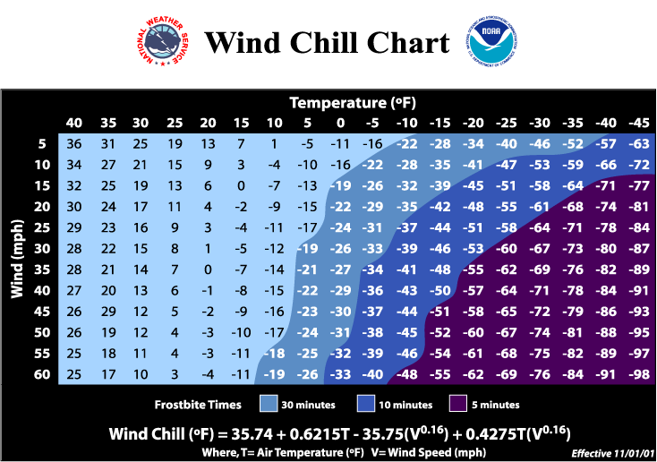
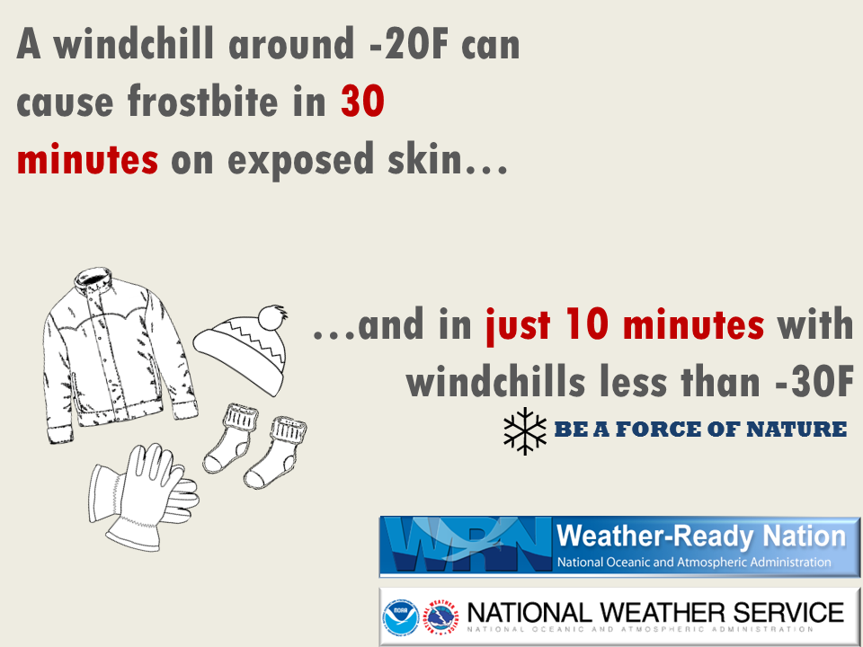
What: Wind chill readings of 25 below to 40 below zero are expected tonight through early Monday morning. Where: Entire area, coldest wind chills across central and north-central Wisconsin. Impacts: Frostbite can occur in as little 10 minutes. (see chart in tab below) Actions: Cover all exposed skin. Wear several layers of clothing, hat, and gloves. Protect pets from the cold, make sure they have fresh water. Limit outdoor exposure if possible. Be sure to prepare and dress appropriately for the cold! See tabs below for more information. Click on any image for a larger view. |
||
|
Current Advisories and Warnings |
|
|
Temperature / Wind Chill
 |
 |
 |
|
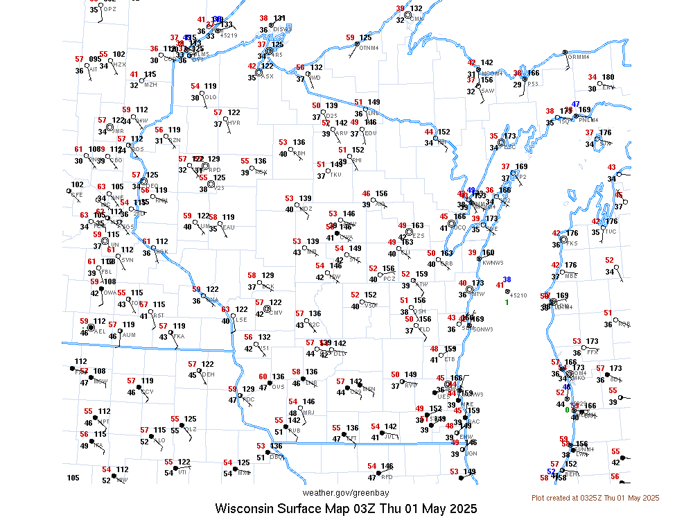
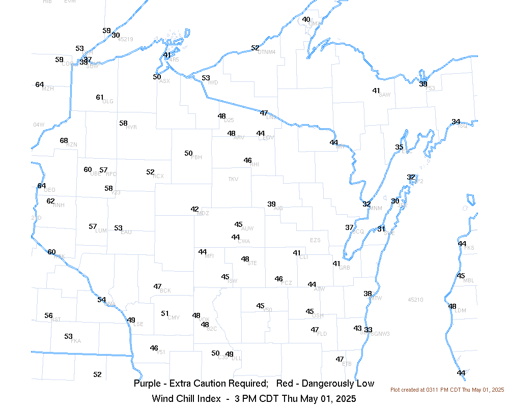
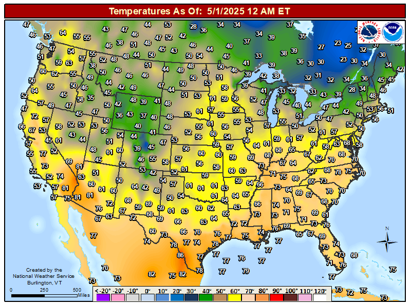
| Current Surface Map | Current Wind Chills | Current Temps Across The U.S. | |
 |
 |
 |
|
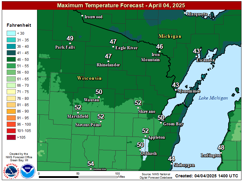
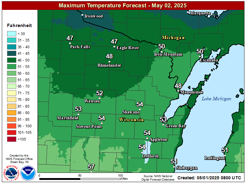
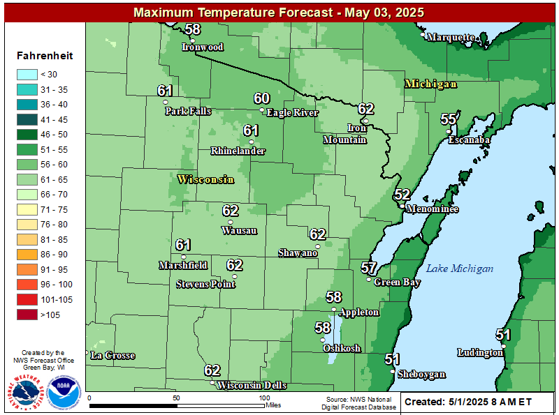
| High Temperature Forecast Day 1 | High Temperature Forecast Day 2 | High Temperature Forecast Day 3 | |
 |
 |
 |
|
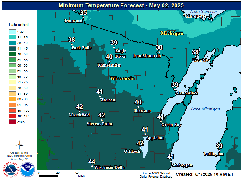
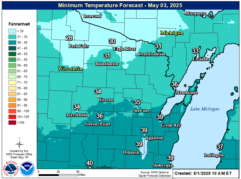
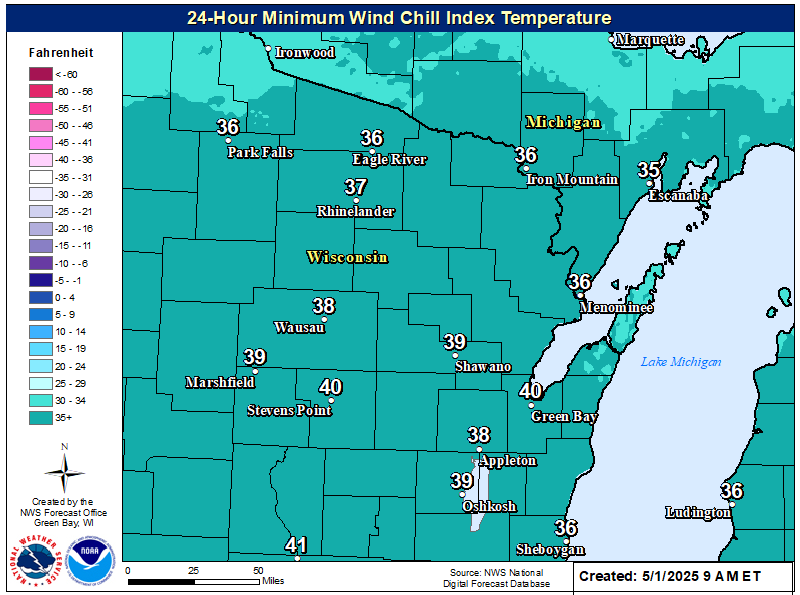
| Low Temperature Forecast Day 1 | Low Temperature Forecast Day 2 | 24-Hour Coldest Wind Chill Forecast |
Wind Chill Chart
Cold Weather Safety Info
| Cold Weather Safety |
If you must venture outdoors during extreme cold, dress in layers. Cover exposed skin to reduce your risk of frostbite or hypothermia. Try to seek shelter from the wind as much as possible while outside. Once inside again, change into dry clothing immediately if you are wet. Understand and watch for frostbite and hypothermia.
Frostbite can happen in minutes, especially on the extremities such as fingers, toes, nose and ears but can affect any area of exposed skin.If you suspect frostbite, immediately move inside to a heated location and begin warming the affected areas using warm water or body heat. Do not use hot water or radiant heat such as a fireplace since affected areas can be easily burned. Seek medical attention for severe frostbite.
Frostbite happens when the body's survival mechanisms kick in during extremely cold weather. To protect the vital inner organs, the body cuts circulation to your extremities: feet, hands, nose, etc., which eventually freeze. To avoid frostbite, stay inside during severe cold, especially when the windchill is -50°F or below. If you must go out, try to cover every part of your body: ears, nose, toes and fingers, etc. Mittens are better than gloves. Keep your skin dry. Stay out of the wind when possible. Drink plenty of fluids since hydration increases the blood's volume, which helps prevent frostbite. Avoid caffeine, alcohol and cigarettes. Caffeine constricts blood vessels, preventing warming of your extremities. Alcohol reduces shivering, which helps keep you warm. Cigarettes shut off the blood flow to your hands. Below are indicators of frostbite:
Get indoors as quickly as possible. Until you can get indoors:
Once indoors:
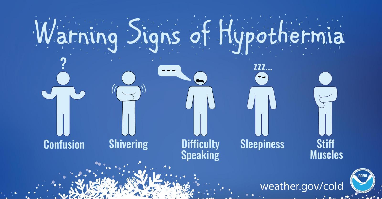
When your body temperature sinks below 96°F, you have hypothermia, a serious health hazard that occurs when body temperature is lowered too much. Get medical attention immediately. Move the victim inside to a heated location and begin warming the center of the body first. If the person is unconscious, administer CPR.
Hypothermia can occur in temperatures as warm as 60°F, particularly in water or with if you are outside a long time and not dressed for the weather. Of the approximately 1,300 people the CDCP lists as being killed by hypothermia each year, most are seniors, according to the National Institute of Aging, but some are children and young adults. Everyone needs to be careful. Some medicines, problems with circulation, and certain illnesses may reduce your ability to resist hypothermia. As you age, your body becomes less efficient at letting you know when you are too cold. In addition, older people tend not to shiver effectively, one of the ways the body warms itself up. Remember these tips to help prevent hypothermia:
If your temperature is 96°F or less, you feel cold and sluggish, or are having trouble thinking clearly, see your doctor immediately or go to the nearest emergency room. It's better to be overly cautious than to die of a disorder that doesn't have to be deadly.
If you are trying to help someone who may have hypothermia, first call an ambulance. Then lie close to the person and cover both of you with thick blankets. The hotter you get, the more warmth you can give the other person. Don't rub the person or handle him or her roughly.
Cold Weather Safety Graphics
| Cold Weather Graphics | ||
|
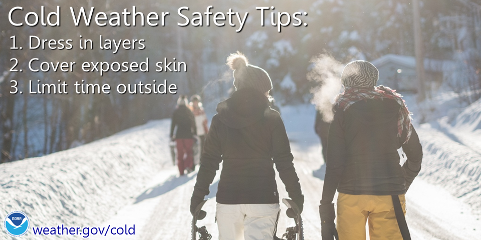
Cold Weather Safety Tips |
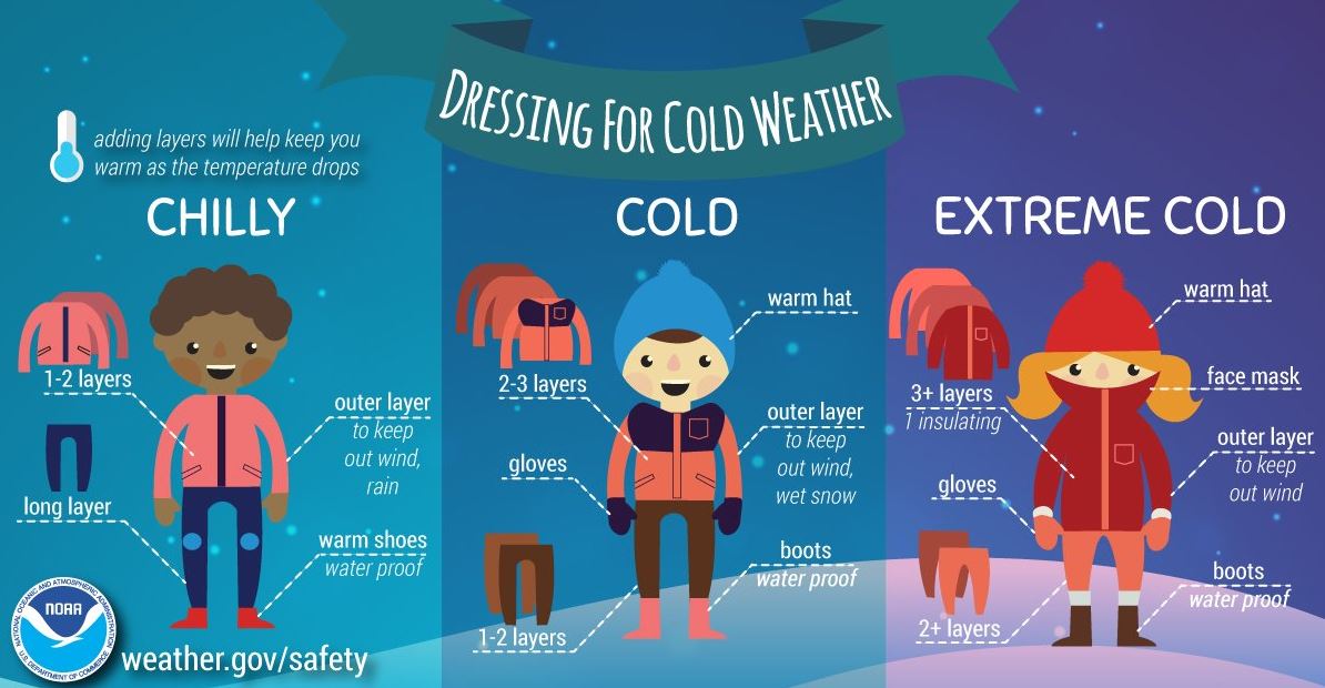
Dressing For Cold Weather |
Hypothermia Info |
|
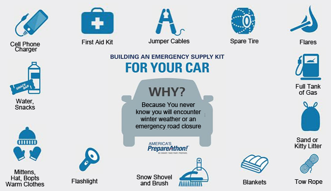
Supply Kit for Your Car |
Wind Chills Facts |
Safety Tips for Your Pets |
 |
Media use of NWS Web News Stories is encouraged! Please acknowledge the NWS as the source of any news information accessed from this site. |
|


.png)