A slow moving front will produce a threat for heavy rainfall and severe weather from the southwest into the western High Plains through the weekend. Heavy rainfall and isolated flash flooding and gusty winds will be possible this weekend into early next week in portions of southern Florida. Coastal flooding impacts remain possible through the weekend along the Southeast and Mid-Atlantic coasts Read More >
GREENVILLE/SPARTANBURG AREA
|
|||
| JANUARY | FEBRUARY | MARCH | APRIL |
| Records Normals |
Records Normals |
Records Normals |
Records Normals |
| MAY | JUNE | JULY | AUGUST |
| Records Normals |
Records Normals |
Records Normals |
Records Normals |
| SEPTEMBER | OCTOBER | NOVEMBER | DECEMBER |
| Records Normals |
Records Normals |
Records Normals |
Records Normals |
| Records are from 1884 to Present, Normals are from 1981 to 2010. | |||

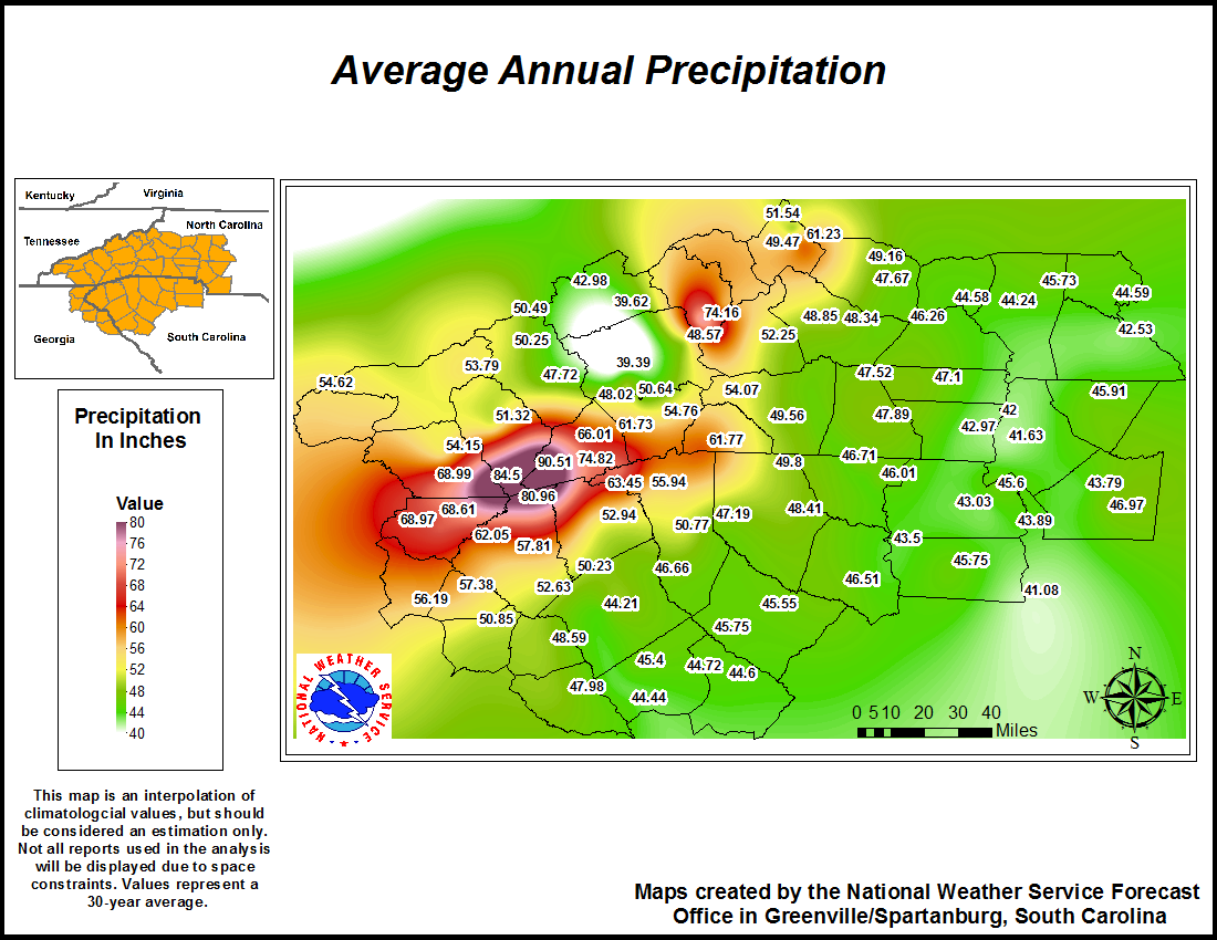
Climatology Maps
| Precipitation | High Temperatures | Low Temperatures |
| RAINFALL DATA | ||
| MONTHLY OBSERVED PRECIPITATION | ||
| WETTEST AND DRIEST MONTHS | ||
| HEAVIEST RAINFALL EVENTS | ||
| RECORD DRY SPELLS | ||
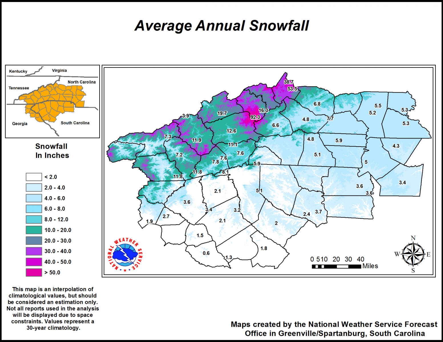
| SNOWFALL DATA | ||
| MONTHLY OBSERVED SNOWFALL | ||
| HEAVIEST SNOWFALL EVENTS AND SNOWIEST WINTERS |
||
| OTHER SIGNIFICANT DATA | ||
| OBSERVER HISTORY | ||
| ALL-TIME RECORDS | ||



 Radar
Radar Current Weather
 Rivers & Lakes
 Satellite
 Forecast Maps
 Hour by Hour Forecast
 Tropical Weather
 Graphical Hazards
 Weather Hazard Briefing
 Report Severe Weather
 Fire Weather
 Drought
 Recreation Forecasts
 Obs & Text Products
 Forecaster's Discussion
 Climate Data
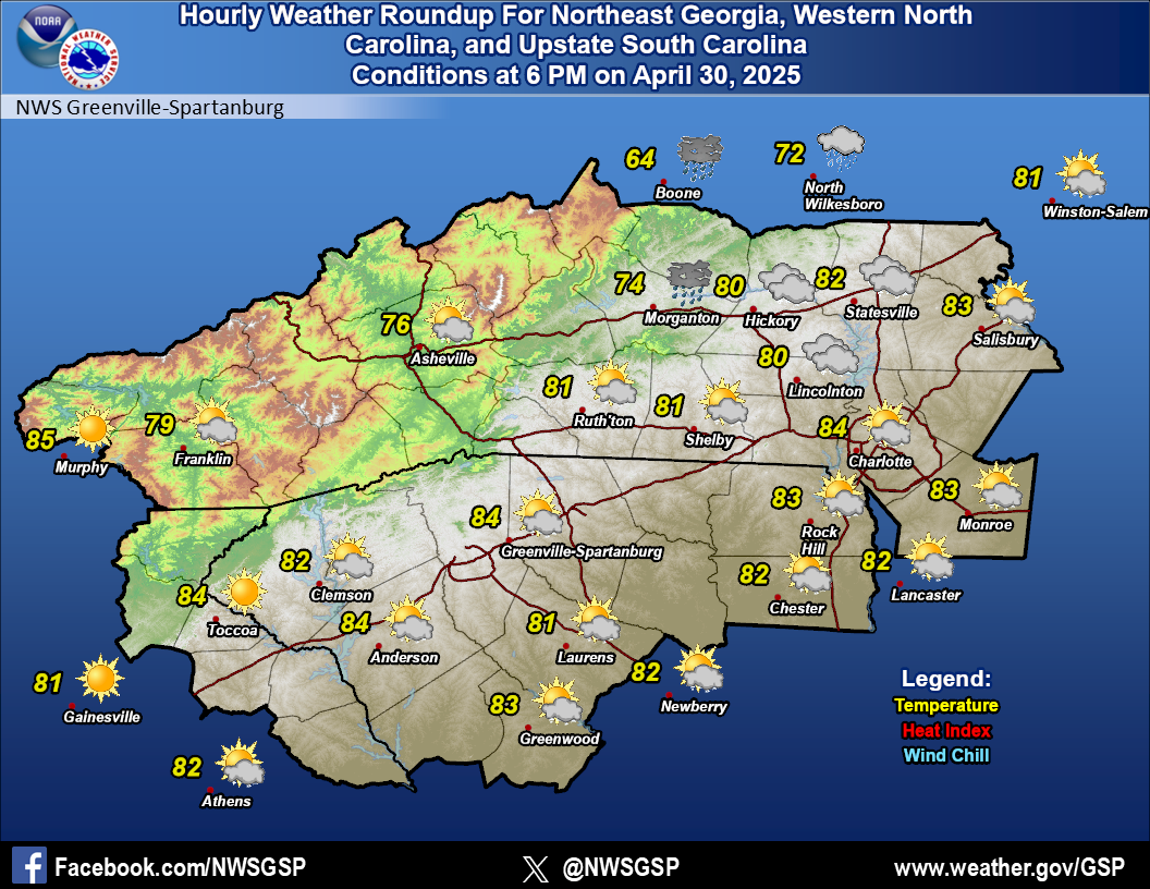 Hourly Weather
 NOAA Weather Radio
 Follow us on X
 Follow us on Facebook
 Follow us on YouTube
 GSP RSS Feed