|
|||||||||||||||||||||||||||||||||||||||||||||||||||||||||||||||||||||
| Mountain Rec Forecast Graphics
|
|||
|
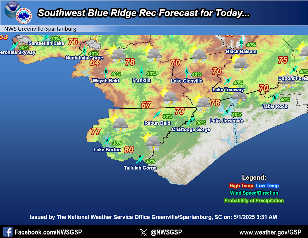
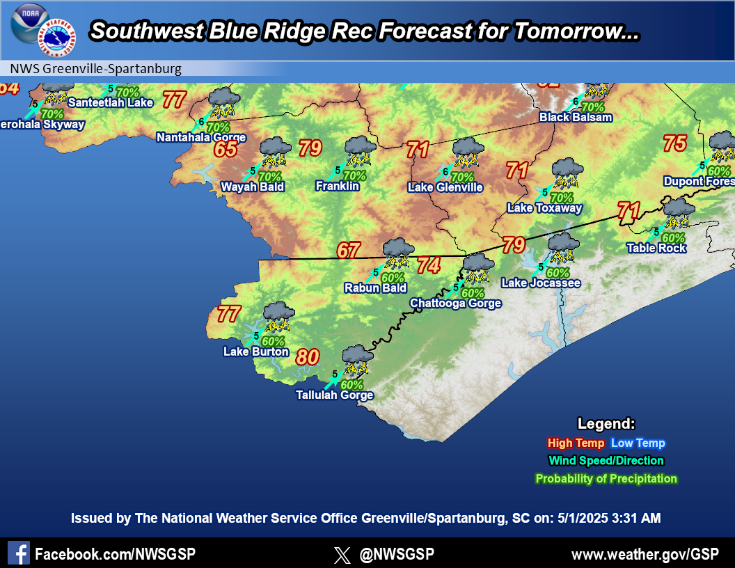
Southwest Blue Ridge
|
|||
|
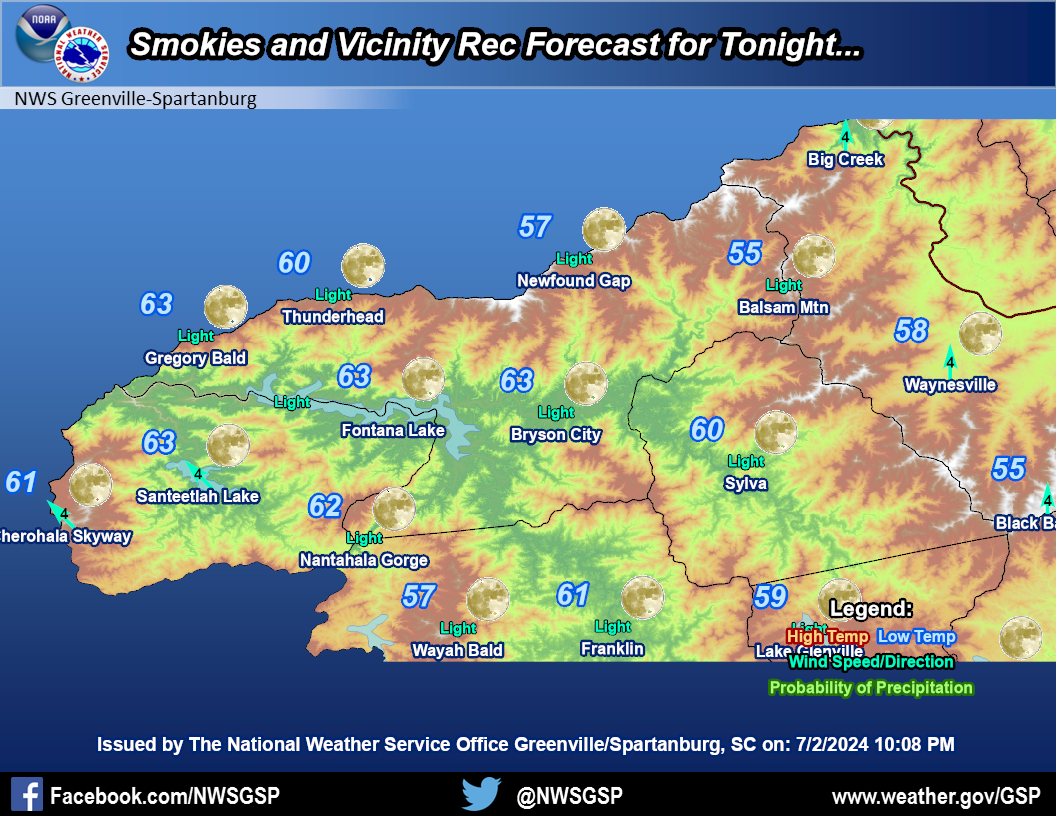
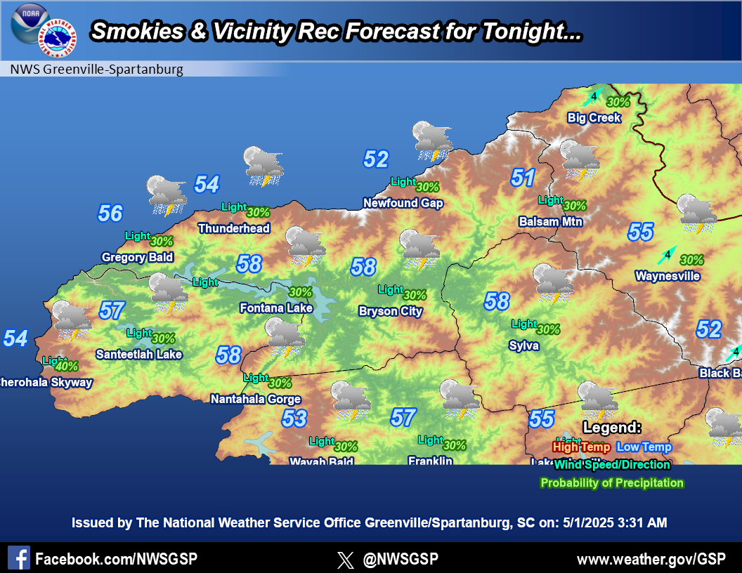
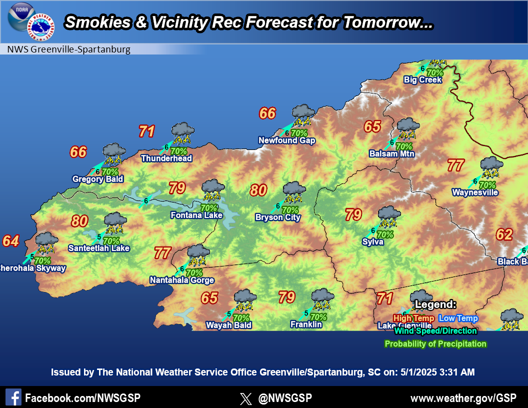
Smokies and Vicinity
|
|||
|
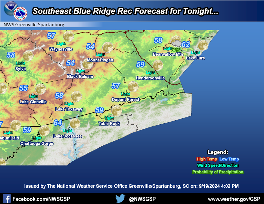
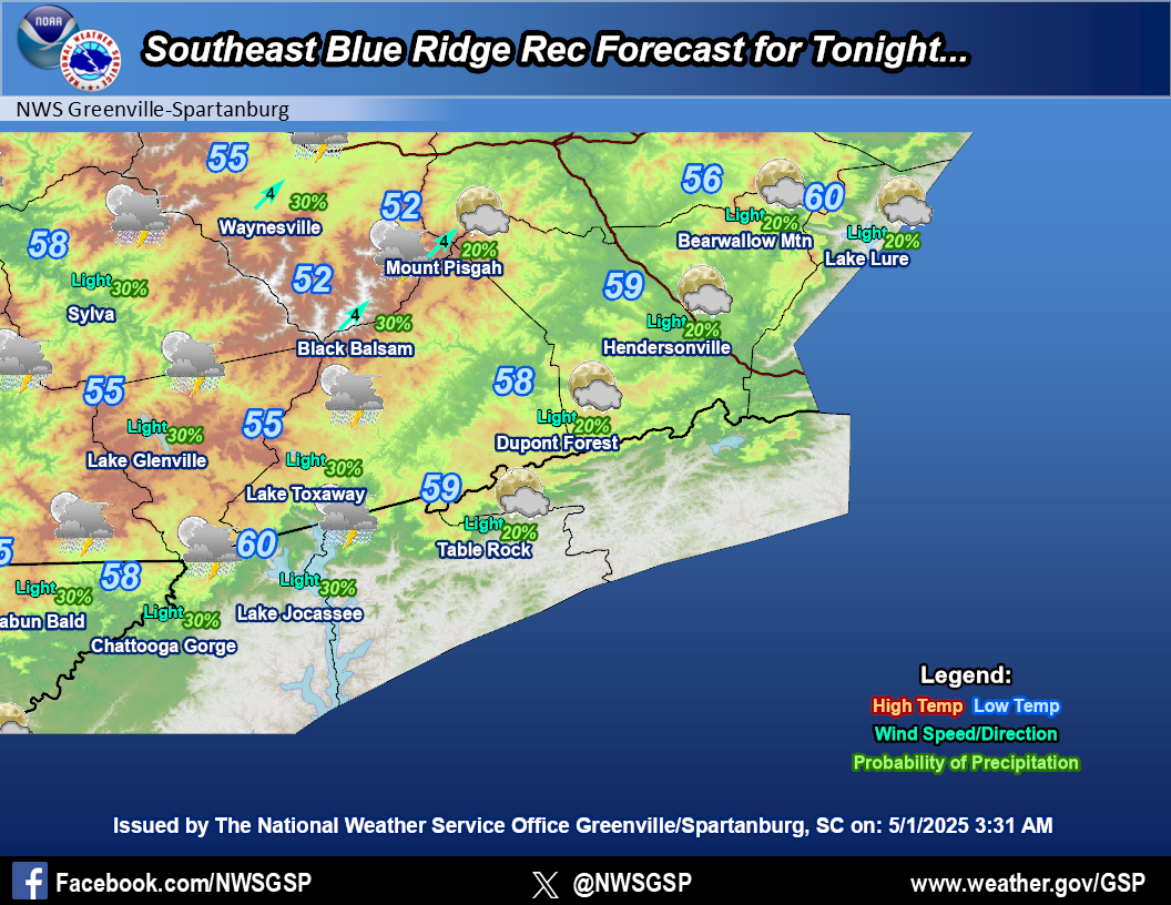
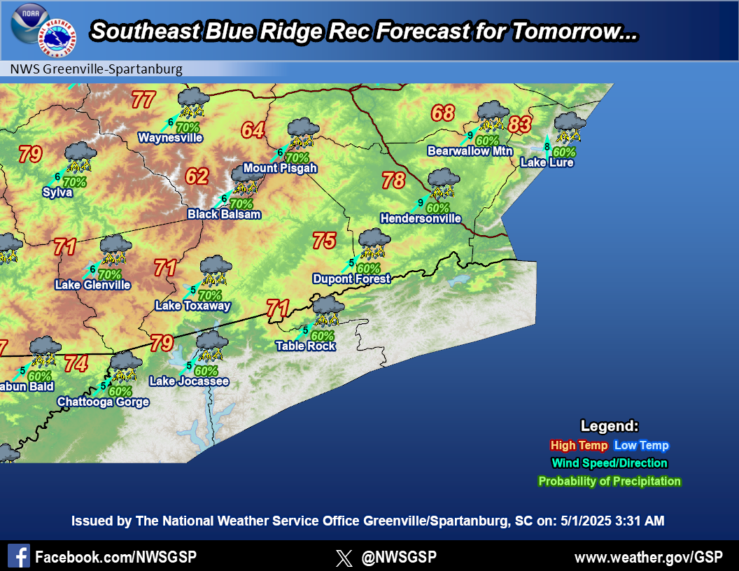
Southeast Blue Ridge
|
|||
|
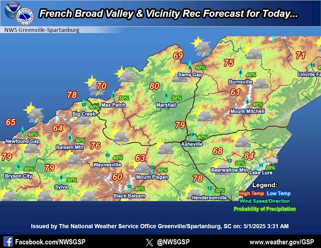
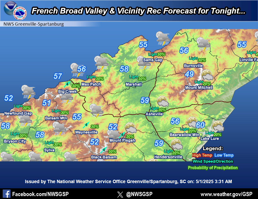
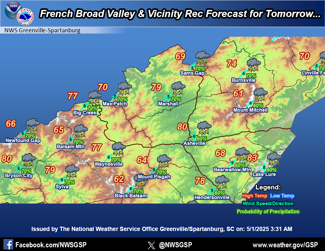
French Broad
Valley & Vicinity |
|||
|
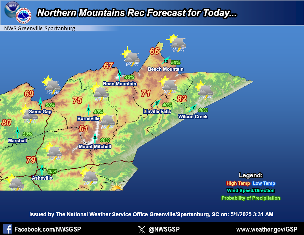
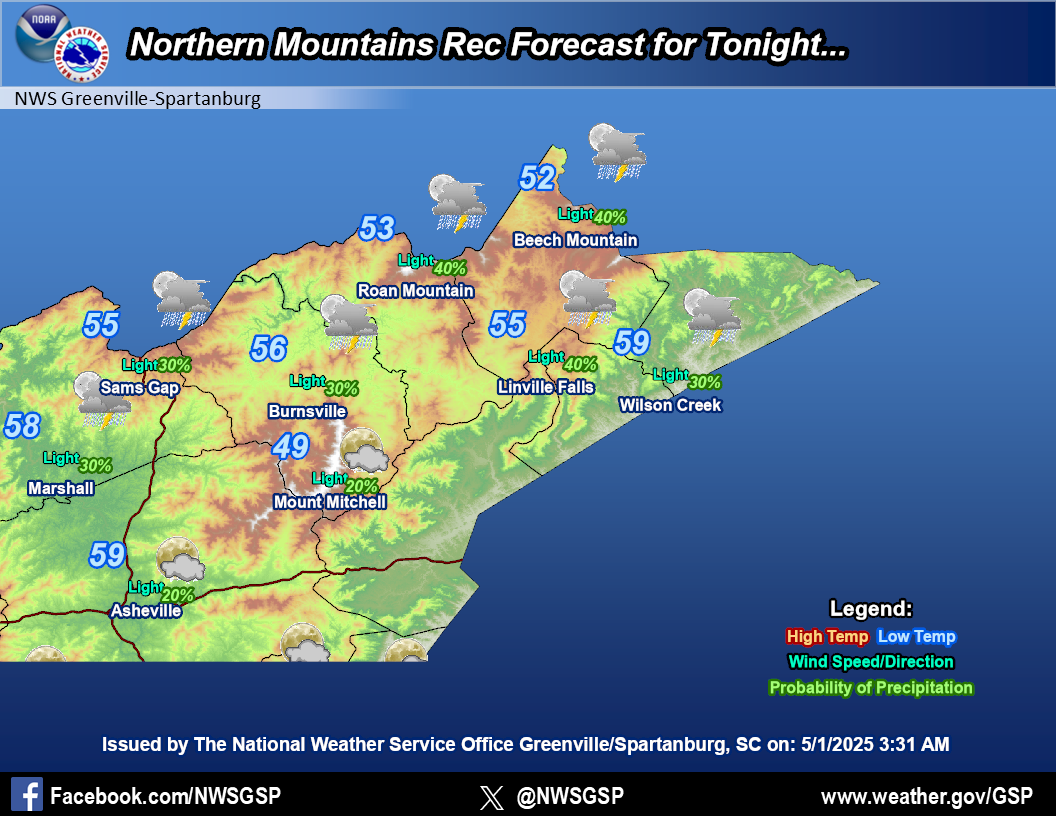
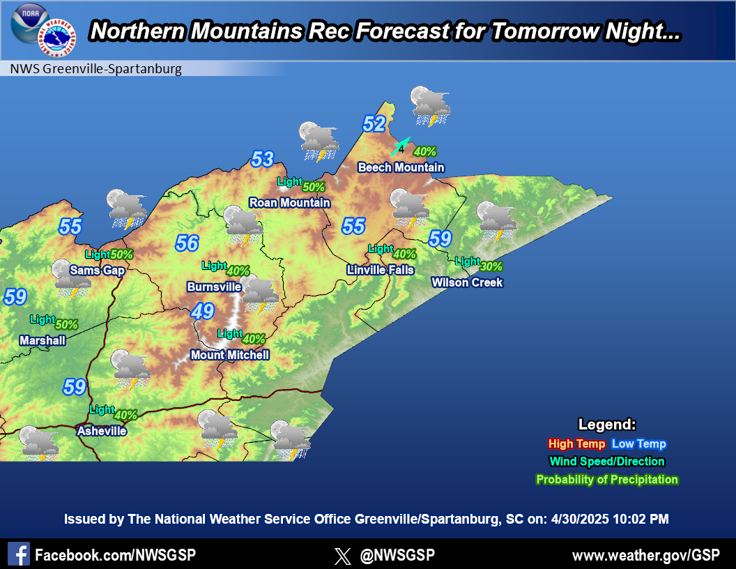
Northern Mountains
|
|||
|
Mountain Weather Observations
|
|
Recreational Forecast
|


 Hourly Weather