
Dangerous and extreme heat will remain across portions of the central U.S. this week, persisting across the mid to lower Mississippi Valley, Gulf Coast, southern Plains and portions of Texas. A heat wave over the Southwest U.S. will peak this weekend. Heavy to excessive rainfall may produce flash flooding from the Delmarva Peninsula north into the Hudson Valley today and tonight. Read More >
| Hazard Type | Watch/Warning Name Criteria |
Advisory Name Criteria |
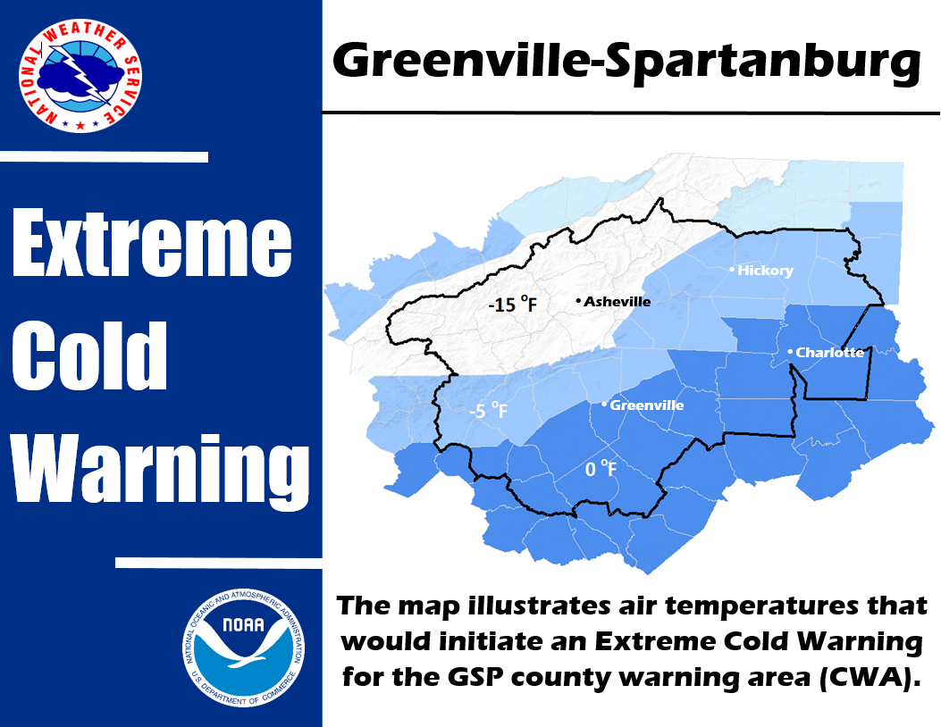
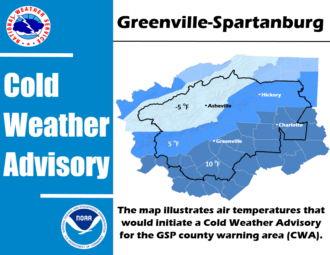
| Cold Weather | ||
| Heat | Excessive Heat Watch/Warning Heat Index 110 or greater |
Heat Advisory Heat Index 105 or greater but less than 110 |
| Wind (Non-Thunderstorm) | High Wind Watch/Warning Sustained winds higher than 40 mph and/or frequent gusts greater than 57 mph |
Wind Advisory |
| Frost Freeze | Freeze Watch/Warning Low temperature of 32 degrees or less during the |
Frost Advisory Scattered to widespread frost is forecast during the Growing Season* |
| Fog | N/A | Dense Fog Advisory Fog causing widespread visibility of 1/4 mile or less |


 Hourly Weather
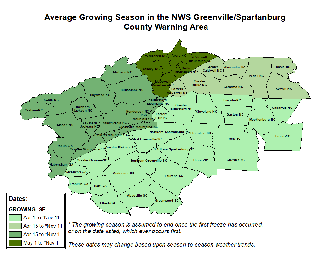