National Weather Service United States Department of Commerce


Learn More By Visiting the Story Map Here:


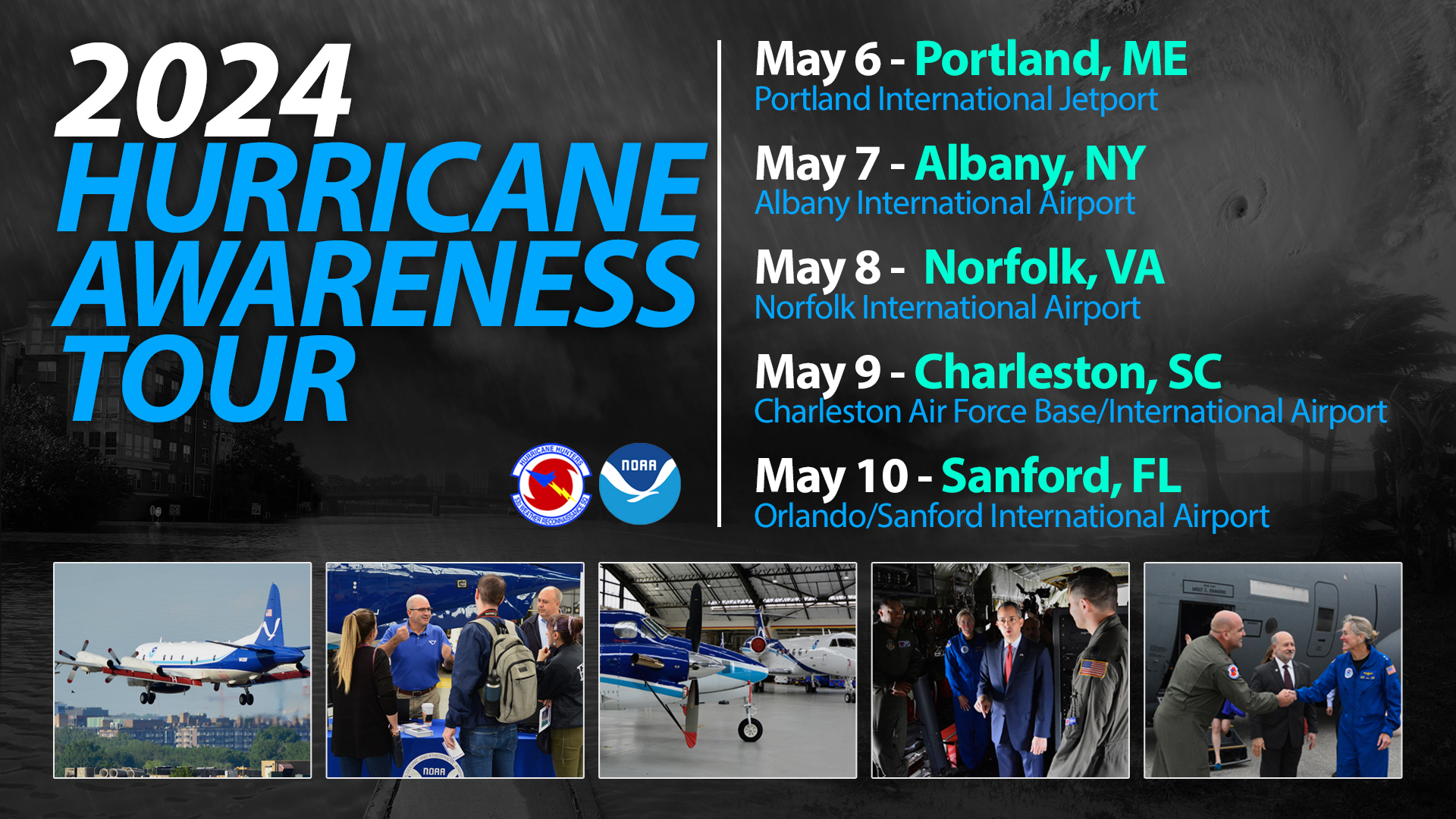
Hurricane experts from the National Oceanic and Atmospheric Administration (NOAA) and the United States Air Force (USAF) will visit five cities this spring, flying aboard a USAF Reserve WC-130J hurricane hunter aircraft and a NOAA WP-3D Orion aircraft. The main purpose of this event is to raise awareness of the impacts from tropical cyclones and the danger of being caught without a personal hurricane plan...and they are kicking off this tour right here in Portland!


Event Information


What: 2024 Hurricane Awareness Tour

Where: Portland Jetport - Portland, ME 

                Westbrook St.

When:  Monday, May 6th, 2024

             1:30 - 4PM (Gates close at 3pm to new entries)

Admission: FREE!
 

Things To Do: 

  • Tour Hurricane Hunter aircraft
  • Meet the pilots & flight crew
  • Speak with hurricane forecasters
  • Meet with local National Weather Service meteorologists
  • Walk through exhibits from various agencies & organizations
  • Learn about weather safety & preparedness

About the Planes

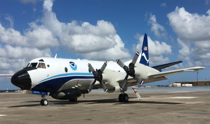
WC-130J - "Hercules"

The WC-130J is a high-wing, medium-range aircraft used in several weather reconnaissance missions throughout the year. This plane is specifically configured to penetrate tropical disturbances and storms, hurricanes and winter storms and is equipped with meteorological instruments and radar to obtain data on the current development, movement, size and intensity of these systems. The WC-130J is the weather data collection platform for the 53rd Weather Reconnaissance Squadron (also known as The Air Force Hurricane Hunters). It carries a minimum crew of five: pilot, co-pilot, navigator, aerial reconnaissance weather officer and weather reconnaissance loadmaster. The crew collects and reports weather data as often as every minute.


WP-3D - "Orion"

The versatile turboprop aircraft is equipped with a variety of scientific instrumentation, radars, and recording systems for both in-situ and remote sensing measurements of the atmosphere, the earth, and its’ environment. Orion aircraft collects low-altitude data to fill gaps in data not available from ground-based radar or satellite imagery.


Other 

There will be a variety of other vehicles displayed during this event:

  • Maine Forest Service Helicopter (dependent on operational needs)
  • USCG Boat (Dependent on Operational Needs)
  • Maine Forest Service Fire Truck
  • State Farm Truck

Schedule

9:15 AM – 9:45 AM    Media Briefing
9:45 AM  – 10:30 AM    Media / VIP USAF Aircraft Tours
10:30 AM  – 1:30 PM    Student Aircraft Tours
1:30 PM - 4:00 PM    Public Tours
3:00 PM    Gates Close to the Public
4:00 PM    Event Closes to the Public


Directions & Parking

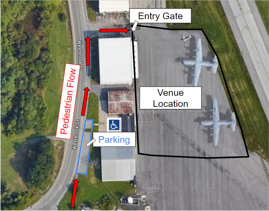
The address of this event is: 1081 Westbrook St., Portland, ME 04102

If you plan on attending, please provide us with how many people are coming in your group and arrival time by going Here!!

***Important Parking Information!***
  • Public Parking is very limited for this event!  Once the free parking lot is full, hourly paid parking is available at the Jetport (first hour is free, $2 dollars per hour after the first hour).  Please car pool if coming with friends.  
  • Event accessibility: A limited number of handicapped parking spaces will be available close to the gate. Non-handicapped parking spots are located approximately 300 to 400 yards from the event. For those who are not able to travel this distance, drop-off at the gate will be permitted but parking in designated handicapped spaces is limited on a first-come, first-served basis to vehicles with a handicapped parking permit.    

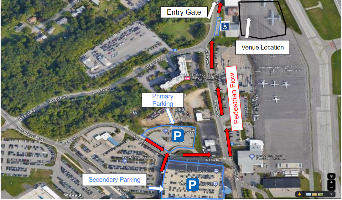
The primary parking location will be the Cell Phone Parking Lot as seen in the image below.  Secondary parking will be the Paid Short Term Parking lot at the Jetport (first hour is free, $2 per hour after). 
We will have signs and helpers directing you where to go as you get near.
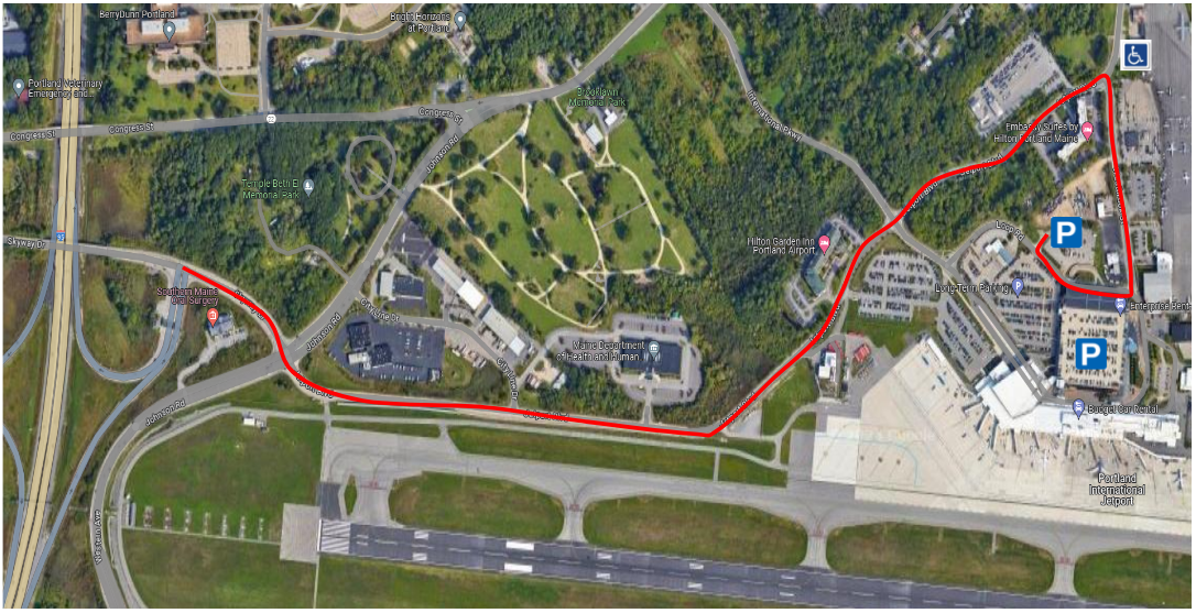
Directions:

  • Take exit 46 off I-95
  • Turn right onto Skyway Drive
  • Continue straight through the light to Jetport Blvd
  • Turn right onto Westbrook St.
  • Turn right onto Loop Rd and turn into the Cell Phone Lot 


Participants


List of Booths:

  • nws Gray Maine

  • Northeast River forecast center

  • noaa nos office for coastal management

  • united states geological survey

  • united states coast guard

  • neracoos

  • gulf of maine research institute

  • fema region 1

  • maine emergency management agency

  • york county emergency management

  • cumerland county emergency management

  • portland emerency management

  • maine geological survey

  • maine forest service

  • FLASH - fEDERAL aLLIANCE FOR SAFE HOMES

  • american red cross


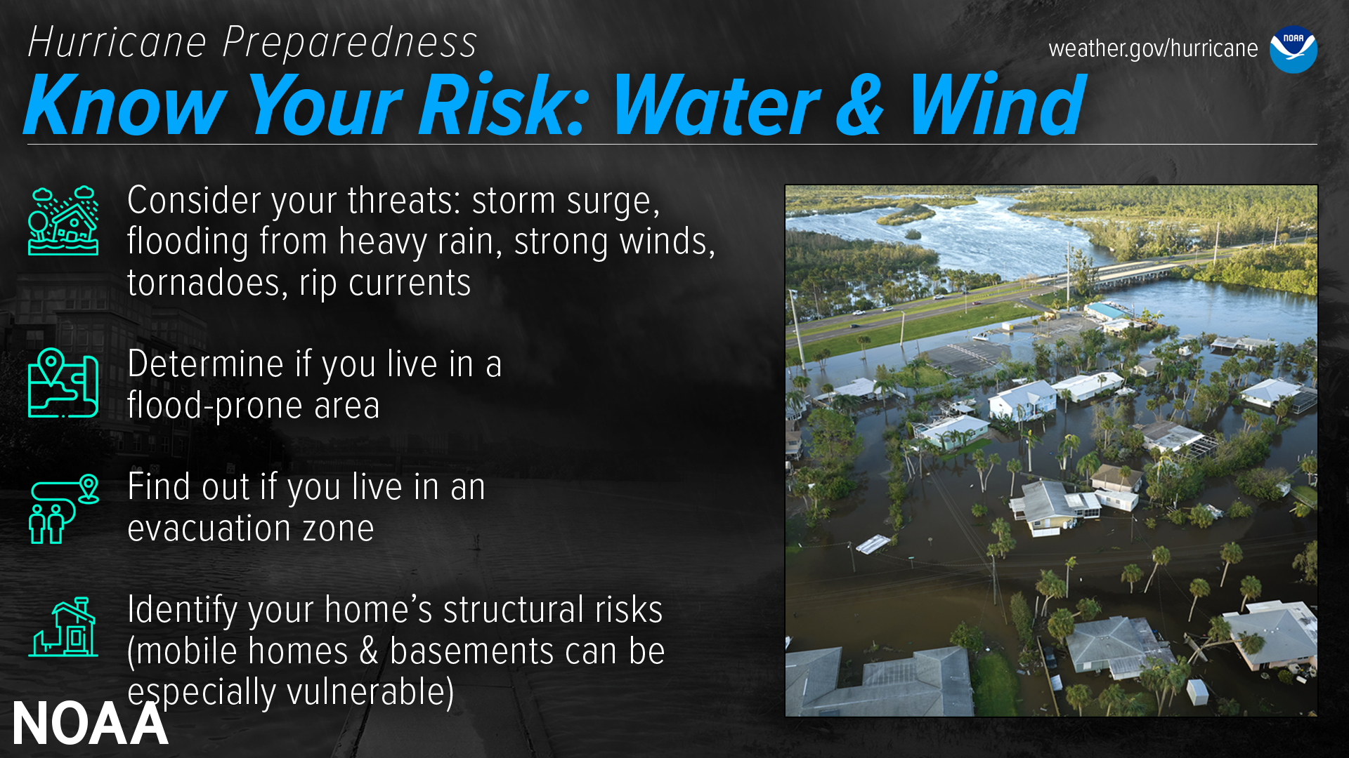
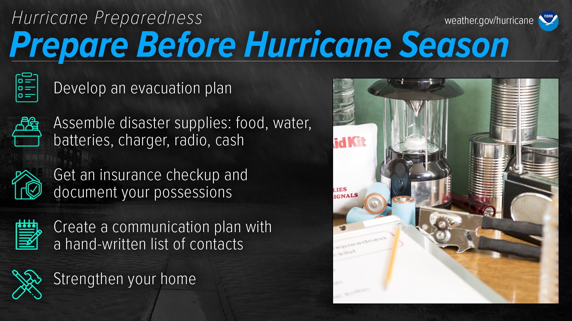
Hurricane Information and Safety

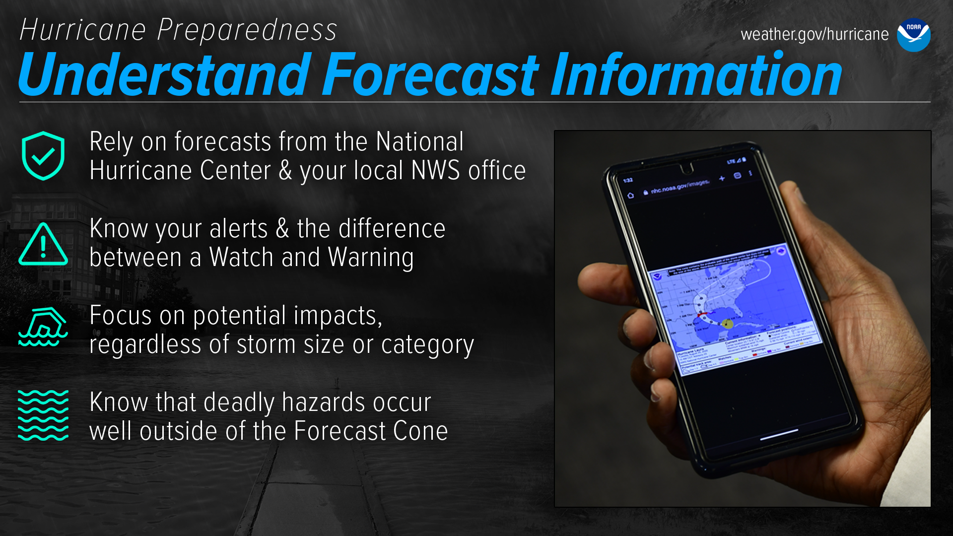
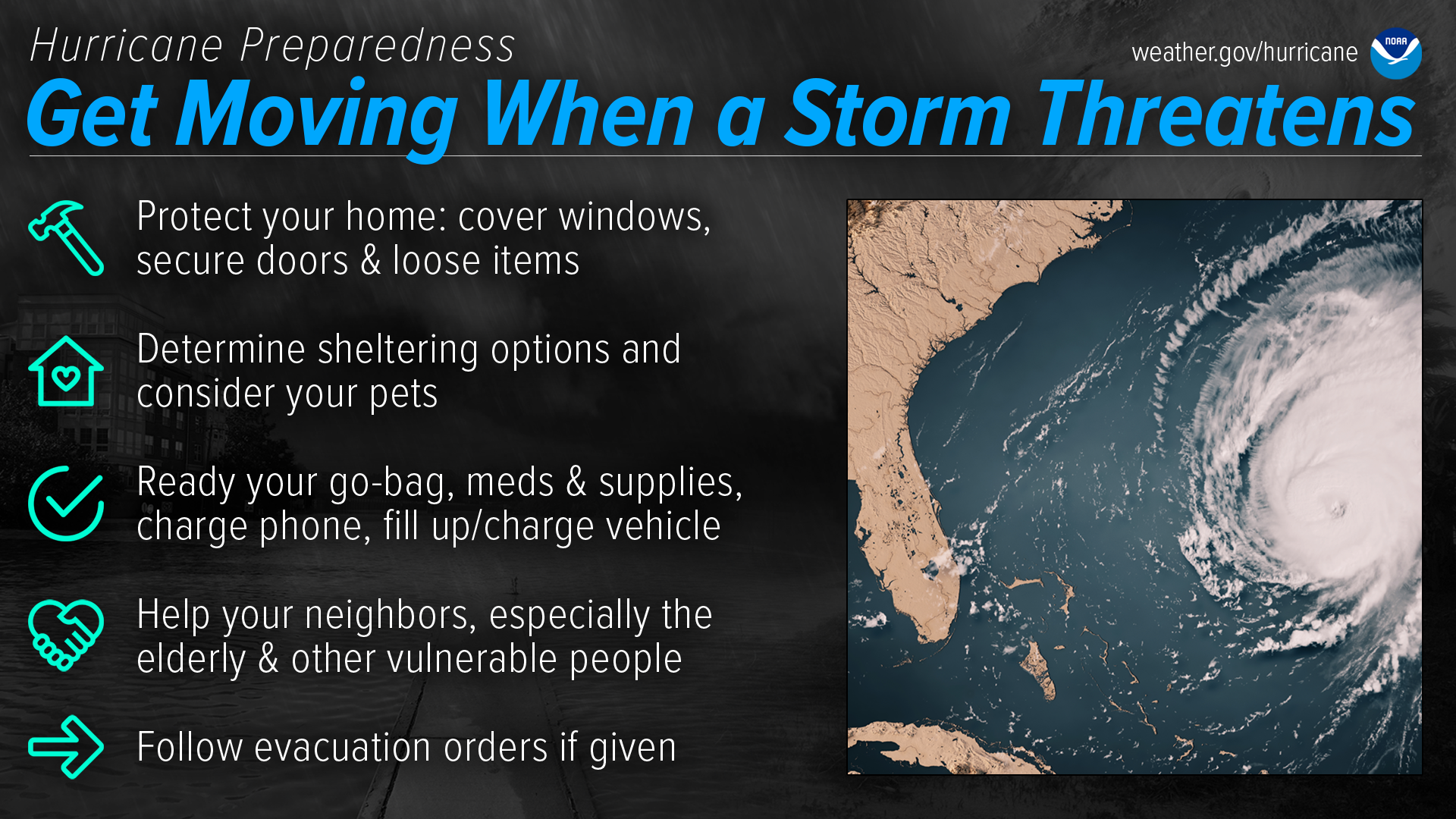
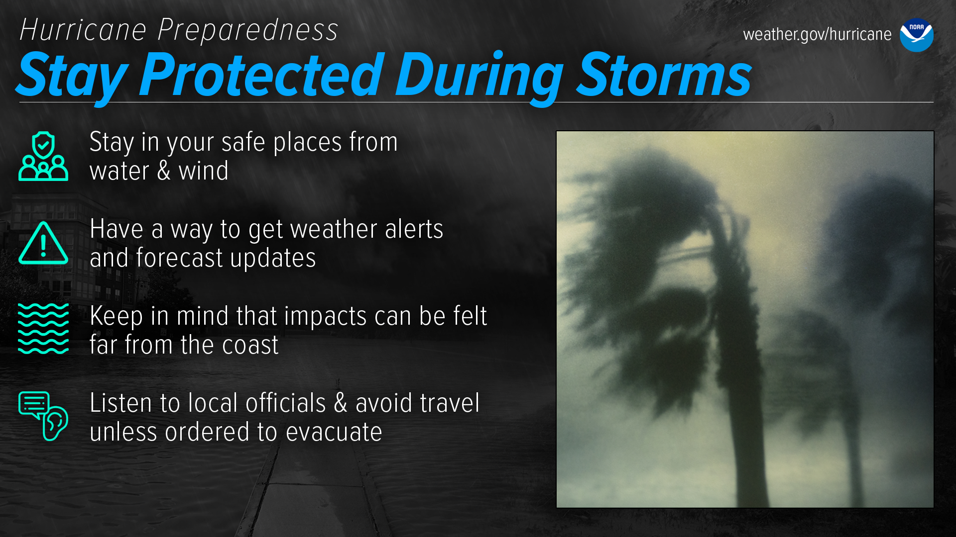
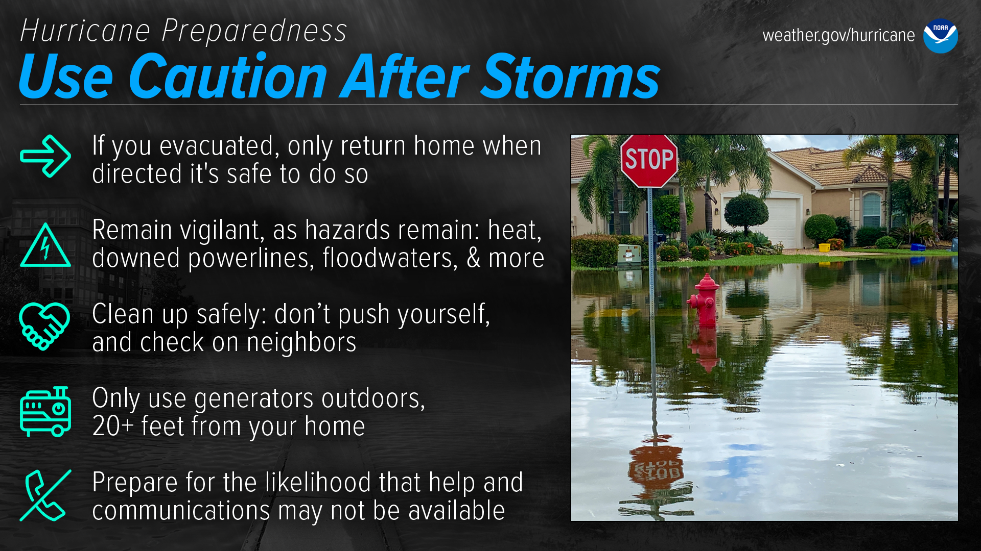
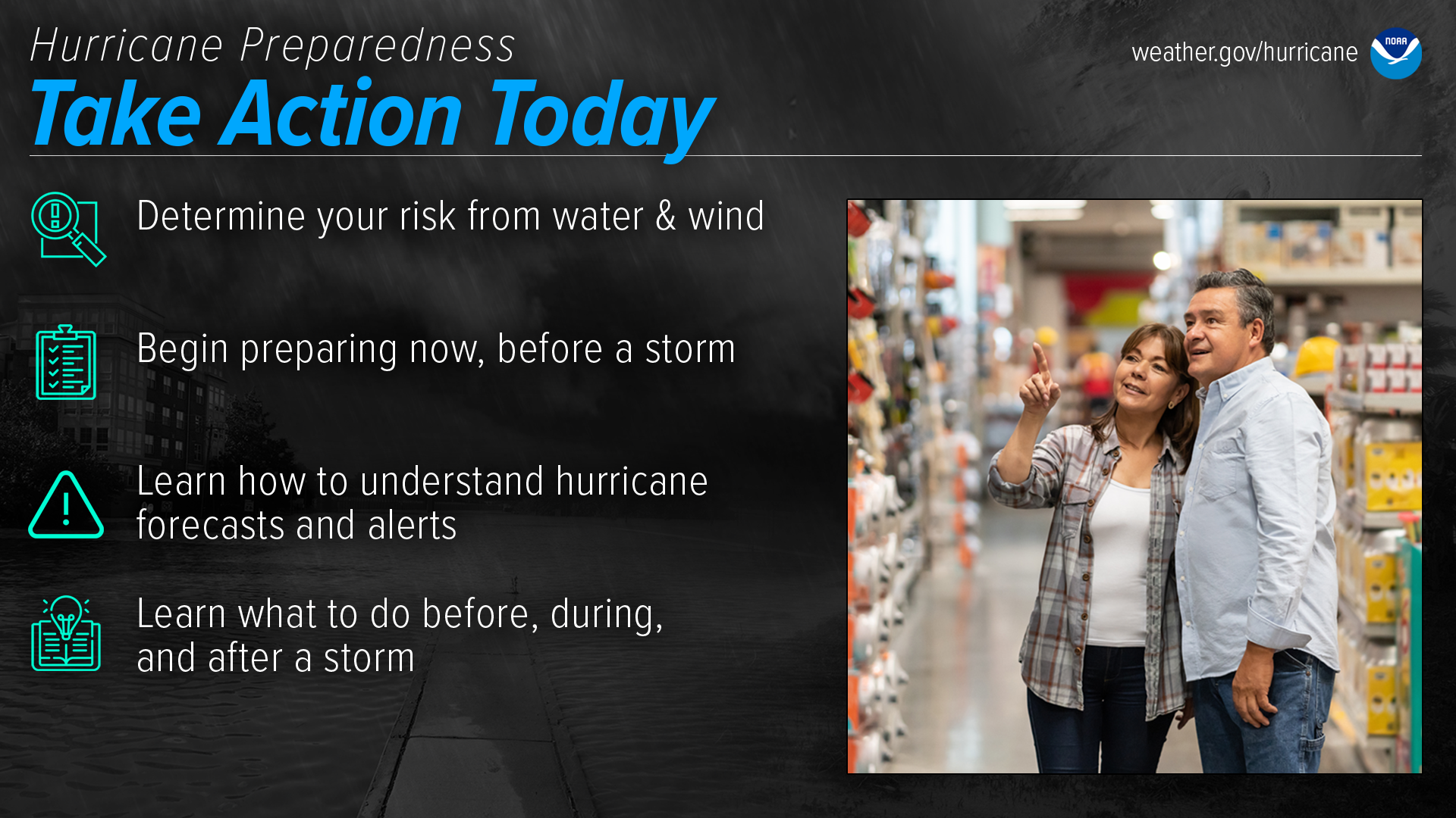
2024 National Hurricane Preparedness Week is May 5-11, 2024

Be ready for hurricane season. Take action TODAY to be better prepared for when the worst happens. Understand your risk from hurricanes, and begin pre-season preparations now. Make sure you understand how to interpret forecasts and alerts, and know what to do before, during, and after a storm.

Hurricane Preparedness - Know Your Risk: Water & Wind. Consider your threats: storm surge, flooding from heavy rain, strong winds, tornadoes, rip currents. Determine if you live in a flood-prone area. Find out if you live in an evacuation zone. Identify your home's structural risk (mobile homes & basements can be especially vulnerable)

Hurricane Preparedness - Prepare Before Hurricane Season. Develop an evacuation plan. Assemble disaster supplies: food, water, batteries, charger, radio, cash. Get an insurance checkup and document your possessions. Create a communication plan with a hand-written list of contacts. Strengthen your home.

Hurricane Preparedness - Understand Forecast Information. Rely on forecasts from the National Hurricane Center and your local NWS office. Know your alerts & the difference between a Watch and Warning. Focus on potential impacts, regardless of storm size or category. Know that deadly hazards occur well outside of the Forecast Cone.

Hurricane Preparedness - Understand Forecast Information. Rely on forecasts from the National Hurricane Center and your local NWS office. Know your alerts & the difference between a Watch and Warning. Focus on potential impacts, regardless of storm size or category. Know that deadly hazards occur well outside of the Forecast Cone.

Hurricane Preparedness - Stay Protected During Storms. Stay in your safe places from water and wind. Have a way to get weather alerts and forecast updates. Keep in mind that impacts can be felt far from the coast. Listen to local officials and avoid travel unless ordered to evacuate.

Hurricane Preparedness - Use Caution After Storms. If you evacuated, only return home when directed that it's safe to do so. Remain vigilant, as hazards remain: heat, downed power lines, floodwaters, and more. Clean up safely: don't push yourself, and check on neighbors. Only use generators outdoors, 20+ feet from your home. Prepare for the likelihood that help and communications may not be available.

Hurricane Preparedness - Take Action Today. Determine your risk from water and wind. Begin preparing now, before a storm. Learn how to understand hurricane forecasts and alerts. Learn what to do before, during, and after a storm.

Links:


Portland is just one stop on the 2024 Hurricane Awareness Tour!

2024 Hurricane Awareness Tour locations

Check out the other locations below:

 
Albany, NY Norfolk, VA Charleston, SC  Orlando, FL
May 7th, 2024 May 8th, 2024 May 9th, 2024 May 10th, 2024