Gray Maine National Weather Service
Marine Zone Expansion to 60 NM Offshore
OVERVIEW
Beginning on or about April 16, 2026, National Weather Service (NWS) Weather Forecast Office (WFO) Gray, ME (GYX) will assume forecast, watch, and warning responsibility for the coastal waters from south of Stonington, ME to the Merrimack River, MA from 25 to 60 Nautical Miles (NM) offshore. Routine forecast services for these waters were previously the responsibility of the Ocean Prediction Center (OPC), with warning responsibility divided between WFO GYX and OPC. This change is part of a regional improvement that will result in all forecasts and warnings for coastal waterways within 60 NM of shore originating from the local WFO across the entire Contiguous United States (CONUS). There will be no change to the current forecast and warning services provided by WFO GYX for coastal waterways within 25 NM of shore.
JUSTIFICATION
The coastal waterways are lifelines of commerce in northern New England, frequented by commercial, recreational, and research vessels year-round. Additionally, fishermen often leave local ports bound for offshore fishing sites. These activities primarily take place within 60 NM of shore, with mariners depending on reliable weather forecasts from the National Weather Service to ensure the safety of themselves and their crew, passengers, and cargo while on the water.
With the redesignation of all forecast and warning responsibility for the coastal waters within 60 NM of shore to the local WFO, users will experience these benefits:
Improved forecast service continuity, with local WFO’s now responsible for issuing routine forecasts and warnings for all marine waters out to 60 NM offshore for the entire CONUS.
Increased number of forecast parameters with temperature, precipitation chances, and weather type among the parameters that are now available for mariners from 25 to 60 NM offshore out to 5 days in the future.
Improved forecast resolution, with point and click forecast capability now enabling mariners to get precise hourly forecasts for specific points (specific fishing location) anywhere within 60 NM of shore out to 5 days in the future.
Expanded suite of short and long-fused watch & warning products to alert mariners to the potential for a variety of hazardous weather conditions.
WFO’s now have the capability to deliver Impact-based Decision Support Services (IDSS) to partners in support of incident response for incidents that occur anywhere within 60 NM of shore. This includes SPOT weather forecasts for ongoing marine incidents.
ZONE CHANGE DESCRIPTIONS

The above graphic shows the previous alignment of marine zones with blue zones being the responsibility of the local WFO.

The above graphic shows the new alignment of marine forecast zones with light and dark blue zones now being the responsibility of the local WFO. All coastal waters to 60 NM offshore from south of Stonington, ME to Merrimack River, MA will now receive forecasts and warnings from NWS GYX.
| AREA | CURRENT ZONE NAME(S) | CURRENT ZONE NUMBER(S) | EXPANDED NEW ZONE NAME(S) | EXPANDED NEW ZONE NUMBER(S) |
| Ocean Waters from Stonington, ME to Port Clyde, ME | Coastal waters from Stonington, ME to Port Clyde, ME out to 25NM |
ANZ150 |
Waters from Stonington, ME to Port Clyde, ME from 25 to 60NM | ANZ180 |
| Ocean Waters from Port Clyde, ME to Cape Elizabeth, ME |
Coastal waters from Port Clyde, ME to Cape Elizabeth, ME out to 25NM |
ANZ152
|
Waters from Port Clyde, ME to Cape Elizabeth, ME from 25 to 60NM | ANZ182 |
| Ocean Waters from Cape Elizabeth, ME to Merrimack River, MA |
Coastal waters from Cape Elizabeth, ME to Merrimack River, MA out to 25NM |
ANZ154 |
Waters from Cape Elizabeth, ME to Merrimack River, MA from 25 to 60NM | ANZ184 |
FORECAST RESOURCES
| Product Name | WMO Header | AWIPS ID |
| Coastal Waters Forecast | FZUS51 | CWFGYX |
| Marine Weather Message | WHUS71 | MWWGYX |
| Special Marine Warning | WHUS51 | SMWGYX |
| Marine Weather Statement | FZUS71 | MWSGYX |
| Watch County Notification | WWUS61 | WCNGYX |
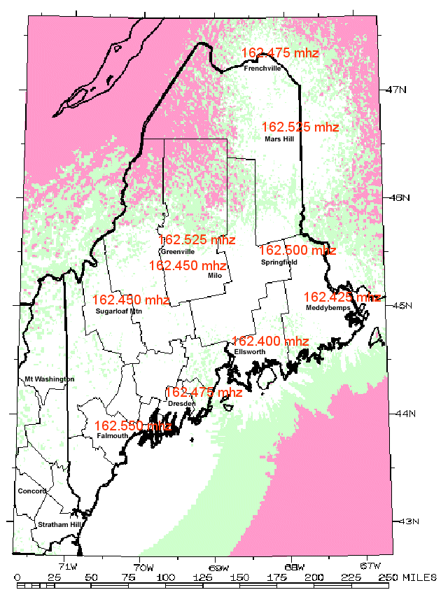
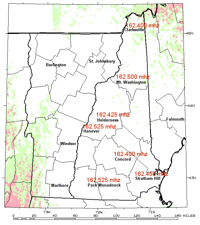
One of the most immediate and reliable ways to receive forecasts, watches, and warnings for the Gulf of Maine is through NOAA Weather Radio. The following table and map outline the best transmitter for coastal water areas:
| AREA | TRANSMMITTER LOCATION | TRANSMITTER FREQUENCY |
| Waters from Stonington, ME to Port Clyde, ME | Wiscasset (Dresden), ME (WSM-60) | 162.475 mhz |
| Waters from Port Clyde, ME to Cape Elizabeth, ME |
Portland (Falmouth), ME (KDO-95) |
162.550 mhz |
| Waters from Cape Elizabeth, ME to Merrimack River, ME | Portsmouth (Deerfield), NH (KZZ-40) | 162.450 mhz |
 |
 |
Routine forecasts and warnings for mariners in New Hampshire waters, along with central and southern Maine waters can be found online at weather.gov/gyx/marine
Alternatively, to get the forecast for a specific point, visit weather.gov/marine/point and click on the map or enter you lat/lon.
You can subscribe to receive marine forecasts/warnings vis the NWS FTP Email option. For details on this service, visit https://www.weather.gov/marine/faq#3.
CONTACT
Please submit any questions or comments to:
Donald Dumont
Warning Coordination Meteorologist
National Weather Service
Gray, Maine
1 Weather Lane
Gray, Maine 04039
207-688-3216 x223
donald.dumont@noaa.gov

