
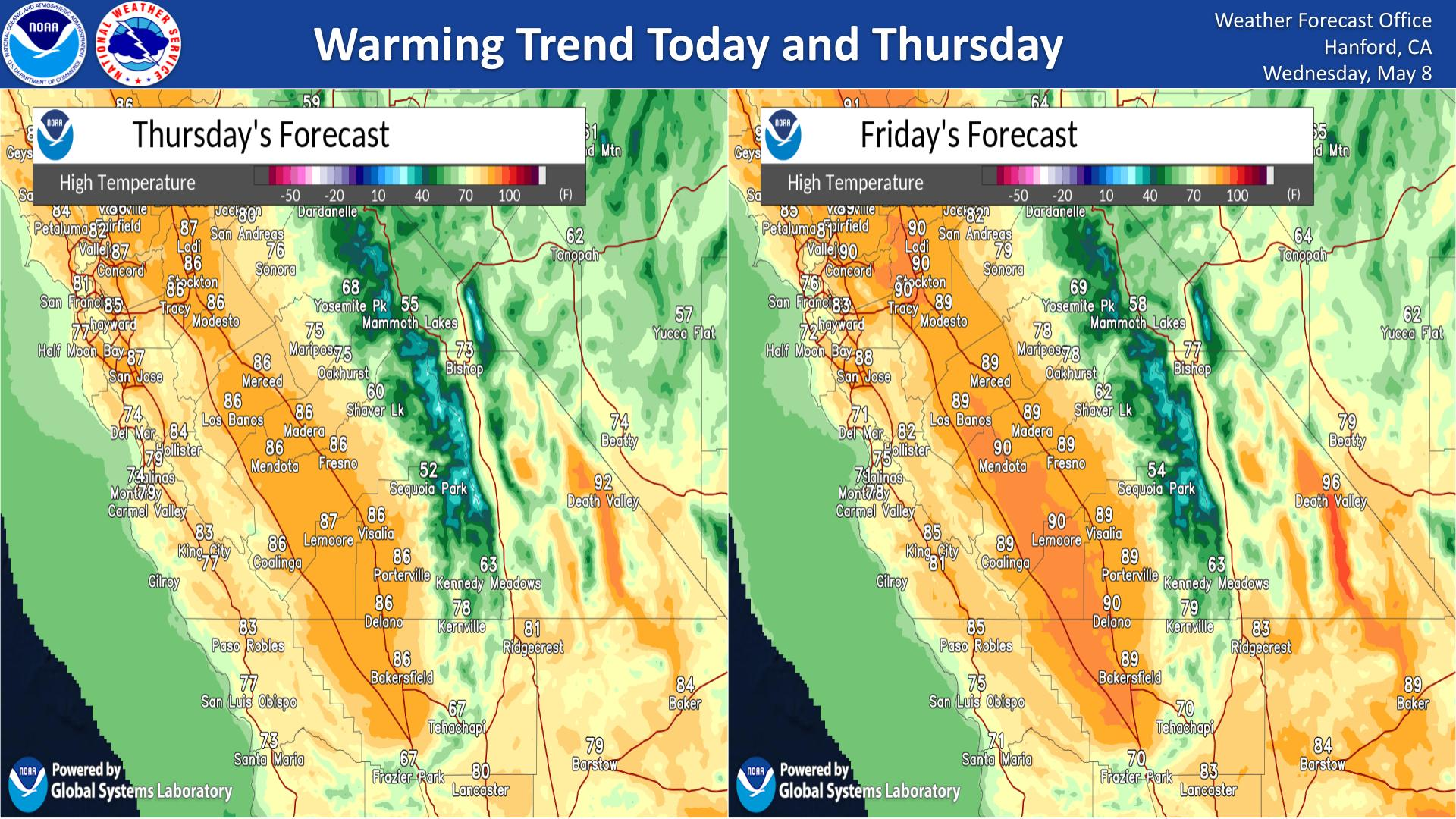
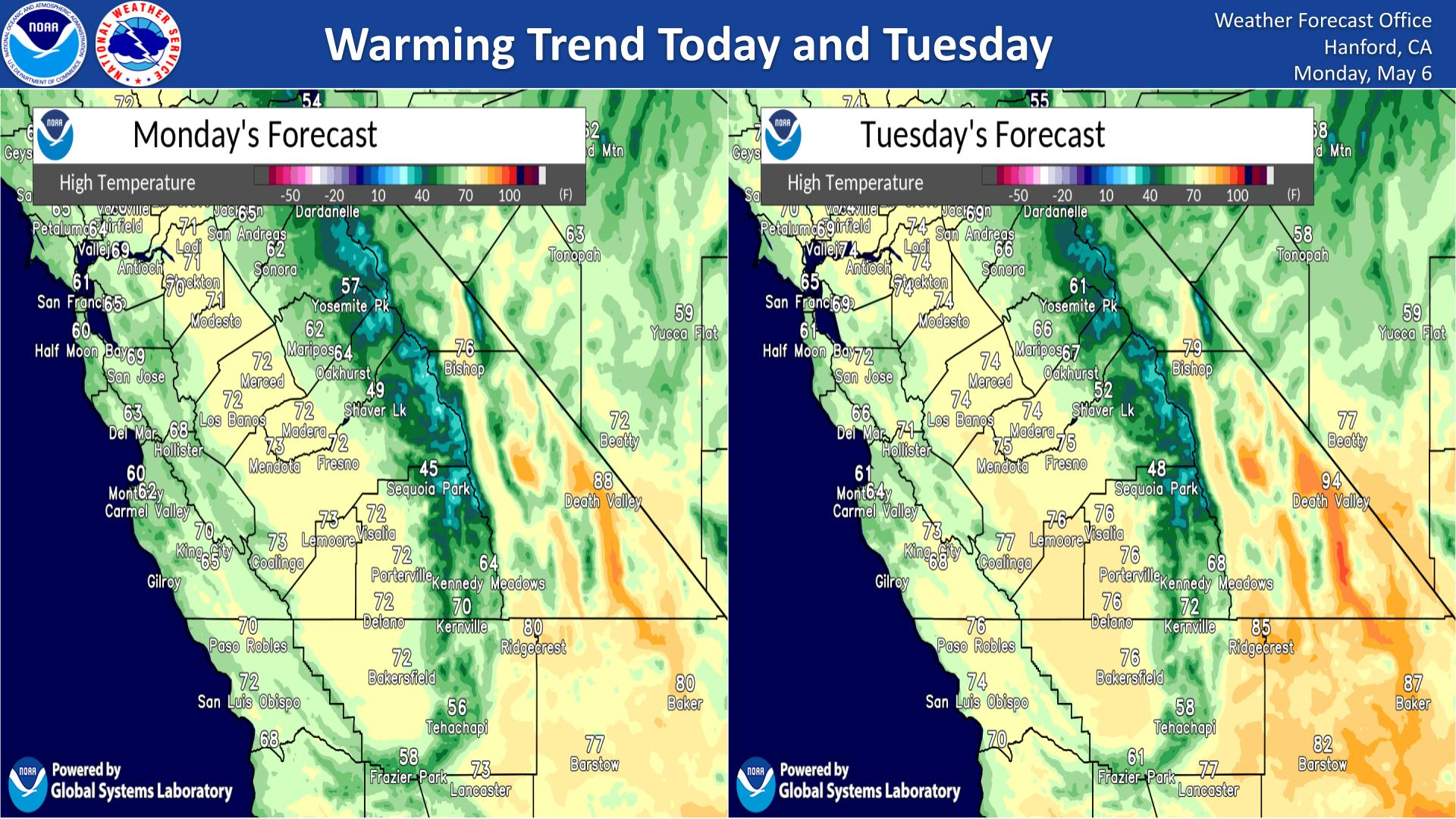
Severe thunderstorms posing a risk for strong gusts and/or large hail are possible across portions of the northern and central Plains, the Lower Missouri to Lower Ohio Valleys, and across the Mid-Atlantic Thursday afternoon and evening. Excessive rainfall may bring flash and urban flooding over the Mid-Mississippi and Ohio Valleys, and Mid-Atlantic on Thursday. Read More >
Last Map Update: Thu, Jul 9, 2026 at 3:34:30 am PDT
|
Text Product Selector (Selected product opens in current window)
|
|


 Hanford Radar
 Edwards Radar
 Recent Temperatures
 Satellite
 Weather Map
 Experimental Fog Severity Index
 Social Media
 Caltrans QuickMap
 Drought
 Weather Stats