
Severe thunderstorms are expected across portions of the central into southern Plains into Sunday, with large hail and severe gusts the main threats. The threat for heavy to excessive rainfall and possible flash flooding will return to the south-central U.S. Friday into this weekend. Read More >
Last Map Update: Fri, May 23, 2025 at 5:42:22 am PDT

|
Text Product Selector (Selected product opens in current window)
|
|


 Hanford Radar
 Edwards Radar
 Recent Temperatures
 Satellite
 Weather Map
 Central Valley and Sierra Nevada Smoke Forecast
 Experimental Fog Severity Index
 Social Media
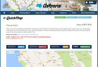 Caltrans QuickMap
 Drought