
Scattered severe storms with wind damage, large hail, and a few tornadoes will be possible this afternoon and evening across much of the Mid Atlantic and Southeast. Heavy rain may cause instances of flash flooding from eastern Kentucky to southern New York. Out west, dangerous heat will develop through Saturday, with record-breaking temperatures expected. Read More >
Last Map Update: Fri, May 30, 2025 at 10:34:31 am PDT


|
Text Product Selector (Selected product opens in current window)
|
|


 Hanford Radar
 Edwards Radar
 Recent Temperatures
 Satellite
 Weather Map
 Central Valley and Sierra Nevada Smoke Forecast
 Experimental Fog Severity Index
 Social Media
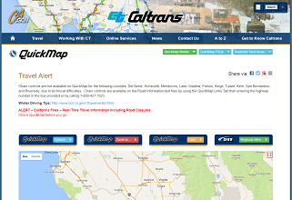 Caltrans QuickMap
 Drought