
Scattered thunderstorms with severe gusts, hail and a tornado risk are possible near a cold front from the Ohio Valley to the Mid-Atlantic tonight. Tropical Storm Bertha is expected to bring tropical storm conditions to portions of the Gulf Coast from the panhandle of Florida into Louisiana through Wednesday. Read More >
|
||||||||||||||||||
Complete Tornado Track Map 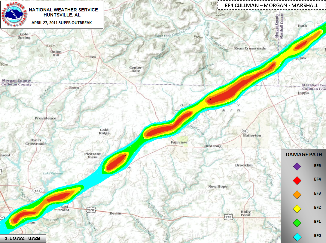 |
||||||||||||||||||
|
Click on the image above to display an experimental contoured map created by Suheiley Lopez (UPRM) dipicting the strength of damage indicators seen along the track during NWS storm surveys. |
||||||||||||||||||
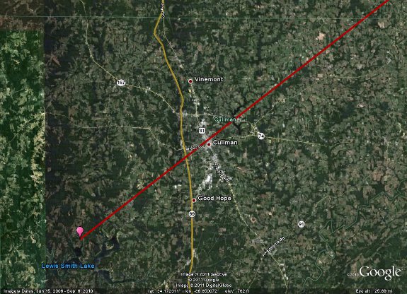
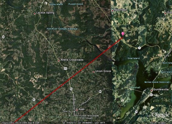
Zoomed in Image of Track From:
|
||||||||||||||||||
|
|
||||||||||||||||||
 |
||||||||||||||||||
|
|
||||||||||||||||||
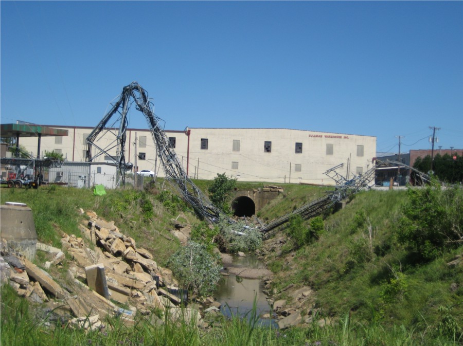
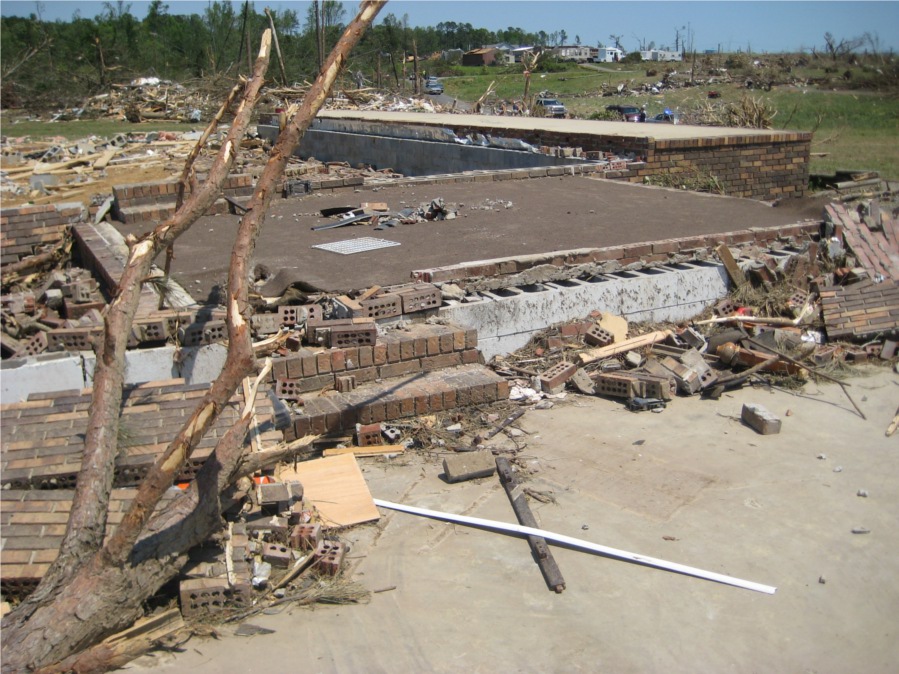
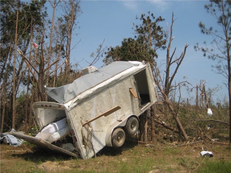
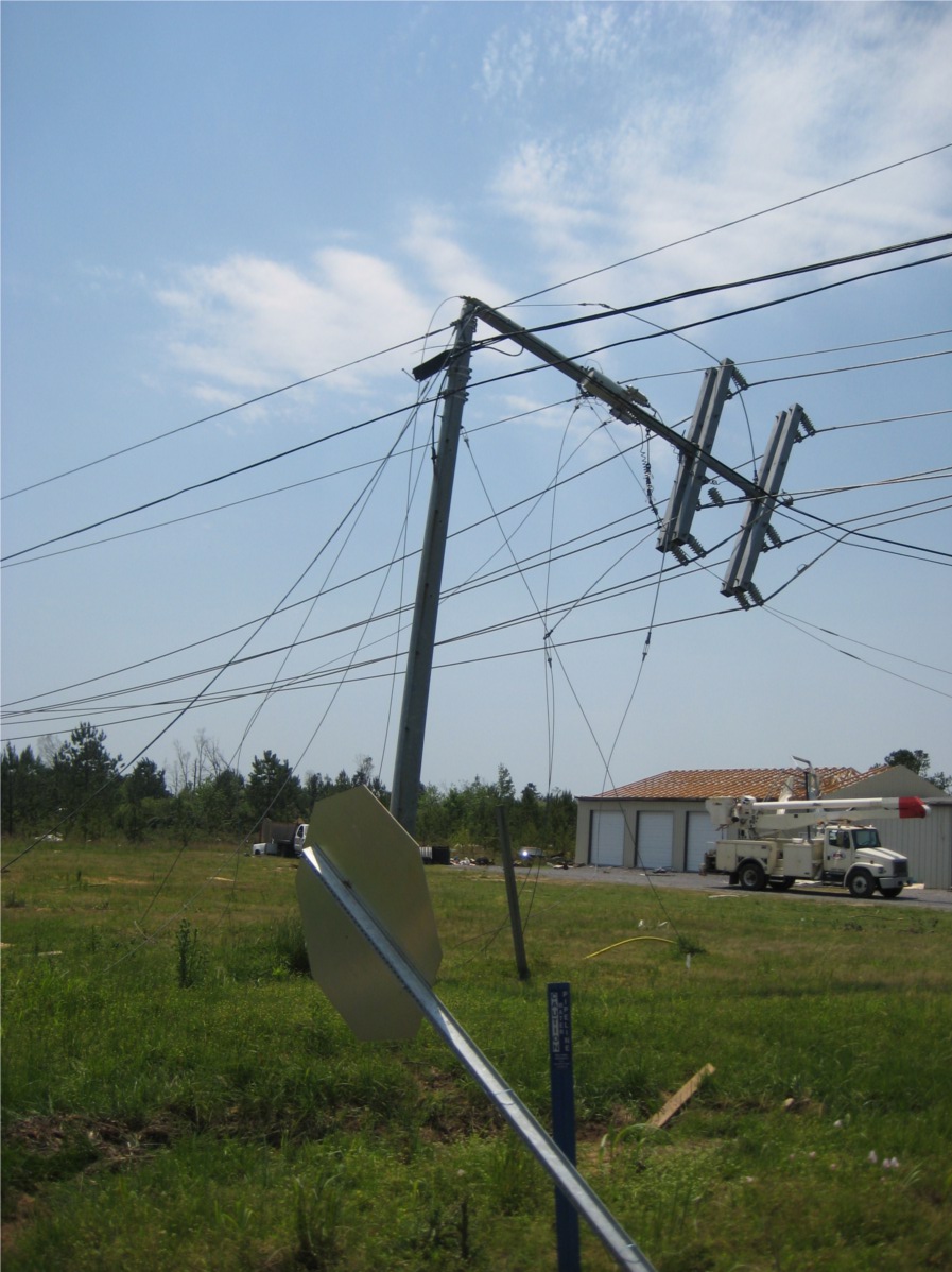
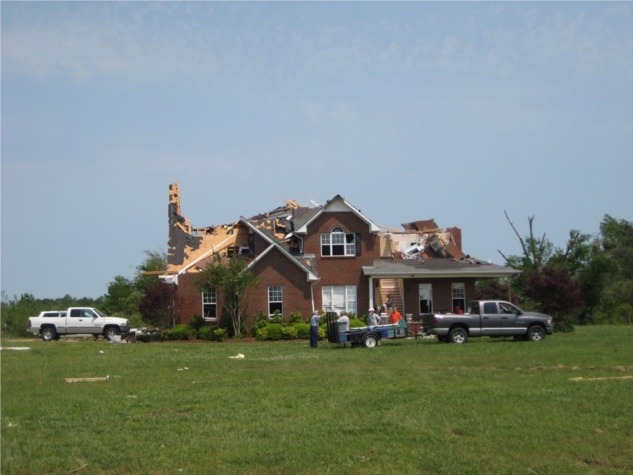
| A long-track tornado went from southwest to northeast across Cullman County before tracking into Morgan and Marshall Counties. Some light damage occurred on the north side of Smith Lake along County Road (CR) 310. More significant damage was observed to the northeast along CR 222 and along CR 436 near Grandview, where significant structural damage occurred to several residences and numerous large trees were snapped. The tornado continued to track northeast toward the town of Cullman where some of the worst damage occurred just northeast of Highways 31 and 278. Several small retail buildings were completely destroyed along with near total destruction of a large church in downtown Cullman. The tornado continued its track northeast, crossing Highway 157 then creating additional damage north of Highway 69 between Simcoe and Pleasant View. Just north of Fairview along CR 1559 and CR 1564, two homes were destroyed with significant portions of the homes not found. Further northeast along CR 1589, major structural damage occurred to several old (early 1900s) homes and numerous hardwood trees were debarked. Outside of the city of Cullman, significant damage occurred in a 1/4-1/2 mile wide corridor north of Highway 69, between Fairview and the Cullman/Morgan county line. The tornado crossed out of Cullman County briefly into extreme southeast Morgan County near the town of Hulaco. Significant damage occurred between Hyatt Bottom Road and Blocker Road, just east of Highway 67. Several cinder block and old construction homes were destroyed and numerous trees were snapped and sheared toward the base. | ||||||||||||||||||
|
||||||||||||||||||
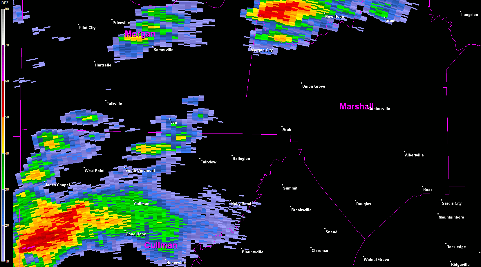
Radar Data
|
||||||||||||||||||
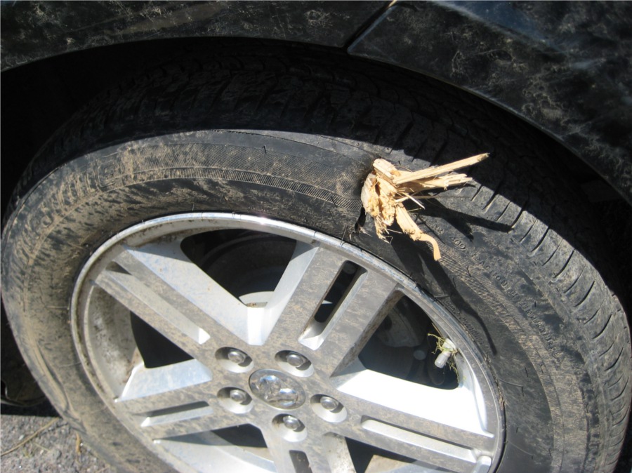
Tornado Damage Photos
|
||||||||||||||||||


 Local Radar
 Weather Map