
A significant heat wave is underway for the Intermountain West, Northern Plains, and Upper Great Lakes, peaking in intensity through midweek and lingering across parts of the Northern Plains and Midwest until this weekend. In southwest Texas, excessive rainfall may bring a risk for potentially life-threatening flash and arroyo flooding through Thursday. Read More >
|
||||||||||||||||
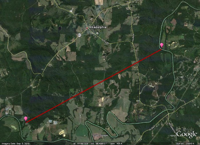
| Complete Tornado Track Map
|
||||||||||||||||
|
Click on the image above to display an experimental contoured map created by Suheiley Lopez (UPRM) dipicting the strength of damage indicators seen along the track during NWS storm surveys.
|
||||||||||||||||
|
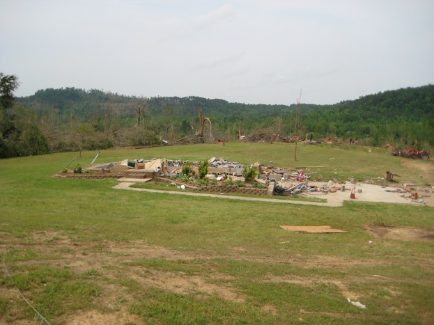
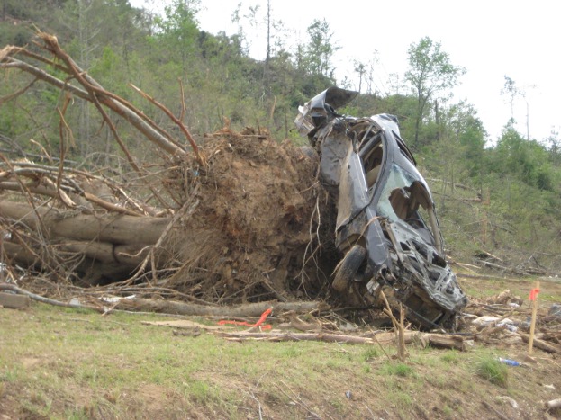
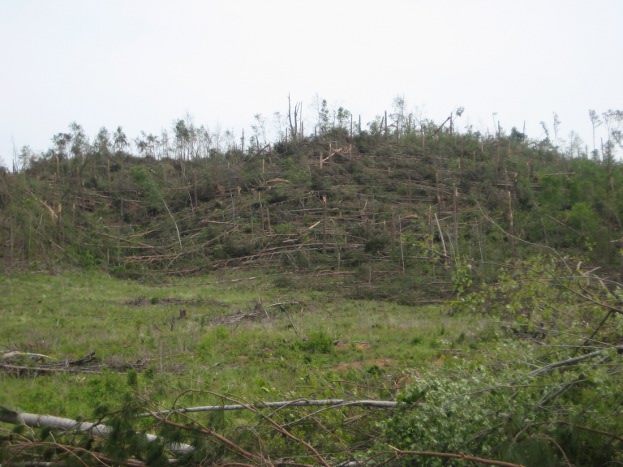
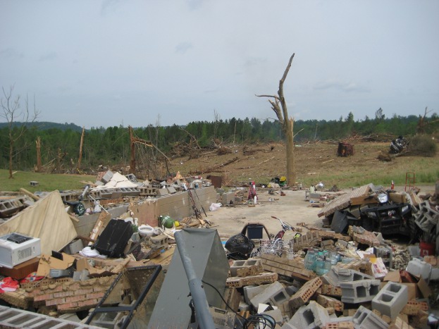
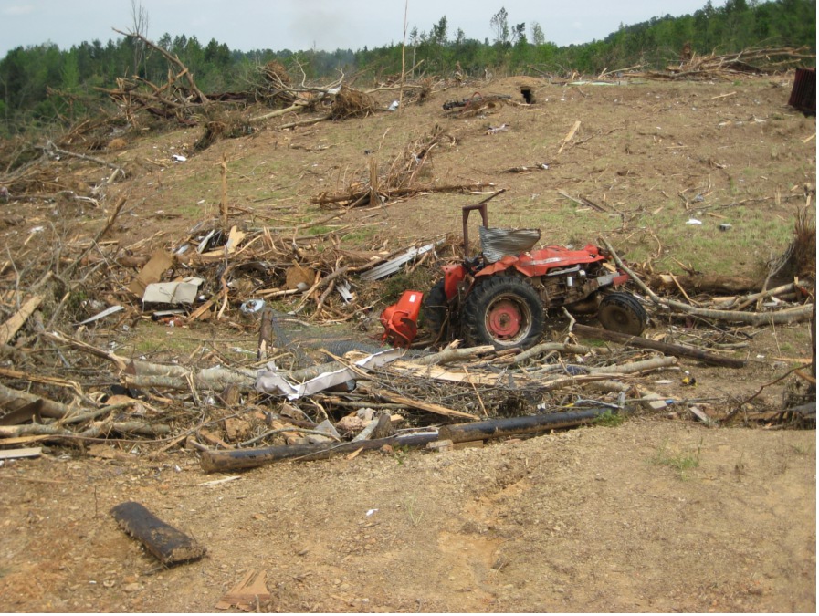
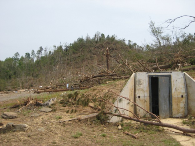
A large tornado tracked into the Huntsville County Warning Area (CWA) across the very southern tip of Cullman County, from about 3 miles southwest of Arkadelphia to just over 2 miles ESE of Arkadelphia. This tornado then tracked out of the Huntsville CWA into Blount County. In Cullman County, a wide swath of pine and hardwood trees was found snapped at the bases or splintered several feet off the ground, with some debarking of trees. South of Hwy 91 along Washington Loop, several homes were damaged or destroyed. A mobile home was obliterated and the frame was found at least 200 yards to the east up a hill. A cinder block home was wiped out, with the contents landing across the road, while the cars nearby were tossed. A truck landed in a nearby hollow at least 50 yards away while a sedan was smashed as it landed about 130 yards away. Farming equipment in a barn was displaced into the hollow, including a hay baler and a tractor. The storm shelter by the residence was partially lifted and damaged. The person inside received minor injuries. Additional homes and buildings nearby were destroyed and only a few trees were left standing or not debarked. The main damage path was fairly well confined, as a well built home just at the edge of the track only sustained minor roof damage. |
||||||||||||||||
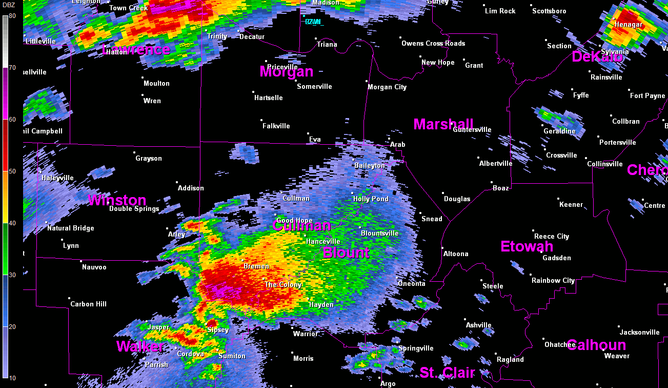
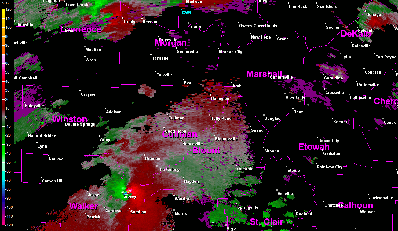
Radar Data
|
||||||||||||||||
Tornado Damage Photos
|
||||||||||||||||


 Local Radar
 Weather Map