
Heat expands across the Desert Southwest, Plains, Mississippi Valley and Midwest into Monday. Fire weather concerns continue for portions of the Intermountain West. Active monsoonal moisture fuels thunderstorms over the Southwest with possible flash flooding. Tropical cyclone Fausto in the Pacific, should weaken as it approaches Hawaii; Dangerous surf, swells and rip currents are expected. Read More >
|
||||||||||||||||
|
The tornado initially touched down northeast of Cullman County Road 1850, snapping numerous hardwood and softwood trees along the path. As the tornado strengthened, it rolled an un-anchored mobile home several times on Feemster Gap Road just over the Marshall County line in Extreme. The mobile home hit a tree and fell back on its side with the roof badly mangled and the frame bent. No injuries were sustained at this location, but residents that had been inside the mobile home took shelter in an underground storm shelter minutes before the tornado hit. Other mobile homes nearby only sustained minor damage to the roofs and flashing underneath. Northeast of this, another mobile home was blown several feet from its original location (as noted by the location of its remaining porch). Behind this mobile home, an unanchored outbuilding was rolled several times and numerous large trees were uprooted and snapped in the field behind the home. |
||||||||||||||||
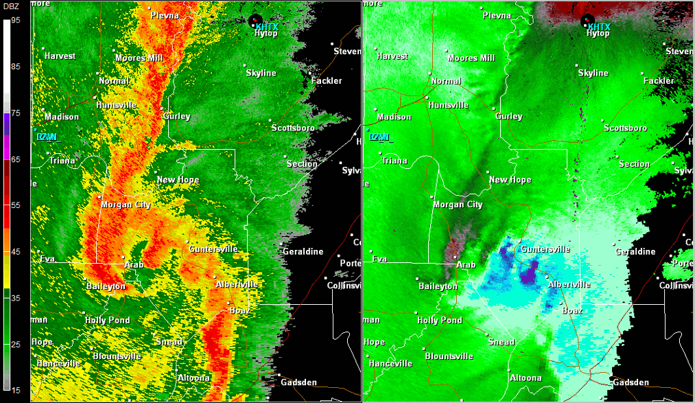
Radar Data |
||||||||||||||||
|
||||||||||||||||


 Local Radar
 Weather Map