
Dangerous and extreme heat will remain across portions of the Central U.S. this week, persisting across the Mid to Lower Mississippi Valleys, Gulf Coast, Southern Plains and portions of Texas. A heat wave over the Southwest will intensify late this week. Severe thunderstorms and flash flooding will spread from the Great Lakes/Ohio Valley to the Mid-Atlantic and Northeast the next few days. Read More >
|
||||||||||||||||
|
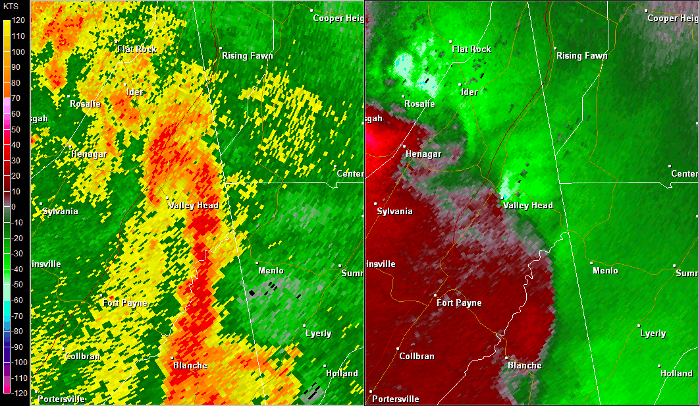
During the morning hours, a tornado touched down just west of CR 89 north of downtown Mentone. The tornado appeared to ride along the ridgeline uprooting many soft and hardwood trees sporadically. The tornado eventually straddled the road further north, partially removing a roof to a residence and snapping numerous trees in this area. This tornado appeared to lift about a mile shy of the Georgia line. It should be noted that the surveyor also found sporadic tree damage further south along CR 89 near and south of downtown Mentone. However, the continuity of the damage was too inconsistent to extend the track further south. |
||||||||||||||||
Radar Data
|
||||||||||||||||


 Local Radar
 Weather Map