
Dangerous and extreme heat will remain across portions of the southern U.S. through the weekend. A heat wave over the Southwest U.S. will intensify this week, peaking and expanding into the Intermountain West and northern High Plains this weekend. Multiple rounds of thunderstorms will produce heavy to excessive rainfall with significant flash flooding across portions of southern New England. Read More >
|
||||||||||||||||
|
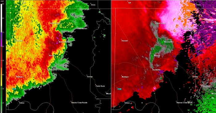
This tornado touched down south of Highway 72 and west of County Road 95 in extreme eastern Limestone County, uprooting large hardwood trees prior to crossing Highway 72 near County Road 99A. The tornado tracked to the east-northeast crossing Capshaw Road near Old Railroad Bed Road, snapping trees and removing roof shingles. The most intense damage occurred between Sam Thomas Road and Wall Triana Highway, producing high-end EF-1 damage with numerous snapped power poles, sheared off hardwood trees, and roof and gutter damage. |
||||||||||||||||
|
1138 AM CDT Image from the Hytop Alabama Doppler Radar
|
||||||||||||||||
|
Loop of storm from the Hytop Alabama Doppler Radar
|
||||||||||||||||


 Local Radar
 Weather Map