
Heat expands across the Desert Southwest, Plains, Mississippi Valley and Midwest into Monday. Fire weather concerns continue for portions of the Intermountain West. Active monsoonal moisture fuels thunderstorms over the Southwest with possible flash flooding. Tropical cyclone Fausto in the Pacific, should weaken as it approaches Hawaii; Dangerous surf, swells and rip currents are expected. Read More >
|
||||||||||||||||
|
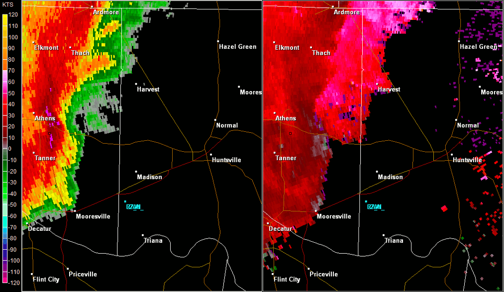
This tornado touched down just west of Old Railroad Bed Road producing some roof and shingle damage. It moved to the east-northeast across the Magnolia Springs neighborhood, producing additional roof and shingle damage. The most intense damage occurred just east of Vine Cliff Drive, along Water Oak Court, where numerous large trees were snapped at their base. This tornado continued to track to the east-northeast snapping trees and producing some light shingle and gutter damage. The tornado dissipated near Nichols Spring Branch. |
||||||||||||||||
Radar Data |
||||||||||||||||
|
||||||||||||||||


 Local Radar
 Weather Map