
Dangerous heat expands across the Desert Southwest, Plains, Mississippi Valley and Midwest. Critical fire weather for portions of the Intermountain West. Risk for severe thunderstorms and flash flooding across the Upper Midwest/Great Lakes, Ohio Valley, and portions of the mid-Atlantic. Active monsoonal moisture fuels thunderstorms over the Southwest. Hurricane Fausto in the Pacific, should weaken Read More >
|
||||||||||||||||
|
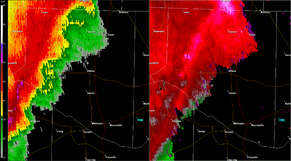
This tornado touched down near the intersection of County Road (CR) 24 and Batts Road around 11:15 AM CDT while embedded in a larger region of straight-line wind damage associated with a bow echo (line of storms). Numerous trees were downed and witnesses indicated a funnel that descended and lifted several times along the surveyed damage path. The tornado continued eastward moving parallel to Snake Road and CR 24, where a concentrated region of numerous large trees were uprooted and snapped. Several houses had shingles removed and damage to gutters and roof awnings in this area. The most notable damage occurred north of CR 24, between Zehner Road and Blackburn Road. The concentrated damage associated with this tornado dissipated near Brownsferry Road as a secondary circulation developed to the south of the tornado. |
||||||||||||||||
Radar Data |
||||||||||||||||
|
||||||||||||||||


 Local Radar
 Weather Map