
Dangerous heat expands across the Desert Southwest, Plains, Mississippi Valley and Midwest. Critical fire weather for portions of the Intermountain West. Risk for severe thunderstorms and flash flooding across the Upper Midwest/Great Lakes, Ohio Valley, and portions of the mid-Atlantic. Active monsoonal moisture fuels thunderstorms over the Southwest. Hurricane Fausto in the Pacific, should weaken Read More >
|
||||||||||||||||
|
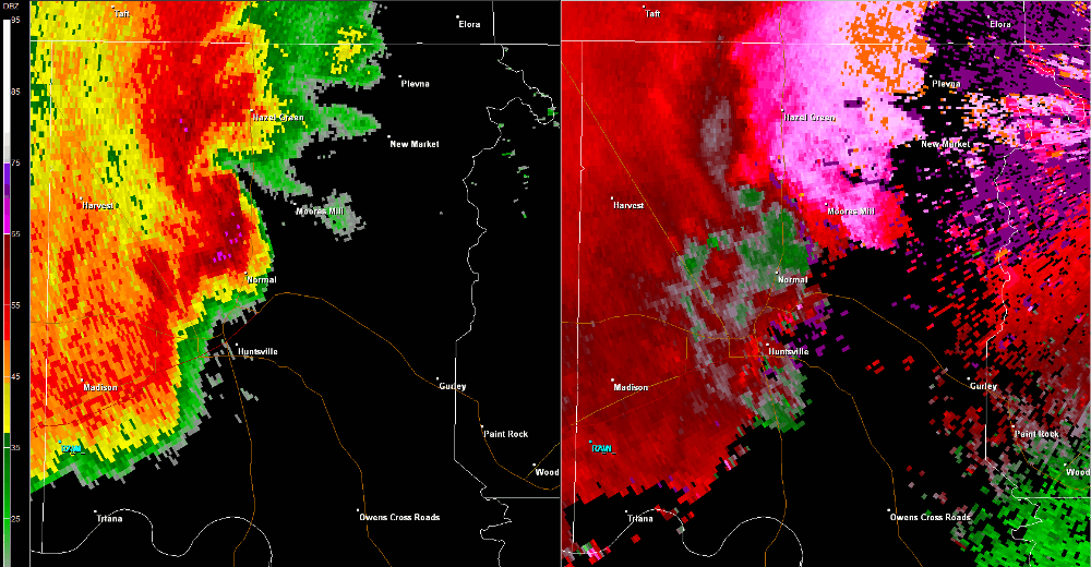
This tornado formed in association with a secondary circulation that developed a few miles south of a pre-existing tornado. The second tornado touched down west of the intersection of Huntsville Brownsferry Road and Neely Road, and moved east-northeast before dissipating near Tanner. This weak/brief tornado primarily uprooted trees and caused damage to signage near Tanner High School. |
||||||||||||||||
Radar Data |
||||||||||||||||
|
||||||||||||||||


 Local Radar
 Weather Map