
Dangerous and extreme heat will remain across portions of the Central U.S. this week, persisting across the Mid to Lower Mississippi Valleys, Gulf Coast, Southern Plains and portions of Texas. A heat wave over the Southwest will intensify late this week. Severe thunderstorms and flash flooding will spread from the Great Lakes/Ohio Valley to the Mid-Atlantic and Northeast the next few days. Read More >
|
||||||||||||||||
|
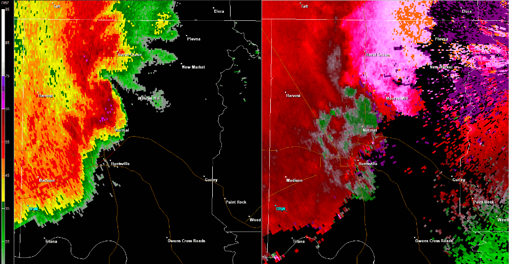
This tornado touched down north of Rube Robinson Road just east of Macon Lane around 11:55 AM CDT while embedded within a larger region of straight-line wind damage associated with a bow echo (line of severe thunderstorms). Numerous trees were downed with many hardwood trees snapped and sheared along its track near Buckhorn High School. The tornado tracked east-northeast across Winchester Road shearing off the top half of numerous hardwood trees before dissipating along the upslope portion of Lewis Mountain. |
||||||||||||||||
Radar Data |
||||||||||||||||
|
||||||||||||||||


 Local Radar
 Weather Map