
Heat expands across the Desert Southwest, Plains, Mississippi Valley and Midwest into Monday. Fire weather concerns continue for portions of the Intermountain West. Active monsoonal moisture fuels thunderstorms over the Southwest with possible flash flooding. Tropical cyclone Fausto in the Pacific, should weaken as it approaches Hawaii; Dangerous surf, swells and rip currents are expected. Read More >
|
||||||||||||||||
|
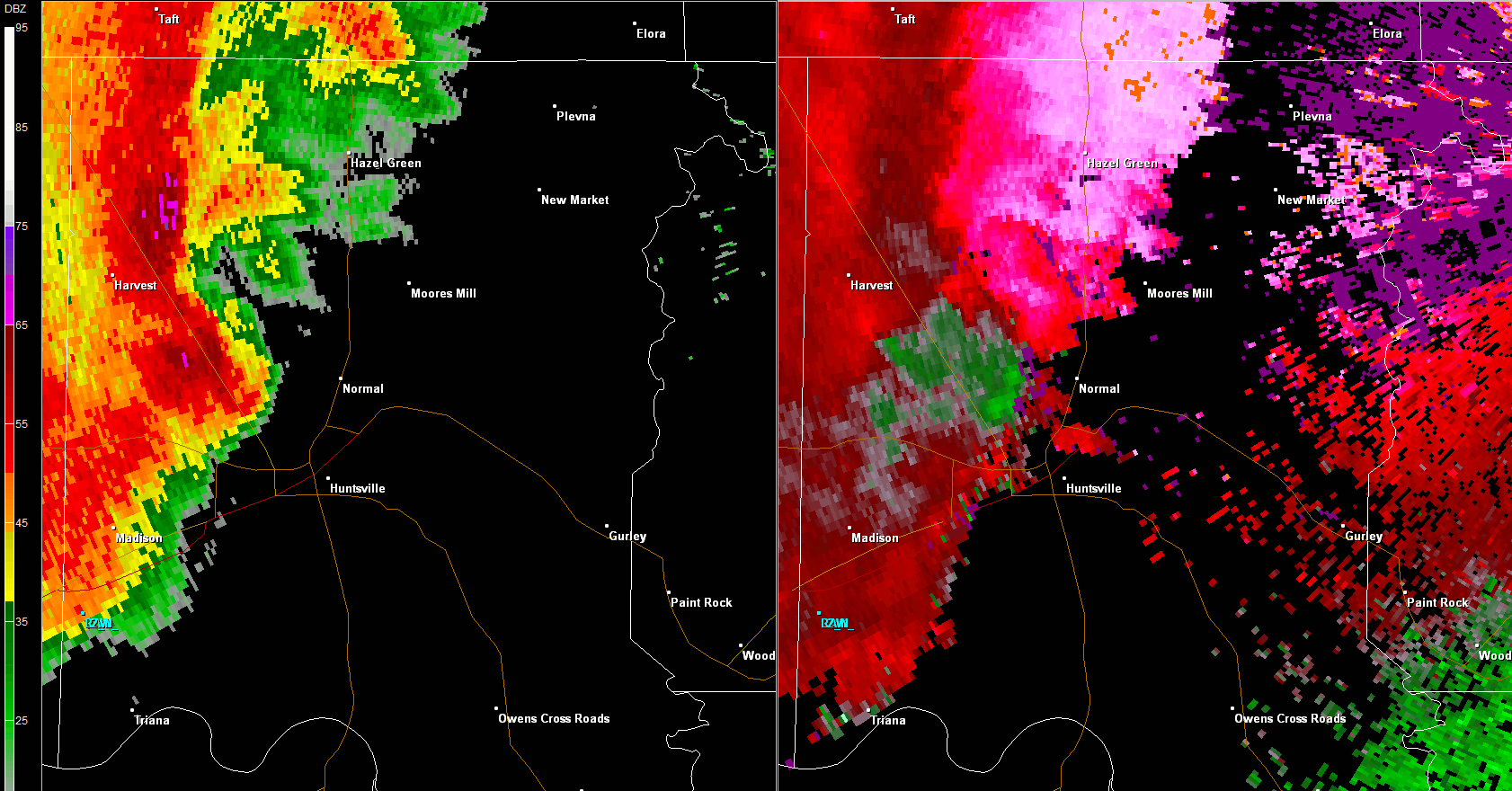
This tornado touched down along the downslope portion of Drake Mountain near the intersection of Pulaski Pike and Cedar Point Drive. A concentrated area of damage consisting of snapped hardwood trees, roof and gutter damage was seen along Cedar Point Drive and Green Meadow Road. Meanwhile, less significant damage was noted along a ridgeline that extended away from Wade Mountain. Another concentrated area of damage that consisted of tree and roof damage was seen along the downslope portion of Smithers Mountain in the Mount Charron Estates and Valley View Estates neighborhoods. The tornado continued east-northeast with the most notable EF-1 damage occurring along Moores Mill Road north of Winchester Road where numerous hardwood trees were snapped and/or sheared off with a convergent damage/debris pattern. Significant tree and roof damage also was noted along Henson Drive, Trailwood Drive, and Bradford Lane before the tornado dissipated near Briar Fork Waterway. |
||||||||||||||||
Radar Data |
||||||||||||||||
|
||||||||||||||||


 Local Radar
 Weather Map