
Numerous severe thunderstorms are expected across a broad region from the Ohio Valley to the Mid-Atlantic and Northeast States today into tonight. Swaths of damaging wind gusts are expected and some tornadoes are possible. Bertha is expected to bring tropical storm conditions to portions of the Gulf Coast from the Florida Panhandle westward to southeastern Louisiana later today and Wednesday. Read More >
|
||||||||||||||||
|
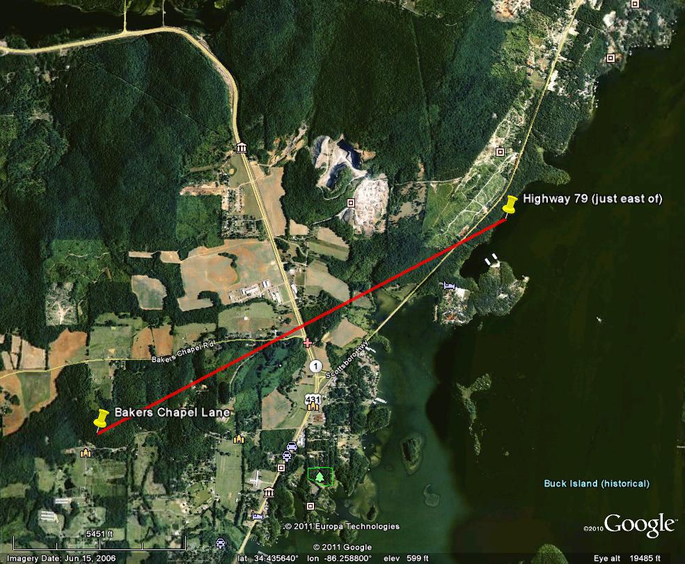
This weak tornado briefly touched down near Bakers Chapel Lane, just south of Bakers Chapel Road. The most significant damage was an area of uprooted trees along Bakers Chapel Road just west of Highway 431/1. The tornado continued northeast and crossed Highway 79 where a few tops of trees were snapped. Beyond this point, there was no other physical evidence of damage as the circulation quickly moved over Guntersville Lake, north of Newman Estate Road. |
||||||||||||||||
|
||||||||||||||||


 Local Radar
 Weather Map