
Heat expands across the Desert Southwest, Plains, Mississippi Valley and Midwest into Monday. Fire weather concerns continue for portions of the Intermountain West. Active monsoonal moisture fuels thunderstorms over the Southwest with possible flash flooding. Tropical cyclone Fausto in the Pacific, should weaken as it approaches Hawaii; Dangerous surf, swells and rip currents are expected. Read More >
|
||||||||||||||||
|
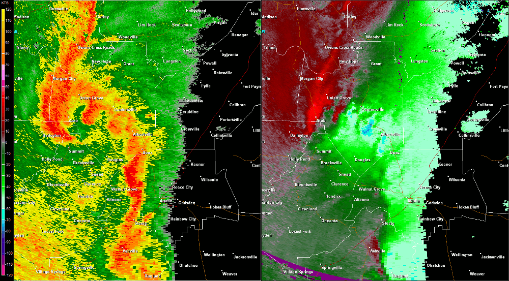
The second of three tornadoes found just south of Guntersville in central Marshall County initially touched down near the intersection of Section Line Road and Beck Road in the Lattiwood community. From there, the tornado moved northeast along Oneonta Cutoff Road and eventually crossed Highway 205. The tornado snapped numerous hardwood and softwood trees along the path and caused damage to homes as trees fell on residences. Power poles were snapped as well. Additional tree damage in a convergent pattern was found northeast of Highway 205 near the intersection of Brashers Chapel Road and Wyeth Mountain Road. Here, several barns were completely destroyed and numerous outbuildings had most of the tin removed from the roof. No further damage was found northeast of Wyeth Mountain Road where the barns were destroyed as the tornado lifted. |
||||||||||||||||
Radar Data |
||||||||||||||||
|
||||||||||||||||


 Local Radar
 Weather Map