
Scattered strong to severe thunderstorms may pose a risk for damaging wind gusts over the Carolinas, southeast Virginia, and the Tennessee Valley Sunday afternoon then the northern Plains from late afternoon into Sunday night. Monsoonal thunderstorms may cause locally considerable flash, urban, and small stream flooding in the Southwest U.S. the next few days. Read More >
|
||||||||||||||||
|
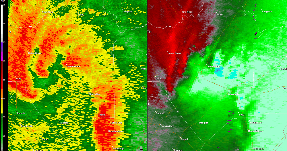
The tornado briefly touched down on Crest Hill Road off of Cathedral Caverns Highway on the south side of Grant Mountain. As the tornado skipped across the short path, several trees were snapped on Crest Hill Road. As it skipped northeast, two very large hardwood trees were snapped and uprooted on Edmonds Road. Minor roof damage was sustained to a house there, but had been repaired by the time the survey was conducted. The tornado lifted shortly thereafter and no additional damage was found northeast of this location. |
||||||||||||||||
Radar Data |
||||||||||||||||
|
||||||||||||||||


 Local Radar
 Weather Map