|
||||||||||||||||
|
||||||||||||||||
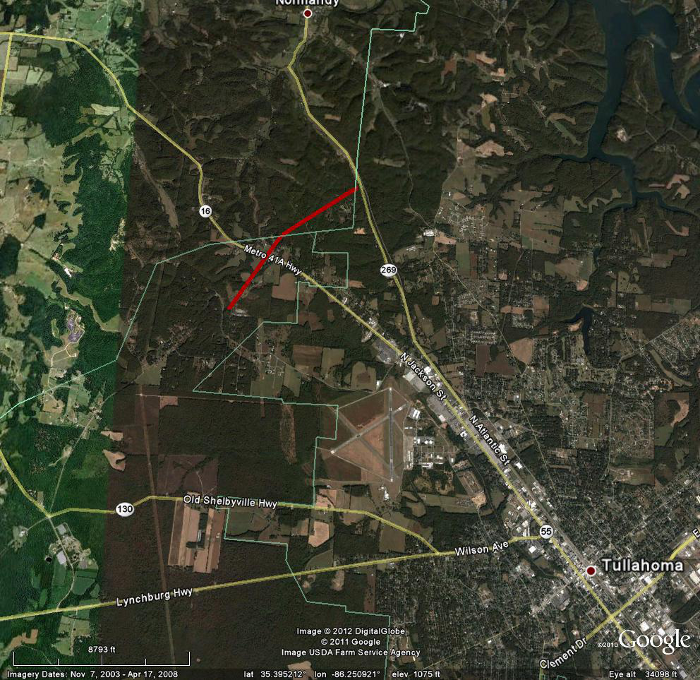
| This tornado was part of the same storm complex that produced a longer track EF-2 across much of Lincoln and part of southwest Moore county earlier in the morning. A tornado of EF-2 intensity produced peak winds speeds up to 115 mph. The tornado touched down along Motlow College Road just southwest of U.S. Highway 41A. The tornado destroyed at least one mobile home on Starbow Lane, rolled others off their foundations, and snapped and uprooted several trees. The tornado also damaged a church on Carr Creek Road. The tornado continued it's path into Bedford County. As the tornado briefly crossed into Bedford County before lifting, it deceased in strength. It entered Bedford County as an EF1 tornado with maximum winds 90 to 100 mph around 615 am in extreme southeast Bedford County. Damage was centered along Magnolia Lane and Winding Way Road. | ||||||||||||||||



 Local Radar
 Weather Map
 NWS Huntsville SitRep
 Follow us on X
 Follow us on Facebook
 Follow us on YouTube
 HUN RSS Feed