
Heat expands across the Desert Southwest, Plains, Mississippi Valley and Midwest into Monday. Fire weather concerns continue for portions of the Intermountain West. Active monsoonal moisture fuels thunderstorms over the Southwest with possible flash flooding. Tropical cyclone Fausto in the Pacific, should weaken as it approaches Hawaii; Dangerous surf, swells and rip currents are expected. Read More >
Huntsville, AL
Weather Forecast Office
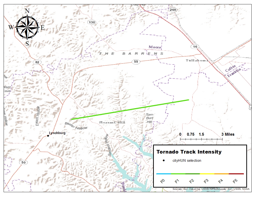
| Tornado Track: Just east of Lynchburg (Moore County, TN) to Center Grove |
 |
| Summary: |
| An F1 tornado touched down just east of Lynchburg and moved eastward out of Moore County and across locations just north of Tims Ford Lake into northwest Franklin County before dissipating near Center Grove. While most of the damage was confined to trees, a few boats were overturned along tributaries extending north from Tims Ford Lake. In Moore County, the tornado remained in rural areas with the damage confined to trees that were snapped and uprooted. |
US Dept of Commerce
National Oceanic and Atmospheric Administration
National Weather Service
Huntsville, AL
320A Sparkman Drive
Huntsville, AL 35805
256-890-8503
Comments? Questions? Please Contact Us.


 Local Radar
 Weather Map